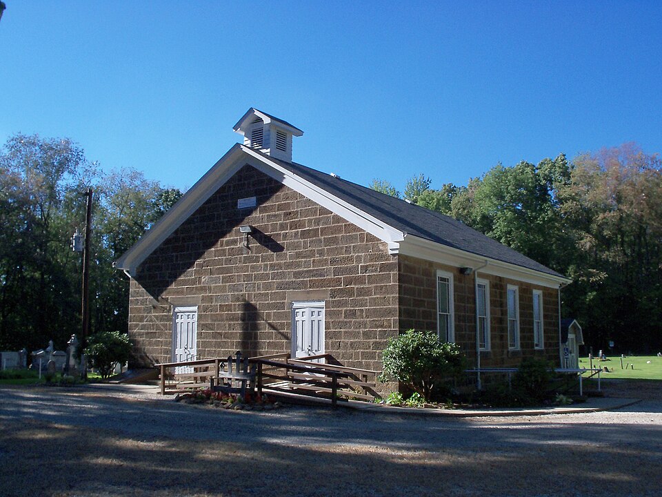
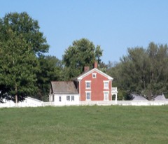
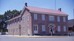
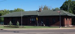
Photograph by Roseohioresident, Public domain. Via
Wikimedia Commons.
Herrington, John, House and Herrington Bethel Church
Listed on the National Register of Historic Places in
1983. A historic map-sheet match is not published yet. The record needs a coordinate-quality review before it can be joined to a sheet boundary.
From the record
“The John Herrington House and Herrington Bethel Church are a pair of historic buildings located near Mechanicstown in Carroll County, Ohio, United States. Constructed in the 1840s, they bear the name of a prominent local Methodist minister, and they have together been named a historic site.”
Wikipedia article John Herrington House and Herrington Bethel Church, CC BY-SA 4.0.
one of 11 National Register listings in Carroll County · listed in 1983 · category: Building.
National Register reference number.83001949- the number the National Park Service assigned this property when it was listed, and the key its nomination file is catalogued under at the National Archives.
Fires near this property
15 since 2004
Regional context, not property-specific
evidence. The
federal wildfire occurrence database
lists 15 fires within 5 miles of Herrington, John, House and Herrington Bethel Church between
2004 and 2020, burning about 64 acres in total. None started naturally. 1 was recorded as arson.
Distance is straight-line from the map coordinates, so a fire counted
here may appear on a neighbouring settlement's page as well.
Reported cause
Fires
Missing data/not specified/undetermined
8
Debris and open burning
4
Smoking
1
Equipment and vehicle use
1
Arson/incendiarism
1
The most recent of
them, most recent first, with the day each was reported and the service
that recorded it.
Regional context, not property-specific
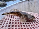
evidence. Museums hold 262 specimens
collected within 10 miles of Herrington, John, House and Herrington Bethel Church between 1928 and
1975: 198 Animalia, 64 Plantae. 12 distinct Species records are shown.
Collected by A.W. Cusick, Allen, E. J., Ash, G. (Gail), Buchanan, F. W. (Forrest W.) & Trautman, M. B. (Milton Bernard) and others. Each is a
physical object with a catalogue
number, and each entry opens the museum's record. This is what was
collected and kept, not a survey of what lives here - nothing can be
concluded from a species being absent.
Regional context, not property-specific
evidence. The National Weather Service names
Mechanicstown, the town this property stands in, in 17 storm reports between 1995 and 2025: 9 thunderstorm wind, 4 hail, 3 flash flood, 1 flood.
The reports record 2 injuries. Each account below is quoted exactly as the forecast office
filed it, from the NOAA Storm Events Database, and each date
opens the federal record of that event.
Thunderstorm rains producing rainfall rates in excess of 1.0 inches per hour and training repeatedly over the same area led to significant road flooding across parts of Carroll County. SR 524, south of Mechanicstown was flooded. Just northwest of Perrysville, Bramble Road near SR 332 was flooded. An some trees were down due to mudslides onto SR 39 near Dellroy.
No historic map-sheet match is published
for this property yet. That does not mean no map exists. This record needs
a coordinate-quality review before it can be joined to a sheet boundary.
Browse the county's mapped places while that work is
pending.
From the nomination file
1,752 words on record
When this property was proposed for the
National Register, someone wrote the case for it: what the building is,
and why it matters. That document is a federal record in the public domain.
It is quoted below word for word, never summarised. The text was read off the scanned case file by machine, so the
occasional stray character is the recogniser's and the 1970s
typewriter's.
Description of the property
gable-end returns.The site includes two associated farm structures --a bank barn and dressing with chiseled margins.
the residence.A simple structure of coursed squared sandstone from the Herrington portion, windows and porch are not recent alterations, and judging from the evidence, with clapboard where a two-story recessed gallery was earlier featured.The infilled probably date from the turn of the century.The sandstone of the facade was quarried on The roof is slate with a heavy entablature and brief The Herrington Bethel Church sits at the top of a hill 500 feet northwest of -prehistoric _ landscape architecture_X religion _ archeology-historic _ conservation .law - science _ economics - sculpture - education - social/ - music X 1800-1899 _ theater _ 1900- _ communications _ invention - other (specify) Specific dates 1840, 1843 Ohio by early settlers and local craftsmen.
Taken together, the house and the church himself, minister and farmer. extended to within a few miles of the Herrington property, northeast Carroll County does residence, the stonework of the church is said to have been done by a local Black mason farm for $1,000.00 from Frederick Woods in 1819. to have yielded 80 converts, including one of his sons. Possibly as a result of his having seen the light at this Revival, Herrington is said to have decided that worshiping in a log structue (which was, by the 1840's, dilapidated) techniques, as well, perhaps, as a certain type of antic religious consciousness. Herrington lived until 1862, a hardy soul who, at 100, walked to Augusta, three miles from his home, to vote and be photographed.
(in one paragraph) and materials. Unlike more northerly counties in Ohio whose predominance of frame and brick struc- also represent the association of frontier protestantism with rural settlement and stand of the types of antebellum stone architecture built in this region of east central The present structure may thus represent the development of more self-conscious building The John Herrington house and the Herrington Bethel Church are significant examples While no records remain to identify the mason who so.expertly dressed the stone of the suggests he may have been responsible for both. as a monument to the earlier embodiment of this association in the person of Herrington the sturdiness of Ohio pioneers. 8.
Significance named Frank Dunmore, and the fact that the structures were built at about the same time class meetings in his home until 1825 when a log building was constructed on the hilltop Areas of Significance-Check and justify below feature a number of stone structues, most of which are of a lesser quality than these. site of the present church.An 184l Revival conducted in this early structure is said Herrington was born in Pennsylvania in 1759 and served as a drummer boy in the - art - archeology-prehistoric community planning X architecture . exploration/settlement - - philosophy Revolutionary War under Washington.
Builder/Architect Frank Dunmore (Church) tures is probably due to the topographical disturbances caused by the glacier that of Indians) spurred him to migrate to Ohio in 1816 where he purchased his Carroll County was sinful. Thereupon, he set fire to the building and watched it burn from his own porch. 1600-1699 transportation Herrington and the stone structues he built reflect The death of his parents (reportedly at the hands 9.
Quoted from the National Register nomination
for reference 83001949, 12 pages, held by the National Archives in Record
Group 79. See the
catalogue record.
Listed places nearby
5 within 8 miles
Other National Register properties close
enough to walk or drive between, ordered by distance from this one. Both
positions come from the same geocoding pass that matched these properties
to their map sheets.
Listing record. National Park Service National Register of Historic Places, listed-properties dataset, current to 2026-05-22.
Map join. Address geocoded through the United States Census geocoder, then tested against the published boundary of every sheet in the USGS Historical Topographic Map Collection.
How this page is made. Listing fields come from federal records; map-sheet coverage is a labelled coordinate-to-boundary calculation, not a source-field claim.
Wildfire. Short, Karen C. 2022. Spatial wildfire occurrence data for the United States, 1992-2020 [FPA_FOD_20221014]. 6th Edition. Fort Collins, CO: Forest Service Research Data Archive. https://doi.org/10.2737/RDS-2013-0009.6 Collected with United States Government funding and usable without additional permissions or fees.
Specimens. Global Biodiversity Information Facility (GBIF), https://www.gbif.org/. Only records licensed CC0 or CC BY are used. Records licensed CC BY-NC are excluded because this site carries advertising. Images are checked individually and any whose licence is non-commercial, no-derivatives or unreadable is refused.
Storms. NOAA National Centers for Environmental Information, Storm Events Database https://www.ncei.noaa.gov/stormevents/ A work of the United States government, no copyright under 17 U.S.C. 105. Narratives are quoted verbatim from the National Weather Service report and are not edited or summarised.
 Block
Block