BlockBefore
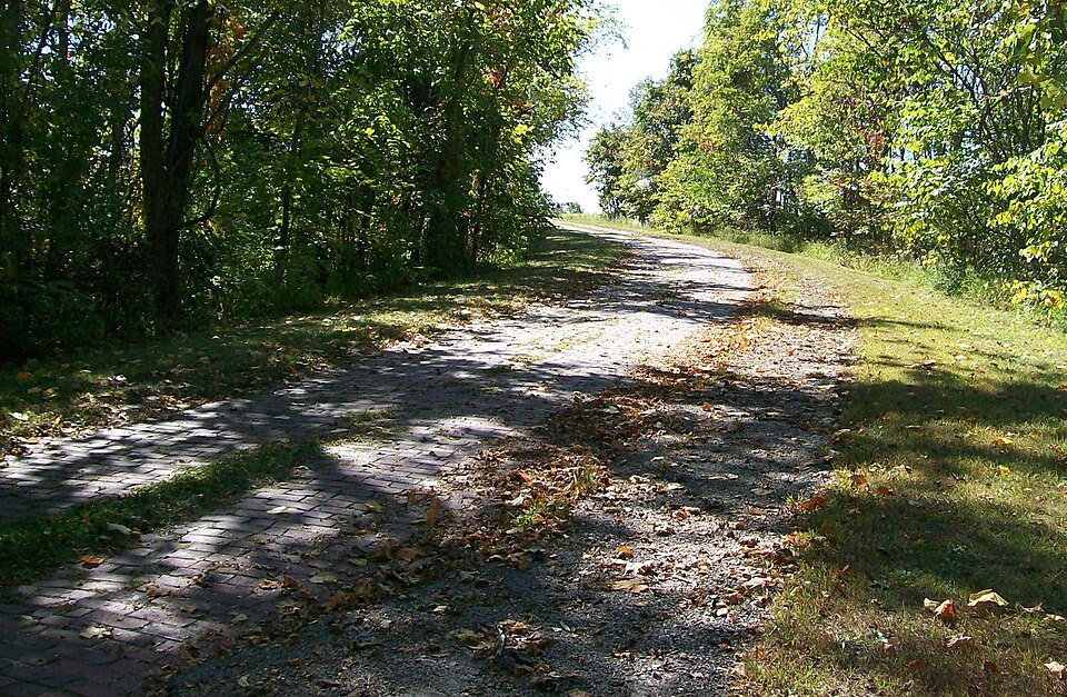
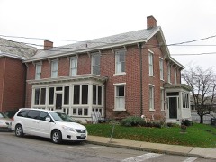
Photograph of National Road
Photograph by Bwsmith84, CC BY 3.0. Via Wikimedia Commons.

National Road

Listed on the National Register of Historic Places in 1985. A historic map-sheet match is not published yet. The record needs a coordinate-quality review before it can be joined to a sheet boundary.

From the record

“National Road, also known as Peacock Road, is located off of U.S. Route 40 between Cambridge and Old Washington, Ohio.”

Wikipedia article National Road (Cambridge, Ohio), CC BY-SA 4.0.

one of 18 National Register listings in Guernsey County · listed in 1985 · category: Structure · one of 1 National Historic Landmarks in Guernsey County.

Sources: the Wikipedia article · the case file at the National Archives · the National Register database, National Park Service · the Wikipedia article

The listing

  • What is counted as historic. The nomination lists 1 structure as contributing to the listing.
  • Address. Center Township Rd. 650, Cambridge, 43725
  • When was it listed? 1985-08-23
  • Category. structure
  • Township. Center township
  • National Register reference number. 85001842 - the number the National Park Service assigned this property when it was listed, and the key its nomination file is catalogued under at the National Archives.

Fires near this property

30 since 2011

Regional context, not property-specific evidence. The federal wildfire occurrence database lists 30 fires within 5 miles of National Road between 2011 and 2020, burning about 37 acres in total. None started naturally. 2 were recorded as arson. Distance is straight-line from the map coordinates, so a fire counted here may appear on a neighbouring settlement's page as well.

Reported cause Fires
Debris and open burning16
Missing data/not specified/undetermined7
Smoking3
Arson/incendiarism2
Equipment and vehicle use1
Recreation and ceremony1

The most recent of them, most recent first, with the day each was reported and the service that recorded it.

DateCause SizeReported by Name on the report
21 July 2016Debris and open burningunder an acreOhio Department of Natural Resources5205
12 July 2016Debris and open burning1.2 acresOhio Department of Natural Resources5165
8 May 2015Missing data/not specified/undeterminedunder an acreOhio Department of Natural Resources1281
8 April 2013Debris and open burningunder an acreOhio Department of Natural Resourcesnot named
26 April 2013Debris and open burning1.0 acresOhio Department of Natural Resourcesnot named
22 April 2020Debris and open burningunder an acreOhio Department of Natural Resources15665
22 April 2013Missing data/not specified/undeterminedunder an acreOhio Department of Natural Resourcesnot named
19 April 2014Missing data/not specified/undeterminedunder an acreOhio Department of Natural Resourcesnot named

Every fire recorded in Guernsey County

Specimens collected near this property

12 of 357 shown

Regional context, not property-specific evidence. Museums hold 357 specimens collected within 10 miles of National Road between 1875 and 1975: 135 Fungi, 133 Animalia, 85 Plantae, 2 Unrecorded, 2 Protozoa. 12 distinct Species records are shown. Collected by Adams, W. (William), Adams, W. (William), Trautman, M. B. (Milton Bernard) et al., Adams, W.; Adams, S. and others. Each is a physical object with a catalogue number, and each entry opens the museum's record. This is what was collected and kept, not a survey of what lives here - nothing can be concluded from a species being absent.

Image SpeciesYear Collected by Where, as recorded
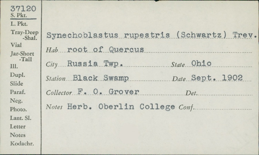
Specimen of Synechoblastus rupestris (F.Desp.) Trevis.Synechoblastus rupestris (F.Desp.) Trevis.1902F.O. GroverBlack Swamp
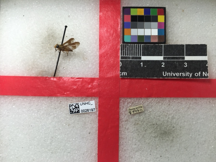
Specimen of Chrysops vittatus Wiedemann, 1821Chrysops vittatus Wiedemann, 18211916not recorded
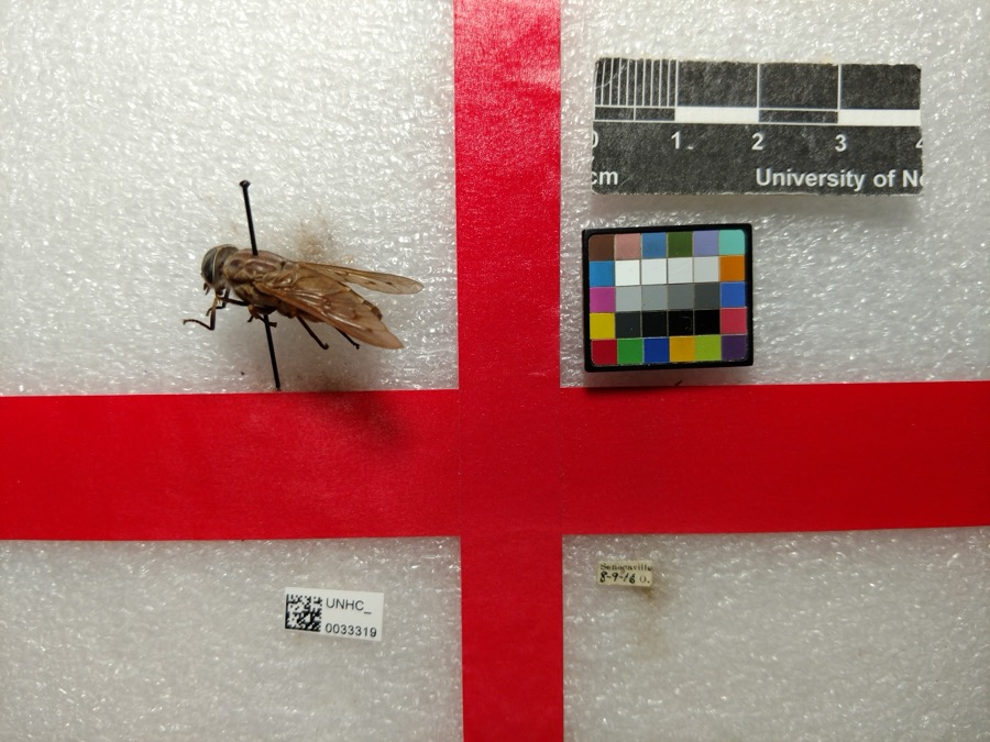
Specimen of Tabanus sulcifrons Osten Sacken, 1878Tabanus sulcifrons Osten Sacken, 18781916not recorded
A photograph of the species Asclepias tuberosa, not of this specimenAsclepias tuberosa L.1875s.c.Fairmont
A photograph of the species Enslenia albida, not of this specimenEnslenia albida Nutt.1875s.c.Fairmont
A photograph of the species Impatiens pallida, not of this specimenImpatiens pallida Nutt.1875Lloyd, Curtis GatesFairmont
A photograph of the species Stereum spadiceum, not of this specimenStereum spadiceum (Pers.) Quél.1893Holden Wm.College Hill
Favolus europaeus Fr.1895Holden Wm.College Hill
A photograph of the species Lenzites trabeus, not of this specimenLenzites trabeus (Pers.) Fr.1895Holden Wm.College Hill
A photograph of the species Pleurotus nidulans, not of this specimenPleurotus nidulans (Pers.) P.Kumm.1895Holden Wm.College Hill
A photograph of the species Polystictus versicolor, not of this specimenPolystictus versicolor (L.) Fr.1895Holden Wm.College Hill
A photograph of the species Trametes malicola, not of this specimenTrametes malicola Berk. & M.A.Curtis1895Holden Wm.College Hill

All 357 specimens within 10 miles, at the Global Biodiversity Information Facility.

Mines and quarries near this property

1 within 5 miles

Regional context, not property-specific evidence. The federal mineral resources record lists 1 working within 5 miles of National Road: 1 producer. All of them still produce. What was taken out: Vanadium, Zirconium, Iron. Distance is straight-line from the map coordinates, so a quarry counted here may appear on a neighbouring settlement's page as well.

Where SiteCommodity StatusRecorded
Cambridge PlantVanadium, Zirconium, IronProducer

Every working recorded in Guernsey County

Storms near this property

60 of 78 shown

Regional context, not property-specific evidence. The National Weather Service names Cambridge, the town this property stands in, in 78 storm reports between 1994 and 2026: 47 thunderstorm wind, 22 hail, 7 flash flood, 1 flood. The reports record 3 injuries. Each account below is quoted exactly as the forecast office filed it, from the NOAA Storm Events Database, and each date opens the federal record of that event.

WhenEvent Place namedHarm What the report says
August 1998Thunderstorm WindCambridge3 hurt, $400,000An intense thunderstorm gust known as a macroburst raked across central Guernsey County, wind gusts were estimated between 80 and 90 mph. The thunderstorm formed in northeast Guernsey County about 430 pm just ahead of another very intense thunderstorm moving through Muskingum County. It then moved southeast at nearly 40 mph.The swath of damage produced by this intense downburst of wind was estimated to be nearly 8 miles long. Its width fluctuated between 0.75 miles to over 2.5 miles. The damage started just south of Cambridge and continued southeast to near the town of Buffalo. There were 3 reported injuries which consisted of cuts and abrasions. One person was treated and released from the hospital. The town of Byesville was hardest hit. Hundreds of trees were snapped or toppled. Power lines and telephone poles were also downed which resulted in widespread power outages. There were some outbuildings destroyed, as well as damage to shingles, siding and roofs. Part of a roof of a school was torn off. Billboards, business signs and Interstate highway signs were also partially or totally destroyed. It was also reported that about 30 automobiles in a grocery store parking lot had their windows completely shattered. A plate glass window in a fast food restaurant was also shattered. The area was declared a disaster area by the Governor of Ohio. On Interstate 77, there was a report of a tractor-trailed truck which was stopped in its tracks by the tremendous gust as it tried to move forward. It actually spun its wheels as if it were on ice without moving and an automobile behind it collided with the truck.
June 2012Thunderstorm WindCambridge$500,000Emergency manager reported damage to the clock tower of an 150 year old courthouse, the collapse of a church, and several other structures damaged in the city of Cambridge.
November 2020Thunderstorm WindCambridge$200,000Widespread tree and power line damage was reported across the county.
April 2006Thunderstorm WindCambridge$55,000Between 840 PM EDT and 9 PM EDT, a microburst struck just southwest of Warrentown, about 4 miles northeast of Cambridge. Numerous trees toppled or snapped. Siding and shingles torn from a few houses. Two small barns knocked down. One mobile home was pushed off its foundation. Maximum estimated wind 75 mph (65 knots). This microburst made a swath of sporadic damage about half a mile in length and 350 yards wide. It started from just south of Lakespur Lane, and moved northeastward to just south of Route 22
July 2024Thunderstorm WindCambridge$50,000Multiple trees and wires were reported to be down in and throughout Cambridge.
June 2010Thunderstorm WindCambridge$50,000The public reported trees down in Cambridge.
August 1998Thunderstorm WindCambridge$50,000Several trees were downed, including one on a car. A porch was ripped off of a house. Downed trees were blocking roads.
October 2010Thunderstorm WindCambridge$35,000Emergency management reported numerous trees down in Cambridge.
July 2008Thunderstorm WindCambridge$30,000Emergency management reported trees down near Cambridge.
July 2013Thunderstorm WindCambridge$25,000Law enforcement reported trees down.
June 1998Thunderstorm WindCambridge$20,000Trees blown down throughout the city from thunderstorm winds.
May 1995Thunderstorm WindCambridge$20,000Thunderstorm winds collapsed a barn, killing two cows inside. Damage was also reported to three vehicles and a boat.
June 2020Thunderstorm WindCambridge$15,000Shingles were blown off of a roof on Jefferson Avenue, with tree limbs also blown down.
June 2012Thunderstorm WindCambridge$10,000State official reported numerous trees down.
August 2004Thunderstorm WindCambridge$10,000Widespread trees and power lines down, especially in eastern half of county, which lost all electric power. Some roads closed because of fallen trees.
January 1996Flash FloodCambridge$10,000no account filed
August 2006Thunderstorm WindCambridge$6,000Trees and power lines down.
November 2005Thunderstorm WindCambridge$6,000Many trees blown down. [CORRECTED TIME]
May 2022Thunderstorm WindCambridge$5,000In Cambridge, power lines were blown down.
June 2012Thunderstorm WindCambridge$5,000Trained spotter reported large branches down.
June 2012Thunderstorm WindCambridge$5,000Trained spotter reported that trees were ripped in half in Cambridge.
July 2011Thunderstorm WindCambridge$5,000State official reported a couple of trees down on Gaston Ave.
May 2004Thunderstorm WindCambridge$5,000Large trees and power lines blown down.
July 2003Thunderstorm WindCambridge$5,000Large trees and power lines down.
July 2003Thunderstorm WindCambridge$5,000Trees and power lines blown down by wind.
August 2001Flash FloodCambridge$5,000Between 1.5 and 2.0 inches of rainfall in just over an hour flooded numerous roadways in the Cambridge area.
June 1998Thunderstorm WindCambridge$5,000Thunderstorm winds estimated at 80 MPH downed several trees.
November 1998Thunderstorm WindCambridge$5,000Thunderstorm winds downed several trees and power lines in the Cambridge and Byesville areas.
June 1998Thunderstorm WindCambridge$5,000Thunderstorm winds downed several trees.
June 1994Thunderstorm WindCambridge$5,000no account filed
June 2000Thunderstorm WindCambridge$3,000Thunderstorm winds downed a large billboard.
October 1999Thunderstorm WindCambridge$3,000Thunderstorm winds downed several trees.
July 1999Thunderstorm WindCambridge$3,000Thunderstorm winds downed several trees near Salt Fork State Park.
July 1997Thunderstorm WindCambridge$3,000Thunderstorm winds downed several trees.
July 2017Thunderstorm WindCambridge$2,500Law Enforcement reported trees down.
June 2025Thunderstorm WindCambridge$2,000A few reports of trees down were received from the Cambridge area.
June 2013Thunderstorm WindCambridge$2,000Local law enforcement reported trees down on the north side of Cambridge.
June 2007Thunderstorm WindCambridge$2,000EMA reported trees down West of Cambridge.
August 2003Thunderstorm WindCambridge$2,000Large trees down.
August 1997Thunderstorm WindCambridge$2,000Thunderstorm winds downed trees.
June 2021Thunderstorm WindCambridge$1,000The State Patrol reported 4 power poles down along SR 209 near mile marker 7.
December 2013Thunderstorm WindCambridge$1,000Local law enforcement reported trees down, scattered across the county.
July 2003Thunderstorm WindCambridge$1,000Large tree down on Old Route 21.
June 2001Thunderstorm WindCambridge$1,000Thunderstorm winds downed several large tree limbs.
July 1997Thunderstorm WindCambridge$1,000Thunderstorm winds downed two trees and some large limbs.
August 1995Thunderstorm WindCambridge$1,000Thunderstorm winds downed a tree and large branches along Route 22 near Cambridge.
June 1995Thunderstorm WindCambridge$1,000Several large trees were downed by thunderstorm winds.
April 2025Thunderstorm WindCambridge-Multiple trees were reported down.
June 2022HailCambridge-Hail the size an inch reported via social media.
February 2020Debris FlowCambridge-A landslide was reported on State Route 209 at Coshocton Avenue.
June 2020Flash FloodCambridge-Flooding was reported over Steubenville Avenue at 3rd Street.
May 2019HailCambridge-A trained spotter reported hail 0.88 inches in size.
June 2008HailCambridge-The public reported penny size hail in Cambridge.
August 2007HailCambridge-Public reported quarter size hail in Cambridge.
March 2007FloodCambridge-Numerous roads flooded across the county due to heavy rains.
June 2007Thunderstorm WindCambridge-Trees down along Parker Road in Salt Fork State Park.
June 2004Flash FloodCambridge-Several roads flooded after 4.5 inches of rain in 1 hr.
July 2002Flash FloodCambridge-Heavy thunderstorm rains of over three inches produced minor flooding along portions of County Road 35.
June 1998Flash FloodCambridge-Runoff from thunderstorm rains covered Peters Creek Road with water.
April 1995HailCambridge-Golf ball-size hail reported. Damage unknown.

Every storm recorded in Guernsey County

Map coverage status

No historic map-sheet match is published for this property yet. That does not mean no map exists. This record needs a coordinate-quality review before it can be joined to a sheet boundary. Browse the county's mapped places while that work is pending.

From the nomination file

4,547 words on record

When this property was proposed for the National Register, someone wrote the case for it: what the building is, and why it matters. That document is a federal record in the public domain. It is quoted below word for word, never summarised. The text was read off the scanned case file by machine, so the occasional stray character is the recogniser's and the 1970s typewriter's.

Description of the property

Peacock Road*is a brick township road running in an east/west direction in Center Township, the middle of Guernsey County, Ohio. Both entrance and exit from this quiet country road are obtained by leaving State Route 40 to the south between Cambridge four miles to the west and 01di Washington one and one-half miles to the Named for the peacocks who once lived on a bordering farm, Peacock Road today serves as an access road for two farm homesteads and a still active township house. This road is a part of the 1828 right ofway of the National Road and typifies the National Road characteristic of following, not resisting, the rough, hilly terrain in eastern Guernsey County.

Within its brick-paved length of six-tenths of a mile, Peacock Road crests a high ridge, skirts a forest, descends a steep hill to round a sharp curve then follows a narrow valley to aseend a hill again. The brick paving which was layed in 1918 originally measured sixteen feet across with six inch concrete curbing on either side for a total of seventeen feet. Today the road width appears to vary due to grass growth creeping over the curbs and edges of the road but the road remains intact beneath the growth. (see "Road Section Illustration!') Worn tire paths and areas' of cracking and splitting in the no ga tan and bricks can be seen in the high traffic stress areas on or near the road curves.

(See photos #4, #17.) This moderately time-worn condition bears witness to the heavy national, state and local traffic the road carried after 1918. At some unrecorded point in time between 1933 and 1950, an inch and a quarter of asphaltum was layed over the brick paving.

Read the complete 4,547-word case file.

Statement of significance

/Architect Not Ipplicable Statement of Significance (in one paragraph) Criteria A & C Peacock Road*has played a vital role in the histories of the county, state and our nation. As an original right of way of the National Road, then as the best possible route for transporting supplies in a World War I emergeney, the importance of this road's service is distinctive. The guality and integrity of it's 1918 brick paving remains today in spite of the stress that the road's important use implies. This road is an outstanding example of transportation in the service of our government. Criteria-A When the furor of fighting in Europe during World War I was at a peak in the winter of 1918, the Federel government determined more war supplies, specifically trucks, were needed to win the war.

Various routes were studied with the result that the National Road was chosen. On March 14, 1918, Ohio Governor Cox, State Highway Commission President A. R. McCulloch, State Auditor Victor Donahey, State Attorney General MoGhee and Mr. Raymond Beck of the Highway Transportation Committee of the Council of National Defense (War Department) all met with the Guernsey County Commissioners and general publie to explain the urgent need for the immediate improvement of an unimproved (unpaved) stretch of the National Road in Guernsey County. The stretch today called Peacock Road was part of the "five miles between Cambridge and Old Washington" as explained in the evening edition of the newspaper.*l Mr.

Beck explained the Federal government had considered and rejected slower but improved alternative routes and found rail transportation was already too burdened toaccept more freight. The trucks must begin moving in six weeks.

Read the complete 4,547-word case file.

The whole case file for this property - 4,547 words, 41 pages, reproduced complete.

Quoted from the National Register nomination for reference 85001842, 41 pages, held by the National Archives in Record Group 79. See the catalogue record.

Listed places nearby

6 within 8 miles

Other National Register properties close enough to walk or drive between, ordered by distance from this one. Both positions come from the same geocoding pass that matched these properties to their map sheets.

Photograph PropertyDistance Listed
McCreary-Burnworth House4.2 miles1982
Broom-Braden Stone House4.2 miles1980
McCracken-Scott House4.6 miles1978
McCracken-McFarland House4.6 miles1979
Sarchet-Burgess House4.7 miles1987
Broom Building4.7 miles1983

Sources for this property

National Archives recordThe nomination case file for reference 85001842 in Record Group 79.
Wikipedia articleCommunity-written account of this property, licensed CC BY-SA.
Guernsey CountyAll 18 listed properties in this county.

Provenance

  • Listing record. National Park Service National Register of Historic Places, listed-properties dataset, current to 2026-05-22.
  • Map join. Address geocoded through the United States Census geocoder, then tested against the published boundary of every sheet in the USGS Historical Topographic Map Collection.
  • How this page is made. Listing fields come from federal records; map-sheet coverage is a labelled coordinate-to-boundary calculation, not a source-field claim.
  • Wildfire. Short, Karen C. 2022. Spatial wildfire occurrence data for the United States, 1992-2020 [FPA_FOD_20221014]. 6th Edition. Fort Collins, CO: Forest Service Research Data Archive. https://doi.org/10.2737/RDS-2013-0009.6 Collected with United States Government funding and usable without additional permissions or fees.
  • Specimens. Global Biodiversity Information Facility (GBIF), https://www.gbif.org/. Only records licensed CC0 or CC BY are used. Records licensed CC BY-NC are excluded because this site carries advertising. Images are checked individually and any whose licence is non-commercial, no-derivatives or unreadable is refused.
  • Mines and quarries. USGS Mineral Resources Data System (MRDS) https://mrdata.usgs.gov/mrds/ A work of the United States government, no copyright under 17 U.S.C. 105.
  • Storms. NOAA National Centers for Environmental Information, Storm Events Database https://www.ncei.noaa.gov/stormevents/ A work of the United States government, no copyright under 17 U.S.C. 105. Narratives are quoted verbatim from the National Weather Service report and are not edited or summarised.