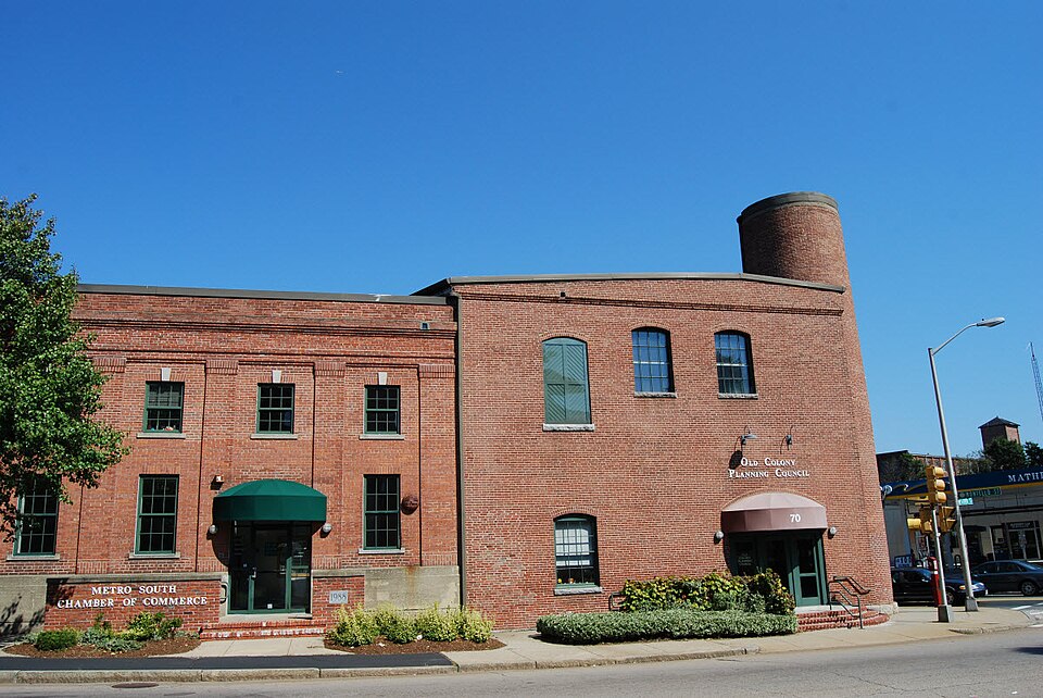
Photograph by Marcbela (Marc N. Belanger), Public domain. Via
Wikimedia Commons.
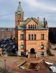
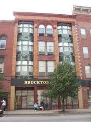
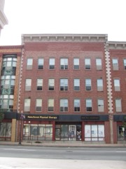
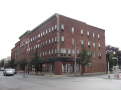
Brockton Edison Electric Illuminating Company Power Station
Built in 1883 in the Italianate architecture. Listed on the National Register of Historic Places in
1987. A historic map-sheet match is not published yet. The record needs a coordinate-quality review before it can be joined to a sheet boundary.
From the record
“Brockton Edison Electric Illuminating Company Power Station or "Brockton Edison Company - Old Power Station" is a historic power plant at 70 School Street in Brockton, Massachusetts. It was one of the earliest power plants built by Thomas Edison.”
Wikipedia article Brockton Edison Electric Illuminating Company Power Station, CC BY-SA 4.0.
one of 93 National Register listings in Plymouth County · listed in 1987 · category: Building · built in 1883, Italianate architecture, by Frank J. Sprague · one of 1 National Historic Landmarks in Plymouth County.
National Register reference number.87000874- the number the National Park Service assigned this property when it was listed, and the key its nomination file is catalogued under at the National Archives.
The history of Brockton has been written, and is at last presented to the public, after an unexpected amount of labor. There is no. locality in New England which has undergone more rapid changes than this. In ISOO the auth(ir wrote an extended histor)' of the town of North Bridgewater, which has long since gone out of print, containing then about six thousand inhabitants. The rapid growth of the town, the change (jf name t(j Brockton, and afterwards its incorporation into a city, rendered the necessity for a new and enlarged naiTative work under the distinctive name of Brockton. The work has been subject to unavoidable delay owing to the extra amount of work in its preparation, and it is submitted to the citizens of Brockton and vicinity, with all its imperfections, with the hope that it may not be disappointing to those who are interested in and have by their encouragement and generous subscriptions been the means of its publication. Of the importance of works of this class, we may be pardoned for quoting from an eminent writer on kindred works: *
The undersigned citizens and legal voters in the town of North Bridgewater, while willing or desirous to change the corporate name of the town, respectfully beg leave to protest against adopting the name of Brockton, and ask to be heard by themselves or counsel thereon.
Regional context, not property-specific
evidence. The
federal wildfire occurrence database
lists 487 fires within 5 miles of Brockton Edison Electric Illuminating Company Power Station between
2005 and 2020, burning about 205 acres in total. 6 started naturally. 7 were recorded as arson.
Distance is straight-line from the map coordinates, so a fire counted
here may appear on a neighbouring settlement's page as well.
Reported cause
Fires
Debris and open burning
242
Missing data/not specified/undetermined
154
Misuse of fire by a minor
38
Smoking
20
Recreation and ceremony
19
Arson/incendiarism
7
Natural
6
Fireworks
1
The most recent of
them, most recent first, with the day each was reported and the service
that recorded it.
Regional context, not property-specific
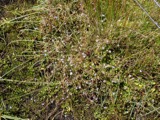
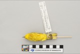
evidence. Museums hold 825 specimens
collected within 10 miles of Brockton Edison Electric Illuminating Company Power Station between 1852 and
1975: 437 Plantae, 236 Fungi, 137 Animalia, 12 Protozoa, 2 Unrecorded, 1 Chromista. 12 distinct Species records are shown.
Collected by A. A. Eaton, A. B. Seymour, A. Clark and others. Each is a
physical object with a catalogue
number, and each entry opens the museum's record. This is what was
collected and kept, not a survey of what lives here - nothing can be
concluded from a species being absent.
Regional context, not property-specific
evidence. The federal mineral resources record lists
10 workings within 5 miles of Brockton Edison Electric Illuminating Company Power Station: 8 past producers, 1 producer, 1 plant.
2 still produce. What was taken out: Sand and Gravel, Construction. Distance is straight-line from the
map coordinates, so a quarry counted here may appear on a neighbouring
settlement's page as well.
Regional context, not property-specific
evidence. The National Weather Service names
Brockton, the town this property stands in, in 26 storm reports between 1994 and 2023: 8 thunderstorm wind, 8 hail, 3 heavy rain, 3 lightning.
The reports record 60 injuries. Each account below is quoted exactly as the forecast office
filed it, from the NOAA Storm Events Database, and each date
opens the federal record of that event.
Numerous trees and wires were downed by thunderstorm winds throughout Brockton. This includes trees and wires on Warren Avenue in front of the Boys and Girls Club, near the high school, on Route 14, on French and Perkins Avenues, and on Ash Street. One of these trees fell on a dentists office on South Street in the Campello neighborhood.
A line of thunderstorms moved across parts of central and eastern Massachusetts with wind gusts to 40 to 50 mph. In Lowell, two children received minor injuries when a tree fell on them after it was uprooted by winds gusting to an estimated 50 mph. In Southboro, large tree limbs were downed. In Swampscott, a tree fell on an automobile. In Belmont, Cambridge, and Watertown, tree limbs and a few power lines were reported blown down. In Brockton, two large tree limbs were knocked down. In downtown Boston, a street sign was blown down and hit a man on the head.
No historic map-sheet match is published
for this property yet. That does not mean no map exists. This record needs
a coordinate-quality review before it can be joined to a sheet boundary.
Browse the county's mapped places while that work is
pending.
From the nomination file
16,026 words on record
When this property was proposed for the
National Register, someone wrote the case for it: what the building is,
and why it matters. That document is a federal record in the public domain.
It is quoted below word for word, never summarised. The text was read off the scanned case file by machine, so the
occasional stray character is the recogniser's and the 1970s
typewriter's.
Description of the property
TheEdison Electric Illuminating Company Power Station is a complex of four adjoining brick buildings, varying in size and ranging in date from 1883 to The complex consists of the original central power generating station (1883) and three subsequent additions (ca. 1884-1886), ca. 1886-1894, and 1907 respectively). The mid-20th century transformer does not contribute to the uildings sgnificance. Located in downtown Brockton, the station complex ccuples a trlangular parcel of land bounded by Montello Street to the east. _incoln Street to the north, and School Street to the south. The apex of the The complex is set directly on the sidewalks; the site is not landscaped. The western tip of the triangular lot is an asphalt paved parking lot.
The station lies in the downtown area of Brockton formerly occupied by several shoe manufacturers. Today the Brockton City Hall (a late 19th century structure) and its park ing lot lie across School Street from the power station. An ear ly 20th centur y bank building and large municipal parking lot lie across Lincoln Street to the north and west of the station. Several 19th century brick factory buildings, formerly engaged in Brockton's active shoe manufacturing industry, lie across Montello Street to the east. Immediately beyond these factory buildings (to the east) are railroad tracks. School and Montello Streets are major thoroughfares in this part of the city, and the site is characterized by heavy vehicular and pedestrian traffic.
The topography in this area is slightly uneven, resulting in a variable grade level for the station: the land slopes up toward the west and south from the corner of Montello and Lincoln Streets, but only to a small degree. The original structure, sited at the corner of Montello and Lincoln Streets, was designed by Frank J. Sprague, chief engineer to Thomas A.
(in one paragraph) Builder/Architect Frank J. Spraque, Engineer The Edison Electric Iluminating Company Power Station, Brockton, is an integral complex of components relating to varying periods of development and Var ying levels of significance. The original station was the first electric generating plant in Massachusetts, and also the first in the United States to use a three-wire, underground transmission and distribution system. It is an ear ly and well-preserved example of late 19th century industrial construction, especially in its use of fireproof materials and open plan. Each of the three additions (ca. 1884-1886, ca.
1886-1894, and 1907 respectively), in turn, is a wel1-preserved example of its type, and was built to accommodate the expansion of the electricity industry of Brockton. A transformer, added to the complex in the mid-20th century, does not contribute to its significance.) The station complex, unique to Brockton both in its heyday and today, retains integrity of location, setting, materials, workmanship, design, feeling and assoclation, and it meets Criter ia A and C of the National Register of Historic Places on both the state and local levels. In 1879, Thomas Alva Edison produced the first incandescent lighting system at Menlo Park, New York. This invention proved the potential for a system of electric lighting powered from a central source.
The world's first commercial incandescent central power station was built in London and opened January 12, Nine months later, the first such station in the United States opened on Pear1 Street in New York City, operated by the Edison Electric Light Company. Pear1 Street Station used a two-wire underground transmission With the help of engineer William S. Andrews and British mathematician John Hopkinson, Edison developed a three-wire system; by adding a neutral wire using only 50% more wire.
Quoted from the National Register nomination
for reference 87000874, 51 pages, held by the National Archives in Record
Group 79. See the
catalogue record.
Listed places nearby
6 within 8 miles
Other National Register properties close
enough to walk or drive between, ordered by distance from this one. Both
positions come from the same geocoding pass that matched these properties
to their map sheets.
Listing record. National Park Service National Register of Historic Places, listed-properties dataset, current to 2026-05-22.
Map join. Address geocoded through the United States Census geocoder, then tested against the published boundary of every sheet in the USGS Historical Topographic Map Collection.
How this page is made. Listing fields come from federal records; map-sheet coverage is a labelled coordinate-to-boundary calculation, not a source-field claim.
Wildfire. Short, Karen C. 2022. Spatial wildfire occurrence data for the United States, 1992-2020 [FPA_FOD_20221014]. 6th Edition. Fort Collins, CO: Forest Service Research Data Archive. https://doi.org/10.2737/RDS-2013-0009.6 Collected with United States Government funding and usable without additional permissions or fees.
Specimens. Global Biodiversity Information Facility (GBIF), https://www.gbif.org/. Only records licensed CC0 or CC BY are used. Records licensed CC BY-NC are excluded because this site carries advertising. Images are checked individually and any whose licence is non-commercial, no-derivatives or unreadable is refused.
Mines and quarries. USGS Mineral Resources Data System (MRDS) https://mrdata.usgs.gov/mrds/ A work of the United States government, no copyright under 17 U.S.C. 105.
Storms. NOAA National Centers for Environmental Information, Storm Events Database https://www.ncei.noaa.gov/stormevents/ A work of the United States government, no copyright under 17 U.S.C. 105. Narratives are quoted verbatim from the National Weather Service report and are not edited or summarised.
 Block
Block