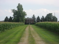
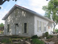
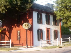
Listed on the National Register of Historic Places in
1988. A historic map-sheet match is not published yet. The record needs a coordinate-quality review before it can be joined to a sheet boundary.
From the record
“Co., in about 1800, and she in Champaign Co. ; the grandfather, John, being a native of Virginia, and removing to this county about 1799, cotemporary with the Knoops, Gerards, etc., the first pioneers of the county. He located on the old Gearheart place, on the west edge of Elizabeth Township, where he lived and died, at the ripe old age of about 100 years.”
The History of Miami County, Ohio : Containing a History of the County; Its Cities, Towns, Etc.; General and Local Statistics; Portraits of Early Settlers and Prominent Men; History of the Northwest Territory; History of Ohio; Map of Miami County; Constitution of the United States; Miscellaneous Matters, Etc., Etc (1880). Machine-read text.
one of 36 National Register listings in Miami County · listed in 1988 · category: Building.
National Register reference number.87002522- the number the National Park Service assigned this property when it was listed, and the key its nomination file is catalogued under at the National Archives.
What happened here
An account from the chapter on Elizabeth township, The inset identifies its exact
source book and publication year.
of 8quirrrfln1h,?t game abounded in the forests. The hunters killed large numbers encountered n Pbeafants' etc- Wolves, bears and panthers were frequently morning Thio* ^atcJ* that ^av*d H. Morris, Sr., killed three panthers in one boys to nw»ns« u.? °^d pioneer was very fond of hunting. He required his the ears was th sbooJ'bl^ daily ; when their record was poor, a general boxing of and difficult, 6 uf8-11*' Ammunition, though in active demand, was expensive every f 0Dtain* obviate all embarrassment, it became customary for sable artinlo his own powder.
Co., in about 1800, and she in Champaign Co. ; the grandfather, John, being a native of Virginia, and removing to this county about 1799, cotemporary with the Knoops, Gerards, etc., the first pioneers of the county. He located on the old Gearheart place, on the west edge of Elizabeth Township, where he lived and died, at the ripe old age of about 100 years. His son John, the father of our subject, after his marriage, located on the farm now owned by Thompson Ely, where he cleared up a farm, most of it right from the native forest ; here he remained for many years, and brought the farm into a good state of cultivation ; then located two miles north, on land now owned by Mr. Turner and James Gearheart, where he lived till his death, which occurred when he was about 52 years of age. They were the parents of five children, of whom two are now living, viz., James M. and John N. John. N., our subject, lived with his father till 1849, when he was united in marriage with Mary A. Rowe, daughter of Henry and Elizabeth Rowe ; he being born in Pennsylvania, but locating in this county when about 18 jrears of age; she was born in this township ; they were the parents of four children, of whom two are now living, viz., Mary A. and Nancy, now Mrs. Isaac A. Beales. After Mr. Gearheart's marriage, he located on a part of his father's place, which Mr. Turner now owns, and resided there some four or five years ; then removed to the farm where he now lives. They are the parents of nine children, of whom eight are now living, viz., John C.; Henry R., dying in infancy; Elizabeth E., now Mrs. William Greer ; Laura J., now Mrs Gross, living in Preble Co.; Nancy C., now Mrs. McNeal ; William M. R., Mary F., Nelson E. and Iva B. Mr. Gearheart has a fine farm of 200 acres, and all but 40 acres in cultivation, with good buildings and improvements. Mr. Gearheart and wife are members of the Christian Church, he having been such for thirty years, and she for thirty -five years. They have also had the pleasure to see all their children but one become Christians and members of the same church.
Regional context, not property-specific
evidence. The
federal wildfire occurrence database
lists 2 fires within 5 miles of Sheets, Andrew, House between
2002 and 2002, burning about 1 acres in total. None started naturally. None was recorded as arson.
Distance is straight-line from the map coordinates, so a fire counted
here may appear on a neighbouring settlement's page as well.
Reported cause
Fires
Equipment and vehicle use
1
Missing data/not specified/undetermined
1
The most recent of
them, most recent first, with the day each was reported and the service
that recorded it.
Regional context, not property-specific
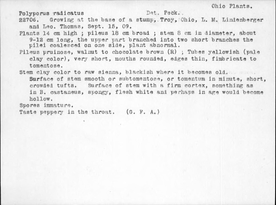
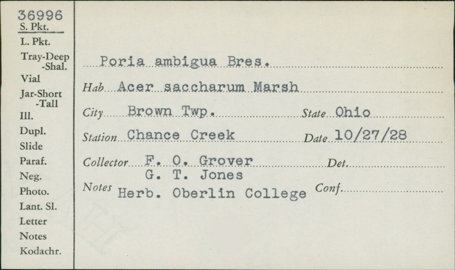
evidence. Museums hold 188 specimens
collected within 10 miles of Sheets, Andrew, House between 1835 and
1975: 159 Animalia, 15 Fungi, 11 Plantae, 3 Protozoa. 12 distinct Species records are shown.
Collected by A. R. Gaufin, A.R. Gaufin, H.H. Ross, Andrew R. Moldenke and others. Each is a
physical object with a catalogue
number, and each entry opens the museum's record. This is what was
collected and kept, not a survey of what lives here - nothing can be
concluded from a species being absent.
Regional context, not property-specific
evidence. The federal mineral resources record lists
3 workings within 5 miles of Sheets, Andrew, House: 3 past producers.
None of them still produces. What was taken out: Stone, Crushed/Broken, Sand and Gravel, Construction, Limestone, General. Distance is straight-line from the
map coordinates, so a quarry counted here may appear on a neighbouring
settlement's page as well.
No historic map-sheet match is published
for this property yet. That does not mean no map exists. This record needs
a coordinate-quality review before it can be joined to a sheet boundary.
Browse the county's mapped places while that work is
pending.
From the nomination file
2,021 words on record
When this property was proposed for the
National Register, someone wrote the case for it: what the building is,
and why it matters. That document is a federal record in the public domain.
It is quoted below word for word, never summarised. The text was read off the scanned case file by machine, so the
occasional stray character is the recogniser's and the 1970s
typewriter's.
Statement of significance
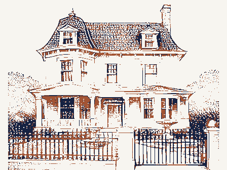
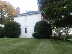
Certifying official has considered the significance of this property in relation to other properties: Applicable National Register Criteria Areas of Significance (enter categories from instructions) Period of Significance C. 1830-1840 parlor frame farmhouse, the unaltered building retains a high degree of Of the over 1000 properties presently surveyed in Montgomery County, no other Andrew Sheets, an early settler and farmer in Elizabeth Township, was originally from Bedford Pennsylvania, until 1807, when he moved to Tennessee. to Champaign County in 1840 and died in 1844. However, this land is owned by architecture unknown characteristics of this house type. physical integrity, displaying Federal style details including narrow first investment property.
Architect/Builder and woodwork including simply detailed Federal style fireplace mantels.
Significant Person and east half of the northwest quarter of section 16 in Elizabeth Township and is essentially as built.The Weisenborns bought the adjacent farmstead as an Significant Dates See continuation sheet floor 9/6 windows with slender muntins, flush facade, and original hardware vernacular rural architecture in Miami County.A two story three bay hall and influence on buildings extends through the 1850s with the majority of surveyed early construction reveals useful information pertaining to the Sheets and his heirs until c.1847.It can be speculated that this frame The Sheets, Andrew, House is significant as an example of early 19th century properties being of brick.The building's well preserved vernacular plan and George Mumford bought the1and in 1853.It remained in the Mumford name for Cultural Affiliation [X locally Criteria Considerations (Exceptions) State significanceof property, and justify criteria, criteria considerations, and areas and periods of significance noted above.
vernacular farmhouse may have likely been built as a tenant house.
Quoted from the National Register nomination
for reference 87002522, 21 pages, held by the National Archives in Record
Group 79. See the
catalogue record.
Listed places nearby
6 within 8 miles
Other National Register properties close
enough to walk or drive between, ordered by distance from this one. Both
positions come from the same geocoding pass that matched these properties
to their map sheets.
Listing record. National Park Service National Register of Historic Places, listed-properties dataset, current to 2026-05-22.
Map join. Address geocoded through the United States Census geocoder, then tested against the published boundary of every sheet in the USGS Historical Topographic Map Collection.
How this page is made. Listing fields come from federal records; map-sheet coverage is a labelled coordinate-to-boundary calculation, not a source-field claim.
Wildfire. Short, Karen C. 2022. Spatial wildfire occurrence data for the United States, 1992-2020 [FPA_FOD_20221014]. 6th Edition. Fort Collins, CO: Forest Service Research Data Archive. https://doi.org/10.2737/RDS-2013-0009.6 Collected with United States Government funding and usable without additional permissions or fees.
Specimens. Global Biodiversity Information Facility (GBIF), https://www.gbif.org/. Only records licensed CC0 or CC BY are used. Records licensed CC BY-NC are excluded because this site carries advertising. Images are checked individually and any whose licence is non-commercial, no-derivatives or unreadable is refused.
Mines and quarries. USGS Mineral Resources Data System (MRDS) https://mrdata.usgs.gov/mrds/ A work of the United States government, no copyright under 17 U.S.C. 105.
 Block
Block