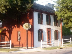
Listed on the National Register of Historic Places in
1976. A historic map-sheet match is not published yet. The record needs a coordinate-quality review before it can be joined to a sheet boundary.
From the record
one of 36 National Register listings in Miami County · listed in 1976 · category: Building.
National Register reference number.76001491- the number the National Park Service assigned this property when it was listed, and the key its nomination file is catalogued under at the National Archives.
What happened here
An account from the chapter on Elizabeth township, The inset identifies its exact
source book and publication year.
of 8quirrrfln1h,?t game abounded in the forests. The hunters killed large numbers encountered n Pbeafants' etc- Wolves, bears and panthers were frequently morning Thio* ^atcJ* that ^av*d H. Morris, Sr., killed three panthers in one boys to nw»ns« u.? °^d pioneer was very fond of hunting. He required his the ears was th sbooJ'bl^ daily ; when their record was poor, a general boxing of and difficult, 6 uf8-11*' Ammunition, though in active demand, was expensive every f 0Dtain* obviate all embarrassment, it became customary for sable artinlo his own powder.
The first meeting of the Baptists was held at the house of Stephen Dye, in Staunton Township, on the 3d of November, 1804, a full account of which will be found in another part of this work. Our forefathers endured all the inconveniences connected with an attendence to these meetings ; yet the long walk through the dense forests was performed without a murmur, and with glad thanksgiving to the Most High. At the residence of William Knight, on the site of the Children's Home, the first meeting within the township was held. Services were also conducted in the houses and barns of the neighbors, and frequentty an adjournment was made to God's first temples. Assembling together for the purpose of holding social religious meetings was the favorite and only pastime of the young folks The house owned by Knight was afterward sold to John 31. Dye, with the express understanding that devotional exercises should be continued, Mr. Dye, being a stanch Baptist, acquiescing readily. These meetings continued for some }Tears. Mrs. Sarah Statler is the only living member of this organization. At present the Casstown Church is attended by the Baptists of Elizabeth ; there is no Baptist Church in the township.
Barnes, natives of New England, the ancestry being of English descent. S. S. Barnes and wife located in Adrian, Mich., about 1833, and there followed his trade, that of a carpenter, at wiiich he continued to work throughout his life ; in about 1840, removed to Cincinnati, where he remained till his death, which occurred in 1852, his wife surviving him till 1863 : they were parents of four children, three now surviving, viz., Louisa (now Mrs. Hart), Helen M. (now Mrs. George Clyde) and Washington. Mr. Barnes resided with his father till his death, being then 17 years of age, and soon after went to Xenia, Ohio, as an apprentice in the carriage manufacturing business ; after becoming proficient in this trade, he continued to work at it until March 1, 1879, when he received his appointment and took charge of the " Knoop Children's Home," as its Superintendent, which position he has since held ; and we can say that to all appearance, the institution which has just been founded, and is, as it were, in its infancy, is being well managed, and will doubtless, in a reasonable time become established upon a basis and a perfection that will ensure its success, and enable it to fulfill the object of its establishment, to the credit of its founder, its Superintendent, and all who have a controlling power over its welfare. On April 7, 1856, Mr. Barnes married Miss Martha Jane, daughter of James and Sarah Ann Jolly, natives of Ohio, who were parents of two children - Simeon and Martha Jane ; also by a second wife there are three children, viz., Mellie (now Mrs. Hammer, living in Fayette Co., Ohio), John and .Sallie (now Mrs. West, of Casstown).
Regional context, not property-specific
evidence. The
federal wildfire occurrence database
lists 2 fires within 5 miles of Saunders, Elizabeth Sheets, Farm between
2002 and 2002, burning about 1 acres in total. None started naturally. None was recorded as arson.
Distance is straight-line from the map coordinates, so a fire counted
here may appear on a neighbouring settlement's page as well.
Reported cause
Fires
Equipment and vehicle use
1
Missing data/not specified/undetermined
1
The most recent of
them, most recent first, with the day each was reported and the service
that recorded it.
Regional context, not property-specific
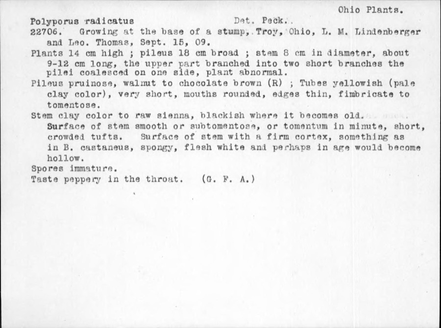
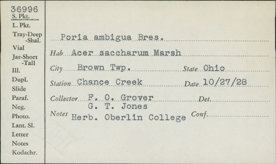
evidence. Museums hold 194 specimens
collected within 10 miles of Saunders, Elizabeth Sheets, Farm between 1835 and
1975: 163 Animalia, 17 Fungi, 11 Plantae, 3 Protozoa. 12 distinct Species records are shown.
Collected by A. R. Gaufin, A.R. Gaufin, H.H. Ross, Adams J. M. R. and others. Each is a
physical object with a catalogue
number, and each entry opens the museum's record. This is what was
collected and kept, not a survey of what lives here - nothing can be
concluded from a species being absent.
Regional context, not property-specific
evidence. The federal mineral resources record lists
5 workings within 5 miles of Saunders, Elizabeth Sheets, Farm: 4 past producers, 1 plant.
1 still produces. What was taken out: Sand and Gravel, Construction, Stone, Crushed/Broken, Limestone, General. Distance is straight-line from the
map coordinates, so a quarry counted here may appear on a neighbouring
settlement's page as well.
Regional context, not property-specific
evidence. The National Weather Service names
Casstown, the town this property stands in, in 7 storm reports between 2007 and 2017: 3 thunderstorm wind, 2 hail, 1 flood, 1 tornado.
No death or injury is recorded in these reports. Each account below is quoted exactly as the forecast office
filed it, from the NOAA Storm Events Database, and each date
opens the federal record of that event.
East Northeast of Casstown, a roof was blown off a garage, a 27 foot camper was blown into a field, large trees were downed, and a house had a chimney blown off due to thunderstorm winds.
Based on video evidence and radar imagery, the tornado is believed to have touched down in a field north of the intersection of Polecat Road and Troy Urbana Road. The tornado moved north to Deweese Road approximately one-half mile north of the intersection with East Rusk Road. Tree branches generally 4 inches in diameter or smaller were broken immediately west of Deweese Road at the start of the tornado track. More significant damage occurred less than one-tenth of a mile north where several maple trees up to 18 inches in diameter were snapped. This is where the tornado was believed to be at peak intensity with winds estimated near 90 mph. There was also a large barn immediately east that was moved several inches off its foundation. This movement was likely caused by winds approaching 90 mph while flowing into the circulation. The tornado then started to weaken as it moved north-|northwest near Deweese Road to a point approximately two-tenths of a mile southwest of the intersection with East Peterson Road. Tree damage was generally less significant in this area with estimated wind speeds of 60-75 mph. The tornado appears to have lifted at this point, and no further damage was observed farther northwest. Damage along this path was oriented in convergent and semi-circular patterns consistent with the presence of a tornado.
No historic map-sheet match is published
for this property yet. That does not mean no map exists. This record needs
a coordinate-quality review before it can be joined to a sheet boundary.
Browse the county's mapped places while that work is
pending.
From the nomination file
2,252 words on record
When this property was proposed for the
National Register, someone wrote the case for it: what the building is,
and why it matters. That document is a federal record in the public domain.
It is quoted below word for word, never summarised. The text was read off the scanned case file by machine, so the
occasional stray character is the recogniser's and the 1970s
typewriter's.
Description of the property
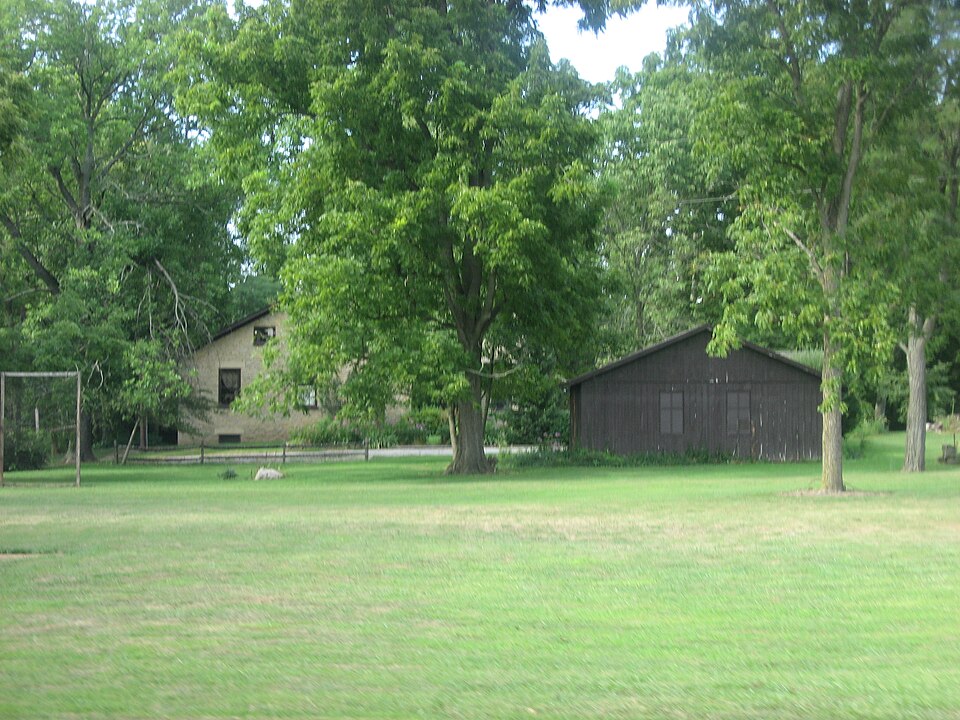
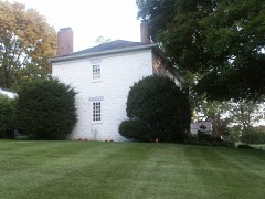
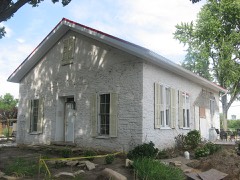
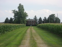
vernacular house undoubtedly stems from the Sheets memory of The porch has plaster walls, a kick board, chair rails and wood kitchen, and pantry. On the south is a master bedroom, bath, The complex of outbuildings is as vitally interesting as a garden shed, stands about thirty feet to the southeast of CONDITION DETERIORATED FAIR XEXCELLENT stream approximately thirty feet north. dressed limestone bay recessed porch with door on the right leading into the kitchen. of life have been discreetly screened. so evident.The builder had several children at home.The house gable verges projecting with frieze. up from a stream with the front and north foundation exposed and elevated wood stoop with latticework side steps and plain balustrade. very old corncrib just west of the barn.
has been rehabilitated with an eye to restoring every possible The asphalt shingle gable roof has an inside end stone chimney The five bay facade has a central door approached by an the rear at ground level.A door in the north foundation wall GOOD foundation bank barn stands about three hundred feet north across XALTERED The one bay projections to each side are a pantry on the Steep steps in the hall lead to the room in the half story _UNALTERED The plan of this one and one-half story with 6/6 wood muntin inserts for effect, having dressed stone lintels CHECK ONE right and a study on the left. _UNEXPOSED above. The dining room, central behind the entrance hall, is the and study. The original uses of some rooms is evident, others not feature of the heavily renovated interior.
Modern necessities The wall with the stable doors is bowing badly. There is a large DATE deck. RUINS the house. The stone springhouse proper is now as in the nineteenth century.
and the springhouse which indicate a change of hands. Jacob Elizabeth Sheets married William Saunders, the son 1400-1499 1500-1599 1700-1799 ECONOMICS ARCHEOLOGY-HISTORIC INVENTION PERIOD BUILDER/ARCHITECT SCIENCE ENGINEERING THEATER RELIGION ART SIGNIFICANCE 1600-1699 LITERATURE TRANSPORTATION INDUSTRY MILITARY XARCHITECTURE _COMMUNICATIONS _PHILOSOPHY MUSIC The research on this house has been most confusing since is interred in Elizabeth Township. _EXPLORATION/SETTLEMENT early farm construction in Miami County by pioneers from Pennsylvania. attention in the near future. suspect that William Saunders did not prosper.Andrew Sheets from Jacob Sheets to Andrew or why the second patent for the Pennsylvania performed guard duty in the revolution.
Andrews's wife Catherine Sills bore him eleven children of which seven it was owned and the complex built in parts by two Andrew Sheets threatened by foundation failure unless it receives some expensive patented the quarter section farm in l8l6. Here we have a complete farm complex of early date being preserved gave Elizabeth the quarter section farm in l822 and it remained drops out of history after about l8l8. - EDUCATION prosperous farmer, Theodore Saunders c.18l6.History leads us to The stone house by itself is valuable and rare evidence of As a young man Andrew Sheets two)of Bedford 1900- X1800-1899 -COMMERCE SPECIFIC DATES same ground. Jacob Sheets, son of Andrew number one, simply built. Jackson.
Quoted from the National Register nomination
for reference 76001491, 17 pages, held by the National Archives in Record
Group 79. See the
catalogue record.
Listed places nearby
6 within 8 miles
Other National Register properties close
enough to walk or drive between, ordered by distance from this one. Both
positions come from the same geocoding pass that matched these properties
to their map sheets.
Listing record. National Park Service National Register of Historic Places, listed-properties dataset, current to 2026-05-22.
Map join. Address geocoded through the United States Census geocoder, then tested against the published boundary of every sheet in the USGS Historical Topographic Map Collection.
How this page is made. Listing fields come from federal records; map-sheet coverage is a labelled coordinate-to-boundary calculation, not a source-field claim.
Wildfire. Short, Karen C. 2022. Spatial wildfire occurrence data for the United States, 1992-2020 [FPA_FOD_20221014]. 6th Edition. Fort Collins, CO: Forest Service Research Data Archive. https://doi.org/10.2737/RDS-2013-0009.6 Collected with United States Government funding and usable without additional permissions or fees.
Specimens. Global Biodiversity Information Facility (GBIF), https://www.gbif.org/. Only records licensed CC0 or CC BY are used. Records licensed CC BY-NC are excluded because this site carries advertising. Images are checked individually and any whose licence is non-commercial, no-derivatives or unreadable is refused.
Mines and quarries. USGS Mineral Resources Data System (MRDS) https://mrdata.usgs.gov/mrds/ A work of the United States government, no copyright under 17 U.S.C. 105.
Storms. NOAA National Centers for Environmental Information, Storm Events Database https://www.ncei.noaa.gov/stormevents/ A work of the United States government, no copyright under 17 U.S.C. 105. Narratives are quoted verbatim from the National Weather Service report and are not edited or summarised.
 Block
Block