BlockBefore
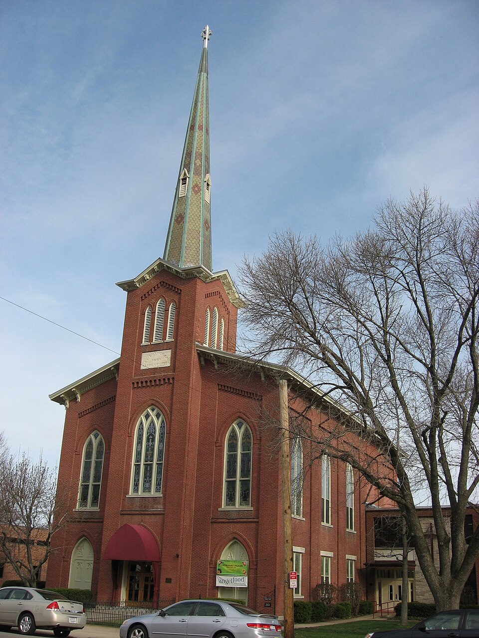
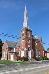
Photograph of Jacob's Church
Photograph by Nyttend, Public domain. Via Wikimedia Commons.

Jacob's Church

Listed on the National Register of Historic Places in 1990. A historic map-sheet match is not published yet. The record needs a coordinate-quality review before it can be joined to a sheet boundary.

From the record

“Jacob's Church is a historic Lutheran church at 213 East Central Avenue in Miamisburg, Ohio.”

Wikipedia article Jacob's Church, CC BY-SA 4.0.

one of 117 National Register listings in Montgomery County · listed in 1990 · category: Building · one of 4 National Historic Landmarks in Montgomery County.

Sources: the Wikipedia article · the case file at the National Archives · the National Register database, National Park Service · the Wikipedia article

The listing

  • What is counted as historic. The nomination lists 1 building as contributing to the listing.
  • Address. 213 E. Central Ave., Miamisburg, 45342
  • When was it listed? 1990-09-06
  • Category. building
  • Also known as. Pennsylvania German Churches of Ohio MPS
  • Township. Miami township
  • Architectural style. Gothic Revival
  • National Register reference number. 90001290 - the number the National Park Service assigned this property when it was listed, and the key its nomination file is catalogued under at the National Archives.

The ground it stands on

25,484 words

The chapter on Miami Township in The History of Montgomery County, Ohio, Containing a History of the County;, published 1882 names Miamisburg. This is what it says, exactly as the scans read.

Water was let into the canal from the mill-race near the corner of Fift and Wyandot streets, Dayton, Friday evening, September 26, 1828. Most of j leaked through the embankment along the river at the bluffs in Van Bure Township ; and a break was made in the embankment there November 24 Wednesday, December 17, the packet Alpha, with a party of Dayton ladies an gentlemen, made a trip to Hole's Creek. With another Dayton party, she mad her next trip to Miamisburg, Monday, the 22d, and returned to Dayton on Wee -nesday; and made a second trip to Miamisburg on Christmas Day, returnin Friday.

Passage source: The History of Montgomery County, Ohio, Containing a History of the County;, published 1882.

The Great Miami Turnpike Company, to run from Dayton over the hills Carrollton, and on down the valley through Miamisburg, Franklin and Middlj town to its junction with the Cincinnati Pike at Sharon, was chartered in Marc 1837. Construction was commeneed in the summer of 1838.

Passage source: The History of Montgomery County, Ohio, Containing a History of the County;, published 1882.

Machine-read from a century-old scan, so expect the errors a machine makes: misspelled names, dropped words, stray characters.

Read the whole chapter on Miami Township - 25,484 words on its settlement, mills, schools and churches.

Specimens collected near this property

12 of 382 shown

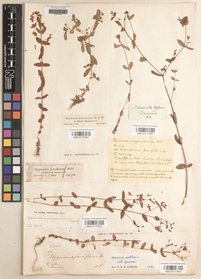
Regional context, not property-specific evidence. Museums hold 382 specimens collected within 10 miles of Jacob's Church between 1835 and 1975: 234 Animalia, 81 Plantae, 59 Fungi, 4 Chromista, 3 Protozoa, 1 Unrecorded. 12 distinct Species records are shown. Collected by ?, A JOHN, A JOHN AND W E DUELLMAN and others. Each is a physical object with a catalogue number, and each entry opens the museum's record. This is what was collected and kept, not a survey of what lives here - nothing can be concluded from a species being absent.

Image SpeciesYear Collected by Where, as recorded
Specimen of Hypericum mutilum subsp. mutilumHypericum mutilum subsp. mutilum1835Joseph C. FrankGermantown
Specimen of Ambrosia artemisiifolia L.Ambrosia artemisiifolia L.1881Foerste AF
Specimen of Geaster limbatus Fr.Geaster limbatus Fr.1883A. E. FoeersteDayton
A photograph of the species Platanthera leucophaea, not of this specimenPlatanthera leucophaea (Nutt.) Lindl.1836C. W. ShortDayton
A photograph of the species Hydrophyllum macrophyllum, not of this specimenHydrophyllum macrophyllum Nutt.1838J. W. Van CleveDayton
A photograph of the species Cassia marilandica, not of this specimenCassia marilandica L.1839Sanders, AlfredDayton
A photograph of the species Cynoglossum officinale, not of this specimenCynoglossum officinale L.1839not recordedDayton. Suburbs E.
A photograph of the species Iris versicolor, not of this specimenIris versicolor L.1839not recordedDayton. 2 mi. south
A photograph of the species Nuphar advena, not of this specimenNuphar advena (Aiton) Aiton1839Sanders, Mrs.; J.G. HauptDayton
A photograph of the species Podophyllum peltatum, not of this specimenPodophyllum peltatum L.1839Nagel, J.J.; J.G. HauptDayton. 1 m. SE
A photograph of the species Polygala verticillata, not of this specimenPolygala verticillata L.1839Sanders, Alfred [?]1 mile SE of Dayton
A photograph of the species Potentilla canadensis, not of this specimenPotentilla canadensis L.1839not recordedDayton. 1 mile south.

All 382 specimens within 10 miles, at the Global Biodiversity Information Facility.

Mines and quarries near this property

8 within 5 miles

Regional context, not property-specific evidence. The federal mineral resources record lists 8 workings within 5 miles of Jacob's Church: 6 producers, 2 past producers. 6 still produce. What was taken out: Sand and Gravel, Construction. Distance is straight-line from the map coordinates, so a quarry counted here may appear on a neighbouring settlement's page as well.

Where SiteCommodity StatusRecorded
Broadway Sand & Gravel Co. Pit #2Sand and Gravel, ConstructionProducer
Carter & Webb IncorporatedSand and Gravel, ConstructionProducer
Hilltop PitSand and Gravel, ConstructionProducer
Number 1 PitSand and Gravel, ConstructionPast ProducerSedimentary
Weidle Sand & GravelSand and Gravel, ConstructionProducer
Weidle Sand and Gravel, Inc. PitSand and Gravel, ConstructionPast ProducerSedimentary
Weidle Sand and Gravel, Inc. PitSand and Gravel, ConstructionProducer
West Carrollton Aggregate No. 1 PitSand and Gravel, ConstructionProducer

Every working recorded in Montgomery County

Storms near this property

33 since 1994

Regional context, not property-specific evidence. The National Weather Service names Miamisburg, the town this property stands in, in 33 storm reports between 1994 and 2025: 17 thunderstorm wind, 10 hail, 3 flash flood, 1 tornado. The reports record 2 injuries. Each account below is quoted exactly as the forecast office filed it, from the NOAA Storm Events Database, and each date opens the federal record of that event.

WhenEvent Place namedHarm What the report says
May 2011HailMiamisburg2 hurt, $10,000Two individuals, one child and one adult, were injured by large hail while running for cover. A truck also sustained damage due to the hail.
July 2006Tornado (F1)Miamisburg$75,000A tornado touched down near the Dayton Mall to the east of Miamisburg and was on the ground for just under a mile. The tornado caused minor damage to a strip mall, a carpet business, a restaurant and a municipal bus outlet. A few trees were downed along the track of the tornado as well.
June 1994Thunderstorm WindMiamisburg$50,000Trees were downed, some on power lines, cars, and structures. A house under construction collapsed in Germantown.
April 2025Thunderstorm WindMiamisburg$10,000A large tree fell onto a house.
June 2008Flash FloodMiamisburg$7,000Numerous homes experienced basement flooding in Miamisburg. Several roads were flooded as well.
April 2006HailMiamisburg$6,000no account filed
June 2015Thunderstorm WindMiamisburg$5,000Numerous large limbs were knocked down. Winds were estimated at 60 to 65 mph.
June 2006Thunderstorm WindMiamisburg$5,000Trees and large limbs four to six inches in diameter were knocked down in Miami Township.
April 2025Thunderstorm WindMiamisburg$3,000A few trees were downed along West Central Avenue between Miamisburg and West Carrollton.
March 2020Thunderstorm WindMiamisburg$3,000Several trees were downed near Manning Road and Bear Creek Road.
January 2018Thunderstorm WindMiamisburg$3,000A few trees were downed in the Miamisburg area.
June 2004Thunderstorm WindMiamisburg$3,000Trees were downed.
June 2020Thunderstorm WindMiamisburg$2,000A tree fell onto some power lines in Miami Township.
July 2017Thunderstorm WindMiamisburg$2,000Several large pieces of siding were stripped from a house.
June 2015Thunderstorm WindMiamisburg$2,000A large tree was uprooted.
April 2007HailMiamisburg$2,000no account filed
June 2014Flash FloodMiamisburg$1,000Two feet of moving water was reported over Vanguard Boulevard and Dayton-Cincinnati Pike due to heavy rainfall.
January 2012FloodMiamisburg$1,000Roads were reported flooded due to recent heavy rain.
August 2010Thunderstorm WindMiamisburg$1,000Several large branches were reported down due to damaging thunderstorm winds.
June 2010Thunderstorm WindMiamisburg$1,000Trees were reported down due to damaging thunderstorm winds.
June 2025Thunderstorm WindMiamisburg$250Several large tree limbs were downed on Panjab Court.
June 2021Thunderstorm WindMiamisburg$100A large tree limb was downed on South Main Street.
July 2019Thunderstorm WindMiamisburg$100A small tree was downed on Cottage Avenue.
June 2015Flash FloodMiamisburg-High water was reported over roadways.
April 2014Heavy RainMiamisburg-Drainage ditches were overflowing and ponding of water was occurring on some roadways due to heavy rainfall.
February 2025HailMiamisburg-no account filed
April 2015HailMiamisburg-no account filed
March 2012HailMiamisburg-no account filed
April 2010HailMiamisburg-no account filed
June 2009HailMiamisburg-no account filed
April 2006HailMiamisburg-no account filed
May 1998HailMiamisburg-no account filed

Every storm recorded in Montgomery County

Map coverage status

No historic map-sheet match is published for this property yet. That does not mean no map exists. This record needs a coordinate-quality review before it can be joined to a sheet boundary. Browse the county's mapped places while that work is pending.

From the nomination file

2,263 words on record

When this property was proposed for the National Register, someone wrote the case for it: what the building is, and why it matters. That document is a federal record in the public domain. It is reproduced in full on its own page, word for word and never summarised. The text was read off the scanned case file by machine, so the occasional stray character is the recogniser's and the 1970s typewriter's.

The whole case file for this property - 2,263 words, 28 pages, reproduced complete.

Quoted from the National Register nomination for reference 90001290, 28 pages, held by the National Archives in Record Group 79. See the catalogue record.

Listed places nearby

6 within 8 miles

Other National Register properties close enough to walk or drive between, ordered by distance from this one. Both positions come from the same geocoding pass that matched these properties to their map sheets.

Photograph PropertyDistance Listed
Miamisburg Mound1.1 miles1970
Salem Bear Creek Church, Salem Evangelical Lutheran Church2.9 miles1990
Schuter Carpenter Shop and House3.8 miles1980
Emmanuel's Evangelical Lutheran Church4.6 miles1990
Kellog, Ethol, House4.6 miles1976
Shuey's Mill4.7 miles1975

Sources for this property

National Archives recordThe nomination case file for reference 90001290 in Record Group 79.
Wikipedia articleCommunity-written account of this property, licensed CC BY-SA.
Montgomery CountyAll 117 listed properties in this county.

Provenance

  • Listing record. National Park Service National Register of Historic Places, listed-properties dataset, current to 2026-05-22.
  • Map join. Address geocoded through the United States Census geocoder, then tested against the published boundary of every sheet in the USGS Historical Topographic Map Collection.
  • How this page is made. Listing fields come from federal records; map-sheet coverage is a labelled coordinate-to-boundary calculation, not a source-field claim.
  • Specimens. Global Biodiversity Information Facility (GBIF), https://www.gbif.org/. Only records licensed CC0 or CC BY are used. Records licensed CC BY-NC are excluded because this site carries advertising. Images are checked individually and any whose licence is non-commercial, no-derivatives or unreadable is refused.
  • Mines and quarries. USGS Mineral Resources Data System (MRDS) https://mrdata.usgs.gov/mrds/ A work of the United States government, no copyright under 17 U.S.C. 105.
  • Storms. NOAA National Centers for Environmental Information, Storm Events Database https://www.ncei.noaa.gov/stormevents/ A work of the United States government, no copyright under 17 U.S.C. 105. Narratives are quoted verbatim from the National Weather Service report and are not edited or summarised.