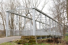
Listed on the National Register of Historic Places in
1993. A historic map-sheet match is not published yet. The record needs a coordinate-quality review before it can be joined to a sheet boundary.
From the record
“The first Methodist church was built in 1833. The trustees were Adam Ebright, Isaac Rainer, Philip Ford, John Milnor, John Tyler, Sr., William Thompson, Thomas McArthur, James Pickering and Andrew Dougherty, Sr.”
History of Fairfield County, Ohio, and Representative Citizens (1912). Machine-read text.
one of 29 National Register listings in Fairfield County · listed in 1993 · category: Building · one of 1 National Historic Landmarks in Fairfield County.
National Register reference number.93000890- the number the National Park Service assigned this property when it was listed, and the key its nomination file is catalogued under at the National Archives.
The name " VioleL" is understood to have been derived from the luxuriance with which the flower bearing that name grew on some portions of its soil. Pickerington is situated in Violet. A man by the name of George Kirk first purchased the eighty-acre tract in which the village stands. Subsequently the land fell into the hands of Mr. Pickering, who laid out the town and christened it with his own name.
Violet; in churches, schools, and the general spirit and enterprise of the times, is not behind any township of the county. Settlements were first begun in the vicinity of where Pickerington now stands. Residences were located through the township with reference to springs and water streams, as well as the quality of the lands. Some of the first settlers came out in advance of their families and first built their cabins; in other instances the families came together, and took their chances in the forests. Dr. Tolbert was prob- ably the first physician in the township - at least among the first. He is still living at a very advanced age, and has been for many years a citizen of Jefierson.
Regional context, not property-specific
evidence. The
federal wildfire occurrence database
lists 2 fires within 5 miles of Dovel--Bowers House between
2020 and 2020, burning about 0 acres in total. None started naturally. None was recorded as arson.
Distance is straight-line from the map coordinates, so a fire counted
here may appear on a neighbouring settlement's page as well.
Reported cause
Fires
Debris and open burning
2
The most recent of
them, most recent first, with the day each was reported and the service
that recorded it.
Regional context, not property-specific
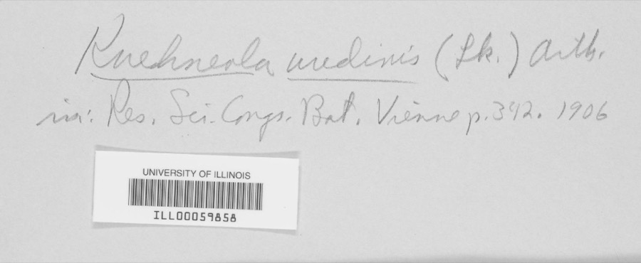
evidence. Museums hold 732 specimens
collected within 10 miles of Dovel--Bowers House between 1891 and
1974: 723 Animalia, 8 Plantae, 1 Fungi. 12 distinct Species records are shown.
Collected by Brzoska, D., C. A. Petrovic, Caldwell and others. Each is a
physical object with a catalogue
number, and each entry opens the museum's record. This is what was
collected and kept, not a survey of what lives here - nothing can be
concluded from a species being absent.
Regional context, not property-specific
evidence. The National Weather Service names
Pickerington, the town this property stands in, in 26 storm reports between 1994 and 2012: 13 thunderstorm wind, 11 hail, 2 flash flood.
No death or injury is recorded in these reports. Each account below is quoted exactly as the forecast office
filed it, from the NOAA Storm Events Database, and each date
opens the federal record of that event.
No historic map-sheet match is published
for this property yet. That does not mean no map exists. This record needs
a coordinate-quality review before it can be joined to a sheet boundary.
Browse the county's mapped places while that work is
pending.
From the nomination file
2,333 words on record
When this property was proposed for the
National Register, someone wrote the case for it: what the building is,
and why it matters. That document is a federal record in the public domain.
It is quoted below word for word, never summarised. The text was read off the scanned case file by machine, so the
occasional stray character is the recogniser's and the 1970s
typewriter's.
Statement of significance
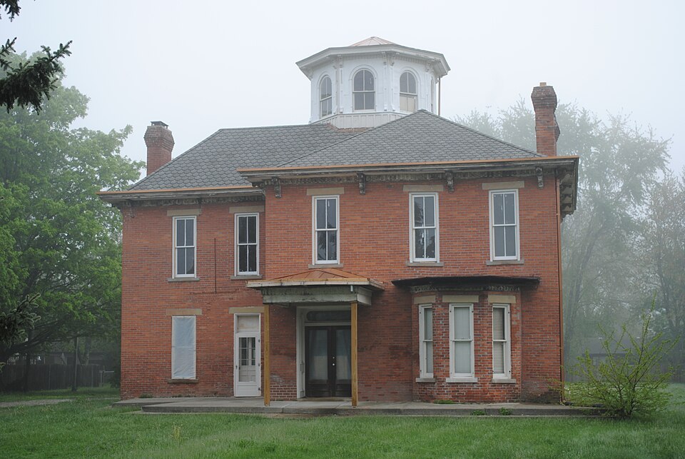
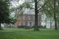
c. 1865 State significance of property, and justify criteria, criteria considerations, and areas and periods of significance noted above. The Dovel-Bowers House, located at 380 West Columbus Street, Pickerington, Fairfield County, is eligible for listing on the National Register of Historic Places under Criteria wall collapsed in the 1980s and was repaired by replacing part of the wall with new bricks. A small brick addition, extends from the northeast side. private residences, commercial buildings, train stations, and industrial structures. The Dovel-Bowers House was built by Jacob B. Dovel, a farmer and livestock herder who (the Dovel-Bowers House, nominated here)is located at 380 West Columbus Street and was built for daughter Lucinda Bowers.
Within the historic architectural context of Pickerington, a windshield survey of the town nly other Italianate in the city which compares favorably to the Dovel-Bowers House i: X See continuation sheet Architecture Unknown gifts. Significant Person Significant Dates Architect/Builder Cultural Affiliation Earlier examples feature a box-like massing while later versions contained an asymmetrical Areas of Significance (enter categories from instructions) Period of Significance 1,0oo acres extending from Refugee to Blacklick Creek.Jacob and his wife Elizabeth gave House is the only Italianate house in Pickerington that features a central cupola.
The Three of these homes built for Jacob B.Dovel remain.One of the houses is the J.H.Dovel settled in Pickerington in 1836 from Virginia.He was a man of wealth who owned more than limitsyielded that there were only 8 late-nineteenth century houses and 4 late nineteenth floor Farm located on Hill Road North.Already listed in the National Register isa X locally its popularity from 1867 to 1873.
Quoted from the National Register nomination
for reference 93000890, 23 pages, held by the National Archives in Record
Group 79. See the
catalogue record.
Listed places nearby
6 within 8 miles
Other National Register properties close
enough to walk or drive between, ordered by distance from this one. Both
positions come from the same geocoding pass that matched these properties
to their map sheets.
Listing record. National Park Service National Register of Historic Places, listed-properties dataset, current to 2026-05-22.
Map join. Address geocoded through the United States Census geocoder, then tested against the published boundary of every sheet in the USGS Historical Topographic Map Collection.
How this page is made. Listing fields come from federal records; map-sheet coverage is a labelled coordinate-to-boundary calculation, not a source-field claim.
Wildfire. Short, Karen C. 2022. Spatial wildfire occurrence data for the United States, 1992-2020 [FPA_FOD_20221014]. 6th Edition. Fort Collins, CO: Forest Service Research Data Archive. https://doi.org/10.2737/RDS-2013-0009.6 Collected with United States Government funding and usable without additional permissions or fees.
Specimens. Global Biodiversity Information Facility (GBIF), https://www.gbif.org/. Only records licensed CC0 or CC BY are used. Records licensed CC BY-NC are excluded because this site carries advertising. Images are checked individually and any whose licence is non-commercial, no-derivatives or unreadable is refused.
Storms. NOAA National Centers for Environmental Information, Storm Events Database https://www.ncei.noaa.gov/stormevents/ A work of the United States government, no copyright under 17 U.S.C. 105. Narratives are quoted verbatim from the National Weather Service report and are not edited or summarised.
 Block
Block