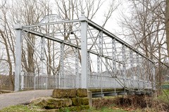
Listed on the National Register of Historic Places in
1990. A historic map-sheet match is not published yet. The record needs a coordinate-quality review before it can be joined to a sheet boundary.
From the record
“The schools of Violet township were no different from other schools in Fairfield County until the school year 1907-8. In 1895 the people of Violet township began to agitate a change in their school system.”
History of Fairfield County, Ohio, and Representative Citizens (1912). Machine-read text.
one of 29 National Register listings in Fairfield County · listed in 1990 · category: Building · one of 1 National Historic Landmarks in Fairfield County.
National Register reference number.90001119- the number the National Park Service assigned this property when it was listed, and the key its nomination file is catalogued under at the National Archives.
The first taxes I paid in Fairfield County was two or three dollars a year. My land was not taxed for five years after I entered it. This was provided for in the patent. Money was hard to come at, and there was very little the farmers produced that would bring it, for we had no market and no way to get our little surplus out of the country. What little money we had was almost entirely silver, and much of it was cut money. The men soon learned to make five " quarters " out of a Spanish dollar, and five "ninepences" out of a halfdollar, or five " fipenybits " from a twenty-five-cent piece.
All around us was a wilderness. There were a few families over on Ewing's Run, and on Fetter's Run, and down on Rush Creek. A man by the name of Lynch had opened a small tanyard where Baldwin's brick house stands, two miles north-east of Lancaster. Jacob Harmon had a cabin where East Lancaster is. He was not of our family. I was eight years old when we came to Fairfield County. I am eighty-five years and six months now.
Regional context, not property-specific
evidence. The
federal wildfire occurrence database
lists 3 fires within 5 miles of Pickerington Depot between
2020 and 2020, burning about 1 acres in total. None started naturally. None was recorded as arson.
Distance is straight-line from the map coordinates, so a fire counted
here may appear on a neighbouring settlement's page as well.
Reported cause
Fires
Debris and open burning
2
Equipment and vehicle use
1
The most recent of
them, most recent first, with the day each was reported and the service
that recorded it.
Regional context, not property-specific
evidence. Museums hold 732 specimens
collected within 10 miles of Pickerington Depot between 1891 and
1974: 723 Animalia, 8 Plantae, 1 Fungi. 12 distinct Species records are shown.
Collected by Brzoska, D., C. A. Petrovic, Caldwell and others. Each is a
physical object with a catalogue
number, and each entry opens the museum's record. This is what was
collected and kept, not a survey of what lives here - nothing can be
concluded from a species being absent.
No historic map-sheet match is published
for this property yet. That does not mean no map exists. This record needs
a coordinate-quality review before it can be joined to a sheet boundary.
Browse the county's mapped places while that work is
pending.
From the nomination file
2,036 words on record
When this property was proposed for the
National Register, someone wrote the case for it: what the building is,
and why it matters. That document is a federal record in the public domain.
It is quoted below word for word, never summarised. The text was read off the scanned case file by machine, so the
occasional stray character is the recogniser's and the 1970s
typewriter's.
Statement of significance
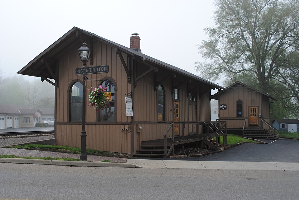
Applicable National Register Criteria In 1880, the Toledo and Ohio Railway Company constructed a depot at Pickerington, linking time the Pickerington Grain Warehouse and Elevator opened, along with the Elgin Butter and function for the area. The extent to which the rallnoad impacted the.community. is. reflected in the population change. Prior,to 1880, Picker Ington experienced l.ittle growth. Within three years after the arrival of the railroad Picker ington's [X See continuation sheet Transportation 1880-1940 Architect/Builder Cultural Affiliation Significant Dates Significant Person population doubled.
produced agricultural goods.The resulting economic growth in this rural community is primary functions under one roof.The floor plan of the passenger waiting room and freight Period of Significance evidenced by the number of businesses that opened within the next decade.During this The railroad enabled Pickerington to become a regional center for the processing and Certifying official has considered the significance of this property in relation to other properties: Areas of Significance (enter categories from instructions) shipment of agricultural products, giving the small community an important central place The Pickerington Depot is eligible under Criterion A for its significance to the role State significance of property,and justify criteria,criteria considerations,and areas and periods of significance noted above.
the community to the larger communities of Columbus and Toledo.The railroad represented transportation played in the development of the community.This well preserved structure room separated by the agent's office,(with ubiquitous bay window on the trackside),was [x locally Criteria Considerations (Exceptions) Cream Company, a drainage tile mill, a cider mill and a stockyard. All these agriculture The Pickerington Depot is a small town, combination station depot.
Quoted from the National Register nomination
for reference 90001119, 12 pages, held by the National Archives in Record
Group 79. See the
catalogue record.
Listed places nearby
6 within 8 miles
Other National Register properties close
enough to walk or drive between, ordered by distance from this one. Both
positions come from the same geocoding pass that matched these properties
to their map sheets.
Listing record. National Park Service National Register of Historic Places, listed-properties dataset, current to 2026-05-22.
Map join. Address geocoded through the United States Census geocoder, then tested against the published boundary of every sheet in the USGS Historical Topographic Map Collection.
How this page is made. Listing fields come from federal records; map-sheet coverage is a labelled coordinate-to-boundary calculation, not a source-field claim.
Wildfire. Short, Karen C. 2022. Spatial wildfire occurrence data for the United States, 1992-2020 [FPA_FOD_20221014]. 6th Edition. Fort Collins, CO: Forest Service Research Data Archive. https://doi.org/10.2737/RDS-2013-0009.6 Collected with United States Government funding and usable without additional permissions or fees.
Specimens. Global Biodiversity Information Facility (GBIF), https://www.gbif.org/. Only records licensed CC0 or CC BY are used. Records licensed CC BY-NC are excluded because this site carries advertising. Images are checked individually and any whose licence is non-commercial, no-derivatives or unreadable is refused.
 Block
Block