Listed on the National Register of Historic Places in
1976. A historic map-sheet match is not published yet. The record needs a coordinate-quality review before it can be joined to a sheet boundary.
From the record
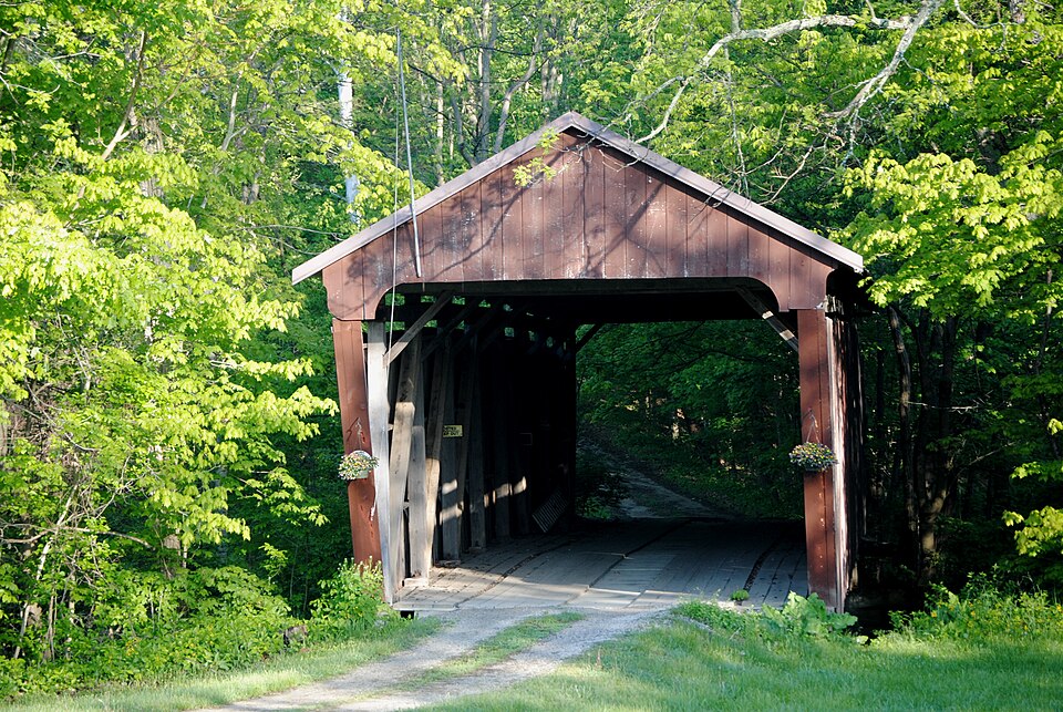
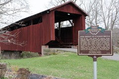
“The Hizey Covered Bridge, in Fairfield County, Ohio, is a Burr Truss covered bridge which was built in 1891 by James W. It was listed on the National Register of Historic Places in 1976 when it was still located at its original location.”
Wikipedia article Hizey Covered Bridge, CC BY-SA 4.0.
one of 29 National Register listings in Fairfield County · listed in 1976 · category: Structure · one of 1 National Historic Landmarks in Fairfield County.
National Register reference number.76001423- the number the National Park Service assigned this property when it was listed, and the key its nomination file is catalogued under at the National Archives.
What happened here
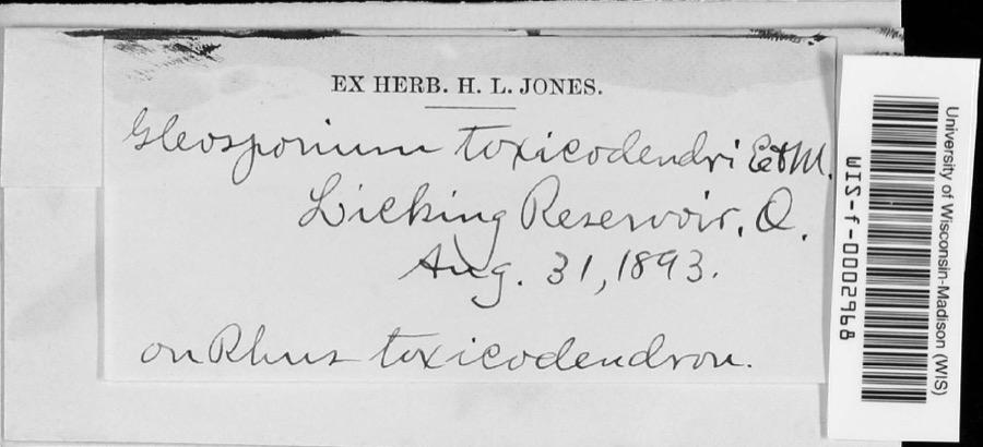
An account from the chapter on Liberty township, The inset identifies its exact
source book and publication year.
The first season they planted about three acres of corn, but they did not even get a peck of ripe corn. The squirrels visited the cornfield in day-time, and the raccoons in the night. Jacob told me that his father, Abraham, went out with his rifle one morning and killed thirty-eight squirrels ofi" of one tree, and then he was not able to count the remainder on the same tree.
Each neighborhood had scrub horses to run from lOO to 300 yards. As early as the thirties, Chancy Rickets of Pickerington, then Jacksonville, owned som.e good horses and that point was somewhat famed for this amusement.
is their son, and Thomas, another son, lives in Indiana. Marietta, the daughter, is the wife of Dr. Stewart of Pickerington. One of the chief characteristics of the Holmes family is good looks, and Mrs. Stewart is not deficient in this respect.
Regional context, not property-specific
evidence. The
federal wildfire occurrence database
lists 4 fires within 5 miles of Hizey Covered Bridge between
2020 and 2020, burning about 1 acres in total. None started naturally. None was recorded as arson.
Distance is straight-line from the map coordinates, so a fire counted
here may appear on a neighbouring settlement's page as well.
Reported cause
Fires
Debris and open burning
3
Equipment and vehicle use
1
The most recent of
them, most recent first, with the day each was reported and the service
that recorded it.
Regional context, not property-specific
evidence. Museums hold 885 specimens
collected within 10 miles of Hizey Covered Bridge between 1891 and
1975: 861 Animalia, 12 Fungi, 12 Plantae. 12 distinct Species records are shown.
Collected by Bangham, R. V., Baugham, R. V. (Ralph V.), Brzoska, D. and others. Each is a
physical object with a catalogue
number, and each entry opens the museum's record. This is what was
collected and kept, not a survey of what lives here - nothing can be
concluded from a species being absent.
Regional context, not property-specific
evidence. The federal mineral resources record lists
1 working within 5 miles of Hizey Covered Bridge: 1 producer.
All of them still produce. What was taken out: Sand and Gravel, Construction. Distance is straight-line from the
map coordinates, so a quarry counted here may appear on a neighbouring
settlement's page as well.
Regional context, not property-specific
evidence. The National Weather Service names
Pickerington, the town this property stands in, in 26 storm reports between 1994 and 2012: 13 thunderstorm wind, 11 hail, 2 flash flood.
No death or injury is recorded in these reports. Each account below is quoted exactly as the forecast office
filed it, from the NOAA Storm Events Database, and each date
opens the federal record of that event.
No historic map-sheet match is published
for this property yet. That does not mean no map exists. This record needs
a coordinate-quality review before it can be joined to a sheet boundary.
Browse the county's mapped places while that work is
pending.
From the nomination file
1,966 words on record
When this property was proposed for the
National Register, someone wrote the case for it: what the building is,
and why it matters. That document is a federal record in the public domain.
It is quoted below word for word, never summarised. The text was read off the scanned case file by machine, so the
occasional stray character is the recogniser's and the 1970s
typewriter's.
Description of the property
CONDITION DATE MOVED UNALTERED EXCELLENT DETERIORATED DESCRIPTION FAIR The structure under consideration is a one-span wooden truss covered bridge XGOOD Burr of New England.Mr. Burr was a well-known bridge-builder who built many portals are painted white. kingpost truss and then anchored into the masonry of the abutments.Mr.Burr's metal roof, cut-stone abutments and projected portals. Township section 5,4 and one-half miles east northeast of Pickerington in We do not know what the original paint job was on this bridge any),but CHECK ONE early 196ois, the county painted over Mr.Buchanan's name when they gave this Buchanan of Basil, Ohio (now known as
Buchanan used the Burr _UNEXPOSED wiath is l9'.The height of the trusses is ll'.The floor is one layer x12.The end posts are 10x 8#;the truss members measure 9x 8 on the end panels,8# x 8# on the second panels and 8ux 7 on the center panels.All idea was not entirely new as wooden arch covered bridges had been built in concrete at its base.One wooden post has been added under the northwest the first truss vertical and between the lower chord sections.This steel is rivers there.
The Burr truss features wooden arches fastened to basic multiple truss plan for this bridge.The Burr truss was patented in l8ol by Theodore bridge a coat of red paint with white trim on the portals.The bridge still undoubtedly a later strengthening addition.The bridge measures 83' long over- for the original shingle.This old bridge is still in good condition today. spanning Poplar Creek on township road 235 Creek Road) in Liberty This is known as the Hizey Covered Bridge and was built in l89l by James W.
state. Liberty Township, where the Hizey Bridge stands, had 14 of these roofed 1872 and learned his trade well. Like Mr. Brandt, he preferred the Burr or 1500-1599 1891 Historic 1600-1699 PHILOSOPHY PERIOD ARCHEOLOGY-HISTORIC CONSERVATION 1700-1799 COMMERCE BUILDER/ARCHITECT X1800-1899 LAW ARCHITECTURE THEATER EXPLORATION/SETTLEMENT POLITICS/GOVERNMENT INDUSTRY ARCHEOLOGY-PREHISTORIC SCIENCE SIGNIFICANCE ART RELIGION LITERATURE MUSIC March on Atlanta.After spending his summers building bridges, Mr. Buchanan -1400-1499 problem in Fairfield County. caped some of this vandalism which has made covered bridge maintenance such a multiple kingpost truss plans and built many covered bridges of this type.
known as Baltimore):Mr.Buchanan was a master bridge-builder who learned his _COMMUNICATIONS as one of the few roofed spans remaining in an area once so rich with them and AGRICULTURE X.ENGINEERING The Hizey Covered Bridge is one ofa fst-vanishing breed in Fairfield County James W. Buchanan which was once the home of more covered bridges than any other county in the -EDUCATION as a fine example of the Burr truss and the building skills of James W. Buchanan The Hizey Bridge is named for a T. Hizey who once owned land near the bridge.
crossings in the 195o's and today the number has dwindled to 5.There were hind the braces to produce a camber to the truss, giving his bridges a hump- trade from old Jacob "Blue Jeans" Brandt.He worked for Mr.Brandt from 1865- out 2 of these bridges in the past l0 years.The Hizey Bridge has so far.es- - MILITARY _1900- E ECONOMICS enlisted in Compnay K, 17th Ohio Volunteer Infantry and was in Sherman's The old span is in a scenic setting over Poplar Creek and is significant to us Mr. Buchanan's covered bridges were distinguished by use of wedges driven be- taught school in the winters. In 1897 he was appointed postmaster at Basil.
Quoted from the National Register nomination
for reference 76001423, 17 pages, held by the National Archives in Record
Group 79. See the
catalogue record.
Listed places nearby
6 within 8 miles
Other National Register properties close
enough to walk or drive between, ordered by distance from this one. Both
positions come from the same geocoding pass that matched these properties
to their map sheets.
Listing record. National Park Service National Register of Historic Places, listed-properties dataset, current to 2026-05-22.
Map join. Address geocoded through the United States Census geocoder, then tested against the published boundary of every sheet in the USGS Historical Topographic Map Collection.
How this page is made. Listing fields come from federal records; map-sheet coverage is a labelled coordinate-to-boundary calculation, not a source-field claim.
Wildfire. Short, Karen C. 2022. Spatial wildfire occurrence data for the United States, 1992-2020 [FPA_FOD_20221014]. 6th Edition. Fort Collins, CO: Forest Service Research Data Archive. https://doi.org/10.2737/RDS-2013-0009.6 Collected with United States Government funding and usable without additional permissions or fees.
Specimens. Global Biodiversity Information Facility (GBIF), https://www.gbif.org/. Only records licensed CC0 or CC BY are used. Records licensed CC BY-NC are excluded because this site carries advertising. Images are checked individually and any whose licence is non-commercial, no-derivatives or unreadable is refused.
Mines and quarries. USGS Mineral Resources Data System (MRDS) https://mrdata.usgs.gov/mrds/ A work of the United States government, no copyright under 17 U.S.C. 105.
Storms. NOAA National Centers for Environmental Information, Storm Events Database https://www.ncei.noaa.gov/stormevents/ A work of the United States government, no copyright under 17 U.S.C. 105. Narratives are quoted verbatim from the National Weather Service report and are not edited or summarised.
 Block
Block