 Block
Richland, Tennessee
17 topographic sheets cover this place, the earliest surveyed in 1903 and the latest in 1997. It stands in District 20. It lies in ZIP code area 37209. It stands on Philips Branch. The Survey maps it on the Nashville West quadrangle.
On record in Richland
Buildings and businesses the archive holds for this place. Each opens its own page, with the source record it came from.
On the National Register within a mile 2 records
The National Register names another town for these. They stand within one mile of this settlement's coordinate.
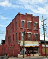 Richland Halllisted 1983 · 0.7 miles away
- Park-Elkins Historic Districtlisted 2011 · 0.9 miles away
Topographic sheets covering this place
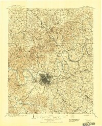
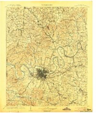
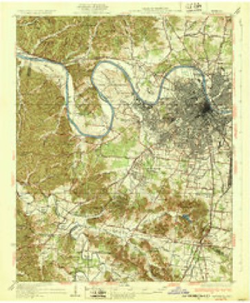
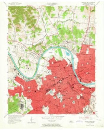
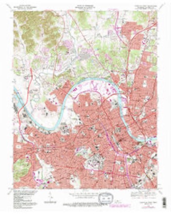
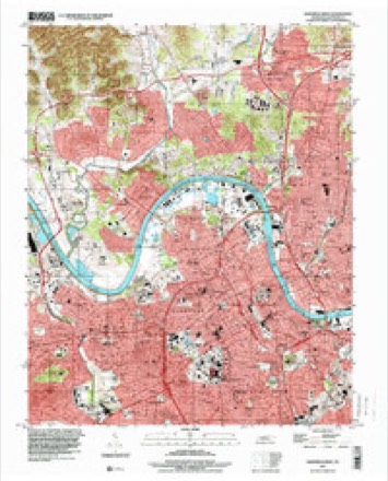
9 surveys from 17 printed sheetsMatched by testing this settlement's coordinate against the published boundary of every sheet in the United States Geological Survey's historical collection. Each opens the scanned sheet at the Survey.
- 1903 USGS Greenbrier quadrangle1:125000, 2 printings
- 1903 USGS Nashville quadrangle1:125000, 2 printings
- 1932 USGS Nashville quadrangle1:62500, 2 printings
- 1952 USGS Nashville West quadrangle1:24000, 2 printings
- 1956 USGS Nashville quadrangle1:250000, 2 printings
- 1959 USGS Nashville quadrangle1:250000
- 1968 USGS Nashville West quadrangle1:24000, 4 printings
- 1984 USGS Nashville quadrangle1:100000
- 1997 USGS Nashville West quadrangle1:24000



Fires near this place
1 since 1998Regional context, not property-specific evidence. The federal wildfire occurrence database lists 1 fire within 5 miles of Richland in 1998, burning under an acre in total. None started naturally. None was recorded as arson. Distance is straight-line from the map coordinates, so a fire counted here may appear on a neighbouring settlement's page as well.
| Reported cause | Fires |
|---|---|
| Debris and open burning | 1 |
The most recent of them, most recent first, with the day each was reported and the service that recorded it.
| Date | Cause | Size | Reported by | Name on the report |
|---|---|---|---|---|
| 3 January 1998 | Debris and open burning | under an acre | Tennessee Division of Forestry | not named |
Settlements close enough to share some of these fires:
Mines and quarries near this place
10 of 14 shownRegional context, not property-specific evidence. The federal mineral resources record lists 14 workings within 5 miles of Richland: 8 producers, 4 past producers, 2 plants. 10 still produce. What was taken out: Clay, Stone, Crushed/Broken, Brick Clay, Limestone, General, Stone, Crushed/Broken. Distance is straight-line from the map coordinates, so a quarry counted here may appear on a neighbouring settlement's page as well.
| Where | Site | Commodity | Status | Recorded |
|---|---|---|---|---|
| Bush No. 2 Pit | Brick Clay | Producer | 1967 | |
| Eller and Olsen Stone Co. Quarry | Stone, Crushed/Broken, Limestone, General | Producer | Limestone | |
| Herbert Sand Yard | Sand and Gravel, Construction | Producer | ||
| Nashville Plant-Uss Agri-Chemical | Fluorine-Fluorite | Plant | ||
| River Road Plant #515 | Limestone, General, Stone, Crushed/Broken | Producer | Limestone | |
| Eller and Olsen Stone Co. Quarry | Stone, Crushed/Broken | Producer | ||
| Nashville Cement Plant | Stone, Crushed/Broken | Plant | ||
| River Road Plant #515 & Quarry | Stone, Crushed/Broken | Producer | ||
| Bush Number 2 Pit | Clay | Past Producer | Sedimentary | |
| Bush Number 2 Pit | Clay | Past Producer |
Storms near this place
38 since 2009Regional context, not property-specific evidence. The National Weather Service names Richland in 38 storm reports between 2009 and 2026: 21 thunderstorm wind, 5 flash flood, 3 hail, 3 lightning. The reports record 2 injuries. Each account below is quoted exactly as the forecast office filed it, from the NOAA Storm Events Database, and each date opens the federal record of that event.
| When | Event | Place named | Harm | What the report says |
|---|---|---|---|---|
| June 2016 | Thunderstorm Wind | Richland | 1 hurt, $20,000 | A large scaffolding structure at a construction site for a water tower collapsed on Morrow Road in The Nations area of west Nashville. A worker on the scaffolding reportedly fell 70 feet and was injured. |
| June 2013 | Lightning | Richland | 1 hurt | One person was reportedly struck by lightning and injured in Sylvan Park. Reported via tspotter on Twitter. |
| February 2019 | Flash Flood | Richland | $1,000,000 | Davidson County Emergency Management reported major flash flooding affected central portions of Nashville during the evening hours on February 6, with numerous roads flooded and closed, vehicles stranded in flood waters with water rescues conducted, and several homes, businesses, and schools flooded. Roadways that were flooded and closed including the two right lanes of westbound I-440 just east of the Nolensville Pike exit, James Kay Lane at Dodsons Chapel Road in Hermitage, Harding Pike at Woodmont Boulevard in Belle Meade, Dartmouth Avenue at Woodmont Boulevard, and numerous other streets around Vanderbilt University and in Hillsboro Village. Flash flooding from Browns Creek near the Fairgrounds stranded numerous vehicles on Nolensville Road between Moore Avenue and Polk Avenue, with several water rescues conducted. Homes and businesses in this same area were also flooded, including a used car dealership on Nolensville Road and an apartment building on Lewis Street. Elsewhere, St. Bernard Academy was flooded with four inches of water inside the school, and several homes flooded in the Inglewood area of East Nashville. |
| March 2017 | Lightning | Richland | $100,000 | A residence in the 3900 block of Nevada Avenue was heavily damaged by a lightning strike. |
| June 2018 | Lightning | Richland | $25,000 | Lightning struck a home on Vine Ridge Drive causing significant fire damage. Time estimated. |
| July 2020 | Flood | Richland | $10,000 | Underpasses beneath I-40 at Alabama Avenue and Morrow Road as well as 51st Street at Delaware Avenue were flooded and closed with 2 cars stalled in the flood waters. |
| August 2019 | Flash Flood | Richland | $10,000 | Flash flooding affected roads across much of south Nashville. Twitter tSpotter reports, photos and videos showed water covering numerous roadways including West End Avenue near Montgomery Bell Academy, Natchez Trace at West End Avenue, I-440 near West End Avenue, I-440 at I-24, the I-65 South ramp to I-440 West, Bransford Road and Craighead Road near the Fairgrounds, and 24th Avenue near Vanderbilt University between the 25th Avenue parking garage and the VA Hospital. Two cars stalled in high water on Morrow Road under I-40. |
| July 2016 | Thunderstorm Wind | Richland | $10,000 | Numerous tSpotter Twitter, media, and fire department reports indicated a roughly 2 mile wide downburst struck the Belle Meade, Charlotte Park and The Nations areas of west Nashville in a southeast to northwest direction. Several trees and tree branches were blown down, including a snapped pine tree at the Rock Harbor Condos on Basswood Avenue, a tree down on a house on Charlotte Pike, and a tree down on Brook Hollow Road. Many power lines were also blown down with widespread power outages. A large scaffolding structure for a water tower construction project on Morrow Road in The Nations collapsed. This was the second time the scaffolding collapsed due to severe thunderstorm winds, with the first time being on June 15, 2016. Pea size hail was also reported in the area. Winds were estimated around 60 mph. |
| April 2015 | Thunderstorm Wind | Richland | $10,000 | A Facebook photo showed a roof partially blown off an apartment building at the Premier West Apartments. |
| July 2016 | Thunderstorm Wind | Richland | $5,000 | Several trees were blown down in Sylvan Park with one tree falling on a car. |
| July 2021 | Thunderstorm Wind | Richland | $3,000 | Several trees were blown down in Bells Bend between 3964 and 4001 Old Hickory Blvd. |
| April 2015 | Thunderstorm Wind | Richland | $3,000 | A Twitter report indicated trees were blown down on Hillwood Drive. |
| January 2013 | Thunderstorm Wind | Richland | $3,000 | A large tree and a power line was blown down in west Nashville on Foundry Drive at Robertson Road. |
| March 2026 | Thunderstorm Wind | Richland | $2,000 | Severe thunderstorm winds downed a tree in Charlotte Park in west Nashville. Damages are a rough estimate. |
| April 2025 | Thunderstorm Wind | Richland | $2,000 | Severe thunderstorm winds downed a large tree onto Cleeces Ferry Road in Nashville. Damages are a rough estimate. |
| June 2018 | Thunderstorm Wind | Richland | $2,000 | A Twitter tSpotter report from Sylvan Heights indicated a tree was blown down into the road on Sentinel Drive and half of a tree was blown down into the yard of a home on 37th Avenue. |
| April 2015 | Thunderstorm Wind | Richland | $2,000 | A large tree was blown down and blocked the intersection of Hickory Valley Road at Summerly Drive. |
| August 2012 | Thunderstorm Wind | Richland | $2,000 | Trees were blown down in west Nashville on Sterling Street and Robertson Avenue. |
| March 2025 | Thunderstorm Wind | Richland | $1,000 | Severe thunderstorm winds downed a tree along Hillwood Boulevard in west Nashville. Damages are a rough estimate. |
| July 2023 | Thunderstorm Wind | Richland | $1,000 | Severe thunderstorm winds downed a tree near Centennial Boulevard and Pennsylvania Avenue in west Nashville. Damages are a rough estimate. |
| August 2019 | Thunderstorm Wind | Richland | $1,000 | A tree was blown down in Sylvan Park. |
| August 2019 | Thunderstorm Wind | Richland | $1,000 | Twitter report indicated a tree was blown down on Charlotte Pike just east of the Nashville West shopping center. |
| February 2018 | Thunderstorm Wind | Richland | $1,000 | A WSMV-TV news crew reported a tree was blown down in West Nashville. |
| July 2016 | Thunderstorm Wind | Richland | $1,000 | A tSpotter Twitter photo showed a small tree was blown down in Bells Bend. |
| February 2014 | Thunderstorm Wind | Richland | $1,000 | A tree was blown down on 46th Avenue at Idaho Avenue in Sylvan Park. |
| February 2011 | Flash Flood | Richland | $1,000 | Road was flooded and impassible at the intersection of Charlotte Pike and American Road. |
| September 2009 | Flash Flood | Richland | $1,000 | Flooding was reported along American Road. |
| July 2023 | Thunderstorm Wind | Richland | - | Severe thunderstorm winds downed a large tree limb near 37th Avenue and Sentinel Drive in west Nashville. Damages are a rough estimate. |
| July 2021 | Flash Flood | Richland | - | Charlotte Pike at American Road was flooded and impassable. |
| July 2020 | Heavy Rain | Richland | - | A Facebook report indicated 3.25 of rain fell in roughly two hours in Sylvan Park. |
| February 2019 | Heavy Rain | Richland | - | CoCoRaHS station Nashville 5.2 WSW measured a 24 hour rainfall total of 6.62 inches. |
| February 2019 | Heavy Rain | Richland | - | CoCoRaHS station Nashville 4.4 WSW measured a 24 hour rainfall total of 5.94 inches. |
| July 2018 | Flood | Richland | - | A tSpotter Twitter report indicated significant street flooding occurred on Charlotte Pike near Richland Creek. |
| July 2017 | Flood | Richland | - | A tSpotter Twitter video showed high water covering Charlotte Pike at American Road which commonly floods in heavy rainfall. |
| March 2017 | Thunderstorm Wind | Richland | - | A wind gust of 61 mph was measured at WSMV-TV. |
| August 2015 | Hail | Richland | - | Nickel to quarter size hail was reported in Sylvan Park. |
| June 2011 | Hail | Richland | - | Quarter size hail observed near Charlotte Pike and Annex Drive. |
| June 2011 | Hail | Richland | - | Two inch diameter hail was observed at McCabe Golf Course in west Nashville. |
Nearest settlements
The eight closest, with where each one stands in the county. Distances are straight-line, computed from the Geographic Names Information System coordinates.
| Map | Place | Distance | Sheets |
|---|---|---|---|
| West Nashville | 0.7 miles | 17 | |
| Charlotte Park | 1.5 miles | 16 | |
| Cherokee Park | 1.8 miles | 17 | |
| Bordeaux Hills | 2.1 miles | 17 | |
| West Meade | 2.9 miles | 17 | |
| Bordeaux | 3.1 miles | 17 | |
| Jordonia | 3.8 miles | 17 | |
| Nashville | 4.0 miles | 17 |
Provenance
This settlement is recorded in the Geographic Names Information System as feature 1299352. The sheet list is computed by point-in-boundary test against the United States Geological Survey's historical topographic inventory. Both are works of the United States government and carry no copyright under 17 U.S.C. 105.
Wildfire. Short, Karen C. 2022. Spatial wildfire occurrence data for the United States, 1992-2020 [FPA_FOD_20221014]. 6th Edition. Fort Collins, CO: Forest Service Research Data Archive. https://doi.org/10.2737/RDS-2013-0009.6 Collected with United States Government funding and usable without additional permissions or fees.
Mines and quarries. USGS Mineral Resources Data System (MRDS) https://mrdata.usgs.gov/mrds/ A work of the United States government, no copyright under 17 U.S.C. 105.
Storms. NOAA National Centers for Environmental Information, Storm Events Database https://www.ncei.noaa.gov/stormevents/ A work of the United States government, no copyright under 17 U.S.C. 105. Narratives are quoted verbatim from the National Weather Service report and are not edited or summarised.