 Block
Avon, Wisconsin
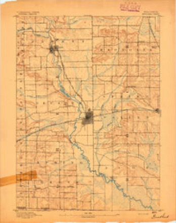
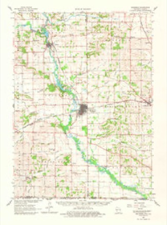
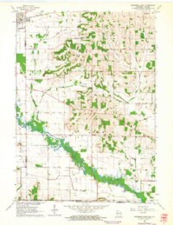
17 topographic sheets cover this place, the earliest surveyed in 1893 and the latest in 1981. It stands in Avon town. It lies in ZIP code area 53520. It stands on Taylor Creek. The Survey maps it on the Brodhead East quadrangle.
Topographic sheets covering this place
8 surveys from 17 printed sheetsMatched by testing this settlement's coordinate against the published boundary of every sheet in the United States Geological Survey's historical collection. Each opens the scanned sheet at the Survey.
- 1893 USGS Brodhead quadrangle1:62500, 5 printings
- 1954 USGS Rockford quadrangle1:250000
- 1955 USGS Rockford quadrangle1:250000
- 1958 USGS Rockford quadrangle1:250000, 4 printings
- 1962 USGS Brodhead quadrangle1:62500, 2 printings
- 1962 USGS Brodhead East quadrangle1:24000, 2 printings
- 1963 USGS Rockford quadrangle1:250000
- 1981 USGS Monroe quadrangle1:100000





In the county-history sources
3,144 words on this townshipThe History of Rock County, Wisconsin; Its Early Settlement, Growth, Development, Resources, Etc., published 1879 names this settlement in its chapter on Avon Town. These are the passages that mention it, exactly as the scans read.
By an act of the Territorial Legislature, approved February 11, 1847, Avon was set apart and named, and a "town meeting" directed to be held pn the first Tuesday of April, 1848, at the house of Willian Crippen. Previous to the erection of Avon as a separate and distinct town, its territory formed a portion of the town of Newark. Among the names of the early settlers may be mentioned Joseph Kinney, Jr., Joseph Huntley, William Crippen, H. Beales, W. F. Thompson, William Grimes and Joseph Watson. Some of the pioneers of this town were Norwegians. In a beautiful valley in the northeast part of Avon, which they christened Luther Valley, they built a church in 1847, and, a few years after, laid out a village, calling it Bornitz. Rev. Claud Lars Clauson was the first Pastor in this neighborhood. Among the pioneers of that nationality in Avon may be mentioned Cleophus Holverson, Lars Simonson, Inbred Ingerbretsen, Gunder Holver, Gens Knudson, Peter Holverson and Andrew Armudson. From the first, the Norwegians have, as a class, ranked high as honest, industrious, enterprising and moral citizens. They assume the habits, manners and customs of Americans with facility. The population of Avon in 1850 was 579 ; in 1860, 908 ; in 1870, 886 ; in 1875, 878.
Passage source: The History of Rock County, Wisconsin; Its Early Settlement, Growth, Development, Resources, Etc., published 1879.
Ill the town of Avon there is one village, Avon Center. The town has no railroad, although one has been projected through its territory. About one-fourth of Avon lies southwest of Sugar River. The town has but one post office - Avon Center.
Passage source: The History of Rock County, Wisconsin; Its Early Settlement, Growth, Development, Resources, Etc., published 1879.
The village of Avon is located upon Sand Prairie, on Sections 17 and 20, in the town of the same name.' The prairie is a beautiful one - level, but sandy, hence its name. It extends along the Sugar River for many miles. The village is situated near the river, " where there. is," says a writer in 1856, "a grist-mill and saw-mill, two stores and a blacksmith's shop." Since that time, the place has grown some ; but it is still of small dimensions.
Passage source: The History of Rock County, Wisconsin; Its Early Settlement, Growth, Development, Resources, Etc., published 1879.
Machine-read from a century-old scan, so expect the errors a machine makes: misspelled names, dropped words, stray characters.
Read the whole chapter on Avon Town - it names this place 19 more 19 times.
Fires near this place
12 since 2006Regional context, not property-specific evidence. The federal wildfire occurrence database lists 12 fires within 5 miles of Avon between 2006 and 2019, burning about 514 acres in total. None started naturally. 1 was recorded as arson. Distance is straight-line from the map coordinates, so a fire counted here may appear on a neighbouring settlement's page as well.
| Reported cause | Fires |
|---|---|
| Missing data/not specified/undetermined | 4 |
| Smoking | 3 |
| Debris and open burning | 3 |
| Equipment and vehicle use | 1 |
| Arson/incendiarism | 1 |
The most recent of them, most recent first, with the day each was reported and the service that recorded it.
| Date | Cause | Size | Reported by | Name on the report |
|---|---|---|---|---|
| 29 April 2018 | Debris and open burning | 5.0 acres | Wisconsin Department of Natural Resources | 78 |
| 23 April 2018 | Smoking | under an acre | Wisconsin Department of Natural Resources | 74 |
| 11 April 2009 | Equipment and vehicle use | 1.0 acres | Wisconsin Department of Natural Resources | AVON BOTTOMS |
| 11 April 2006 | Arson/incendiarism | 1.2 acres | Wisconsin Department of Natural Resources | not named |
| 7 March 2019 | Debris and open burning | under an acre | Wisconsin Department of Natural Resources | 52 |
| 30 March 2019 | Debris and open burning | 2.0 acres | Wisconsin Department of Natural Resources | 72 |
| 30 March 2018 | Missing data/not specified/undetermined | 1.0 acres | Wisconsin Department of Natural Resources | 55 |
| 30 March 2018 | Smoking | under an acre | Wisconsin Department of Natural Resources | 57 |
Settlements close enough to share some of these fires:
Mines and quarries near this place
1 within 5 milesRegional context, not property-specific evidence. The federal mineral resources record lists 1 working within 5 miles of Avon: 1 past producer. None of them still produces. What was taken out: Stone, Crushed/Broken. Distance is straight-line from the map coordinates, so a quarry counted here may appear on a neighbouring settlement's page as well.
| Where | Site | Commodity | Status | Recorded |
|---|---|---|---|---|
| Cole Quarry | Stone, Crushed/Broken | Past Producer |
Storms near this place
18 since 1994Regional context, not property-specific evidence. The National Weather Service names Avon in 18 storm reports between 1994 and 2025: 11 flood, 2 hail, 2 thunderstorm wind, 1 tornado. No death or injury is recorded in these reports. Each account below is quoted exactly as the forecast office filed it, from the NOAA Storm Events Database, and each date opens the federal record of that event.
| When | Event | Place named | Harm | What the report says |
|---|---|---|---|---|
| February 2018 | Flood | Avon | $20,000 | Widespread flooding of lowland and agricultural land countywide, including numerous road closures. Street flooding in Janesville and Beloit. Multiple vehicles stranded in high water. A gas station in Beloit was closed due to high water. |
| June 2024 | Flash Flood | Avon | $15,000 | Flowing water over small portions of rural roads due to flooding of farm fields or ditches. This included high water over a portion of highway A between Footville and Janesville, and several inches of water on Townline Road near Avon. A roof collapsed in Edgerton due to the accumulation and weight of rain water. Urban street flooding also prevalent. |
| April 2024 | Flood | Avon | $2,000 | Downstream in Rock County in the Avon Township and the Avon Bottoms Wildlife Area, there is widespread flooding of lowland and agricultural land. There is flooding in Sugar River Park and some roads are flooded including Beloit Newark Rd. |
| July 2024 | Flood | Avon | $1,000 | In the Avon Bottoms area, there is flooding in Sugar River Park, and Beloit Newark Rd. and S. Hopkins Rd. |
| February 2019 | Flood | Avon | $1,000 | The Sugar River at Brodhead reached minor flood stage, cresting at 5.65 feet the early afternoon of February 7th. Some roads were flooded in the Avon Township. In the Avon Bottoms area, flooding occurred in Sugar River Park. |
| October 2019 | Flood | Avon | $1,000 | The Sugar River at Brodhead reached minor flood stage, cresting at 7.53 feet the evening of October 4th. Some roads are flooded about 6 miles downstream in Avon Township of Rock County. In the Avon Bottoms area of Rock County, flooding is occurring in Sugar River Park. |
| February 2018 | Flood | Avon | $1,000 | The Sugar River flooded from Green County into Rock County. The Avon Bottoms State Natural Area and Sugar River Park is flooded, including County Road T, which is the border of Green and Rock County. |
| October 2018 | Flood | Avon | $1,000 | The Sugar River continued to flood from upstream in Brodhead through southwest Rock County. Floodwaters cover roads in the Avon Township of Rock County. Floodwaters are over Highway T which is the border of Green and Rock County. In the Avon Bottoms area, there is flooding in Sugar River Park. |
| September 2018 | Flood | Avon | $1,000 | The Sugar River reached minor flood stage, cresting at 6.6 feet. Some roads are flooded in the Avon Township. There is flooding in Sugar River Park. |
| September 2018 | Flood | Avon | $1,000 | The Sugar River reached minor flood stage, cresting at 6.26 feet the afternoon of September 22nd. Some roads are flooded in the Avon Township. There is flooding in Sugar River Park. |
| August 2018 | Flood | Avon | $1,000 | The Sugar River flooded from Green County into Rock County. The Avon Bottoms State Natural Area and Sugar River Park is flooded, including County Road T, which is the border of Green and Rock County. |
| July 2017 | Flood | Avon | $1,000 | The Sugar River flooded from Green County into Rock County. The Avon Bottoms State Natural Area is flooded including County Road T which is the border of Green and Rock County. |
| March 2017 | Thunderstorm Wind | Avon | $1,000 | A tree down in Avon Township. |
| March 2025 | Thunderstorm Wind | Avon | - | Trees down on power lines southwest of Orfordville. |
| July 2024 | Funnel Cloud | Avon | - | Numerous funnel clouds were reported across central Rock County. The locations were from just east of Brodhead to near Orfordville, Footville, Janesville, and just south of Milton. No tornadoes occurred. |
| May 2003 | Tornado (F1) | Avon | - | This tornado, which spun up in southeast Green County, tracked east-southeast into extreme southwest Rock County at a point 2.3 miles southwest of Avon, where Douglas Road intersects County Trunk T. In Rock County, this tornado blew over a small grain bin, blew a gravity bin off its foundation, flipped and twisted a large field sprinkler system, lightly damaged a home's siding and roof, and ripped up some yard fencing. It is estimated that maximum wind were about 78 to 86 knots (90 to 100 mph). It dissipated in the wooded bottom lands of the Sugar River southeast of Avon, about three-fourths of a mile north of the Illinois state border. |
| March 2024 | Hail | Avon | - | no account filed |
| May 1994 | Hail | Avon | - | no account filed |
Nearest settlements
The eight closest, with where each one stands in the county. Distances are straight-line, computed from the Geographic Names Information System coordinates.
| Map | Place | Distance | Sheets |
|---|---|---|---|
| Newark | 5.5 miles | 17 | |
| Orfordville | 7.1 miles | 17 | |
| Spring Valley | 8.0 miles | 17 | |
| Footville | 10.9 miles | 16 | |
| Hanover | 11.1 miles | 16 | |
| Magnolia | 12.1 miles | 17 | |
| Cainville | 12.2 miles | 17 | |
| Belcrest | 12.5 miles | 16 |
Provenance
This settlement is recorded in the Geographic Names Information System as feature 1561037. The sheet list is computed by point-in-boundary test against the United States Geological Survey's historical topographic inventory. Both are works of the United States government and carry no copyright under 17 U.S.C. 105.
Wildfire. Short, Karen C. 2022. Spatial wildfire occurrence data for the United States, 1992-2020 [FPA_FOD_20221014]. 6th Edition. Fort Collins, CO: Forest Service Research Data Archive. https://doi.org/10.2737/RDS-2013-0009.6 Collected with United States Government funding and usable without additional permissions or fees.
Mines and quarries. USGS Mineral Resources Data System (MRDS) https://mrdata.usgs.gov/mrds/ A work of the United States government, no copyright under 17 U.S.C. 105.
Storms. NOAA National Centers for Environmental Information, Storm Events Database https://www.ncei.noaa.gov/stormevents/ A work of the United States government, no copyright under 17 U.S.C. 105. Narratives are quoted verbatim from the National Weather Service report and are not edited or summarised.