 Block
Ripon, Wisconsin
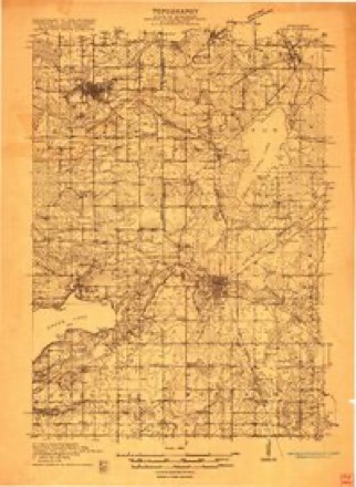
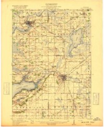
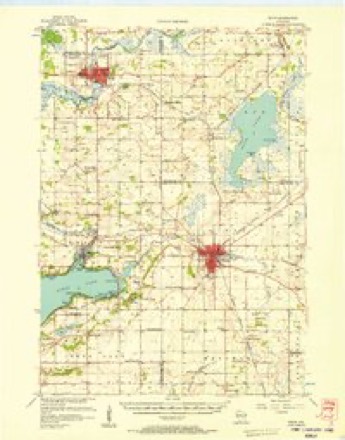
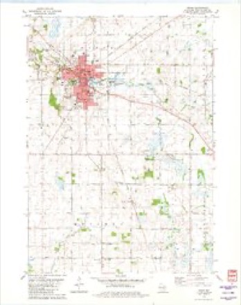
10 topographic sheets cover this place, the earliest surveyed in 1916 and the latest in 1980. It stands in Ripon town. It lies in ZIP code area 54971. The Survey maps it on the Ripon quadrangle. 7,863 people lived here at the 2020 count. It stands 932 feet above sea level.
On record in Ripon
Buildings and businesses the archive holds for this place. Each opens its own page, with the source record it came from.
On the National Register 12 of 14 shown
- Little White SchoolhouseNational Historic Landmark · listed 1973
 First Congregational Churchlisted 1979
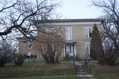 John Scott Horner Houselisted 1984
 Longfellow Schoollisted 1997
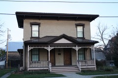 Marcellus Pedrick Houselisted 1976
 Ripon College Historic Districtlisted 1995
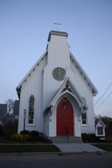 St. Peter's Episcopal Churchlisted 1974
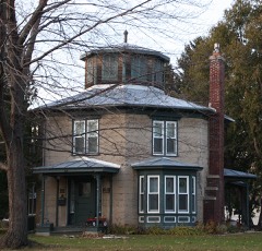 Jacob Woodruff Houselisted 1974
- Baptist Churchlisted 2007
- Ceresco Sitelisted 1975
- Little White Schoolhouselisted 2024
- Southwest Historic Districtlisted 2004
Population over time
2 figuresRipon grew from 7,733 to 7,863 between 2010 and 2020. These are the recorded population figures Wikidata holds for this place, reached through the Geographic Names Information System number this page is keyed on rather than by name, so they belong to this place and not to another of the same name. Most are census counts, but not all are: an early figure may be a founding or settlement estimate, and an estimate published within five years of a census is left out. The change column is computed, and is left blank where more than 20 years separate a figure from the one before it, because a gap that long is not a change between two counts.
| Year | People | Change |
|---|---|---|
| 2010 | 7,733 | |
| 2020 | 7,863 | +130 (+2%) |
Topographic sheets covering this place
7 surveys from 10 printed sheetsMatched by testing this settlement's coordinate against the published boundary of every sheet in the United States Geological Survey's historical collection. Each opens the scanned sheet at the Survey.
- 1916 USGS Ripon quadrangle1:48000
- 1918 USGS Ripon quadrangle1:62500
- 1956 USGS Ripon quadrangle1:62500
- 1957 USGS Madison quadrangle1:250000, 3 printings
- 1960 USGS Madison quadrangle1:250000, 2 printings
- 1980 USGS Fond Du Lac quadrangle1:100000
- 1980 USGS Ripon quadrangle1:24000



What happened here
An account from the chapter on Ripon town. The inset identifies its exact source book and publication year.
Scraps Of War History
The first man to shed Wisconsin blood on a Southern battlefield in the rebellion, was Lieut. William A. Matthews, of Company G, First Wisconsin Volunteers, who was severely wounded at the battle of Falling Waters, in July, 1861, in Virginia. He enlisted at Fond du Lac, his home. The last Wisconsin blood shed was at the capture of Jeff Davis, in Irwin County, Ga., May 10, 1865, when several men were wounded by volleys fired by a detachment of the Fourth Michigan Cavalry upon a detachment of the First Wisconsin Cavalry.
In the county-history sources
38,693 words on this townshipThe History of Fond Du Lac County, Wisconsin, published 1880 names this settlement in its chapter on Ripon Town. These are the passages that mention it, exactly as the scans read.
I can only say, 'they know not what they do.' They might, with greater propriety, denounce all denominations of Christians, except their own, because they differed from each other as to what are the truths of the Bible. The Roman Catholic believes in transubstantiation - in the real presence - that the real body and blood of Christ are contained in the consecrated wafer. He goes to the Bible for the truth of this doctrine. Some Protestants go to the same book to prove this doctrine rank blasphemy. Most of the Christian world finds in the Bible the doctrine of the Trinity, while the Unitarian sect, one of the most intelligent and intellectual in this country, finds in it the unity of the Godhead. The same might be said of all the various doctrines, of the different religious sects and denominations ; they are all according to their respective advocates, to be found in the Bible, however inconsistent or antagonistic they may be. When then, these reverend gentlemen tell us that Spiritualism denies the truths of the Bible, will they be so good as to agree upon and inform us what these truths are? Christ never taught sectarianism. That has been taught by the creeds of men. Out of these creeds has sprung the antagonism of the Christian world - an antagonism which brought Cranmer and Latimer and Ridley and Servetus to the stake - and which would bring Spiritualists to the stake also, if we were not so far advanced in the light and progress of the nineteenth century. Every real Christian looks forward to the time when this antagonists shall be done away, and we shall stand on one broad platform, founded on the doctrines taught by Christ, instead of the doctrines taught by the creeds of men."
Passage source: The History of Fond Du Lac County, Wisconsin, published 1880.
In 1854, Martin Mitchell, a man prominent in the affairs of Fond du Lac City and County, compiled and published a history of the towns and county - the first and last given to the public up to date. It contained about 100 pages, and was printed by J. A. Smith, then publishing the Western Freeman newspaper at the city of Fond'du Lac. The work was quite an undertaking at that period, and contained some information which might not otherwise have been preserved. It was the first book published in Fond du Lac County. »
Passage source: The History of Fond Du Lac County, Wisconsin, published 1880.
Mr. Whinfield has been a prolific writer. Some of his favorite themes were reform in spelling and punctuation, protection, political economy and manufacturing. He wrote a pamphlet in 1867, upon iron industries and iron manufacturing in the Western States, which contained valuable information. It was written, the author advertised, " with a view to the establishment of iron works in the Western States, and the use of peat as a fuel." From his work this quotation is made:
Passage source: The History of Fond Du Lac County, Wisconsin, published 1880.
Machine-read from a century-old scan, so expect the errors a machine makes: misspelled names, dropped words, stray characters.
Read the whole chapter on Ripon Town - it names this place 180 more 180 times.
Fires near this place
26 since 1993Regional context, not property-specific evidence. The federal wildfire occurrence database lists 26 fires within 5 miles of Ripon between 1993 and 2020, burning about 40 acres in total. None started naturally. 1 was recorded as arson. Distance is straight-line from the map coordinates, so a fire counted here may appear on a neighbouring settlement's page as well.
| Reported cause | Fires |
|---|---|
| Debris and open burning | 16 |
| Equipment and vehicle use | 5 |
| Smoking | 2 |
| Fireworks | 1 |
| Missing data/not specified/undetermined | 1 |
| Arson/incendiarism | 1 |
The most recent of them, most recent first, with the day each was reported and the service that recorded it.
| Date | Cause | Size | Reported by | Name on the report |
|---|---|---|---|---|
| 3 August 2000 | Equipment and vehicle use | under an acre | Wisconsin Department of Natural Resources | not named |
| 3 July 2012 | Equipment and vehicle use | under an acre | Wisconsin Department of Natural Resources | SUNNYSIDE COMBINE |
| 26 July 2012 | Equipment and vehicle use | under an acre | Wisconsin Department of Natural Resources | GREEN LAKE COUNTY F |
| 2 July 2010 | Fireworks | under an acre | Wisconsin Department of Natural Resources | SECOND TIME FIRE |
| 15 July 2006 | Missing data/not specified/undetermined | under an acre | Wisconsin Department of Natural Resources | not named |
| 8 April 2000 | Debris and open burning | under an acre | Wisconsin Department of Natural Resources | not named |
| 6 April 2008 | Arson/incendiarism | under an acre | Wisconsin Department of Natural Resources | not named |
| 5 April 2011 | Debris and open burning | under an acre | Wisconsin Department of Natural Resources | MAUG ROAD #2 |
Settlements close enough to share some of these fires:
Mines and quarries near this place
4 within 5 milesRegional context, not property-specific evidence. The federal mineral resources record lists 4 workings within 5 miles of Ripon: 2 past producers, 2 producers. 2 still produce. What was taken out: Sand and Gravel, Construction, Stone, Crushed/Broken. Distance is straight-line from the map coordinates, so a quarry counted here may appear on a neighbouring settlement's page as well.
| Where | Site | Commodity | Status | Recorded |
|---|---|---|---|---|
| Nellis Limestone Quarry | Stone, Crushed/Broken | Producer | ||
| Bronson Pit | Sand and Gravel, Construction | Past Producer | ||
| R & R Pit | Sand and Gravel, Construction | Producer | ||
| Silverthorn Pit | Sand and Gravel, Construction | Past Producer |
Storms near this place
37 since 1995Regional context, not property-specific evidence. The National Weather Service names Ripon in 37 storm reports between 1995 and 2026: 22 thunderstorm wind, 10 hail, 3 flash flood, 1 lightning. No death or injury is recorded in these reports. Each account below is quoted exactly as the forecast office filed it, from the NOAA Storm Events Database, and each date opens the federal record of that event.
| When | Event | Place named | Harm | What the report says |
|---|---|---|---|---|
| June 2008 | Flash Flood | Ripon | $4,640,000 | Heavy rains resulted in flash flooding across much of western Fond du Lac County. Water depths on road surfaces reached 3 feet or more and there were gravel washouts. Some farm fields remained flooded into early July. The breakdown for residential home losses were: 4000 minimally affected, 2100 with minor damage, 125 with major damage, and 15 destroyed (total of $3.87 million for home losses). The breakdown for business losses were: 35 with minor damage (total of $242 thousand). Crop losses were estimated at $9 million. Public sector damage was about $772 thousand. There were several roads and bridges that sustained damage. |
| August 1995 | Thunderstorm Wind | Ripon | $75,000 | no account filed |
| August 2000 | Flash Flood | Ripon | $50,000 | no account filed |
| July 2006 | Hail | Ripon | $30,000 | About 300 trees were damaged or detroyed by the hail at a tree nusury 3 miles east of Ripon. |
| May 2024 | Thunderstorm Wind | Ripon | $20,000 | Multiple trees and power lines down. Trees down on a few homes. |
| May 1998 | Thunderstorm Wind | Ripon | $20,000 | no account filed |
| July 2021 | Thunderstorm Wind | Ripon | $15,000 | Multiple reports of trees down, snapped power poles, road closures, and power outages in the Ripon area. Sheet metal roofing or siding was strewn in the field on either side of Brandon Street, north of the intersection with Highway KK. Damage was assessed to be due to straight-line winds. A man was killed when he drove his car into a downed tree on a road near Ripon. |
| August 2000 | Lightning | Ripon | $15,000 | no account filed |
| May 2016 | Thunderstorm Wind | Ripon | $10,000 | Several trees and power lines down. Power lines downed across highway 44. |
| July 2006 | Thunderstorm Wind | Ripon | $10,000 | Trees and power lines down. |
| August 2000 | Thunderstorm Wind | Ripon | $10,000 | no account filed |
| July 1998 | Thunderstorm Wind | Ripon | $10,000 | no account filed |
| July 2006 | Thunderstorm Wind | Ripon | $5,000 | Trees and power lines reported down. |
| June 2019 | Thunderstorm Wind | Ripon | $3,000 | Several large trees down. |
| September 2022 | Thunderstorm Wind | Ripon | $2,000 | Several trees and branches down. |
| July 2017 | Thunderstorm Wind | Ripon | $2,000 | A 1.5 foot diameter tree snapped at its base and a 2 foot diameter tree snapped upward from the trunk. |
| June 2008 | Flash Flood | Ripon | $1,350 | Heavy rains resulted in flash flooding across much of western Fond du Lac County. Water depths on road surfaces reached 3 feet or more and there were gravel washouts. Manhole covers popped in Ripon. Some farm fields remained flooded into early July. The breakdown for residential home losses were: 1000 minimally affected, 500 with minor damage, 25 with major damage, and 5 destroyed (total of $1 million for home losses). The breakdown for business losses were: 15 with minor damage (total of $50 thousand). Crop losses were estimated at 17 million. Public sector damage was about $1.3 million. There were several roads and bridges that sustained damage. |
| June 1999 | Thunderstorm Wind | Ripon | $1,000 | no account filed |
| July 2022 | Thunderstorm Wind | Ripon | $500 | Tree down in the road. |
| June 2014 | Heavy Rain | Ripon | $500 | Street and parking low flooding led to water rushing into a business on highway 23 just east of Ripon. One hour rainfall estimated by doppler radar was 1.50 inches. |
| April 2026 | Hail | Ripon | - | Public report of 1 inch diameter hail in Ripon. |
| September 2021 | Hail | Ripon | - | Reports of 3/4 inch diameter hail up to 2 inch hail. |
| June 2011 | Hail | Ripon | - | This hail swath was about 3 miles wide. |
| July 2010 | Thunderstorm Wind | Ripon | - | A trained spotter reported trees blown down by thunderstorm wind gusts estimated at 52 knots (60 mph). |
| June 2008 | Thunderstorm Wind | Ripon | - | Powerful thunderstorms winds knocked down a few large trees. |
| August 2019 | Hail | Ripon | - | no account filed |
| May 2011 | Hail | Ripon | - | no account filed |
| April 2008 | Hail | Ripon | - | no account filed |
| June 2008 | Hail | Ripon | - | no account filed |
| June 2005 | Thunderstorm Wind | Ripon | - | no account filed |
| August 2004 | Thunderstorm Wind | Ripon | - | no account filed |
| July 2003 | Thunderstorm Wind | Ripon | - | no account filed |
| September 2002 | Thunderstorm Wind | Ripon | - | no account filed |
| July 2002 | Thunderstorm Wind | Ripon | - | no account filed |
| August 2002 | Thunderstorm Wind | Ripon | - | no account filed |
| May 2000 | Hail | Ripon | - | no account filed |
| July 1996 | Hail | Ripon | - | no account filed |
Nearest settlements
The eight closest, with where each one stands in the county. Distances are straight-line, computed from the Geographic Names Information System coordinates.
| Map | Place | Distance | Sheets |
|---|---|---|---|
| Arcade Acres | 2.2 miles | 10 | |
| Wilmoore Heights | 3.5 miles | 10 | |
| West Rosendale | 6.0 miles | 9 | |
| Rosendale Center | 6.2 miles | 9 | |
| Fairwater | 7.0 miles | 8 | |
| Brandon | 7.9 miles | 8 | |
| Rosendale | 8.9 miles | 9 | |
| Eldorado | 11.4 miles | 10 |
Elsewhere
Matched on this settlement's Geographic Names Information System number rather than its name, so it cannot be a different place of the same name in another state.
| Wikipedia article on Ripon | An encyclopaedic summary. Its text is share-alike, so it is linked here rather than copied. |
| Wikidata item Q1025333 | The structured record the population and elevation above come from. Public domain (CC0). |
Provenance
This settlement is recorded in the Geographic Names Information System as feature 1572338. The sheet list is computed by point-in-boundary test against the United States Geological Survey's historical topographic inventory. Both are works of the United States government and carry no copyright under 17 U.S.C. 105.
Wildfire. Short, Karen C. 2022. Spatial wildfire occurrence data for the United States, 1992-2020 [FPA_FOD_20221014]. 6th Edition. Fort Collins, CO: Forest Service Research Data Archive. https://doi.org/10.2737/RDS-2013-0009.6 Collected with United States Government funding and usable without additional permissions or fees.
Mines and quarries. USGS Mineral Resources Data System (MRDS) https://mrdata.usgs.gov/mrds/ A work of the United States government, no copyright under 17 U.S.C. 105.
Storms. NOAA National Centers for Environmental Information, Storm Events Database https://www.ncei.noaa.gov/stormevents/ A work of the United States government, no copyright under 17 U.S.C. 105. Narratives are quoted verbatim from the National Weather Service report and are not edited or summarised.