 Block
Knowles, Wisconsin
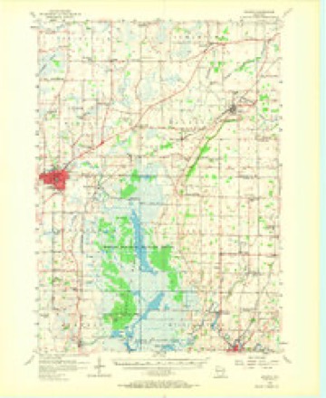
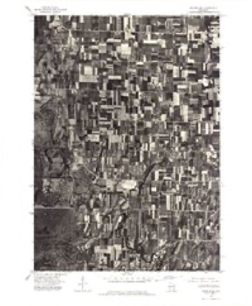
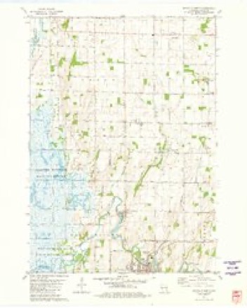
10 topographic sheets cover this place, the earliest surveyed in 1955 and the latest in 1981. It stands in Lomira town. It lies in ZIP code area 53048. The Survey maps it on the Mayville North quadrangle. It stands 1,050 feet above sea level.
Topographic sheets covering this place
6 surveys from 10 printed sheetsMatched by testing this settlement's coordinate against the published boundary of every sheet in the United States Geological Survey's historical collection. Each opens the scanned sheet at the Survey.
- 1955 USGS Waupun quadrangle1:62500, 2 printings
- 1957 USGS Madison quadrangle1:250000, 3 printings
- 1960 USGS Madison quadrangle1:250000, 2 printings
- 1975 USGS Waupun SE quadrangle1:24000
- 1980 USGS Fond Du Lac quadrangle1:100000
- 1981 USGS Mayville North quadrangle1:24000



In the county-history sources
3,352 words on this townshipThe History of Dodge County, Wisconsin, Containing ... Its Early Settlement, Growth ... an Extensive and Minute Sketch of Its Cities ... War Record, Biographical Sketches, published 1880 names this settlement in its chapter on Lomira Town. These are the passages that mention it, exactly as the scans read.
CHRISTIAN EHRH.4.R'l>T, fanner, Sec. 21 .and P.); P. 0. Knowles ; born in Alsace March 31, 1828; spent his early life and was educated in his native land; came to America in 184() ; spent one year in Milwaukee ('ounty, one year in Merman, and settled in Mayville, February, 1848 ; having no means, he worked at anything he could do until 1 854, when he bought eighty acres of heavy timber land in Williamstown ; this he cleared and improved, building a stone house and making a home; he sett'ed on his present 20l)-aerc farm in 18(.I3, h;is cleared more than one-half of tliis, built a large stone house, raised and rebuilt his 40x84 foot barn, built a tasty horse-barn, and though he began with nothing, now has one of the best farms and homos in the county; near his house is a large spring, from which runs a stream large enough to turn <a small grist-mill ; he is now oonUruoting a trout-pond. He married Miss Barbara Buchner in 1855; they have ten children - Mary, William C, Amelia, Martin, Anna, Edward, Lydia, Daniel N., Sophia, and Sarah. Mr. Ehrhardt is a Republican, and has been Justice of the Peace, and Assessor. He belongs to the Ev'an^elical Association. He owns 120 acres in Ls Roy, on which his eldest son and daughters Amelia and Sophia reside. Mr. Ehrhardt gave hearty support and pecuniary aid to the Union cause during the late war ; he also gave over three acres of land to the F. A. & P. R. R. Co., thus securing a station and elevator within one hundred rods of his house. Mr. Ehrhardt is a public-spirited farmer, and a stanch temperance man. as are all his sons.
Passage source: The History of Dodge County, Wisconsin, Containing ... Its Early Settlement, Growth ... an Extensive and Minute Sketch of Its Cities ... War Record, Biographical Sketches, published 1880.
Machine-read from a century-old scan, so expect the errors a machine makes: misspelled names, dropped words, stray characters.
Read the whole chapter on Lomira Town - it names this place 2 more 2 times.
Fires near this place
12 since 2006Regional context, not property-specific evidence. The federal wildfire occurrence database lists 12 fires within 5 miles of Knowles between 2006 and 2020, burning about 45 acres in total. None started naturally. None was recorded as arson. Distance is straight-line from the map coordinates, so a fire counted here may appear on a neighbouring settlement's page as well.
| Reported cause | Fires |
|---|---|
| Missing data/not specified/undetermined | 4 |
| Equipment and vehicle use | 4 |
| Debris and open burning | 2 |
| Railroad operations and maintenance | 2 |
The most recent of them, most recent first, with the day each was reported and the service that recorded it.
| Date | Cause | Size | Reported by | Name on the report |
|---|---|---|---|---|
| 4 September 2014 | Equipment and vehicle use | under an acre | Horicon National Wildlife Refuge | GRINDER WF |
| 16 August 2006 | Debris and open burning | under an acre | Horicon National Wildlife Refuge | BRUMMOND WF |
| 30 May 2017 | Railroad operations and maintenance | under an acre | Wisconsin Department of Natural Resources | THERESA SITE 1 |
| 30 May 2017 | Railroad operations and maintenance | under an acre | Wisconsin Department of Natural Resources | THERESA SITE 2 |
| 29 April 2018 | Missing data/not specified/undetermined | 35 acres | Wisconsin Department of Natural Resources | 18062 |
| 21 April 2019 | Debris and open burning | under an acre | Wisconsin Department of Natural Resources | 19023 |
| 2 April 2020 | Equipment and vehicle use | 1.0 acres | Wisconsin Department of Natural Resources | 20012 |
| 16 April 2009 | Missing data/not specified/undetermined | 5.0 acres | Horicon National Wildlife Refuge | FINALS WF |
Settlements close enough to share some of these fires:
Mines and quarries near this place
3 within 5 milesRegional context, not property-specific evidence. The federal mineral resources record lists 3 workings within 5 miles of Knowles: 2 producers, 1 unknown. 2 still produce. What was taken out: Calcium, Stone, Crushed/Broken, Stone. Distance is straight-line from the map coordinates, so a quarry counted here may appear on a neighbouring settlement's page as well.
| Where | Site | Commodity | Status | Recorded |
|---|---|---|---|---|
| Farmersville Quarry | Stone, Crushed/Broken | Producer | ||
| Farmersville Quarry | Stone | Unknown | ||
| Western Lime-Knowles Quarry | Calcium | Producer |
Storms near this place
1 since 2005Regional context, not property-specific evidence. The National Weather Service names Knowles in 1 storm report in 2005: 1 funnel cloud. No death or injury is recorded in these reports. Each account below is quoted exactly as the forecast office filed it, from the NOAA Storm Events Database, and each date opens the federal record of that event.
| When | Event | Place named | Harm | What the report says |
|---|---|---|---|---|
| July 2005 | Funnel Cloud | Knowles | - | no account filed |
Nearest settlements
The eight closest, with where each one stands in the county. Distances are straight-line, computed from the Geographic Names Information System coordinates.
| Map | Place | Distance | Sheets |
|---|---|---|---|
| Nasbro | 1.5 miles | 10 | |
| Farmersville | 1.8 miles | 10 | |
| LeRoy | 3.0 miles | 10 | |
| Brownsville | 3.1 miles | 9 | |
| Lomira | 3.5 miles | 9 | |
| Kekoskee | 4.2 miles | 10 | |
| Theresa | 4.8 miles | 9 | |
| Theresa Station | 5.1 miles | 9 |
Elsewhere
Matched on this settlement's Geographic Names Information System number rather than its name, so it cannot be a different place of the same name in another state.
| Wikipedia article on Knowles | An encyclopaedic summary. Its text is share-alike, so it is linked here rather than copied. |
| Wikidata item Q6423409 | The structured record the population and elevation above come from. Public domain (CC0). |
Provenance
This settlement is recorded in the Geographic Names Information System as feature 1567580. The sheet list is computed by point-in-boundary test against the United States Geological Survey's historical topographic inventory. Both are works of the United States government and carry no copyright under 17 U.S.C. 105.
Wildfire. Short, Karen C. 2022. Spatial wildfire occurrence data for the United States, 1992-2020 [FPA_FOD_20221014]. 6th Edition. Fort Collins, CO: Forest Service Research Data Archive. https://doi.org/10.2737/RDS-2013-0009.6 Collected with United States Government funding and usable without additional permissions or fees.
Mines and quarries. USGS Mineral Resources Data System (MRDS) https://mrdata.usgs.gov/mrds/ A work of the United States government, no copyright under 17 U.S.C. 105.
Storms. NOAA National Centers for Environmental Information, Storm Events Database https://www.ncei.noaa.gov/stormevents/ A work of the United States government, no copyright under 17 U.S.C. 105. Narratives are quoted verbatim from the National Weather Service report and are not edited or summarised.