 Block
Lomira, Wisconsin
9 topographic sheets cover this place, the earliest surveyed in 1955 and the latest in 1980. It stands in Lomira town. It lies in ZIP code area 53048. The Survey maps it on the Lomira quadrangle. 2,678 people lived here at the 2020 count. It stands 1,004 feet above sea level.
On record in Lomira
Buildings and businesses the archive holds for this place. Each opens its own page, with the source record it came from.
On the National Register 1 record
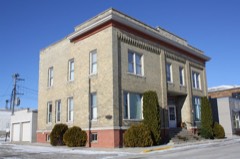 W. H. Boller Meat Market and Residencelisted 1994
Population over time
2 figuresLomira grew from 2,430 to 2,678 between 2010 and 2020. These are the recorded population figures Wikidata holds for this place, reached through the Geographic Names Information System number this page is keyed on rather than by name, so they belong to this place and not to another of the same name. Most are census counts, but not all are: an early figure may be a founding or settlement estimate, and an estimate published within five years of a census is left out. The change column is computed, and is left blank where more than 20 years separate a figure from the one before it, because a gap that long is not a change between two counts.
| Year | People | Change |
|---|---|---|
| 2010 | 2,430 | |
| 2020 | 2,678 | +248 (+10%) |
Topographic sheets covering this place
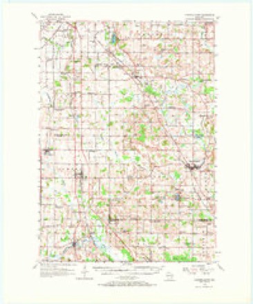
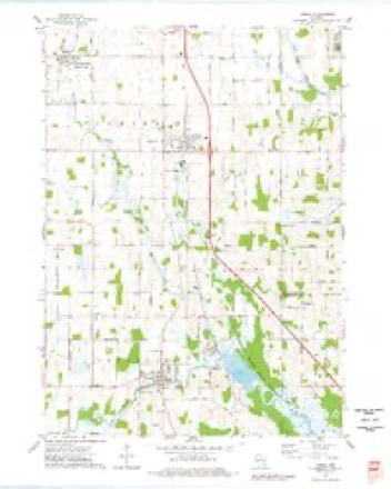
5 surveys from 9 printed sheetsMatched by testing this settlement's coordinate against the published boundary of every sheet in the United States Geological Survey's historical collection. Each opens the scanned sheet at the Survey.
- 1955 USGS Campbellsport quadrangle1:62500, 2 printings
- 1957 USGS Madison quadrangle1:250000, 3 printings
- 1960 USGS Madison quadrangle1:250000, 2 printings
- 1974 USGS Lomira quadrangle1:24000
- 1980 USGS Fond Du Lac quadrangle1:100000



In the county-history sources
3,352 words on this townshipThe History of Dodge County, Wisconsin, Containing ... Its Early Settlement, Growth ... an Extensive and Minute Sketch of Its Cities ... War Record, Biographical Sketches, published 1880 names this settlement in its chapter on Lomira Town. These are the passages that mention it, exactly as the scans read.
In Town 13 north. Range 17 east, in the extreme northeastern part, lies the town of Lomira, an exclusively farming town, there being no village within its boundary, though there is one post ofiBce. The nearest trading-points for her people are Mayville and Waupun. The population in 1870 was 1,905, and almost exclusively Germans. In 1879, were reported for assessment 23,446 acres, showing very little unavailable land. This was valued at $813,278. There were also returned as in cultivation, of wheat, 6,080 ; corn, 788 ; oats, 1,180 ; barley, 510 ; rye, 37 ; potatoes, 158 ; apple orchards, 127 ; grasses, 1,295.
Passage source: The History of Dodge County, Wisconsin, Containing ... Its Early Settlement, Growth ... an Extensive and Minute Sketch of Its Cities ... War Record, Biographical Sketches, published 1880.
ALFRED D. BROW9f, farmer and merchant, Brownsville; born in London, England, July 30, 1846 ; son of Joseph Brown, who came to America in 1850 ; he brought a general stock of merchandise from New York City, which whs the first stock sold in Lomira Township; he also broii.;ht the scciond thrashing-machine into the town from Milwaukee, which he used with horses bought in Chicago; settled on eighty acres of land whore he now lives, built a house and store cimbinod, and began as the pioneer merchant; boui^ht his second stock in Milwaukee ; the station and village of Urownsvillo was named in his honor, April, 1S78 ; his only son, A. D. Brown, has been in charge during the past fifteen years; he has a general stock of goods to meet country trade, viz., dry sjoods, groceries, boots and shoes, hardware, tinware, glassware, crockery, paints and oils, also imported and native wines, ales and other li(|uors sold for medicinal purposes ; he also has a well-improved farm of 280 acres. Father and son are in accord with the Episi-opal Church.
Passage source: The History of Dodge County, Wisconsin, Containing ... Its Early Settlement, Growth ... an Extensive and Minute Sketch of Its Cities ... War Record, Biographical Sketches, published 1880.
CROMWELL BUI^LOCK, farmer. Sec. U; P. 0. Lomira; born in O.swego Co., N. Y., Feb. 11), 1824 ; spent his early life and was educated in his native State; came to Mayfield, Dodge Co., Wis., in 184!). spending the winter in the Wolf River pineries; returning to New York, he worked two years on the Erie Canal; he then went overland to California; spint six months as a miner, then sailed for Australia; after two years of mining here he returned to San Francisco; took passage on the Golden Gate for the i.sthmus, the ship striking a rock and sinking on the way ; all hands were saved by the fortunate proximity of an island ; he landed safely in New York City, thence going to Philadelphia, where his savings were coined ; he then bought land in Minnesota, but settled in Wisconsin, on his present farm of eighty acres; Mr. Bullock was one of the 3d W. V. I.; was in the great battle of Nashville, and served until the war (tlosed. He married Miss Mary A. Wheeler in 1857; they have four children - Clifford A., Josephine iM,, Alice L., and Elinor A. Mr. Bullock is a Republican in politics.
Passage source: The History of Dodge County, Wisconsin, Containing ... Its Early Settlement, Growth ... an Extensive and Minute Sketch of Its Cities ... War Record, Biographical Sketches, published 1880.
Machine-read from a century-old scan, so expect the errors a machine makes: misspelled names, dropped words, stray characters.
Read the whole chapter on Lomira Town - it names this place 15 more 15 times.
Fires near this place
6 since 2017Regional context, not property-specific evidence. The federal wildfire occurrence database lists 6 fires within 5 miles of Lomira between 2017 and 2019, burning about 38 acres in total. None started naturally. None was recorded as arson. Distance is straight-line from the map coordinates, so a fire counted here may appear on a neighbouring settlement's page as well.
| Reported cause | Fires |
|---|---|
| Railroad operations and maintenance | 2 |
| Missing data/not specified/undetermined | 2 |
| Debris and open burning | 1 |
| Equipment and vehicle use | 1 |
The most recent of them, most recent first, with the day each was reported and the service that recorded it.
| Date | Cause | Size | Reported by | Name on the report |
|---|---|---|---|---|
| 8 July 2018 | Missing data/not specified/undetermined | under an acre | Wisconsin Department of Natural Resources | 201859 |
| 30 May 2017 | Railroad operations and maintenance | under an acre | Wisconsin Department of Natural Resources | THERESA SITE 1 |
| 30 May 2017 | Railroad operations and maintenance | under an acre | Wisconsin Department of Natural Resources | THERESA SITE 2 |
| 29 April 2018 | Missing data/not specified/undetermined | 35 acres | Wisconsin Department of Natural Resources | 18062 |
| 21 April 2019 | Debris and open burning | under an acre | Wisconsin Department of Natural Resources | 19023 |
| 19 March 2018 | Equipment and vehicle use | 3.0 acres | Wisconsin Department of Natural Resources | 18042 |
Settlements close enough to share some of these fires:
Mines and quarries near this place
6 within 5 milesRegional context, not property-specific evidence. The federal mineral resources record lists 6 workings within 5 miles of Lomira: 4 producers, 1 unknown, 1 past producer. 4 still produce. What was taken out: Sand and Gravel, Construction, Calcium, Stone, Crushed/Broken, Stone. Distance is straight-line from the map coordinates, so a quarry counted here may appear on a neighbouring settlement's page as well.
| Where | Site | Commodity | Status | Recorded |
|---|---|---|---|---|
| Farmersville Quarry | Stone, Crushed/Broken | Producer | ||
| Farmersville Quarry | Stone | Unknown | ||
| Western Lime-Knowles Quarry | Calcium | Producer | ||
| Byron Pit | Sand and Gravel, Construction | Past Producer | ||
| Hoppe Pit | Sand and Gravel, Construction | Producer | ||
| Reischke Pit | Sand and Gravel, Construction | Producer |
Storms near this place
14 since 1996Regional context, not property-specific evidence. The National Weather Service names Lomira in 14 storm reports between 1996 and 2025: 7 thunderstorm wind, 7 hail. No death or injury is recorded in these reports. Each account below is quoted exactly as the forecast office filed it, from the NOAA Storm Events Database, and each date opens the federal record of that event.
| When | Event | Place named | Harm | What the report says |
|---|---|---|---|---|
| August 2018 | Thunderstorm Wind | Lomira | $8,000 | Many large trees and branches down including uprooted trees. |
| June 2025 | Thunderstorm Wind | Lomira | $6,000 | Power pole and lines downed. Several large tree branches downed. |
| June 2017 | Thunderstorm Wind | Lomira | $5,000 | Many large trees snapped at ground level throughout a golf course. |
| July 2006 | Thunderstorm Wind | Lomira | $5,000 | Trees and power-lines down. |
| July 2006 | Thunderstorm Wind | Lomira | $5,000 | Trees and power-lines down. Garage door blown in. |
| June 1996 | Thunderstorm Wind | Lomira | $4,000 | no account filed |
| June 2017 | Thunderstorm Wind | Lomira | $3,000 | Large tree limbs down in Lomira. |
| June 2008 | Hail | Lomira | - | The ground was covered white with hail, and wind gusts to about 43 knots (50 mph) were noted by the trained spotter. |
| May 2025 | Hail | Lomira | - | no account filed |
| November 2022 | Hail | Lomira | - | no account filed |
| August 2015 | Hail | Lomira | - | no account filed |
| May 2014 | Hail | Lomira | - | no account filed |
| April 2008 | Hail | Lomira | - | no account filed |
| September 2006 | Hail | Lomira | - | no account filed |
Nearest settlements
The eight closest, with where each one stands in the county. Distances are straight-line, computed from the Geographic Names Information System coordinates.
| Map | Place | Distance | Sheets |
|---|---|---|---|
| Brownsville | 3.0 miles | 9 | |
| Nasbro | 3.2 miles | 10 | |
| Knowles | 3.5 miles | 10 | |
| Theresa Station | 4.5 miles | 9 | |
| Theresa | 5.1 miles | 9 | |
| Farmersville | 5.2 miles | 10 | |
| LeRoy | 6.3 miles | 10 | |
| Kekoskee | 7.5 miles | 10 |
Elsewhere
Matched on this settlement's Geographic Names Information System number rather than its name, so it cannot be a different place of the same name in another state.
| Wikipedia article on Lomira | An encyclopaedic summary. Its text is share-alike, so it is linked here rather than copied. |
| Wikidata item Q2229609 | The structured record the population and elevation above come from. Public domain (CC0). |
Provenance
This settlement is recorded in the Geographic Names Information System as feature 1568503. The sheet list is computed by point-in-boundary test against the United States Geological Survey's historical topographic inventory. Both are works of the United States government and carry no copyright under 17 U.S.C. 105.
Wildfire. Short, Karen C. 2022. Spatial wildfire occurrence data for the United States, 1992-2020 [FPA_FOD_20221014]. 6th Edition. Fort Collins, CO: Forest Service Research Data Archive. https://doi.org/10.2737/RDS-2013-0009.6 Collected with United States Government funding and usable without additional permissions or fees.
Mines and quarries. USGS Mineral Resources Data System (MRDS) https://mrdata.usgs.gov/mrds/ A work of the United States government, no copyright under 17 U.S.C. 105.
Storms. NOAA National Centers for Environmental Information, Storm Events Database https://www.ncei.noaa.gov/stormevents/ A work of the United States government, no copyright under 17 U.S.C. 105. Narratives are quoted verbatim from the National Weather Service report and are not edited or summarised.