 Block
Mayville, Wisconsin
10 topographic sheets cover this place, the earliest surveyed in 1955 and the latest in 1991. It stands in Mayville City. It lies in ZIP code area 53050. It stands on Fink Creek. The Survey maps it on the Mayville South quadrangle. 5,196 people lived here at the 2020 count. It stands 928 feet above sea level.
On record in Mayville
Buildings and businesses the archive holds for this place. Each opens its own page, with the source record it came from.
On the National Register 4 records
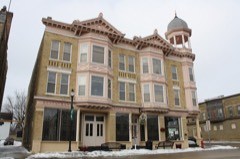 Beaumont Hotellisted 1988
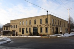 Hollenstein Wagon and Carriage Factorylisted 1979
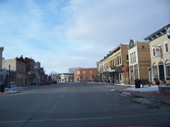 Main Street Historic Districtlisted 1995
 White Limestone Schoollisted 1976
Population over time
2 figuresMayville grew from 5,154 to 5,196 between 2010 and 2020. These are the recorded population figures Wikidata holds for this place, reached through the Geographic Names Information System number this page is keyed on rather than by name, so they belong to this place and not to another of the same name. Most are census counts, but not all are: an early figure may be a founding or settlement estimate, and an estimate published within five years of a census is left out. The change column is computed, and is left blank where more than 20 years separate a figure from the one before it, because a gap that long is not a change between two counts.
| Year | People | Change |
|---|---|---|
| 2010 | 5,154 | |
| 2020 | 5,196 | +42 (+1%) |
Topographic sheets covering this place
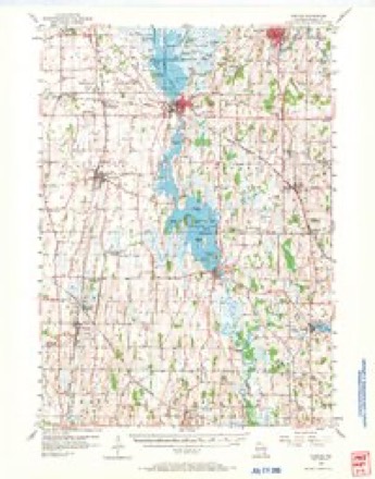
7 surveys from 10 printed sheetsMatched by testing this settlement's coordinate against the published boundary of every sheet in the United States Geological Survey's historical collection. Each opens the scanned sheet at the Survey.
- 1955 USGS Horicon quadrangle1:62500
- 1957 USGS Madison quadrangle1:250000, 3 printings
- 1960 USGS Madison quadrangle1:250000, 2 printings
- 1975 USGS Horicon NE quadrangle1:24000
- 1980 USGS Mayville South quadrangle1:24000
- 1984 USGS Oconomowoc quadrangle1:100000
- 1991 USGS Oconomowoc quadrangle1:100000


What happened here
An account from the chapter on Mayville city. The inset identifies its exact source book and publication year.
A Beaver Dam Murder
The history of Beaver Dam is comparatively free from crime. In September, 1858, occurred, probably, the only deliberate murder that the local press has been called upon to chronicle. James M. Conklin, a disreputable character, and Simon Malone, having been engaged in a protracted family quarrel over the use of a well located on the line dividing their respective premises, the feud culminated in Conklin's insulting, and ill-treating members of Malone's family, after which he proceeded to a saloon on Front street, and, while standing at the bar drinking, having remarked in the presence of Malone that he would " drive the red-mouthed Irishman out of town,' the latter deliberately drew a revolver and shot Conklin in the back, the ball passing through his lungs, resulting in death within the next forty-eight hours.
In the county-history sources
10,116 words on this townshipThe History of Dodge County, Wisconsin, Containing ... Its Early Settlement, Growth ... an Extensive and Minute Sketch of Its Cities ... War Record, Biographical Sketches, published 1880 names this settlement in its chapter on Mayville City. These are the passages that mention it, exactly as the scans read.
The Vita Spring has become a favorite resort for the citizens of Beaver Dam and the numerous individuals attracted thither for purposes of business or pleasure ; and, in fair weather, hundreds of people make daily pilgrimage to the place that, only a few months ago, was a cow pasture. During the coming spring, 500 maples, 50 elms and a large number of other varieties of trees, such as basswoods, butternuts and walnuts, together with a corresponding amount of shrubbery and evergi'eens, will be set out within the eleven-acre park surrounding the spring. A neat picket fence around the grounds, a rustic observator'y and boat-house, to be located near the junction of the second and* third lakes, gold-fish, row-bo.ats, a beautiful greenhouse, a bath-house, and a system of posts and chains on each side of the numerous walks and driveways, a compressed-air engine and fountain, are improvements that will come with the winds of March, the buds of April and the blossoms of May. Come and drink of this nectar, ye listless denizens of the ('' solid ") Sunny South, and ye torpid-livered automatons of the great cities North, East and West, and have your physical (and political) disabilities removed.
Passage source: The History of Dodge County, Wisconsin, Containing ... Its Early Settlement, Growth ... an Extensive and Minute Sketch of Its Cities ... War Record, Biographical Sketches, published 1880.
The Perry Coupler was first patented in 1871, again in 1875 and 1877, and, in January of the latter year, with the object of universalizing the wonderful invention, a stock company was incorporated, with the style and name of " The Perry Safety Car Coupling Company of Beaver Dam, Wis.," by the following named individuals : President, Oliver H. Crowl ; Vice President, Richard Ackerman ; Secretary, 0. L. Moore ; Treasurer, J. S. Church. Directors - W. A. Stuart and W. H. McReynolds, of Kokomo, Ind. ; Calvin E. Lewis, W. R. Chatfield,
Passage source: The History of Dodge County, Wisconsin, Containing ... Its Early Settlement, Growth ... an Extensive and Minute Sketch of Its Cities ... War Record, Biographical Sketches, published 1880.
Several years previous to this tragedy there was a case of blood-letting in the Fourth Ward, in which one McCabe was shot and killed by William Haskell, who, however, claimed that the shooting was accidental, he having aimed to kill a dog. Haskell was acquitted at the preliminary examination of intent to murder.
Passage source: The History of Dodge County, Wisconsin, Containing ... Its Early Settlement, Growth ... an Extensive and Minute Sketch of Its Cities ... War Record, Biographical Sketches, published 1880.
Machine-read from a century-old scan, so expect the errors a machine makes: misspelled names, dropped words, stray characters.
Read the whole chapter on Mayville City - it names this place 6 more 6 times.
Fires near this place
12 since 1996Regional context, not property-specific evidence. The federal wildfire occurrence database lists 12 fires within 5 miles of Mayville between 1996 and 2020, burning about 620 acres in total. 2 started naturally. 1 was recorded as arson. Distance is straight-line from the map coordinates, so a fire counted here may appear on a neighbouring settlement's page as well.
| Reported cause | Fires |
|---|---|
| Missing data/not specified/undetermined | 5 |
| Debris and open burning | 3 |
| Natural | 2 |
| Arson/incendiarism | 1 |
| Equipment and vehicle use | 1 |
The most recent of them, most recent first, with the day each was reported and the service that recorded it.
| Date | Cause | Size | Reported by | Name on the report |
|---|---|---|---|---|
| 16 August 2006 | Debris and open burning | under an acre | Horicon National Wildlife Refuge | BRUMMOND WF |
| 9 April 2012 | Missing data/not specified/undetermined | 4.5 acres | Wisconsin Department of Natural Resources | not named |
| 5 April 2020 | Missing data/not specified/undetermined | under an acre | Wisconsin Department of Natural Resources | 2000023 |
| 24 April 2018 | Missing data/not specified/undetermined | under an acre | Wisconsin Department of Natural Resources | 1800020 |
| 24 April 2003 | Debris and open burning | 250 acres | Horicon National Wildlife Refuge | I-9 IMPOUNDMENT |
| 18 April 2002 | Natural | 360 acres | Wisconsin Department of Natural Resources | not named |
| 12 April 2000 | Arson/incendiarism | 3.0 acres | Wisconsin Department of Natural Resources | not named |
| 30 March 2018 | Missing data/not specified/undetermined | under an acre | Wisconsin Department of Natural Resources | 1800017 |
Settlements close enough to share some of these fires:
Mines and quarries near this place
8 within 5 milesRegional context, not property-specific evidence. The federal mineral resources record lists 8 workings within 5 miles of Mayville: 6 past producers, 2 producers. 2 still produce. What was taken out: Sand and Gravel, Construction, Iron, Iron, Copper, Lead, Calcium. Distance is straight-line from the map coordinates, so a quarry counted here may appear on a neighbouring settlement's page as well.
| Where | Site | Commodity | Status | Recorded |
|---|---|---|---|---|
| Mayville Mine | Iron, Copper, Lead | Past Producer | 1892, 1928 | |
| Mayville White Lime Quarry | Calcium | Producer | ||
| Horicon Pit | Sand and Gravel, Construction | Producer | ||
| Iron Ridge Mine | Iron | Past Producer | 1849, 1914 | |
| Iron Ridge Mine | Iron | Past Producer | 1849 | |
| Linck-Henes Construction Co., Inc. | Sand and Gravel, Construction | Past Producer | ||
| Mayville Mine | Iron | Past Producer | 1892 | |
| Merget Pit | Sand and Gravel, Construction | Past Producer |
Storms near this place
19 since 1995Regional context, not property-specific evidence. The National Weather Service names Mayville in 19 storm reports between 1995 and 2025: 8 thunderstorm wind, 6 hail, 2 lightning, 2 flood. No death or injury is recorded in these reports. Each account below is quoted exactly as the forecast office filed it, from the NOAA Storm Events Database, and each date opens the federal record of that event.
| When | Event | Place named | Harm | What the report says |
|---|---|---|---|---|
| July 2007 | Lightning | Mayville | $60,000 | Lightning struck a barn on Morris Rd., resulting in a fire that destroyed the structure, as well as a 1994 vehicle parked inside. An adjacent small shed also had a small fire that was quickly extinguished. |
| June 2017 | Thunderstorm Wind | Mayville | $50,000 | Numerous trees and power lines down throughout Mayville. Some trees uprooted, others snapped. A large tree on a house and trees down on vehicles. City Works Department using front end loaders to clear the streets from fallen trees. |
| May 1998 | Thunderstorm Wind | Mayville | $30,000 | no account filed |
| July 2022 | Thunderstorm Wind | Mayville | $25,000 | Many trees down and much of Mayville without power. |
| July 1999 | Lightning | Mayville | $20,000 | no account filed |
| September 2016 | Flood | Mayville | $5,000 | Several inches of rain during the overnight and morning hours resulted in flooding around St. John's Lutheran School and Parkview Elementary School. The schools were evacuated and sandbagging was necessary. Nearby highway 28 and a few other road closures occurred due to deep water. |
| May 2013 | Thunderstorm Wind | Mayville | $5,000 | Law enforcement officials reported a few trees and power lines downed by thunderstorm wind gusts estimated at 70 mph (61 knots) along a path from Mayville to Brownsville. |
| May 2023 | Thunderstorm Wind | Mayville | $4,000 | Many tree branches and leaves down from the gust front of a thunderstorm. |
| July 2025 | Flood | Mayville | $1,000 | Dodge County dispatch and emergency management report minor street flooding on Bridge and Main St. in Mayville. |
| July 2025 | Thunderstorm Wind | Mayville | $1,000 | Dodge County Dispatch reports of a fallen tree on Horicon St. in Mayville. |
| July 2010 | Thunderstorm Wind | Mayville | $1,000 | Law enforcement reported a power pole snapped by strong thunderstorm wind gusts estimated up to 65 knots (75 mph). |
| July 2025 | Hail | Mayville | - | Penny to nickel sized hail in Mayville. |
| June 2008 | Tornado (EF0) | Mayville | - | This weak tornado lasted less than a minute and resulted in only broken tree limbs. It spun up southwest of the intersection of Polk Road and Madison Rd. The starting and ending locations, with respect to lat/long pairs of numbers, were 43.46927/-88.52612 and 43.47016/-88.52494. DI#28 (TS), DOD2. Wind speed estimated at about 75 mph. Average path width about was about 10 yards. |
| November 2022 | Hail | Mayville | - | no account filed |
| April 2018 | Hail | Mayville | - | no account filed |
| April 2018 | Hail | Mayville | - | no account filed |
| October 2013 | Hail | Mayville | - | no account filed |
| July 2001 | Thunderstorm Wind | Mayville | - | no account filed |
| August 1995 | Hail | Mayville | - | no account filed |
Nearest settlements
The eight closest, with where each one stands in the county. Distances are straight-line, computed from the Geographic Names Information System coordinates.
Elsewhere
Matched on this settlement's Geographic Names Information System number rather than its name, so it cannot be a different place of the same name in another state.
| Wikipedia article on Mayville | An encyclopaedic summary. Its text is share-alike, so it is linked here rather than copied. |
| Wikidata item Q1570088 | The structured record the population and elevation above come from. Public domain (CC0). |
Provenance
This settlement is recorded in the Geographic Names Information System as feature 1569151. The sheet list is computed by point-in-boundary test against the United States Geological Survey's historical topographic inventory. Both are works of the United States government and carry no copyright under 17 U.S.C. 105.
Wildfire. Short, Karen C. 2022. Spatial wildfire occurrence data for the United States, 1992-2020 [FPA_FOD_20221014]. 6th Edition. Fort Collins, CO: Forest Service Research Data Archive. https://doi.org/10.2737/RDS-2013-0009.6 Collected with United States Government funding and usable without additional permissions or fees.
Mines and quarries. USGS Mineral Resources Data System (MRDS) https://mrdata.usgs.gov/mrds/ A work of the United States government, no copyright under 17 U.S.C. 105.
Storms. NOAA National Centers for Environmental Information, Storm Events Database https://www.ncei.noaa.gov/stormevents/ A work of the United States government, no copyright under 17 U.S.C. 105. Narratives are quoted verbatim from the National Weather Service report and are not edited or summarised.