 Block
Oakfield, Wisconsin
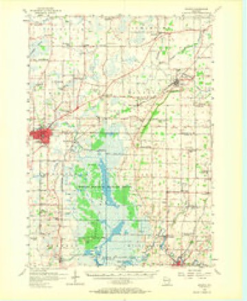
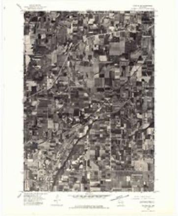
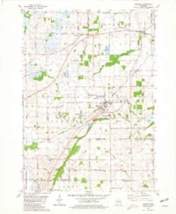
10 topographic sheets cover this place, the earliest surveyed in 1955 and the latest in 1980. It stands in Oakfield town. It lies in ZIP code area 53065. The Survey maps it on the Oakfield quadrangle. 1,052 people lived here at the 2020 count. It stands 860 feet above sea level.
Population over time
2 figuresOakfield fell from 1,075 to 1,052 between 2010 and 2020. These are the recorded population figures Wikidata holds for this place, reached through the Geographic Names Information System number this page is keyed on rather than by name, so they belong to this place and not to another of the same name. Most are census counts, but not all are: an early figure may be a founding or settlement estimate, and an estimate published within five years of a census is left out. The change column is computed, and is left blank where more than 20 years separate a figure from the one before it, because a gap that long is not a change between two counts.
| Year | People | Change |
|---|---|---|
| 2010 | 1,075 | |
| 2020 | 1,052 | -23 (-2%) |
Topographic sheets covering this place
6 surveys from 10 printed sheetsMatched by testing this settlement's coordinate against the published boundary of every sheet in the United States Geological Survey's historical collection. Each opens the scanned sheet at the Survey.
- 1955 USGS Waupun quadrangle1:62500, 2 printings
- 1957 USGS Madison quadrangle1:250000, 3 printings
- 1960 USGS Madison quadrangle1:250000, 2 printings
- 1975 USGS Waupun NE quadrangle1:24000
- 1980 USGS Fond Du Lac quadrangle1:100000
- 1980 USGS Oakfield quadrangle1:24000



In the county-history sources
2,295 words on this townshipThe History of Fond Du Lac County, Wisconsin, published 1880 names this settlement in its chapter on Oakfield Town. These are the passages that mention it, exactly as the scans read.
This is a rich, prosperous and pleasant town. It was erected into the town of Lime by an act approved February 2, 1816, and the name changed to Oakfield February 10, 1847. The extensive and rich quarries of limestone afforded by the " Ledge," in Township 14 north, of Range 10 east, suggested the name of Lime, and the beautiful oak openings suggested the present name of Onkfield. It is about equally divided between the high oak openings and prairie. That portion of Iloricon Marsh which extends into Oakfield has been drained, and is now mostly tillable land. The Ledge is very prominent in this town. It furnishes lime, building material, delicious springs and picturesque scenery - Darling's Gap," a wild spot near the village of Oakfield, being the most notable and attractive. Its winding crevices, deep caverns, overhanging precipices and vast domes of disintegrated rocks attract thousands of tourists and picnickers.
Passage source: The History of Fond Du Lac County, Wisconsin, published 1880.
The first settlement was begun in 1810, south of the present village of Oakfield, by Russell Wilkinson, who came with his family from Rensselaer County, N. Y., early that year, and built a log house. The Winnebago Indians were very numerous about the Ledge then, owing to the abundance of game in its retreats, and were highly displeased by the invasion of the paleface. They stole nearly everything he possessed that was movable, and finally burned bis home with all its contents. Mr. Wilkinson then procured a yoke of oxen and removed his wife, who was in delicate health, to the house of Edward Pier, at Fond du Lac. The Indians then held undisputed sway in that section until October, 1813, when Mr. AVdkinson and his brotlier Robert recurned to the farm and made a permanent settlement. They were for some time the only white denizens of the town, but were joined not much later by John Wilkinson, John Beirne, S. Botsford and Messrs. Silvernail, Ilubbard and Ilazen. When once the richness and^warmth of the soil, the beauty of the location ami the healtlifulness of the climate became generally known, tiie town settled with wonderful rapidity, and has always maintained itself in the front rank of prosperous and populous towns.
Passage source: The History of Fond Du Lac County, Wisconsin, published 1880.
The first post' office was established at Avoca, one mile east of what is now the village of Oakfield, on Section 13. Isaac Orvis was the first Postmaster. Henry Cornell is the present Postmaster of Oakfield, as it has many years been called.
Passage source: The History of Fond Du Lac County, Wisconsin, published 1880.
Machine-read from a century-old scan, so expect the errors a machine makes: misspelled names, dropped words, stray characters.
Read the whole chapter on Oakfield Town - it names this place 16 more 16 times.
Fires near this place
17 since 1997Regional context, not property-specific evidence. The federal wildfire occurrence database lists 17 fires within 5 miles of Oakfield between 1997 and 2020, burning about 178 acres in total. None started naturally. 1 was recorded as arson. Distance is straight-line from the map coordinates, so a fire counted here may appear on a neighbouring settlement's page as well.
| Reported cause | Fires |
|---|---|
| Debris and open burning | 9 |
| Missing data/not specified/undetermined | 4 |
| Equipment and vehicle use | 3 |
| Arson/incendiarism | 1 |
The most recent of them, most recent first, with the day each was reported and the service that recorded it.
| Date | Cause | Size | Reported by | Name on the report |
|---|---|---|---|---|
| 4 August 2003 | Equipment and vehicle use | under an acre | Leopold Wetland Management District | NKING CHASE |
| 5 June 1997 | Debris and open burning | 5.0 acres | Leopold Wetland Management District | BRADLEY2 |
| 4 May 2003 | Debris and open burning | under an acre | Leopold Wetland Management District | SCHOENBERG |
| 21 May 1997 | Debris and open burning | 30 acres | Leopold Wetland Management District | BRADLEY RD |
| 2 May 2020 | Equipment and vehicle use | 3.0 acres | Wisconsin Department of Natural Resources | 2005016 |
| 3 April 2001 | Arson/incendiarism | under an acre | Leopold Wetland Management District | MANTHEYW |
| 25 April 2018 | Debris and open burning | under an acre | Wisconsin Department of Natural Resources | 1804019 |
| 24 April 2003 | Debris and open burning | 3.8 acres | Leopold Wetland Management District | GATOR |
Settlements close enough to share some of these fires:
Mines and quarries near this place
8 within 5 milesRegional context, not property-specific evidence. The federal mineral resources record lists 8 workings within 5 miles of Oakfield: 4 past producers, 3 producers, 1 unknown. 3 still produce. What was taken out: Limestone, Dimension, Stone, Crushed/Broken, Stone. Distance is straight-line from the map coordinates, so a quarry counted here may appear on a neighbouring settlement's page as well.
| Where | Site | Commodity | Status | Recorded |
|---|---|---|---|---|
| El Dais Stone Company Plant | Stone | Past Producer | ||
| Oakfield & Byron Quarries | Stone | Unknown | ||
| Fond Du Lac Limestone Quarry | Stone, Crushed/Broken | Producer | ||
| Lehner Quarry | Stone, Crushed/Broken | Producer | ||
| Panetti Limestone Quarry | Stone, Crushed/Broken, Limestone, Dimension | Past Producer | ||
| Oak Stone Quarry | Limestone, Dimension | Past Producer | ||
| Oakfield Quarry | Limestone, Dimension | Producer | ||
| Oakfield Quarry,Eden Stone Co Inc | Limestone, Dimension | Past Producer |
Storms near this place
14 since 1996Regional context, not property-specific evidence. The National Weather Service names Oakfield in 14 storm reports between 1996 and 2022: 7 thunderstorm wind, 4 hail, 3 tornado. The reports record 12 injuries. Each account below is quoted exactly as the forecast office filed it, from the NOAA Storm Events Database, and each date opens the federal record of that event.
| When | Event | Place named | Harm | What the report says |
|---|---|---|---|---|
| July 1996 | Tornado (F5) | Oakfield | 12 hurt, $39,500,000 | no account filed |
| April 2004 | Thunderstorm Wind | Oakfield | $250,000 | no account filed |
| August 2002 | Thunderstorm Wind | Oakfield | $100,000 | no account filed |
| June 1996 | Thunderstorm Wind | Oakfield | $100,000 | no account filed |
| June 2017 | Thunderstorm Wind | Oakfield | $20,000 | A tree fell onto a garage causing structural damage and damage to the vehicle inside. Numerous tree damage including an uprooted tree and the trunks of smaller trees split. |
| June 2017 | Thunderstorm Wind | Oakfield | $3,000 | Several trees down. |
| June 2022 | Thunderstorm Wind | Oakfield | $1,000 | A tree down and shingles blown off a shed. |
| September 1997 | Thunderstorm Wind | Oakfield | $500 | no account filed |
| August 2018 | Tornado (EF0) | Oakfield | - | Tornado was 1 of 19 tornadoes that occurred across central to east central Wisconsin on the afternoon of August 28th. This tornado went through mainly rural areas southwest of Oakfield and crossed Kinwood Rd. Widespread straight line winds caused significant tree and crop damage across the county as well. |
| August 2015 | Hail | Oakfield | - | no account filed |
| June 2008 | Hail | Oakfield | - | no account filed |
| October 2006 | Hail | Oakfield | - | no account filed |
| July 1996 | Tornado (F0) | Oakfield | - | no account filed |
| July 1996 | Hail | Oakfield | - | no account filed |
Nearest settlements
The eight closest, with where each one stands in the county. Distances are straight-line, computed from the Geographic Names Information System coordinates.
| Map | Place | Distance | Sheets |
|---|---|---|---|
| Oak Center | 3.3 miles | 10 | |
| Lamartine | 3.5 miles | 10 | |
| South Byron | 4.6 miles | 9 | |
| Hamilton (historical) | 4.7 miles | 9 | |
| Byron | 5.6 miles | 9 | |
| Rogersville | 6.3 miles | 10 | |
| Woodhull | 6.5 miles | 10 | |
| Ladoga | 7.2 miles | 10 |
Elsewhere
Matched on this settlement's Geographic Names Information System number rather than its name, so it cannot be a different place of the same name in another state.
| Wikipedia article on Oakfield | An encyclopaedic summary. Its text is share-alike, so it is linked here rather than copied. |
| Wikidata item Q2671429 | The structured record the population and elevation above come from. Public domain (CC0). |
Provenance
This settlement is recorded in the Geographic Names Information System as feature 1570697. The sheet list is computed by point-in-boundary test against the United States Geological Survey's historical topographic inventory. Both are works of the United States government and carry no copyright under 17 U.S.C. 105.
Wildfire. Short, Karen C. 2022. Spatial wildfire occurrence data for the United States, 1992-2020 [FPA_FOD_20221014]. 6th Edition. Fort Collins, CO: Forest Service Research Data Archive. https://doi.org/10.2737/RDS-2013-0009.6 Collected with United States Government funding and usable without additional permissions or fees.
Mines and quarries. USGS Mineral Resources Data System (MRDS) https://mrdata.usgs.gov/mrds/ A work of the United States government, no copyright under 17 U.S.C. 105.
Storms. NOAA National Centers for Environmental Information, Storm Events Database https://www.ncei.noaa.gov/stormevents/ A work of the United States government, no copyright under 17 U.S.C. 105. Narratives are quoted verbatim from the National Weather Service report and are not edited or summarised.