 Block
South Byron, Wisconsin
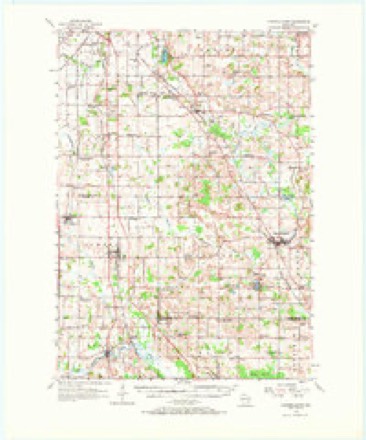
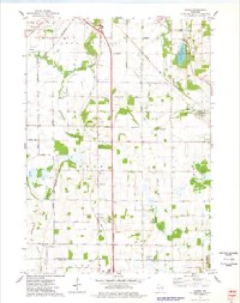
9 topographic sheets cover this place, the earliest surveyed in 1955 and the latest in 1980. It stands in Byron town. It lies in ZIP code area 53006. The Survey maps it on the Byron quadrangle. It stands 1,030 feet above sea level.
Topographic sheets covering this place
5 surveys from 9 printed sheetsMatched by testing this settlement's coordinate against the published boundary of every sheet in the United States Geological Survey's historical collection. Each opens the scanned sheet at the Survey.
- 1955 USGS Campbellsport quadrangle1:62500, 2 printings
- 1957 USGS Madison quadrangle1:250000, 3 printings
- 1960 USGS Madison quadrangle1:250000, 2 printings
- 1974 USGS Byron quadrangle1:24000
- 1980 USGS Fond Du Lac quadrangle1:100000



In the county-history sources
7,371 words on this townshipThe History of Fond Du Lac County, Wisconsin, published 1880 names this settlement in its chapter on Byron Town. These are the passages that mention it, exactly as the scans read.
G-EOKtJE B. MoLEAN, general store ; P. 0. South Byron ; born near Toronto, Ont., in 1837 ; son of William and Mary McLean, the former a farmer ; in 1838, Mr. McLean moved to New York State, near Lockport, buying a farm there; the subject of this sketch received his education in the common schools of that place, and, at the age of 15, came West and located in Byron, his father working a farm onshares; in 18.53, George was taken sick, and was an invalid for six years, not being able to do anything, and the effect of this sickness left him a cripple in one limb for life ; his father then moved to Iowa, taking George with him ; in 1860, George launched out for himself; buying a small tin trunk and stock of goods, he peddled his way back to Byron, and he has made his home in different parts of the town ever sioce, peddling part of the time on foot, and, after awhile, purchasing a horse and wagon for his business ; for one year, he entered into partnership with John Miles, in the grocery business, at Fond du Lac; finding that this venture did not prove a success, they closed out, and he went back to peddling ; a year after this, he bought a house and small piece of land for a home in Sec. 32, Byron, and has lived here ever since ; he is now running an elevator, in partnership with J. Simmons, and also keeping a general store, his wife - a woman of great ability - running the store ; Mr. McLean has a man on the road constantly, he being occupied at the elevator. He married, in 1866, in Byron, Anna Eliza, daughter of Benjamin and Margaret Van Valkenburg, the former a farmer ; they have five children - Fred B., John C, Viola A., George and Arthur. Mr. McL. has held the office of Town Treasurer for six different terms, and is now holding that office; he is a member of Oakfield Lodge, I. 0.0. F., and, politically, is a Republican.
Passage source: The History of Fond Du Lac County, Wisconsin, published 1880.
Machine-read from a century-old scan, so expect the errors a machine makes: misspelled names, dropped words, stray characters.
Read the whole chapter on Byron Town - it names this place 5 more 5 times.
Fires near this place
6 since 2018Regional context, not property-specific evidence. The federal wildfire occurrence database lists 6 fires within 5 miles of South Byron between 2018 and 2020, burning about 61 acres in total. None started naturally. None was recorded as arson. Distance is straight-line from the map coordinates, so a fire counted here may appear on a neighbouring settlement's page as well.
| Reported cause | Fires |
|---|---|
| Debris and open burning | 2 |
| Missing data/not specified/undetermined | 2 |
| Equipment and vehicle use | 2 |
The most recent of them, most recent first, with the day each was reported and the service that recorded it.
| Date | Cause | Size | Reported by | Name on the report |
|---|---|---|---|---|
| 2 May 2020 | Equipment and vehicle use | 3.0 acres | Wisconsin Department of Natural Resources | 2005016 |
| 30 April 2018 | Debris and open burning | 15 acres | Wisconsin Department of Natural Resources | 40 |
| 29 April 2018 | Missing data/not specified/undetermined | 35 acres | Wisconsin Department of Natural Resources | 18062 |
| 21 April 2019 | Debris and open burning | under an acre | Wisconsin Department of Natural Resources | 19023 |
| 19 March 2018 | Equipment and vehicle use | 3.0 acres | Wisconsin Department of Natural Resources | 18042 |
| 23 November 2018 | Missing data/not specified/undetermined | 5.0 acres | Wisconsin Department of Natural Resources | 1811060 |
Settlements close enough to share some of these fires:
Mines and quarries near this place
10 of 16 shownRegional context, not property-specific evidence. The federal mineral resources record lists 16 workings within 5 miles of South Byron: 9 producers, 5 past producers, 2 unknowns. 9 still produce. What was taken out: Limestone, Dimension, Sand and Gravel, Construction, Stone, Crushed/Broken, Stone. Distance is straight-line from the map coordinates, so a quarry counted here may appear on a neighbouring settlement's page as well.
| Where | Site | Commodity | Status | Recorded |
|---|---|---|---|---|
| Buechel Stone Center | Stone, Dimension | Producer | ||
| Western Lime-Knowles Quarry | Calcium | Producer | ||
| El Dais Stone Company Plant | Stone | Past Producer | ||
| Farmersville Quarry | Stone, Crushed/Broken | Producer | ||
| Farmersville Quarry | Stone | Unknown | ||
| Fond Du Lac Limestone Quarry | Stone, Crushed/Broken | Producer | ||
| Oakfield & Byron Quarries | Stone | Unknown | ||
| Panetti Limestone Quarry | Stone, Crushed/Broken, Limestone, Dimension | Past Producer | ||
| Byron Pit | Sand and Gravel, Construction | Past Producer | ||
| Hoppe Pit | Sand and Gravel, Construction | Producer |
Storms near this place
3 since 2018Regional context, not property-specific evidence. The National Weather Service names South Byron in 3 storm reports in 2018: 3 tornado. No death or injury is recorded in these reports. Each account below is quoted exactly as the forecast office filed it, from the NOAA Storm Events Database, and each date opens the federal record of that event.
| When | Event | Place named | Harm | What the report says |
|---|---|---|---|---|
| August 2018 | Tornado (EF1) | South Byron | - | Tornado was 1 of 19 tornadoes that occurred across central to east central Wisconsin on the afternoon of August 28th. This was the strongest tornado of the event and went just north of the Village of Brownsville. The worst damage was to a Canadian National Railway communications tower which was crumpled over. Widespread straight line winds caused significant tree and crop damage across the county as well. EF2 Damage occurred with the tornado further south at the onset of the tornado with EF1 damage occurring at the tail end of the tornado in southern Fond du Lac county. |
| August 2018 | Tornado (EF1) | South Byron | - | Tornado was 1 of 19 tornadoes that occurred across central to east central Wisconsin on the afternoon of August 28th. This tornado was one of a cluster of 4 that occurred between Brownsville and South Byron and crossed County Rd Y. Widespread straight line winds caused significant tree and crop damage across the county as well. |
| August 2018 | Tornado (EF1) | South Byron | - | Tornado was 1 of 19 tornadoes that occurred across central to east central Wisconsin on the afternoon of August 28th. This tornado went just north of South Byron and went along County Road Y. Widespread straight line winds caused significant tree and crop damage across the county as well. |
Nearest settlements
The eight closest, with where each one stands in the county. Distances are straight-line, computed from the Geographic Names Information System coordinates.
| Map | Place | Distance | Sheets |
|---|---|---|---|
| Byron | 2.1 miles | 9 | |
| Hamilton (historical) | 4.3 miles | 9 | |
| Oakfield | 4.6 miles | 10 | |
| Oak Center | 6.2 miles | 10 | |
| Marblehead | 7.1 miles | 9 | |
| Ashford | 7.1 miles | 9 | |
| Eden | 7.7 miles | 9 | |
| Lamartine | 7.8 miles | 10 |
Elsewhere
Matched on this settlement's Geographic Names Information System number rather than its name, so it cannot be a different place of the same name in another state.
| Wikipedia article on South Byron | An encyclopaedic summary. Its text is share-alike, so it is linked here rather than copied. |
| Wikidata item Q7566463 | The structured record the population and elevation above come from. Public domain (CC0). |
Provenance
This settlement is recorded in the Geographic Names Information System as feature 1574425. The sheet list is computed by point-in-boundary test against the United States Geological Survey's historical topographic inventory. Both are works of the United States government and carry no copyright under 17 U.S.C. 105.
Wildfire. Short, Karen C. 2022. Spatial wildfire occurrence data for the United States, 1992-2020 [FPA_FOD_20221014]. 6th Edition. Fort Collins, CO: Forest Service Research Data Archive. https://doi.org/10.2737/RDS-2013-0009.6 Collected with United States Government funding and usable without additional permissions or fees.
Mines and quarries. USGS Mineral Resources Data System (MRDS) https://mrdata.usgs.gov/mrds/ A work of the United States government, no copyright under 17 U.S.C. 105.
Storms. NOAA National Centers for Environmental Information, Storm Events Database https://www.ncei.noaa.gov/stormevents/ A work of the United States government, no copyright under 17 U.S.C. 105. Narratives are quoted verbatim from the National Weather Service report and are not edited or summarised.