 Block
Byron, Wisconsin
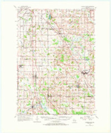
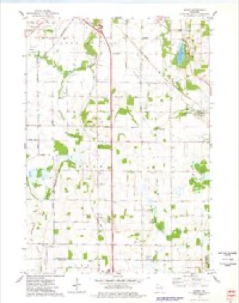
9 topographic sheets cover this place, the earliest surveyed in 1955 and the latest in 1980. It stands in Byron town. It lies in ZIP code area 53006. The Survey maps it on the Byron quadrangle.
Topographic sheets covering this place
5 surveys from 9 printed sheetsMatched by testing this settlement's coordinate against the published boundary of every sheet in the United States Geological Survey's historical collection. Each opens the scanned sheet at the Survey.
- 1955 USGS Campbellsport quadrangle1:62500, 2 printings
- 1957 USGS Madison quadrangle1:250000, 3 printings
- 1960 USGS Madison quadrangle1:250000, 2 printings
- 1974 USGS Byron quadrangle1:24000
- 1980 USGS Fond Du Lac quadrangle1:100000



In the county-history sources
7,371 words on this townshipThe History of Fond Du Lac County, Wisconsin, published 1880 names this settlement in its chapter on Byron Town. These are the passages that mention it, exactly as the scans read.
The first settlement in the town of Byron was in the year 1889 ; John Case and Oscar Pier, Patrick Kelley and William Stewart, selected a position and commenced the improvement of a neighborhood a little east of the middle of the north line of the town. Their location embraced a desirable variety of rich prairie, warm and fertile oak openings, and a beautiful grove of forest timber, with a small brook flowing through it. John Parsons, arriving direct from England, located upon a lot about a mile farther west. James Balson and Samuel Butler settled in this neighborhood in the fall of 1842. In the summer of 1844, John Potts, with his wife and four children, removed from the State of New York to Mound Prairie, in Byron. He set up crotches, upon which he laid long poles. He used prairie grass for a covering to this rude structure, and hung up blankets for its sides. Here he and his family were domiciled until he could build a house, obtaining hands from about ten miles distant to assist in rolling up the logs. Another settlement was soon after commenced by Hiram Merriam, Jabez C. Clemens and Jonas C. Reynolds, the last mentioned arriving in November.
Passage source: The History of Fond Du Lac County, Wisconsin, published 1880.
These pioneers on Mound Prairie, were, many of them, nearly destitute of capital when they arrived at their new homes. They were able, however, to purchase some cows, which were then very cheap in Illinois. They put their cows together for a team ; broke up the prairie land, and planted corn on the sod in the spring. They realized a good harvest, and, although they met with some inconveniences, felt they were getting rich. In 1845, Messrs. Bullock, Churchill and Roan settled in the southeasterly part of the town, and in the month following, Sumner Sweet and Joseph Nightingale came into the same neighborhood. They were joined the same season by several others. Rev. Mr. Vaughn and some friends from the county of Genesee, N. Y., settled near Oakfield, and formed what was called the " Genesee neighborhood."
Passage source: The History of Fond Du Lac County, Wisconsin, published 1880.
The early settlers in Byron shared in all the privations and difficulties so common in new countries. They raised grain in abundance, but found it very difficult to get it ground ; the few milh in this region were small and could not supply the demand. For several years the settlers went to Watertown, a distance of forty miles, to get their grinding done. The roads -were bad, and they had to wait several days to get their grists. Mr. Vaughn once sent his son to mill, and told him to wait for'his "grinding; " he was gone ten days. Mr. Reynolds once paid $14.50 for the milling of twenty bushels, and did not think it more than an average cost.
Passage source: The History of Fond Du Lac County, Wisconsin, published 1880.
Machine-read from a century-old scan, so expect the errors a machine makes: misspelled names, dropped words, stray characters.
Read the whole chapter on Byron Town - it names this place 28 more 28 times.
Fires near this place
6 since 2018Regional context, not property-specific evidence. The federal wildfire occurrence database lists 6 fires within 5 miles of Byron between 2018 and 2020, burning about 60 acres in total. None started naturally. None was recorded as arson. Distance is straight-line from the map coordinates, so a fire counted here may appear on a neighbouring settlement's page as well.
| Reported cause | Fires |
|---|---|
| Missing data/not specified/undetermined | 3 |
| Debris and open burning | 2 |
| Equipment and vehicle use | 1 |
The most recent of them, most recent first, with the day each was reported and the service that recorded it.
| Date | Cause | Size | Reported by | Name on the report |
|---|---|---|---|---|
| 30 April 2018 | Debris and open burning | 15 acres | Wisconsin Department of Natural Resources | 40 |
| 29 April 2018 | Missing data/not specified/undetermined | 35 acres | Wisconsin Department of Natural Resources | 18062 |
| 19 March 2018 | Equipment and vehicle use | 3.0 acres | Wisconsin Department of Natural Resources | 18042 |
| 18 March 2018 | Debris and open burning | 1.0 acres | Wisconsin Department of Natural Resources | 19 |
| 23 November 2018 | Missing data/not specified/undetermined | 5.0 acres | Wisconsin Department of Natural Resources | 1811060 |
| 19 November 2020 | Missing data/not specified/undetermined | 1.0 acres | Wisconsin Department of Natural Resources | 2020087 |
Settlements close enough to share some of these fires:
Mines and quarries near this place
10 of 11 shownRegional context, not property-specific evidence. The federal mineral resources record lists 11 workings within 5 miles of Byron: 6 producers, 3 past producers, 1 unknown, 1 plant. 7 still produce. What was taken out: Sand and Gravel, Construction, Limestone, Dimension, Stone, Crushed/Broken, Stone. Distance is straight-line from the map coordinates, so a quarry counted here may appear on a neighbouring settlement's page as well.
| Where | Site | Commodity | Status | Recorded |
|---|---|---|---|---|
| Buechel Stone Center | Stone, Dimension | Producer | ||
| Eden Quarry & Mill | Calcium | Plant | ||
| Farmersville Quarry | Stone | Unknown | ||
| Fond Du Lac Limestone Quarry | Stone, Crushed/Broken | Producer | ||
| Panetti Limestone Quarry | Stone, Crushed/Broken, Limestone, Dimension | Past Producer | ||
| Fon Du Lac Quarry | Limestone, Dimension | Past Producer | ||
| Rademann Stone & Landscape Co | Limestone, Dimension | Producer | ||
| Byron Pit | Sand and Gravel, Construction | Past Producer | ||
| Hoppe Pit | Sand and Gravel, Construction | Producer | ||
| Majerus Pit | Sand and Gravel, Construction | Producer |
Storms near this place
11 since 1996Regional context, not property-specific evidence. The National Weather Service names Byron in 11 storm reports between 1996 and 2018: 5 tornado, 3 thunderstorm wind, 2 hail, 1 funnel cloud. No death or injury is recorded in these reports. Each account below is quoted exactly as the forecast office filed it, from the NOAA Storm Events Database, and each date opens the federal record of that event.
| When | Event | Place named | Harm | What the report says |
|---|---|---|---|---|
| June 2017 | Thunderstorm Wind | Byron | $60,000 | Straight-line winds sheared off a stave silo and collapsed a large barn. Tree damage also occurred including a 2-3 foot diameter tree down. |
| July 2011 | Thunderstorm Wind | Byron | $5,000 | The Fond Du Lac County Emergency Manager reported trees blown down and blocking a few roads as well as power lines and telephone lines blown down by thunderstorm wind gusts estimated at 64 mph (56 knots). The damage occurred in a 3-mile wide swath from Byron to north of Cambellsport. |
| August 2018 | Tornado (EF1) | South Byron | - | Tornado was 1 of 19 tornadoes that occurred across central to east central Wisconsin on the afternoon of August 28th. This was the strongest tornado of the event and went just north of the Village of Brownsville. The worst damage was to a Canadian National Railway communications tower which was crumpled over. Widespread straight line winds caused significant tree and crop damage across the county as well. EF2 Damage occurred with the tornado further south at the onset of the tornado with EF1 damage occurring at the tail end of the tornado in southern Fond du Lac county. |
| August 2018 | Tornado (EF1) | South Byron | - | Tornado was 1 of 19 tornadoes that occurred across central to east central Wisconsin on the afternoon of August 28th. This tornado was one of a cluster of 4 that occurred between Brownsville and South Byron and crossed County Rd Y. Widespread straight line winds caused significant tree and crop damage across the county as well. |
| August 2018 | Tornado (EF1) | Byron | - | Tornado was 1 of 19 tornadoes that occurred across central to east central Wisconsin on the afternoon of August 28th. This tornado went through mainly rural areas east of South Byron and ending up south of Eden. Widespread straight line winds caused significant tree and crop damage across the county as well. |
| August 2018 | Tornado (EF1) | South Byron | - | Tornado was 1 of 19 tornadoes that occurred across central to east central Wisconsin on the afternoon of August 28th. This tornado went just north of South Byron and went along County Road Y. Widespread straight line winds caused significant tree and crop damage across the county as well. |
| June 2005 | Thunderstorm Wind | Byron | - | A 4 by 12 foot panel was tossed 50 feet. Trees and shingles were also reported down. |
| August 2015 | Hail | Byron | - | no account filed |
| July 2005 | Funnel Cloud | Byron | - | no account filed |
| March 2000 | Hail | Byron | - | no account filed |
| July 1996 | Tornado (F0) | Byron | - | no account filed |
Nearest settlements
The eight closest, with where each one stands in the county. Distances are straight-line, computed from the Geographic Names Information System coordinates.
| Map | Place | Distance | Sheets |
|---|---|---|---|
| South Byron | 2.1 miles | 9 | |
| Hamilton (historical) | 3.2 miles | 9 | |
| Marblehead | 5.1 miles | 9 | |
| Eden | 5.6 miles | 9 | |
| Oakfield | 5.6 miles | 10 | |
| Ashford | 6.2 miles | 9 | |
| Oak Center | 7.9 miles | 10 | |
| Fond du Lac | 8.3 miles | 13 |
Provenance
This settlement is recorded in the Geographic Names Information System as feature 1562496. The sheet list is computed by point-in-boundary test against the United States Geological Survey's historical topographic inventory. Both are works of the United States government and carry no copyright under 17 U.S.C. 105.
Wildfire. Short, Karen C. 2022. Spatial wildfire occurrence data for the United States, 1992-2020 [FPA_FOD_20221014]. 6th Edition. Fort Collins, CO: Forest Service Research Data Archive. https://doi.org/10.2737/RDS-2013-0009.6 Collected with United States Government funding and usable without additional permissions or fees.
Mines and quarries. USGS Mineral Resources Data System (MRDS) https://mrdata.usgs.gov/mrds/ A work of the United States government, no copyright under 17 U.S.C. 105.
Storms. NOAA National Centers for Environmental Information, Storm Events Database https://www.ncei.noaa.gov/stormevents/ A work of the United States government, no copyright under 17 U.S.C. 105. Narratives are quoted verbatim from the National Weather Service report and are not edited or summarised.