 Block
Clarence, Wisconsin
18 topographic sheets cover this place, the earliest surveyed in 1893 and the latest in 1981. It stands in Spring Grove town. It lies in ZIP code area 53520. It stands on Sylvester Creek. The Survey maps it on the Brodhead West quadrangle. The federal gazetteer marks this settlement historical: it is no longer a populated place, though the surveys that recorded it still are.
On record in Clarence
Buildings and businesses the archive holds for this place. Each opens its own page, with the source record it came from.
On the National Register within a mile 1 record
The National Register names another town for these. They stand within one mile of this settlement's coordinate.
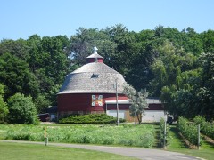 Albert and Minna Ten Eyck Round Barnlisted 2016 · 0.6 miles away
Topographic sheets covering this place
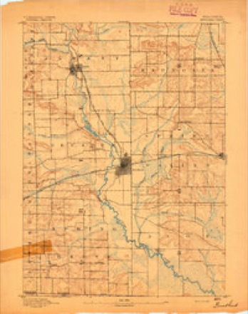
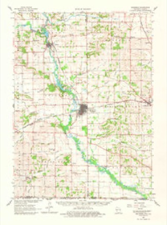
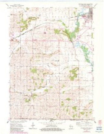
8 surveys from 18 printed sheetsMatched by testing this settlement's coordinate against the published boundary of every sheet in the United States Geological Survey's historical collection. Each opens the scanned sheet at the Survey.
- 1893 USGS Brodhead quadrangle1:62500, 5 printings
- 1954 USGS Rockford quadrangle1:250000
- 1955 USGS Rockford quadrangle1:250000
- 1958 USGS Rockford quadrangle1:250000, 4 printings
- 1962 USGS Brodhead quadrangle1:62500, 2 printings
- 1962 USGS Brodhead West quadrangle1:24000, 3 printings
- 1963 USGS Rockford quadrangle1:250000
- 1981 USGS Monroe quadrangle1:100000





In the county-history sources
28,363 words on this townshipHistory of Green County, Wisconsin, published 1877 names this settlement in its chapter on Spring Grove Town. These are the passages that mention it, exactly as the scans read.
The first mention of paupers in the county commissioners'journal is this of January, 1S43: "Ordered that Alexis Van Ornum he paid only $30 for nursing and for funeral expenses of Benjamin Jacobs, a poor person." From 1849 until '60 each town took care of its own poor. In 1S60 the supervisors elected three superintendents of the poor - Hiram Rust, I. M. Bennett, and Ransom Drake - and appropriated $2,000 to buy a county poor house and farm. The farm is in Mount Pleasant. The superintendents erected a building in the summer of 1861, and additional building's were erected in 1S70 and '73. During the year ending Nov. 15, 1S76, the average number of inmates at the poor house was 53, and the whole number of week's support given to inmates was 1,996. The average cost to the county of each week's maintenance was $1.46. The poor commissioners also expended about $1,500 for the poor living in the several towns. The principal buildings on the poor farm were destroyed by fire on the last day of May, 1S77, but new buildings will be erected as soon as possible.
Passage source: History of Green County, Wisconsin, published 1877.
Springstead. Dr. Springstead's son and son-in-law, Chancellor Springstead and Wm. Sherry, built in 1841 the first house on Sand Prairie. Clarence was the child of this settlement. The first house was built in '45 by Wm. Sherry. For a number of years'the village grew, and then, when Brodhead and Juda began to grow, it wasted away as an apple tree withers, and yellows, and dies, when a walnut begins to grow by its side, and by the time the railroad was completed the life of Clarence was gone. Like Decatur, the other village that died that Brodhead might be, Clarence had for some time borne a bad reputation. Counterfeiters had given it a notoriety that must have gone far to reconcile its best friends to its decline.
Passage source: History of Green County, Wisconsin, published 1877.
Machine-read from a century-old scan, so expect the errors a machine makes: misspelled names, dropped words, stray characters.
Fires near this place
14 since 2006Regional context, not property-specific evidence. The federal wildfire occurrence database lists 14 fires within 5 miles of Clarence (historical) between 2006 and 2020, burning about 14 acres in total. None started naturally. 1 was recorded as arson. Distance is straight-line from the map coordinates, so a fire counted here may appear on a neighbouring settlement's page as well.
| Reported cause | Fires |
|---|---|
| Debris and open burning | 6 |
| Smoking | 3 |
| Equipment and vehicle use | 2 |
| Arson/incendiarism | 1 |
| Missing data/not specified/undetermined | 1 |
| Power generation/transmission/distribution | 1 |
The most recent of them, most recent first, with the day each was reported and the service that recorded it.
| Date | Cause | Size | Reported by | Name on the report |
|---|---|---|---|---|
| 11 July 2018 | Equipment and vehicle use | 2.0 acres | Wisconsin Department of Natural Resources | 18067 |
| 20 June 2018 | Power generation/transmission/distribution | 1.0 acres | Wisconsin Department of Natural Resources | 105 |
| 17 June 2020 | Equipment and vehicle use | 1.0 acres | Wisconsin Department of Natural Resources | 60 |
| 3 April 2019 | Smoking | under an acre | Wisconsin Department of Natural Resources | 19030 |
| 29 April 2018 | Debris and open burning | 5.0 acres | Wisconsin Department of Natural Resources | 78 |
| 23 April 2018 | Smoking | under an acre | Wisconsin Department of Natural Resources | 74 |
| 22 April 2018 | Debris and open burning | under an acre | Wisconsin Department of Natural Resources | 72 |
| 15 April 2019 | Debris and open burning | under an acre | Wisconsin Department of Natural Resources | 19034 |
Settlements close enough to share some of these fires:
Mines and quarries near this place
2 within 5 milesRegional context, not property-specific evidence. The federal mineral resources record lists 2 workings within 5 miles of Clarence (historical): 1 past producer, 1 unknown. None of them still produces. What was taken out: Stone, Crushed/Broken, Stone. Distance is straight-line from the map coordinates, so a quarry counted here may appear on a neighbouring settlement's page as well.
| Where | Site | Commodity | Status | Recorded |
|---|---|---|---|---|
| Coles Quarry | Stone | Unknown | ||
| State Right of Way Quarry | Stone, Crushed/Broken | Past Producer |
Nearest settlements
The eight closest, with where each one stands in the county. Distances are straight-line, computed from the Geographic Names Information System coordinates.
| Map | Place | Distance | Sheets |
|---|---|---|---|
| Cardinal Crest | 1.8 miles | 18 | |
| Brodhead | 2.2 miles | 18 | |
| Decatur | 3.1 miles | 17 | |
| Juda | 5.7 miles | 15 | |
| Oakley | 5.7 miles | 18 | |
| Albany | 8.3 miles | 17 | |
| Twin Grove | 8.7 miles | 15 | |
| Mineral Point (historical) | 9.1 miles | 17 |
Provenance
This settlement is recorded in the Geographic Names Information System as feature 2760453. The sheet list is computed by point-in-boundary test against the United States Geological Survey's historical topographic inventory. Both are works of the United States government and carry no copyright under 17 U.S.C. 105.
Wildfire. Short, Karen C. 2022. Spatial wildfire occurrence data for the United States, 1992-2020 [FPA_FOD_20221014]. 6th Edition. Fort Collins, CO: Forest Service Research Data Archive. https://doi.org/10.2737/RDS-2013-0009.6 Collected with United States Government funding and usable without additional permissions or fees.
Mines and quarries. USGS Mineral Resources Data System (MRDS) https://mrdata.usgs.gov/mrds/ A work of the United States government, no copyright under 17 U.S.C. 105.