Block
From the record
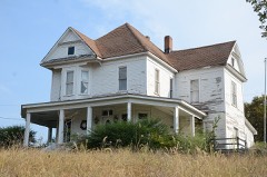
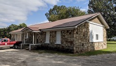
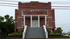
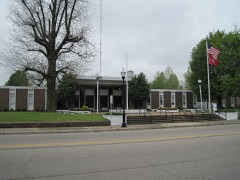
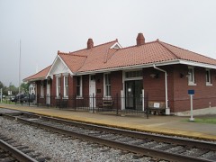
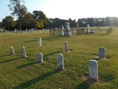
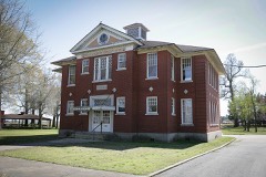
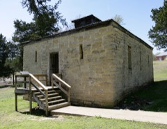
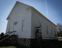
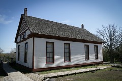
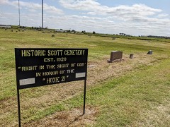
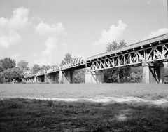
31 National Register listings published here.
Sources: the National Register database, National Park Service
60 topographic sheets cover 41 settlements here, and 31 properties are on the National Register of Historic Places.
31 National Register listings published here.
Sources: the National Register database, National Park Service
Every property in this county listed on the National Register of Historic Places, with the year it was listed and the federal nomination document.
Every wildfire the federal occurrence database records inside this county: 284 of them, burning about 5,712 acres. 2 started naturally and 84 were recorded as arson. Each settlement page carries the fires within five miles of it.
| Reported cause | Fires |
|---|---|
| Debris and open burning | 110 |
| Arson/incendiarism | 84 |
| Missing data/not specified/undetermined | 74 |
| Equipment and vehicle use | 10 |
| Natural | 2 |
| Railroad operations and maintenance | 2 |
| Misuse of fire by a minor | 1 |
| Smoking | 1 |
The five largest, by the area the report gives. One of them was set deliberately.
| Date | Cause | Size | Reported by | Name on the report |
|---|---|---|---|---|
| 27 November 2017 | Missing data/not specified/undetermined | 278 acres | Arkansas Forestry Commission | not named |
| 15 March 2018 | Missing data/not specified/undetermined | 226 acres | Arkansas Forestry Commission | not named |
| 26 January 2018 | Missing data/not specified/undetermined | 213 acres | Arkansas Forestry Commission | not named |
| 13 March 2014 | Debris and open burning | 195 acres | Arkansas Forestry Commission | LAW15526244 |
| 5 March 2020 | Missing data/not specified/undetermined | 180 acres | Arkansas Forestry Commission | not named |
| 20 January 2018 | Missing data/not specified/undetermined | 159 acres | Arkansas Forestry Commission | not named |
| 21 January 2014 | Missing data/not specified/undetermined | 125 acres | Arkansas Forestry Commission | LAW4914507 |
| 12 November 2005 | Arson/incendiarism | 96 acres | Arkansas Forestry Commission | not named |
Every settlement page carries the fires within five miles of it - see the settlement index below.
The NOAA Storm Events Database holds 407 reports for this county, causing 2 deaths, 16 injuries and about $24,662,570 in recorded property damage. Each settlement page carries the reports that name it.
| Kind of event | Reports |
|---|---|
| Thunderstorm Wind | 164 |
| Hail | 100 |
| Flood | 71 |
| Flash Flood | 45 |
| Tornado | 24 |
| Heavy Rain | 3 |
The most serious of them, by death, then injury, then recorded damage. The accounts are quoted exactly as the forecast office filed them.
| When | Event | Place named | Harm | What the report says |
|---|---|---|---|---|
| September 1977 | Tornado (F2) | not stated | 1 killed, 3 hurt, $25,000 | no account filed |
| June 2014 | Thunderstorm Wind | Ravenden | 1 killed | Straight line winds produced widespread wind damage across Lawrence County. Numerous trees and power lines were knocked down with a few blocking roads. One tree fell on vehicle, killing the driver, after the motorist decided to pull over due to the blinding rain. Three other occupants sustained injuries. A few trees fell onto homes producing damage. Roof damage occurred to a few other homes. At least two car accidents occurred during the storm. |
| November 1955 | Tornado (F3) | not stated | 9 hurt, $250,000 | no account filed |
| March 1997 | Tornado (F3) | Sedgwick | 2 hurt, $500,000 | no account filed |
| January 1999 | Tornado (F0) | Sedgwick | 1 hurt, $10,000 | The tornado that started near Egypt in Craighead county continued to move northeast into Lawrence county. The tornado damaged one home in Lawrence county. A farm shop was destroyed. |
| May 2013 | Thunderstorm Wind | Ravenden | 1 hurt | Straight line winds knocked down several trees and a few power poles in Ravenden. One person was injured by a falling tree. |
| May 2017 | Flood | Black Rock | $5,000,000 | Heavy rain brought the Black River at Black Rock to just under record levels in early May. Homes and businesses suffered minor damage from the flooding. Many road and bridges were also flooded and damaged. Thousands of acres of cropland was also flooded. The Lawrence County Dive team performed 14 rescues in the first couple days of May. They rescued people from their vehicle on County Road 514 on May 2nd. The dive team rescued two people from a home on May 3rd. |
| March 2008 | Flood | Annieville | $5,000,000 | Heavy rain produced flooding along the Black River and it's tributaries. Numerous roads were closed due to the high water including Arkansas 115, Arkansas 117, U.S. Highway 63 from Hoxie to the Sharp County line, Arkansas 25, and U.S. Highway 412. County Roads 106 and 107 received damage from the flooding as well. Twenty-five homes were destroyed and forty received major damage. Many cabins and other dwellings received damage as well. Lawrence County was declared a state disaster area. |
| April 2008 | Flood | Annieville | $5,000,000 | Heavy rain in March produced flooding along the Black River and it's tributaries. Numerous roads were closed due to the high water including Arkansas 115, Arkansas 117, U.S. Highway 63 from Hoxie to the Sharp County line, Arkansas 25, and U.S. Highway 412. County Roads 106 and 107 received damage from the flooding as well. By the beginning of April, twenty-five homes were destroyed and forty received major damage. Many cabins and other dwellings received damage as well. Lawrence County was declared a state disaster area. |
| May 2017 | Flash Flood | (Arg)Walnut Ridge Ar | $2,000,000 | The Black River levee east of Pocahontas suffered several breaches during the early morning hours of May 3rd. The water flowed south along the Big Running Water Creek and eventually flooded parts of Lawrence County. Highway 63 was closed between Portia and Walnut Ridge. Water flowing over the highway damaged the shoulders. Roads leading into Clover Bend were flooded and several houses in the area had water inside them. |
| April 2014 | Flash Flood | (Arg)Walnut Ridge Ar | $1,000,000 | Heavy rain flooded several roadways in the Walnut Ridge area. Several county roads were washed out. |
| September 2006 | Flash Flood | Northwest Portion | $1,000,000 | Heavy rains caused flash flooding along the Spring River. People had to be rescued from homes along the river. Six homes were damaged by the flood waters. Some crop damage also occurred from the flooding. Near Imboden and Ravenden, farmers reported a loss more than 500 bales of hay due to rising waters. In addition, more than 150 head of cattle were killed by flood waters. Some farm equipment, vehicles, and campers was also damaged from flood water or swept away by the rising flood waters. Black Rock was also especially hit hard by the flooding. |
| June 1994 | Thunderstorm Wind | Imboden | $500,000 | Thunderstorm winds, estimated as high as 90 mph, knocked down numerous trees and power lines. Several trees fell onto cars. |
| June 1994 | Thunderstorm Wind | Walnut Ridge | $500,000 | Thunderstorm winds, estimated up to 100 mph, blew down numerous large trees. A roof was blown off a college dormitory and several airplanes were damaged. |
| April 2014 | Flash Flood | Powhatan | $488,000 | Heavy rain caused flash flooding between Imboden and Black Rock. Highway 63 was flooded. |
| February 2011 | Flash Flood | Sedgwick | $250,000 | Heavy rain produced flash flooding near Sedgwick. Several county roads were flooded near Highway 228 and Highway 63. Sections of pavement were swept away on Eighth Street in Black Rock. Highway 412 near Walnut Ridge was closed due to flooding. All low water crossings across Lawrence County were flooded. Bridge and culverts throughout the county have been damaged. |
| May 2000 | Thunderstorm Wind | Walnut Ridge | $250,000 | Five airplanes were damaged at the Walnut Ridge airport along with a hangar door and several skylights. A wind gust of over 60 mph was reported at the airport. |
| April 1979 | Tornado (F2) | not stated | $250,000 | no account filed |
| April 2010 | Thunderstorm Wind | Strawberry | $150,000 | Straight line winds completely destroyed a shop building, a tractor barn and damaged wooden high voltage transmission poles and lines along County Road 410 near College City. In addition, large trees were toppled at Williams Baptist College. Winds were measured in College City at 67 mph. A tree was knocked down on Highway 25 between Strawberry and Saffell as well. In Alicia, large wooden high voltage transmission poles and lines were damaged. Scattered damage to trees, small sheds, and outbuildings occurred along Highway 230, Highway 91 and Highway 228 between Alicia and Sedewick. Sheet metal from the Morgan Portable Building plant was blown onto the Walnut Ridge Regional Airport grounds. A few signs at the airport were damaged as well. A home on County Road 723 received major damage as the garage and sunroom were destroyed and part of the roof was blown off. The school district in Hoxie reported damage to an awning at the elementary school and to the roof of a dug out and ticket booth at the athletic fields. Several sections of fence and a few signs were damaged on campus as well. |
| May 2021 | Thunderstorm Wind | Walnut Ridge | $100,000 | Windows were blown out of the Walmart and power poles were down in the parking lot. Trees were reported down and there was damage to buildings in the city. |
| April 2017 | Flash Flood | Richwoods | $100,000 | Several businesses and the courthouse was flooded. Parts of West Main Street underwater. |
| April 2006 | Tornado (F0) | Ravenden | $100,000 | The tornado moved into Lawrence County from Sharp County and tracked east to 3 miles east of Ravenden. The tornado lifted near the Randolph and Lawrence County line. A rental home was damaged in Ravenden. Thirty to forty other homes had minor damage across the county. A barn was damaged in Ravenden. Four unoccupied buildings were also damaged in Ravenden. |
| March 1996 | Tornado (F1) | Jesup | $100,000 | no account filed |
| October 2009 | Flash Flood | Black Rock | $76,000 | Heavy rain caused Coffee Creek to overflow producing flooding on several nearby roads. |
| May 2017 | Thunderstorm Wind | Hoxie | $75,000 | Tree fell on house on Gum Street in Walnut Ridge. |
| June 2017 | Thunderstorm Wind | Powhatan | $75,000 | Many trees and power-lines down across Lawrence county. One tree blocking the railroad. |
| March 2006 | Thunderstorm Wind | Walnut Ridge | $75,000 | A roof was blown off at a women's residence hall and a softball dugout was destroyed at Williams Baptist College. The roof of the Walnut Ridge Army Flying School Museum was torn off. Debris from the roof was carried across the street and hit the Parachute Inn Restaurant at the Walnut Ridge Airport. Roofs were also blown off of several other businesses in Walnut Ridge. Several trees and power lines were knocked down. |
| April 2011 | Flood | Black Rock | $65,000 | Heavy rain brought the Black River in Black Rock to just under record levels in late April that continued into mid May. The river remained above flood stage through the end of May. Homes and businesses sustained minor damage from the flooding. Evacuations of Black Rock and Portia, but Portia was spared from any damage. Many roads and bridges were also flooded and/or damaged. Portions of Black Rock and Powhatan Courthouse State Parks. Several thousand acres of cropland was flooded as well. |
| May 2011 | Flood | Black Rock | $65,000 | Heavy rain brought the Black River in Black Rock to just under record levels in late April and the river remained above flood stage through the end of May. Homes and businesses sustained minor damage from the flooding. Black Rock and Portia were evacuated, but Portia was spared from any damage. Many roads and bridges were also flooded and/or damaged. Portions of Black Rock and Powhatan Courthouse State Parks were flooded. Several thousand acres of cropland was flooded as well. |
| March 2017 | Thunderstorm Wind | Richwoods | $60,000 | Emergency manager and public also reported a hangar door blown in at the regional airport along with trees and power lines down at Williams Baptist college. |
| March 2017 | Tornado (EF0) | Black Rock | $60,000 | Damage was primarily to metal roofing and some farm buildings and trees. Peak winds estimated at 75 mph. |
| May 2021 | Thunderstorm Wind | Hoxie | $50,000 | Straight-line wind damage was noted across the city of Walnut Ridge. Damage consisted of trees uprooted or snapped, power lines blown down, some minor damage to homes, and damage to retail structures along Business Highway 67. |
| May 2021 | Thunderstorm Wind | Walnut Ridge | $50,000 | Multiple trees and power lines were down across the city. Multiple structures had damage. A tree fell onto a home with people trapped inside. |
| February 2018 | Thunderstorm Wind | Portia | $50,000 | Multiple reports of trees downed across Lawrence County. A couple of barns sustained roof damage. |
| March 2017 | Thunderstorm Wind | Ravenden | $50,000 | Rodeo arena damaged and bleachers overturned. U-Haul trailer blown over. Roof blown off a home in Ravenden also. |
| June 2017 | Thunderstorm Wind | Alicia | $50,000 | A large grain bin was toppled and destroyed. |
| March 2004 | Thunderstorm Wind | Walnut Ridge | $50,000 | Several homes and farm buildings were damaged. |
| July 2003 | Hail | Imboden | $50,000 | A car dealership in Black Rock had many of its vehicles damaged by the hail. |
| September 1993 | Thunderstorm Wind | Black Rock | $50,000 | Several highway signs were knocked down, as well as some trees and power lines. |
| September 1993 | Thunderstorm Wind | Imboden | $50,000 | Thunderstorm winds blew down trees and power lines. |
| May 2000 | Thunderstorm Wind | Countywide | $47,000 | A few structures were damaged across the northern part of Lawrence county. Numerous trees and power lines were blown down. |
| February 2022 | Thunderstorm Wind | Sedgwick | $40,000 | We received a report of a tree that fell on a house in Sedgwick. |
| March 2017 | Thunderstorm Wind | Smithville | $40,000 | Some trees and power lines were blown down. A couple of barns were damaged. |
| October 2000 | Thunderstorm Wind | Minturn | $40,000 | One vacant house trailer was destroyed. A second trailer was blown over. Some grain bins were damaged. Some trees and power lines were blown over. One tree fell on a house. |
| November 1998 | Thunderstorm Wind | Hoxie | $40,000 | A 50'x50' section of the roof to an elementary school in Walnut Ridge was blown away. A nearby outbuilding was destroyed. A few homes were also damaged. Several trees were also knocked down. |
| June 2018 | Thunderstorm Wind | Walnut Ridge | $30,000 | Trees and power lines down around Walnut Ridge. |
| March 2017 | Thunderstorm Wind | Lynn | $30,000 | Farm shop and lumber yard damaged. Trees uprooted. |
| March 2017 | Thunderstorm Wind | (Arg)Walnut Ridge Ar | $30,000 | Two trees down with one on a house on Faculty Drive. |
| June 2017 | Thunderstorm Wind | Ravenden | $30,000 | Tree down on a house. |
| January 1999 | Thunderstorm Wind | Walnut Ridge | $30,000 | A building lost part of its roof. A truck was overturned. Several trees were blown down. |
| July 1996 | Thunderstorm Wind | Imboden | $30,000 | no account filed |
| February 2022 | Thunderstorm Wind | Sedgwick | $25,000 | A roof was partially blown off a mobile home and several trees and power lines were down on Cypress Street in Sedgwick. |
| April 2010 | Flash Flood | Lynn | $25,000 | Heavy rain produced flash flooding all around Lawrence County. At least six inches of water covered roadways near College City. A culvert was washed out on Highway 25, north of Lynn. In addition, Highway 25 between Lynn and Lake Charles was completely underwater as well as Fowler Road in Lawrence County. Both roads were closed as a result. |
| November 2005 | Thunderstorm Wind | Clover Bend | $25,000 | A fully secured trailer lost its roof and sustained significant structural damage near the town of Whiskerville. Some minor roof damage occurred and several trees were blown down. |
| November 2005 | Thunderstorm Wind | Ravenden | $25,000 | Two homes were damaged in Imboden. Several trees were blown down. |
| March 2002 | Thunderstorm Wind | Minturn | $25,000 | A barn was demolished. Three homes were damaged. |
| May 2002 | Thunderstorm Wind | Ravenden | $25,000 | Two shop buildings and five storage units were damaged. Two cars were damaged by fallen trees. Several trees were blown down including one tree that was at least 200 years old. |
| May 1998 | Tornado (F0) | Walnut Ridge | $25,000 | A tornado touched down near Walnut Ridge and moved northeast. One mobile home was destroyed and several others were damaged. Several houses had roof damage. |
| April 2006 | Hail | Ravenden | $25,000 | no account filed |
| July 1985 | Tornado (F0) | not stated | $25,000 | no account filed |
The Survey's mineral resources record lists 65 workings inside this county. 3 still produce and 62 are closed or unrecorded. Each settlement page carries the workings within five miles of it.
| Commodity | Workings |
|---|---|
| Sand and Gravel, Construction | 30 |
| Zinc | 13 |
| Lead, Zinc | 8 |
| Iron | 5 |
| Lead | 3 |
| Stone, Crushed/Broken | 2 |
| Limestone, Dimension | 2 |
| Dolomite | 1 |
| Zinc, Lead | 1 |
| Clay | 1 |
The least common of them first, because a county's hundredth gravel pit says nothing its first ten did not.
| Where | Site | Commodity | Status | Recorded |
|---|---|---|---|---|
| Campbell Zinc Co's Shaft 1 | Lead, Zinc, Dolomite | Past Producer | ||
| Fannie Richey Place | Clay | Unknown | ||
| Hoppe Mine | Zinc, Lead | Past Producer | ||
| Ben M Hogan | Limestone, Dimension | Past Producer | ||
| Black Rock Quarry & Mill | Stone, Crushed/Broken | Producer | ||
| Toles Quarry | Limestone, Dimension | Producer | ||
| Verkler Quarry | Stone, Crushed/Broken | Producer | ||
| Barber Mine | Lead | Past Producer | ||
| Gibson-Finch | Lead | Past Producer | ||
| Mccaa Prospects | Lead | Past Producer | ||
| Clifton E.Cook Property | Iron | Unknown | ||
| James Prospect | Iron | Occurrence | ||
| Lester Ratliff Property | Iron | Past Producer | ||
| Pearl Pen Property | Iron | Past Producer | ||
| T.H.Matthews Property | Iron | Past Producer | ||
| Adams Prospects | Lead, Zinc | Past Producer | ||
| Anderson Prospect | Lead, Zinc | Occurrence | ||
| Campbell Zinc Co's Shafts 2 & 3 | Lead, Zinc | Past Producer | ||
| Harris Property | Lead, Zinc | Past Producer | ||
| Moore Mountain | Lead, Zinc | Past Producer | ||
| Unk | Lead, Zinc | Past Producer | ||
| Unk | Lead, Zinc | Past Producer | ||
| Casper Mine | Zinc | Past Producer | ||
| Hendrick | Zinc | Past Producer | ||
| J.B.Butler | Zinc | Past Producer | ||
| King Jack | Zinc | Past Producer | ||
| Lincoln | Zinc | Past Producer | ||
| Miller | Zinc | Past Producer | ||
| Old Mill | Zinc | Past Producer | ||
| Penn | Zinc | Past Producer | ||
| Poe Mine | Zinc | Past Producer | ||
| Raney Mine | Zinc | Past Producer | ||
| Red Fox | Zinc | Past Producer | ||
| Richardson | Zinc | Past Producer | ||
| Runyan | Zinc | Past Producer | ||
| Bessie Cmp | Sand and Gravel, Construction | Past Producer | ||
| Black Rock S & G | Sand and Gravel, Construction | Past Producer | ||
| Black Rock Sand & Gravel Co | Sand and Gravel, Construction | Past Producer | ||
| D F Jones | Sand and Gravel, Construction | Past Producer | ||
| Unk | Sand and Gravel, Construction | Past Producer | ||
| Unk | Sand and Gravel, Construction | Past Producer | ||
| Unk | Sand and Gravel, Construction | Past Producer | ||
| Unk | Sand and Gravel, Construction | Past Producer | ||
| Unk | Sand and Gravel, Construction | Past Producer | ||
| Unk | Sand and Gravel, Construction | Past Producer | ||
| Unk | Sand and Gravel, Construction | Past Producer | ||
| Unk | Sand and Gravel, Construction | Past Producer | ||
| Unk | Sand and Gravel, Construction | Past Producer | ||
| Unk | Sand and Gravel, Construction | Past Producer | ||
| Unk | Sand and Gravel, Construction | Past Producer | ||
| Unk | Sand and Gravel, Construction | Past Producer | ||
| Unk | Sand and Gravel, Construction | Past Producer | ||
| Unk | Sand and Gravel, Construction | Past Producer | ||
| Unk | Sand and Gravel, Construction | Past Producer | ||
| Unk | Sand and Gravel, Construction | Past Producer | ||
| Unk | Sand and Gravel, Construction | Past Producer | ||
| Unk | Sand and Gravel, Construction | Past Producer | ||
| Unk | Sand and Gravel, Construction | Past Producer | ||
| Unk | Sand and Gravel, Construction | Past Producer | ||
| Unk | Sand and Gravel, Construction | Past Producer | ||
| Unk | Sand and Gravel, Construction | Past Producer | ||
| Unk | Sand and Gravel, Construction | Past Producer | ||
| Unk | Sand and Gravel, Construction | Past Producer | ||
| Unk | Sand and Gravel, Construction | Past Producer | ||
| Unk | Sand and Gravel, Construction | Past Producer |
Named settlements recorded in the Geographic Names Information System, each with the topographic sheets covering it. Villages, hamlets and abandoned places alike. Each is shown with the nearest named watercourse or landform and the survey quadrangle it falls on.
Dowell township · 72476 · Podo Creek quadrangle
11 sheets, 1935 to 1986
No longer a settlement
Black Rock township · 72415 · On Fall Creek · Black Rock quadrangle
12 sheets, 1934 to 1983
Spring River township · 72459 · Near Cave Hill · Ravenden quadrangle
9 sheets, 1957 to 1983
No longer a settlement
Spring River township · 72459 · Near Opossum Hollow · Ravenden quadrangle
9 sheets, 1957 to 1983
No longer a settlement
Black River township · 72458 · On Bay Creek · Black Rock quadrangle
12 sheets, 1934 to 1983
Strawberry township · 72466 · On East Cooper Creek · Smithville quadrangle
9 sheets, 1957 to 1983
Cache township · 72476 · On Tupelo Slough · Walnut Ridge SE quadrangle
14 sheets, 1932 to 1984
The vanished settlements of Lawrence County: the places named above that are no longer on the map.