 Block
Morristown, Arizona
17 topographic sheets cover this place, the earliest surveyed in 1954 and the latest in 1988. It stands in the Wickenburg census division. It lies in ZIP code area 85342. The Survey maps it on the Wittmann quadrangle. 186 people lived here at the 2020 count. It stands 1,988 feet above sea level.
On record in Morristown
Buildings and businesses the archive holds for this place. Each opens its own page, with the source record it came from.
On the National Register 1 record
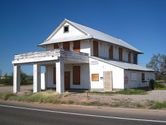 Morristown Storelisted 1991
Population over time
2 figuresMorristown fell from 227 to 186 between 2010 and 2020. These are the recorded population figures Wikidata holds for this place, reached through the Geographic Names Information System number this page is keyed on rather than by name, so they belong to this place and not to another of the same name. Most are census counts, but not all are: an early figure may be a founding or settlement estimate, and an estimate published within five years of a census is left out. The change column is computed, and is left blank where more than 20 years separate a figure from the one before it, because a gap that long is not a change between two counts.
| Year | People | Change |
|---|---|---|
| 2010 | 227 | |
| 2020 | 186 | -41 (-18%) |
Topographic sheets covering this place
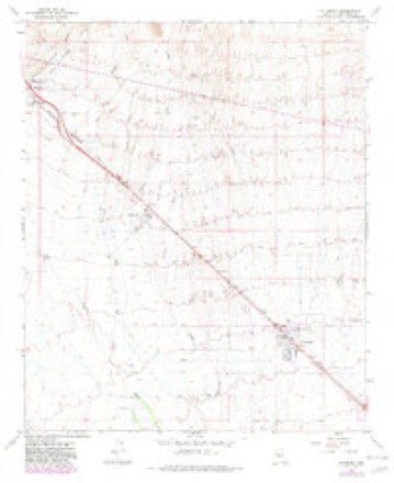
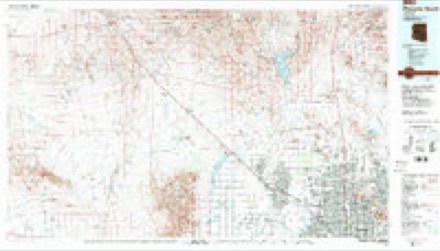
8 surveys from 17 printed sheetsMatched by testing this settlement's coordinate against the published boundary of every sheet in the United States Geological Survey's historical collection. Each opens the scanned sheet at the Survey.
- 1954 USGS Phoenix quadrangle1:250000, 5 printings
- 1957 USGS Phoenix quadrangle1:250000
- 1958 USGS Phoenix quadrangle1:250000
- 1960 USGS Phoenix quadrangle1:250000
- 1965 USGS Wittmann quadrangle1:24000, 4 printings
- 1969 USGS Phoenix quadrangle1:250000, 2 printings
- 1971 USGS Phoenix quadrangle1:250000
- 1988 USGS Phoenix North quadrangle1:100000, 2 printings






Fires near this place
65 since 1992Regional context, not property-specific evidence. The federal wildfire occurrence database lists 65 fires within 5 miles of Morristown between 1992 and 2020, burning about 155 acres in total. 1 started naturally. 3 were recorded as arson. Distance is straight-line from the map coordinates, so a fire counted here may appear on a neighbouring settlement's page as well.
| Reported cause | Fires |
|---|---|
| Missing data/not specified/undetermined | 51 |
| Arson/incendiarism | 3 |
| Equipment and vehicle use | 3 |
| Smoking | 3 |
| Railroad operations and maintenance | 2 |
| Natural | 1 |
| Recreation and ceremony | 1 |
| Misuse of fire by a minor | 1 |
The most recent of them, most recent first, with the day each was reported and the service that recorded it.
| Date | Cause | Size | Reported by | Name on the report |
|---|---|---|---|---|
| 25 September 1995 | Equipment and vehicle use | under an acre | Arizona Department of Forestry and Fire Management - State Office | not named |
| 24 September 2020 | Missing data/not specified/undetermined | 4.0 acres | Phoenix District Office | MORRISTOWN |
| 14 September 1995 | Railroad operations and maintenance | 3.0 acres | Arizona Department of Forestry and Fire Management - State Office | not named |
| 13 September 2019 | Missing data/not specified/undetermined | under an acre | Circle City-Morristown Fire Department | NOT NAMED |
| 9 August 2001 | Missing data/not specified/undetermined | under an acre | Arizona Department of Forestry and Fire Management - State Office | TRILBY |
| 15 August 2019 | Missing data/not specified/undetermined | under an acre | Circle City-Morristown Fire Department | NOT NAMED |
| 14 August 1995 | Natural | 1.2 acres | Arizona Department of Forestry and Fire Management - State Office | not named |
| 29 July 2020 | Missing data/not specified/undetermined | 2.0 acres | Phoenix District Office | MCCARROLL ROAD |
Settlements close enough to share some of these fires:
Mines and quarries near this place
10 of 26 shownRegional context, not property-specific evidence. The federal mineral resources record lists 26 workings within 5 miles of Morristown: 7 occurrences, 6 prospects, 6 past producers, 5 unknowns. 2 still produce. What was taken out: Gold, Copper, Lead, Silver, Gold, Silver. Distance is straight-line from the map coordinates, so a quarry counted here may appear on a neighbouring settlement's page as well.
| Where | Site | Commodity | Status | Recorded |
|---|---|---|---|---|
| Acme #5 | Lead, Silver, Copper, Gold | Unknown | ||
| Blak Gold | Uranium | Unknown | ||
| Bluebird Claims | Copper, Iron | Prospect | ||
| Cactus Group | Copper, Lead | Occurrence | ||
| El Tigre | Copper, Calcium, Manganese, Silver, Vanadium | Prospect | ||
| Flamingo 21 | Copper, Gold, Silver, Sulfur-Pyrite | Occurrence | ||
| Golden Cycle | Lead, Silver, Calcium, Gold | Prospect | ||
| Gravel Pit | Sand and Gravel, Construction | Unknown | ||
| Idaho Group | Gold, Lead | Occurrence | ||
| Montezuma Mine | Lead, Silver, Gold, Copper, Vanadium, Iron, Antimony | Past Producer | 1863, 1947 |
Storms near this place
12 since 2000Regional context, not property-specific evidence. The National Weather Service names Morristown in 12 storm reports between 2000 and 2023: 5 thunderstorm wind, 3 flash flood, 2 funnel cloud, 1 heavy rain. No death or injury is recorded in these reports. Each account below is quoted exactly as the forecast office filed it, from the NOAA Storm Events Database, and each date opens the federal record of that event.
| When | Event | Place named | Harm | What the report says |
|---|---|---|---|---|
| July 2015 | Thunderstorm Wind | Morristown | $100,000 | Strong thunderstorms developed over south central Arizona during the afternoon hours on August 18th, and due to a significant infusion of tropical moisture they became very intense and produced gusty and damaging outflow winds. Some of the storms affected communities such as Morristown. According to a trained weather spotter located about 1 mile southeast of Morristown, gusty winds estimated to be in excess of 60 mph downed several power poles at 1640MST. At about the same time, local law enforcement reported that 2 miles of power poles were blown down 1 mile northwest of Morristown and that US 60 had been closed between milepost 122 and 124 due to the downed poles. |
| August 2010 | Thunderstorm Wind | Morristown | $40,000 | APS, reported that power poles, and power lines, were downed near highway 60, approximately one mile east of highway 74 in the town of Morristown. Downburst winds were estimated to be in excess of 50kt. |
| June 2022 | Thunderstorm Wind | Morristown | $5,000 | Arizona Department of Transportation reported US-60 was closed in both directions in Morristown due to downed power lines. Winds were estimated at 50 mph. Timing of the damage was estimated based on radar. No injuries were reported. |
| August 2022 | Thunderstorm Wind | Morristown | $4,000 | Power poles were reported down near Castle Hot Springs Road north of SR 74. No injuries were reported. |
| July 2009 | Thunderstorm Wind | Morristown | $1,000 | A utility trailer was flipped due to strong winds. |
| March 2023 | Flood | Morristown | - | Patton Road was closed due to flooding from the Hassayampa River. A Maricopa County Flood Control District Gauge located 11 miles upstream registered flows rising above alarm stage, which is 9 feet, at 22:18 PM MST on 3/21, peaking at 12.25 feet (7903 cfs) at 12:24 PM MST on 3/22. The water flow went below alarm stage at 3:07 PM MST on 3/23. No damages or injuries were reported. |
| July 2018 | Flash Flood | Morristown | - | Thunderstorms developed across the northwestern portion of Maricopa County during the afternoon hours on July 14th and some of the stronger storms produced locally heavy rains with peak rain rates well above one inch per hour. The intense rains led to flash flooding in the Hassayampa drainage area, to the south of Wickenburg and southwest of Morristown. According to data from a Maricopa County Flood Control District streamgage along the Box Wash, located 9 miles southwest of Morristown, the wash rose 2 feet and impacted several road crossings including Whispering Ranch Road and Galvin Road. This occurred at about 1630MST. A Flash Flood Warning was issued for the area at 1530MST and eventually cancelled at 1736MST as floodwaters had significantly receded. No accidents or injuries were reported as a result of the flash flooding. |
| July 2018 | Flash Flood | Morristown | - | Thunderstorms with very heavy rain developed just south of Wickenburg during the evening hours on July 30th; radar indicated rainfall amounts of up to 2 inches had fallen which resulted in flooding of area streams and washes such as the Box Wash. Significant rises in the streams and washes impacted various low water crossings and resulted in flash flooding. According to mesonet data, there were quick water rises noted in the Box Wash which impacted low water crossings at Restin Road, Galvin Road and Whispering Ranch Road. The Maricopa County stream gauge along Box Wash quickly increased with a rise of greater than 3 feet. Based on the mesonet gauge data flash flooding was occurring by 2135MST. The general location of the stream gauge as well as the significant flash flooding was 9 miles southwest of Morristown. |
| October 2015 | Funnel Cloud | Morristown | - | Scattered thunderstorms developed across the greater Phoenix metropolitan area during the morning hours on October 20th. Due in part to the presence of a cold upper level low pressure system with elevated upper level winds, isolated stronger storms produced funnel clouds. One such funnel was reported near the town of Morristown. According to a public report, a cold air funnel was spotted near the intersection of Highway 60 and Highway 74, about 1 mile northwest of Morristown. The funnel cloud did not last for long and never touched the ground. |
| September 2013 | Funnel Cloud | Morristown | - | Thunderstorms developed along the Grand Avenue Corridor from Wittmann northwestward towards Wickenburg during the morning hours on September 10th. One of the stronger thunderstorms produced a funnel cloud. According to a local broadcast media report, a funnel cloud was spotted on US 60 near Morristown. The funnel cloud produced no damage and a tornado was not reported. Due to the infrequency of either funnel cloud or tornado occurrences in southern Arizona, this report was included into Stormdata. |
| August 2012 | Heavy Rain | Morristown | - | A convective complex developed across south central Arizona during the early morning hours on August 23rd, and it affected the entire Phoenix metropolitan area, including the community of Wittmann. The storms produced locally heavy rainfall which led to flooding of streets, washes and low lying areas. An Urban and Small Stream Flood Advisory was issued for northwest Maricopa county, including Wittmann, beginning at 1 am and continuing through 4 am. At 125 AM, a Flood Control District rain gage located 10 miles northwest of Wittmann, measured 1.73 inches of rain at Daggs Wash. The rain fell in a one hour period of time. |
| June 2000 | Flash Flood | Morristown | - | A vehicle was swept downstream by heavy runoff. About 2.5 inches of rain fell in just 90 minutes. |
Nearest settlements
The eight closest, with where each one stands in the county. Distances are straight-line, computed from the Geographic Names Information System coordinates.
| Map | Place | Distance | Sheets |
|---|---|---|---|
| Circle City | 3.6 miles | 17 | |
| Allah | 6.1 miles | 17 | |
| Wittmann | 7.5 miles | 17 | |
| Wickenburg | 9.6 miles | 17 | |
| Matthie | 13.7 miles | 18 | |
| Vistancia | 17.2 miles | 17 | |
| Beardsley | 18.7 miles | 18 | |
| Waddell | 19.9 miles | 18 |
Elsewhere
Matched on this settlement's Geographic Names Information System number rather than its name, so it cannot be a different place of the same name in another state.
| Wikipedia article on Morristown | An encyclopaedic summary. Its text is share-alike, so it is linked here rather than copied. |
| Wikidata item Q6644636 | The structured record the population and elevation above come from. Public domain (CC0). |
Provenance
This settlement is recorded in the Geographic Names Information System as feature 8311. The sheet list is computed by point-in-boundary test against the United States Geological Survey's historical topographic inventory. Both are works of the United States government and carry no copyright under 17 U.S.C. 105.
Wildfire. Short, Karen C. 2022. Spatial wildfire occurrence data for the United States, 1992-2020 [FPA_FOD_20221014]. 6th Edition. Fort Collins, CO: Forest Service Research Data Archive. https://doi.org/10.2737/RDS-2013-0009.6 Collected with United States Government funding and usable without additional permissions or fees.
Mines and quarries. USGS Mineral Resources Data System (MRDS) https://mrdata.usgs.gov/mrds/ A work of the United States government, no copyright under 17 U.S.C. 105.
Storms. NOAA National Centers for Environmental Information, Storm Events Database https://www.ncei.noaa.gov/stormevents/ A work of the United States government, no copyright under 17 U.S.C. 105. Narratives are quoted verbatim from the National Weather Service report and are not edited or summarised.