 Block
Wittmann, Arizona
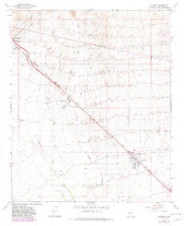
17 topographic sheets cover this place, the earliest surveyed in 1954 and the latest in 1988. It stands in the Wickenburg census division. It lies in ZIP code area 85361. The Survey maps it on the Wittmann quadrangle. 684 people lived here at the 2020 count. It stands 1,683 feet above sea level.
Topographic sheets covering this place
8 surveys from 17 printed sheetsMatched by testing this settlement's coordinate against the published boundary of every sheet in the United States Geological Survey's historical collection. Each opens the scanned sheet at the Survey.
- 1954 USGS Phoenix quadrangle1:250000, 5 printings
- 1957 USGS Phoenix quadrangle1:250000
- 1958 USGS Phoenix quadrangle1:250000
- 1960 USGS Phoenix quadrangle1:250000
- 1965 USGS Wittmann quadrangle1:24000, 4 printings
- 1969 USGS Phoenix quadrangle1:250000, 2 printings
- 1971 USGS Phoenix quadrangle1:250000
- 1988 USGS Phoenix North quadrangle1:100000, 2 printings






Fires near this place
119 since 1992Regional context, not property-specific evidence. The federal wildfire occurrence database lists 119 fires within 5 miles of Wittmann between 1992 and 2020, burning about 273 acres in total. 2 started naturally. 2 were recorded as arson. Distance is straight-line from the map coordinates, so a fire counted here may appear on a neighbouring settlement's page as well.
| Reported cause | Fires |
|---|---|
| Missing data/not specified/undetermined | 106 |
| Equipment and vehicle use | 5 |
| Arson/incendiarism | 2 |
| Debris and open burning | 2 |
| Natural | 2 |
| Railroad operations and maintenance | 1 |
| Recreation and ceremony | 1 |
The most recent of them, most recent first, with the day each was reported and the service that recorded it.
| Date | Cause | Size | Reported by | Name on the report |
|---|---|---|---|---|
| 8 September 2020 | Missing data/not specified/undetermined | under an acre | Arizona Department of Forestry and Fire Management - State Office | not named |
| 8 September 1992 | Debris and open burning | under an acre | Arizona Department of Forestry and Fire Management - State Office | not named |
| 5 August 2009 | Missing data/not specified/undetermined | 10 acres | Arizona Department of Forestry and Fire Management - State Office | PATTON |
| 29 August 2010 | Missing data/not specified/undetermined | under an acre | Arizona Department of Forestry and Fire Management - State Office | AZ-102260 |
| 14 August 2020 | Missing data/not specified/undetermined | under an acre | Arizona Department of Forestry and Fire Management - State Office | not named |
| 14 August 1995 | Natural | 1.2 acres | Arizona Department of Forestry and Fire Management - State Office | not named |
| 6 July 1998 | Arson/incendiarism | under an acre | Phoenix District Office | BOWLING |
| 5 July 2020 | Missing data/not specified/undetermined | 3.0 acres | Arizona Department of Forestry and Fire Management - Central District | WHITTMANN |
Settlements close enough to share some of these fires:
Mines and quarries near this place
1 within 5 milesRegional context, not property-specific evidence. The federal mineral resources record lists 1 working within 5 miles of Wittmann: 1 prospect. None of them still produces. What was taken out: Gold. Distance is straight-line from the map coordinates, so a quarry counted here may appear on a neighbouring settlement's page as well.
| Where | Site | Commodity | Status | Recorded |
|---|---|---|---|---|
| Arizona Placers | Gold | Prospect |
Storms near this place
39 since 2001Regional context, not property-specific evidence. The National Weather Service names Wittmann in 39 storm reports between 2001 and 2025: 15 thunderstorm wind, 13 flash flood, 5 funnel cloud, 3 heavy rain. No death or injury is recorded in these reports. Each account below is quoted exactly as the forecast office filed it, from the NOAA Storm Events Database, and each date opens the federal record of that event.
| When | Event | Place named | Harm | What the report says |
|---|---|---|---|---|
| August 2012 | Flash Flood | Wittmann | $500,000 | Scattered thunderstorms developed across northern portions of Maricopa county during the evening hours on August 16th, and they produced locally heavy rain with rain rates in excess of one inch per hour. Radar and rain gage data indicated some locations picked up between one half and one and a half inches of rain, especially areas to the north of Surprise. The heavy rain led to excessive urban flooding, which transitioned into flash flooding. A Flash Flood Warning was not issued, however an Urban and Small Stream Flood Advisory was in effect as of 9 pm for portions of north central Maricopa county. As seen on a channel 15 television interview, significant street flooding occurred in portions of Surprise with water at least one foot deep in places. Ponded water approached several homes and actually flowed into the first floor of at least one home, causing significant damage. According to local law enforcement, multiple cars were washed off the road near Dale Lane and 170th Avenue. Rain falling north of the area caused washes to flow rapidly, and water from a flooding wash flowed over the road, trapping a number of drivers. Surprise fire Captain Kevin Spirlong indicated that there were multiple swift water rescues; rescue units had to pluck people from 8 vehicles. It took about 30 firefighters from 6 local agencies to get the residents from the wash which was located near 173rd Avenue and Dixieleta Road. The swift water rescues took place from around 10 pm to midnight. Surprise police spokesman Mark Ortega indicated that there was damage to some of the roads as a result of the flooding and the roads were going to be tested for safety. Fortunately, no injuries were reported as a result of the flash flooding. |
| July 2015 | Thunderstorm Wind | Wittmann | $75,000 | During the early evening hours on July 6th, a strong and slow moving cluster of thunderstorms produced damaging microburst winds that affected the community of Wittmann. According to local broadcast media, at 1935MST gusty microburst winds estimated to be at least 55 mph blew down a number of power poles covering a 4 mile stretch along Crozier Road beginning at Lone Mountain Road and ending at Rancho Del Oro Road. 18 power lines were also blown down along Patton Road from 215th to 230th Avenues. Additionally, a home at 22200 West Bajada Drive shifted from wind damage and trapped 6 people inside the home. Local Fire Department units responded to the people trapped inside the home. |
| August 2020 | Thunderstorm Wind | Wittmann | $50,000 | Thunderstorms with strong, damaging outflow winds developed near the town of Wittmann during late afternoon hours on August 16th. At about 1744MST, a member of the public located 7 miles northeast of Wittmann reported that strong winds blew down about 20 trees at a local golf course. The diameter of the largest trees was about 12 inches. Peak wind gusts were estimated by radar to be at least 60 mph in strength. The gusty winds also did additional damage such as to fencing, as reported by the course manager. There were no reports of injury due to the strong winds. |
| August 2018 | Thunderstorm Wind | Wittmann | $40,000 | Thunderstorms with strong and damaging outflow winds moved across the northwest portion of the greater Phoenix area during the evening hours on August 12th. One of the stronger storms moved through the community of Wittmann. According to a social media report from the public, at 1936MST gusty outflow winds estimated as high as 70 mph downed a number of power poles into the road near the intersection of 211th Avenue and Dove Valley Road. The downed poles and lines resulted in a power outage in Wittmann. The downed poles were about 1 mile to the northeast of Wittmann. No injuries were reported due to the fallen power poles and power lines. |
| August 2012 | Flash Flood | Wittmann | $40,000 | A large convective complex developed across the greater Phoenix metropolitan area, including the community of Wittman, during the very early morning hours on August 23rd. The combination of a weather disturbance and a very humid and unstable airmass allowed the thunderstorms to produce locally heavy rainfall, with peak rain rates in excess of 2 inches per hour. The first rains began shortly after midnight, and continued into the early morning hours. At approximately 350 AM, local Fire Department and Rescue units reported a water rescue at 211th Avenu and West Montgomery Road, one mile southeast of the town of Wittman. A vehicle was stuck in rapidly rising water, and the occupants needed to be rescued. Although no Flash Flood Warning were in effect at the time, an Urban and Small Stream Flood Advisory was in effect and continued through 4 AM. No injures were reported due to the flash flooding. |
| August 2003 | Thunderstorm Wind | Wittmann | $30,000 | no account filed |
| August 2018 | Flash Flood | Wittmann | $25,000 | Thunderstorms with very heavy rain moved across the far northwest portions of the greater Phoenix metropolitan area during the evening hours on August 12th. Some of the stronger storms affected areas to the north of Sun City West. Peak rainfall rates exceeded 3 inches per hour at times; at 1948MST a flood control district gauge measured 1.89 inches of rain at 163rd Avenue and Cap Canal Service Road within a 50 minute period. 1.14 inches of that total fell within 20 minutes. The intense rainfall led to an episode of flash flooding about 6 miles northwest of Beardsley. At 2025MST, local fire and rescue reported a water rescue of multiple occupants of a truck at 163rd Avenue and White Wing Road. Multiple low water crossings were flooded along 163rd Avenue north of Grande Avenue. |There were no reports of injuries to any of the truck occupants. A Flash Flood Warning was in effect at the time of the rescue and it remained in effect through 2230MST. |
| September 2025 | Flash Flood | Wittmann | $20,000 | Water rescue reported in the vicinity of North 227th Avenue and West Patton Road in Wittmann. No injuries reported. |
| July 2001 | Thunderstorm Wind | Wittmann | $20,000 | Winds blew sheds and trees down while damaging several homes in the area. |
| August 2022 | Thunderstorm Wind | Wittmann | $15,000 | Images showed multiple snapped and uprooted trees in the Sun City Festival area. Some trees knocked down road signs and also fell onto walls and a pergola. No injuries were reported. |
| August 2022 | Thunderstorm Wind | Wittmann | $10,000 | Numerous downed trees with diameters ranging from 6-24 inches in the area of West Beardsley Parkway and North Desert Oasis Boulevard in Sun City Festival. Winds were estimated at around 60 mph. No injuries were reported. |
| August 2022 | Thunderstorm Wind | Wittmann | $10,000 | Numerous trees were knocked down with trunk diameters ranging from 6-12 inches along the area of Sun Valley Parkway and North Desert Oasis Boulevard in Sun City Festival. Winds were estimated at around 60 mph. No injuries were reported. |
| August 2014 | Flash Flood | Wittmann | $10,000 | Scattered thunderstorms continued to develop across the north and west portions of the greater Phoenix metropolitan area during the late morning hours on August 19th, affecting communities such as Surprise, Beardsley and Wittmann. The stronger storms produced locally heavy rainfall, with peak rain rates in excess of one inch per hour. The heavy rain led to urban flooding as well as flash flooding. At 1119MST, Phoenix Fire and Rescue reported flash flooding about 2 miles southeast of Wittmann; the Phoenix fire department was dispatched to assist with a water rescue. Also, at 1131MST, Phoenix Fire and Rescue reported another water rescue in progress about 4 miles north of the community of Beardsley. No injuries were reported due to the flooding. At the time, a Flash Flood Warning was not in effect, rather an Urban and Small Stream Flood Advisory had been issued for the area. |
| August 2012 | Flash Flood | Wittmann | $10,000 | A large convective complex developed across south central Arizona, including the greater Phoenix area, during the early morning hours on August 23rd. The combination of a passing weather disturbance and a very humid airmass allowed thunderstorms to produce excessive rain, with peak rain rates in excess of 2 inches per hour. The heavy rains initially developed in the Wittmann area after 130 AM, but they persisted off and on through sunrise. According to a trained weather spotter 2 miles southwest of Wittmann, at about 6 AM flooding was reported along Patton Road. Water up to 6 inches deep was reported to be flowing across the road for at least a one mile stretch of the roadway. Flash Flood Warnings were not in effect at the time, but an Urban and Small Stream Flood Advisory had been issued and was in effect through 9 AM. No injuries were reported in association with the flash flooding. |
| August 2022 | Thunderstorm Wind | Wittmann | $8,000 | A video showed multiple downed power poles along Patton Road near 259th Avenue with 60 mph winds recorded in the area. No injuries were reported. |
| August 2022 | Thunderstorm Wind | Wittmann | $5,000 | Power poles were down in the area between Happy Valley Rd and Deer Valley Rd and between 225th Ave and US-60 in Surprise. Timing estimated from radar. No injuries were reported. |
| March 2020 | Flash Flood | Wittmann | $5,000 | A powerful Pacific low pressure system spread considerable moisture into the central deserts on March 12th, and aided by modest instability it generated scattered showers and thunderstorms. Some of the stronger storms produced heavy rain sufficient to lead to an episode of flash flooding near the town of Wittmann and to the northwest of Surprise. According to a public report from the town of Surprise, at 1000MST flash flooding occurred about 1 mile northeast of Wittmann. Flooding caused the closure of Dove Valley Road between 203rd and 211th Avenues. The closure was due to debris across the road. A Flash Flood Warning was in effect at the time of the flooding but there were no reports of accidents or injuries. |
| August 2006 | Flash Flood | Wittmann | $5,000 | Very heavy rainfall...up to 1.61 inches...left many washes and streets flooded in the Wittmann area. Up to 6 inches of water was flowing across U.S. 60 at one point. One half inch of rain fell in Wickenburg in less than an hour. Small hail accompanied some of the heavy showers and thunderstorms. |
| July 2018 | Thunderstorm Wind | Wittmann | $4,000 | Isolated thunderstorms developed during the evening hours over the central deserts northwest of Phoenix; the stronger storms generated gusty damaging outflow winds estimated to be as high as 60 mph. According to a trained weather spotter located 9 miles southwest of the town of Wittmann, gusty winds downed 3 trees. The largest tree was 16 inches in diameter and 30 feet tall. The root system was about 5 feet in diameter and 3 feet deep. The downed trees were near the Copper Canyon Golf Club, north of Sun Valley Parkway. |
| August 2018 | Thunderstorm Wind | Wittmann | $500 | A large cluster of intense thunderstorms moved north through the western portion of the greater Phoenix area during the evening hours on August 2nd. Some of the stronger storms produced gusty and damaging outflow winds and affected areas around the community of Wittmann. A trained weather spotter reported that a wind gust, estimated to be about 60 mph in strength, snapped a branch off of one of his trees. The branch had a diameter of 5 inches. |
| November 2025 | Hail | Wittmann | - | Report of hail up to 1 inch in diameter in Sun City Festival. Hail also accumulated to cover the ground. No damages or injuries reported. |
| November 2025 | Funnel Cloud | Wittmann | - | Multiple photos and videos of a brief cold air funnel cloud as seen from Surprise and Wittman areas. Timing and location based on radar. |
| November 2025 | Flash Flood | Wittmann | - | Patton Rd between 195th Ave and 203rd Ave closed due to flooding. No damages or injuries reported. |
| August 2022 | Flash Flood | Wittmann | - | MCDOT reported that Patton Road between 195th Avenue and 203rd Avenue was closed due to flooding. No damage or injuries were reported. |
| September 2022 | Flash Flood | Wittmann | - | Video from broadcast of media showed water and debris flowing over roadway off of Grand Ave & Jomax near Wittman. Timing estimated from radar. No damages or injuries were reported. |
| August 2021 | Thunderstorm Wind | Wittmann | - | A home weather station measured a 60 mph wind gust. |
| March 2020 | Funnel Cloud | Wittmann | - | Isolated to scattered thunderstorms developed across the central deserts and to the northwest of Phoenix during the late morning hours on March 13th. One of the stronger storms generated a funnel cloud. According to a trained spotter located about 5 miles to the southeast of the town of Wittmann, at 1025MST a funnel cloud was observed along Highway 60 between Patton Road and Happy Valley Road. Although the funnel did not produce any damage, it was noteworthy due to its rarity and high media interest. |
| February 2019 | Funnel Cloud | Wittmann | - | A powerful winter storm continued to slowly push eastward across Arizona on February 22nd. In addition to generating moderate to heavy desert rain and higher elevation snow the storm produced a couple of funnel clouds, one of which occurred near the town of Wittmann. At 1730MST a member of the public captured the funnel cloud on video; the funnel was located about 4 miles northeast of the town. Although the funnel never touched ground and produced no damage, it was noteworthy due to its rarity and as such generated some media attention. |
| September 2019 | Flash Flood | Wittmann | - | Scattered to numerous showers and thunderstorms continued to develop across the northern portions of the Phoenix area through late morning and into the afternoon hours on September 23rd, and some of the storms continued to produce very heavy rain with peak rain rates well in excess of one inch per hour. The heavy rain led to episodes of flash flooding, one of which occurred about 5 miles to the northeast of Wittmann and near Highway 74. According to data from the Picacho Wash Maricopa County Flood Control District stream gauge (ID #5678), rapidly rising waters exceeded the bank full flood levels, reaching a stage of 4.36 feet. Bank full stage was 4 feet. There were no reports of any accidents due to the flash flooding. A Flash Flood Warning was issued and was in effect at the time of the report. |
| July 2015 | Heavy Rain | Wittmann | - | A slow moving cluster of thunderstorms produced locally heavy rainfall which affected the community of Wittmann during the evening hours on July 6th. According to local broadcast media, 1.81 inches of rain was measured within one hour ending at 2030MST about 2 miles southwest of Wittmann. The rain led to significant urban street flooding; area washes were running heavily and water was flowing across some of the roads in Wittmann. |
| July 2015 | Flash Flood | Wittmann | - | Thunderstorms developed across the northwest portions of the greater Phoenix metropolitan area during the afternoon hours on July 18th; due to an infusion of tropical moisture from hurricane Dolores the stronger storms produced very intense rainfall with peak rain rates above 2 inches per hour. The heavy rain led to both urban and flash flooding in the area around Circle City. At about 1700MST, the public reported that 3 to 6 inches of rain was flowing over the roads from heavy rain, about 6 miles southwest of Circle City. Cars were unable to pass due to the swiftly flowing water. Initially, at 1701MST, an Urban and Small Stream Flood Advisory was issued for the area and this was upgraded to a Flash Flood Warning at 1756MST. |
| September 2008 | Hail | Wittmann | - | Hail to dime size was reported in Wittmann. |
| August 2006 | Heavy Rain | Wittmann | - | Heavy rainfall resulted in local flooding along U.S. Route 60 at Patton Road. At one point, 4 to 6 inches of water was flowing across the roadway in Wittmann. |
| September 2006 | Heavy Rain | Wittmann | - | Brief heavy rain resulted in minor flooding of Patton Road. One report indicated one to six inches of water covering the roadway. |
| September 2006 | Thunderstorm Wind | Wittmann | - | Power lines and poles downed by very strong winds across portions of the north and west areas of the Valley. Over 10,000 APS customers were without power at the height of the storm. Luke AFB recorded a peak wind of 56 mph while a spotter in Wittmann had 52 mph gusts along with pea size hail. |
| August 2006 | Funnel Cloud | Wittmann | - | no account filed |
| August 2006 | Hail | Wittmann | - | no account filed |
| August 2003 | Thunderstorm Wind | Wittmann | - | no account filed |
| January 2001 | Funnel Cloud | Wittmann | - | no account filed |
Nearest settlements
The eight closest, with where each one stands in the county. Distances are straight-line, computed from the Geographic Names Information System coordinates.
| Map | Place | Distance | Sheets |
|---|---|---|---|
| Circle City | 3.9 miles | 17 | |
| Morristown | 7.5 miles | 17 | |
| Vistancia | 10.7 miles | 17 | |
| Beardsley | 11.2 miles | 18 | |
| Waddell | 12.6 miles | 18 | |
| Sun City West | 12.7 miles | 20 | |
| Lizard Acres | 13.4 miles | 20 | |
| Allah | 13.5 miles | 17 |
Elsewhere
Matched on this settlement's Geographic Names Information System number rather than its name, so it cannot be a different place of the same name in another state.
| Wikipedia article on Wittmann | An encyclopaedic summary. Its text is share-alike, so it is linked here rather than copied. |
| Wikidata item Q6644624 | The structured record the population and elevation above come from. Public domain (CC0). |
Provenance
This settlement is recorded in the Geographic Names Information System as feature 13950. The sheet list is computed by point-in-boundary test against the United States Geological Survey's historical topographic inventory. Both are works of the United States government and carry no copyright under 17 U.S.C. 105.
Wildfire. Short, Karen C. 2022. Spatial wildfire occurrence data for the United States, 1992-2020 [FPA_FOD_20221014]. 6th Edition. Fort Collins, CO: Forest Service Research Data Archive. https://doi.org/10.2737/RDS-2013-0009.6 Collected with United States Government funding and usable without additional permissions or fees.
Mines and quarries. USGS Mineral Resources Data System (MRDS) https://mrdata.usgs.gov/mrds/ A work of the United States government, no copyright under 17 U.S.C. 105.
Storms. NOAA National Centers for Environmental Information, Storm Events Database https://www.ncei.noaa.gov/stormevents/ A work of the United States government, no copyright under 17 U.S.C. 105. Narratives are quoted verbatim from the National Weather Service report and are not edited or summarised.