 Block
Matthie, Arizona
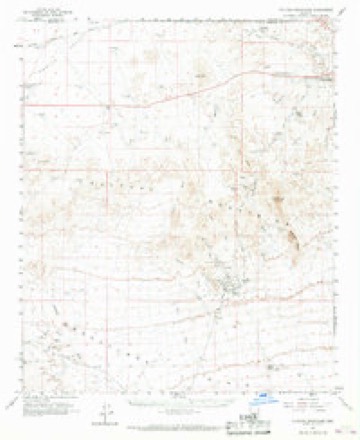
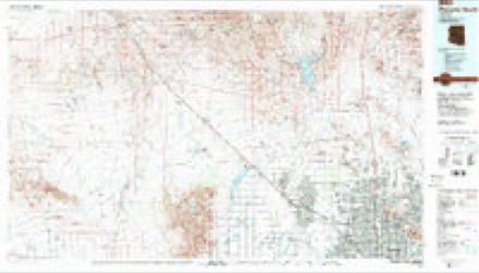
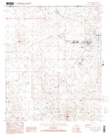
18 topographic sheets cover this place, the earliest surveyed in 1954 and the latest in 1990. It stands in the Wickenburg census division. It lies in ZIP code area 85390. The Survey maps it on the Vulture Peak quadrangle.
Topographic sheets covering this place
9 surveys from 18 printed sheetsMatched by testing this settlement's coordinate against the published boundary of every sheet in the United States Geological Survey's historical collection. Each opens the scanned sheet at the Survey.
- 1954 USGS Phoenix quadrangle1:250000, 5 printings
- 1957 USGS Phoenix quadrangle1:250000
- 1958 USGS Phoenix quadrangle1:250000
- 1960 USGS Phoenix quadrangle1:250000
- 1961 USGS Vulture Mountains quadrangle1:62500, 3 printings
- 1969 USGS Phoenix quadrangle1:250000, 2 printings
- 1971 USGS Phoenix quadrangle1:250000
- 1988 USGS Phoenix North quadrangle1:100000, 2 printings
- 1990 USGS Vulture Peak quadrangle1:24000, 2 printings






Fires near this place
50 since 1993Regional context, not property-specific evidence. The federal wildfire occurrence database lists 50 fires within 5 miles of Matthie between 1993 and 2020, burning about 66 acres in total. 1 started naturally. 2 were recorded as arson. Distance is straight-line from the map coordinates, so a fire counted here may appear on a neighbouring settlement's page as well.
| Reported cause | Fires |
|---|---|
| Missing data/not specified/undetermined | 38 |
| Railroad operations and maintenance | 3 |
| Arson/incendiarism | 2 |
| Equipment and vehicle use | 2 |
| Misuse of fire by a minor | 1 |
| Natural | 1 |
| Debris and open burning | 1 |
| Power generation/transmission/distribution | 1 |
| Smoking | 1 |
The most recent of them, most recent first, with the day each was reported and the service that recorded it.
| Date | Cause | Size | Reported by | Name on the report |
|---|---|---|---|---|
| 25 September 2019 | Power generation/transmission/distribution | under an acre | Wickenburg Fire Department | NOT NAMED |
| 16 September 1995 | Natural | under an acre | Arizona Department of Forestry and Fire Management - State Office | not named |
| 13 September 2019 | Missing data/not specified/undetermined | under an acre | Wickenburg Fire Department | NOT NAMED |
| 12 September 1996 | Debris and open burning | under an acre | Arizona Department of Forestry and Fire Management - State Office | not named |
| 29 August 2020 | Missing data/not specified/undetermined | under an acre | Arizona Department of Forestry and Fire Management - State Office | not named |
| 16 July 2019 | Missing data/not specified/undetermined | 22 acres | Phoenix District Office | TOWER ASSIST |
| 16 July 2019 | Arson/incendiarism | under an acre | Wickenburg Fire Department | NOT NAMED |
| 1 July 2011 | Missing data/not specified/undetermined | under an acre | Phoenix District Office | FLORES |
Settlements close enough to share some of these fires:
Mines and quarries near this place
9 within 5 milesRegional context, not property-specific evidence. The federal mineral resources record lists 9 workings within 5 miles of Matthie: 7 occurrences, 1 past producer, 1 prospect. None of them still produces. What was taken out: Vermiculite, Vanadium, Lead, Zinc, Copper, Feldspar, Mica, Gold, Silver. Distance is straight-line from the map coordinates, so a quarry counted here may appear on a neighbouring settlement's page as well.
| Where | Site | Commodity | Status | Recorded |
|---|---|---|---|---|
| Copper Prince | Gold, Silver, Copper | Past Producer | ||
| Santa Margarita | Iron, Manganese, Titanium | Prospect | ||
| Velvet Star | Gold | Occurrence | ||
| Bar Fx Ranch | Vermiculite | Occurrence | Vermiculite | |
| Bar Fx Ranch | Vermiculite | Occurrence | ||
| Burchfield Feldspar | Feldspar, Mica | Occurrence | Feldspar, Muscovite | |
| Burchfield Feldspar | Feldspar, Mica | Occurrence | ||
| Cochrane Property | Vanadium, Lead, Zinc, Copper | Occurrence | ||
| Doyle Property | Vanadium, Lead, Zinc, Copper | Occurrence |
Storms near this place
11 since 2011Regional context, not property-specific evidence. The National Weather Service names Matthie in 11 storm reports between 2011 and 2025: 9 flash flood, 2 thunderstorm wind. No death or injury is recorded in these reports. Each account below is quoted exactly as the forecast office filed it, from the NOAA Storm Events Database, and each date opens the federal record of that event.
| When | Event | Place named | Harm | What the report says |
|---|---|---|---|---|
| June 2015 | Thunderstorm Wind | Matthie | $30,000 | Strong thunderstorms developed across central Arizona during the evening hours on June 29th, and the more intense storms generated gusty and damaging microburst winds. Some of the stronger storms affected the community of Wickenburg. According to the Wickenburg Fire Department and Rescue, at 2118MST gusty microburst winds downed several large trees located about 1 mile northwest of Wickenburg. The trees were estimated to be 4 feet in diameter. The winds also blew down a number of power poles in the area. The wind gusts were estimated to range from 60 to 80 mph. Fortunately, no injuries were reported due to the strong winds. |
| August 2011 | Thunderstorm Wind | Matthie | $25,000 | Isolated high based thunderstorms developed in the Wickenburg area during the late afternoon hours on August 26th. The storms generated strong gusty winds, estimated by local law enforcement to be upwards of 70 mph. The strong winds downed several power poles which caused the area near North Vulture Mine Road and Easy Street to be closed to traffic. |
| November 2025 | Flash Flood | Matthie | $20,000 | Vulture Mine Rd low water crossing at Sols Wash in Wickenburg was closed due to flooding along with a water rescue reported. A Maricopa County Flood Control District Stream Gauge at Sols Wash, just upstream of North Vulture Mine Road, measured water levels exceeding both the alarm (1.83 feet) and bank full (4.10 feet) levels, with the flow peaking at 4.17 feet (4970 cfs). Timing was estimated based on radar and the nearby stream gauge. No injuries reported. |
| March 2023 | Flash Flood | Matthie | - | Portions of Vulture Mine Rd in Wickenburg closed due to flooding. No damages or injuries were reported. |
| May 2023 | Flash Flood | Matthie | - | Running washes lead to the closure of North Vulture Mine Road in Wickenburg. No damages or injuries were reported. |
| August 2022 | Flash Flood | Matthie | - | A FCDMC stream gage along Sols Wash exceed alarm stage, impacting a downstream low water crossing on Vulture Mine Road. At 1529MST, the gage peaked at a depth of 2.51 feet and a flow of 1,577 CFS. No damage or injuries were reported. |
| September 2022 | Flash Flood | Matthie | - | Wickenburg Police Department reported Vulture Mine Road at Sols Wash was closed due to flooding. The road was reported closed at 2005MST, but flooding impacts likely began around 1950MST based on radar and an upstream streamflow gage. The streamflow gage is roughly 2 miles upstream and measured 1.69 inches in 1 hour ending at 1900MST. Streamflow exceeded alarm stage at 1930MST. The gage peaked at 4.10 feet and 4815 cfs at 2010MST. Flow fell back below alarm stage at 2100MST. No damages or injuries were reported. |
| August 2022 | Flash Flood | Matthie | - | A FCDMC streamflow gage along Sols Wash exceeded alarm stage, making a low water crossing along Vulture Mine Road impassable. At 0424MST, the gage peaked at a depth of 3.65 feet and a flow of 3,822 CFS. A social media video showed Sols Wash flowing across Vulture Mine Road and Wickenburg dispatch reported the road was closed as a result of the flooding. No damage or injuries were reported. |
| August 2022 | Flash Flood | Matthie | - | A video showed Flying E Wash flowing across a low water crossing along Vulture Mine Road, making the roadway impassable. An upstream FCDMC streamflow gage along the wash exceeded alarm stage, peaking at a depth of 1.77 feet and a flow of 269 CFS at 1858MST. No damage or injuries were reported. |
| August 2021 | Flash Flood | Matthie | - | A photo on social media showed flash flooding occurring in Flying E Wash in Wickenburg with significant flow over Vulture Mine Road north of US 60, resulting in the closure of the road. No damage or injuries were reported. |
| August 2013 | Flash Flood | Matthie | - | On August 26th, thunderstorms developed well into the evening hours across far northwestern portions of Maricopa county and they affected the community of Wickenburg. The atmosphere was very moist and unstable; as a result the thunderstorms produced locally heavy rain with rain rates in excess of one inch per hour. Locally heavy rain began to fall in the Wickenburg area after 1930MST and by 2026MST an Urban and Small Stream Flood Advisory was issued. Thunderstorms with heavy rain continued well into the evening leading to flooding of area roads and washes. At 2240MST a trained spotter in Wickenburg reported that the Sols Wash at the unbridged crossing at Vulture Mine Road was flowing 2 feet deep. Despite the high flow, it was contained and not spilling out over the banks. In addition, Maricopa County Flood Control District gages indicated significant stream flow in the Flying E and Casandro Washes near Wickenburg; these washes are known to impact several roads in the area. Flash Flood Warnings were not issued for the area, however Urban and Small Stream Flood Advisories did remain in effect until just past midnight. |
Nearest settlements
The eight closest, with where each one stands in the county. Distances are straight-line, computed from the Geographic Names Information System coordinates.
| Map | Place | Distance | Sheets |
|---|---|---|---|
| Wickenburg | 4.6 miles | 17 | |
| Allah | 7.8 miles | 17 | |
| Forepaugh | 12.7 miles | 16 | |
| Morristown | 13.7 miles | 17 | |
| Circle City | 17.3 miles | 17 | |
| Aguila | 19.7 miles | 16 | |
| Wittmann | 21.2 miles | 17 | |
| Ambrosia Mill | 23.9 miles | 16 |
Provenance
This settlement is recorded in the Geographic Names Information System as feature 24509. The sheet list is computed by point-in-boundary test against the United States Geological Survey's historical topographic inventory. Both are works of the United States government and carry no copyright under 17 U.S.C. 105.
Wildfire. Short, Karen C. 2022. Spatial wildfire occurrence data for the United States, 1992-2020 [FPA_FOD_20221014]. 6th Edition. Fort Collins, CO: Forest Service Research Data Archive. https://doi.org/10.2737/RDS-2013-0009.6 Collected with United States Government funding and usable without additional permissions or fees.
Mines and quarries. USGS Mineral Resources Data System (MRDS) https://mrdata.usgs.gov/mrds/ A work of the United States government, no copyright under 17 U.S.C. 105.
Storms. NOAA National Centers for Environmental Information, Storm Events Database https://www.ncei.noaa.gov/stormevents/ A work of the United States government, no copyright under 17 U.S.C. 105. Narratives are quoted verbatim from the National Weather Service report and are not edited or summarised.