 Block
Bristol, Connecticut
34 topographic sheets cover this place, the earliest surveyed in 1892 and the latest in 1994. It stands in Bristol town. It lies in ZIP code area 06010. It stands on Birge Pond Brook. The Survey maps it on the Bristol quadrangle. 60,833 people lived here at the 2020 count. It stands 305 feet above sea level.
On record in Bristol
Buildings and businesses the archive holds for this place. Each opens its own page, with the source record it came from.
On the National Register 12 of 17 shown
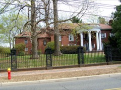 Beleden Houselisted 1982
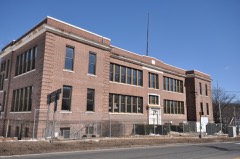 Clarence A. Bingham Schoollisted 2017
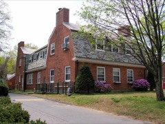 Bristol Girls' Clublisted 1987
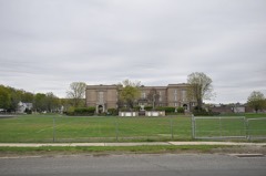 Bristol High Schoollisted 2018
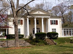 Ernest R. Burwell Houselisted 1992
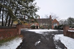 Copper Ledges and Chimney Crestlisted 1992
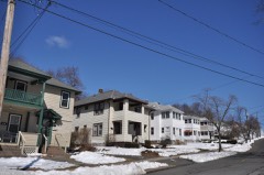 Endee Manor Historic Districtlisted 1996
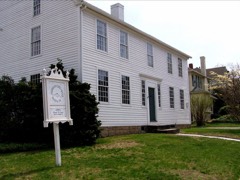 Federal Hill Historic Districtlisted 1986
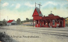 Forestville Passenger Stationlisted 1978
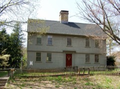 Jerome, William I, Houselisted 1987
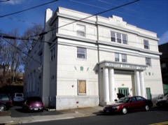 Main Street Historic Districtlisted 1995
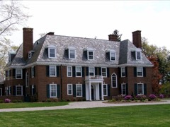 Marlborough Houselisted 1993
Population over time
2 figuresBristol grew from 60,477 to 60,833 between 2010 and 2020. These are the recorded population figures Wikidata holds for this place, reached through the Geographic Names Information System number this page is keyed on rather than by name, so they belong to this place and not to another of the same name. Most are census counts, but not all are: an early figure may be a founding or settlement estimate, and an estimate published within five years of a census is left out. The change column is computed, and is left blank where more than 20 years separate a figure from the one before it, because a gap that long is not a change between two counts.
| Year | People | Change |
|---|---|---|
| 2010 | 60,477 | |
| 2020 | 60,833 | +356 (+1%) |
Topographic sheets covering this place
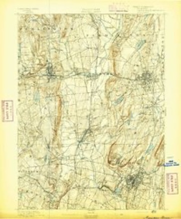
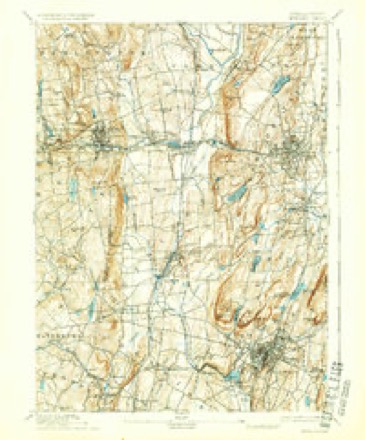
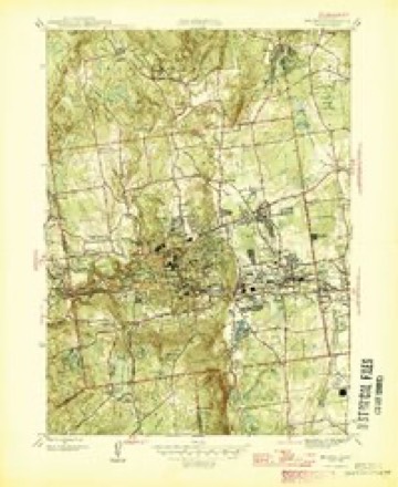
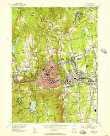
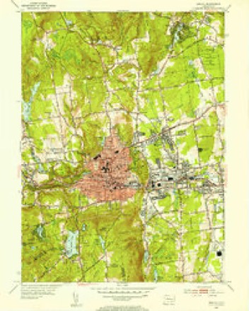
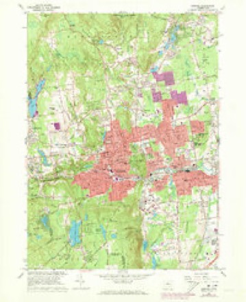
14 surveys from 34 printed sheetsMatched by testing this settlement's coordinate against the published boundary of every sheet in the United States Geological Survey's historical collection. Each opens the scanned sheet at the Survey.
- 1892 USGS Meriden quadrangle1:62500
- 1893 USGS Meriden quadrangle1:62500, 10 printings
- 1906 USGS Farmington quadrangle1:125000, 2 printings
- 1946 USGS Bristol quadrangle1:31680
- 1947 USGS Hartford quadrangle1:250000, 2 printings
- 1948 USGS Hartford quadrangle1:250000, 2 printings
- 1953 USGS Bristol quadrangle1:24000
- 1953 USGS Bristol quadrangle1:31680, 2 printings
- 1961 USGS Hartford quadrangle1:250000
- 1962 USGS Hartford quadrangle1:250000, 3 printings
- 1965 USGS Hartford quadrangle1:250000, 2 printings
- 1966 USGS Bristol quadrangle1:24000, 4 printings
- 1986 USGS Hartford quadrangle1:100000
- 1994 USGS Hartford quadrangle1:100000, 2 printings








In the county-history sources
9,412 words on this townshipThe Memorial History of Hartford County, Connecticut, 1633-1884;, published 1886 names this settlement in its chapter on Bristol Town. These are the passages that mention it, exactly as the scans read.
THE town of Bristol lies in the soutliAvestern part of Hartford County, touching Litchfield County on the west and New Haven on the southwest ; it is bounded north by Burlington, east by Farmington and Plainville, south by Southington and Wolcott, west by Plymouth. From 1806, when the Burlington parish w^as set off from this town, till 1875, when its symmetry was destroyed by the annexation to its territory of a single farm, formerly a part of Southington, it was exactly five miles square. In surface hilly, in soil rocky and somewhat unfertile, it has of necessity become a manufacturing rather than a farming town. With Fall Mountain for its southern boundary. Chippins (modernized form of Cochipianee's) Hill on the northwest, and Federal Hill occupying all the centre, there is left but a narrow valley, sloping down from the higlier land in Terryville to the eastward plains. Through this runs the Pequabuck River, furnishing power for most of tlie larger factories. On the plains, at the east side of the town, lies the village of Forestville, which has come to furnish an important part both of the population and of the business of the town.
Passage source: The Memorial History of Hartford County, Connecticut, 1633-1884;, published 1886.
This district of Poland was probably in tlie northeastern part of the present town of Bristol, and this record indicates a much greater antiquity to the name of Poland than has been generally ascribed to it. Popular tradition has supposed that the name, which now belongs to a little stream, Poland Brook, in East Bristol, was derived from the name of an Indian who lived upon its bank sixty years later than the date of this record. It may be sui)posed that " their farm at Paquabuck " lay within the present town of Plainville ; with the lapse oi time the name has been moved seven miles toward the west.
Passage source: The Memorial History of Hartford County, Connecticut, 1633-1884;, published 1886.
In 1721 the eighty-four original proprietors of Farmington made partition among themselves of the undivided lands lying to the west of their settlements. The land was surveyed into six divisions, each a mile wide and five miles long, running from north to south. The last five of these divisions constitute the present limits of Bristol. For six years more no settlements were made ; but in 1727, by a deed bearing date November 22, Daniel Brownson, of Farmington, bought a farm lying near the present corner of West and South streets, known as (toosc Corner; and there, in the same year, the first house was built. This house has not been standing for many years.
Passage source: The Memorial History of Hartford County, Connecticut, 1633-1884;, published 1886.
Machine-read from a century-old scan, so expect the errors a machine makes: misspelled names, dropped words, stray characters.
Read the whole chapter on Bristol Town - it names this place 28 more 28 times.
Fires near this place
53 since 1994Regional context, not property-specific evidence. The federal wildfire occurrence database lists 53 fires within 5 miles of Bristol between 1994 and 2020, burning about 328 acres in total. None started naturally. 7 were recorded as arson. Distance is straight-line from the map coordinates, so a fire counted here may appear on a neighbouring settlement's page as well.
| Reported cause | Fires |
|---|---|
| Missing data/not specified/undetermined | 27 |
| Misuse of fire by a minor | 10 |
| Arson/incendiarism | 7 |
| Recreation and ceremony | 4 |
| Debris and open burning | 4 |
| Smoking | 1 |
The most recent of them, most recent first, with the day each was reported and the service that recorded it.
| Date | Cause | Size | Reported by | Name on the report |
|---|---|---|---|---|
| 16 September 2020 | Missing data/not specified/undetermined | under an acre | Connecticut Division of Forestry | PINE VIEW CT |
| 26 August 2020 | Missing data/not specified/undetermined | under an acre | Connecticut Division of Forestry | 26 EMMETT STREET |
| 7 July 2010 | Recreation and ceremony | 7.5 acres | Connecticut Division of Forestry | not named |
| 29 July 2020 | Missing data/not specified/undetermined | under an acre | Connecticut Division of Forestry | 131 MAIN STREET (RT 6) |
| 26 June 1999 | Missing data/not specified/undetermined | under an acre | Connecticut Division of Forestry | not named |
| 11 June 1994 | Misuse of fire by a minor | 5.0 acres | Connecticut Division of Forestry | not named |
| 1 June 1999 | Arson/incendiarism | under an acre | Connecticut Division of Forestry | not named |
| 7 May 2001 | Misuse of fire by a minor | under an acre | Connecticut Division of Forestry | not named |
Settlements close enough to share some of these fires:
Mines and quarries near this place
10 of 34 shownRegional context, not property-specific evidence. The federal mineral resources record lists 34 workings within 5 miles of Bristol: 24 past producers, 7 producers, 2 unknowns, 1 occurrence. 7 still produce. What was taken out: Sand and Gravel, Construction, Stone, Dimension, Granite, Iron. Distance is straight-line from the map coordinates, so a quarry counted here may appear on a neighbouring settlement's page as well.
| Where | Site | Commodity | Status | Recorded |
|---|---|---|---|---|
| Bristol Copper Mine | Molybdenum, Silver, Copper, Sulfur | Past Producer | 1795, 1836 | |
| Bristol Mine | Copper | Past Producer | ||
| Brownstone Quarry | Flagstone | Past Producer | ||
| Dunn Granite Gneiss Rock Quarry | Stone, Dimension | Past Producer | Unknown | |
| Dunn Quarry | Granite | Past Producer | ||
| Magnetite Mine | Iron | Past Producer | ||
| Seymour Street Granite Gneiss Rock Quarry | Stone, Dimension | Past Producer | ||
| Seymour Street Quarry | Granite | Past Producer | ||
| Unnamed Magnetite Occurrence | Iron | Occurrence | Magnetite | |
| Bell City Pit | Sand and Gravel, Construction | Past Producer |
Storms near this place
23 since 1994Regional context, not property-specific evidence. The National Weather Service names Bristol in 23 storm reports between 1994 and 2023: 11 thunderstorm wind, 6 hail, 2 heavy rain, 2 flash flood. The reports record 1 death. Each account below is quoted exactly as the forecast office filed it, from the NOAA Storm Events Database, and each date opens the federal record of that event.
| When | Event | Place named | Harm | What the report says |
|---|---|---|---|---|
| August 2011 | Flood | Bristol | 1 killed, $8,000,000 | Four to ten inches of heavy rain from Tropical Storm Irene resulted in the Pequabuck River overflowing its banks. This led to flooding on roads and homes along the river throughout Bristol. Flooded roads ran approximately three and a half feet deep. A 46 year old man went canoeing in floodwaters. He drowned when his canoe capsized and he was unable to make it to shore. At least 50 people were evacuated from areas around the river, and took shelter at Chippens Hill Middle School. The river flooding undermined at least 7 feet of Route 72 eastbound, washing out this portion of the road. Numerous houses and businesses were affected by the flooding. Forty high water rescues took place in Bristol. |
| July 2010 | Tornado (EF1) | Bristol | $565,000 | A brief tornado touchdown occurred on the east side of Rockwell Park and had an intermittent damage path, mostly at the tree top level, to the end of High Street. Straight line winds appeared to be the main cause of damage in Bristol, however, damage from a small, brief tornado was also evident. Trees felled in different directions, tree tops twisted off, and shearing off of tree tops were the nature of tree damage viewed by NWS Storm Survey team members in the area of High and Blakeslee Streets. This is consistent with low end EF1 tornado damage. Damage was consistent with a maximum wind speed of about 90 mph. Numerous trees were downed, bringing down wires and power lines, as well as moving a garage off its foundation, blowing lawn furniture several houses down the street, and crushing an above ground pool. The Imagine Nation Museum which was very near the damage path recorded a wind gust of 67 mph on their anemometer. |
| June 2009 | Thunderstorm Wind | Bristol | $50,000 | Large trees, up to two feet in diameter, in the Elmwood section of Bristol were downed by thunderstorm winds. |
| July 1994 | Thunderstorm Wind | Bristol | $50,000 | Numerous trees and power lines were reported down. Also, there was extensive damage to a house, as reported by the local police. |
| July 2016 | Thunderstorm Wind | Bristol | $40,000 | Trees, wires, and utility poles on Fair, Summer, and Woodland Streets were downed by thunderstorm winds. |
| September 2021 | Flash Flood | Bristol | $30,000 | In Bristol, boat rescues occurred at a small condominium complex on Main Street, along the Pequabuck River, which went out of its banks. Multiple additional roads were flooded due to the Pequabuck River. |
| August 2003 | Thunderstorm Wind | Bristol | $25,000 | no account filed |
| August 2016 | Thunderstorm Wind | Bristol | $5,000 | Wires on James P Casey Road and Lawrence Lane were downed by thunderstorm winds. |
| June 2008 | Thunderstorm Wind | Bristol | $3,000 | Trees and wires were downed by thunderstorm winds. |
| August 2002 | Thunderstorm Wind | Bristol | $2,000 | no account filed |
| July 2023 | Flash Flood | Bristol | - | In Bristol, several roads were covered in deep water and impassable with cars stuck. |
| June 2008 | Thunderstorm Wind | Bristol | - | Trees on Mill Street were downed by thunderstorm winds. |
| June 2007 | Hail | Bristol | - | Penny size hail. |
| July 2007 | Thunderstorm Wind | Bristol | - | Numerous trees and wired downed. |
| May 2008 | Hail | Bristol | - | no account filed |
| July 2006 | Hail | Bristol | - | no account filed |
| May 2004 | Hail | Bristol | - | no account filed |
| May 2004 | Hail | Bristol | - | no account filed |
| July 2001 | Thunderstorm Wind | Bristol | - | no account filed |
| July 2000 | Heavy Rain | Bristol | - | no account filed |
| September 1999 | Heavy Rain | Bristol | - | no account filed |
| July 1997 | Hail | Bristol | - | no account filed |
| October 1995 | Thunderstorm Wind | Bristol | - | no account filed |
Nearest settlements
The eight closest, with where each one stands in the county. Distances are straight-line, computed from the Geographic Names Information System coordinates.
| Map | Place | Distance | Sheets |
|---|---|---|---|
| Forestville | 1.6 miles | 34 | |
| East Bristol | 2.0 miles | 34 | |
| Edgewood | 2.5 miles | 34 | |
| Whigville | 4.3 miles | 34 | |
| Bensted Corner | 4.4 miles | 34 | |
| Plainville | 4.8 miles | 38 | |
| Lamson Corner | 5.0 miles | 34 | |
| North End | 5.6 miles | 37 |
Elsewhere
Matched on this settlement's Geographic Names Information System number rather than its name, so it cannot be a different place of the same name in another state.
| Wikipedia article on Bristol | An encyclopaedic summary. Its text is share-alike, so it is linked here rather than copied. |
| Wikidata item Q755149 | The structured record the population and elevation above come from. Public domain (CC0). |
Provenance
This settlement is recorded in the Geographic Names Information System as feature 205727. The sheet list is computed by point-in-boundary test against the United States Geological Survey's historical topographic inventory. Both are works of the United States government and carry no copyright under 17 U.S.C. 105.
Wildfire. Short, Karen C. 2022. Spatial wildfire occurrence data for the United States, 1992-2020 [FPA_FOD_20221014]. 6th Edition. Fort Collins, CO: Forest Service Research Data Archive. https://doi.org/10.2737/RDS-2013-0009.6 Collected with United States Government funding and usable without additional permissions or fees.
Mines and quarries. USGS Mineral Resources Data System (MRDS) https://mrdata.usgs.gov/mrds/ A work of the United States government, no copyright under 17 U.S.C. 105.
Storms. NOAA National Centers for Environmental Information, Storm Events Database https://www.ncei.noaa.gov/stormevents/ A work of the United States government, no copyright under 17 U.S.C. 105. Narratives are quoted verbatim from the National Weather Service report and are not edited or summarised.