 Block
Centerbrook, Connecticut
28 topographic sheets cover this place, the earliest surveyed in 1893 and the latest in 1983. It stands in Essex town. It lies in ZIP code area 06409. It stands on Ward Brook. The Survey maps it on the Essex quadrangle. It stands 43 feet above sea level.
On record in Centerbrook
Buildings and businesses the archive holds for this place. Each opens its own page, with the source record it came from.
On the National Register 1 record
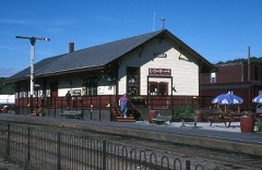 Essex Freight Stationlisted 1994
Topographic sheets covering this place
9 surveys from 28 printed sheetsMatched by testing this settlement's coordinate against the published boundary of every sheet in the United States Geological Survey's historical collection. Each opens the scanned sheet at the Survey.
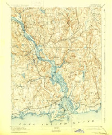
- 1893 USGS Saybrook quadrangle1:62500, 8 printings
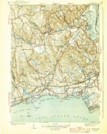
- 1944 USGS Essex quadrangle1:31680, 3 printings
- 1947 USGS Hartford quadrangle1:250000, 2 printings
- 1948 USGS Hartford quadrangle1:250000, 2 printings
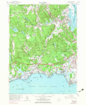
- 1958 USGS Essex quadrangle1:24000, 5 printings
- 1961 USGS Hartford quadrangle1:250000
- 1962 USGS Hartford quadrangle1:250000, 3 printings
- 1965 USGS Hartford quadrangle1:250000, 2 printings
- 1983 USGS New Haven quadrangle1:100000, 2 printings






In the county-history sources
35,861 words on this townshipHistory of Middlesex County, Connecticut, with Biographical Sketches of Its Prominent Men, published 1884 names this settlement in its chapter on Essex Town. These are the passages that mention it, exactly as the scans read.
Robert's Hill is situated about one-third of a mile north of the Congregational church in Centerbrook. In its side, and on the old Eli Denison place, there is a quarry of steatite or soapstone, which was also sometimes called cottonstone. This lies about one half a mile northward from the railroad station, on the road to Meadow Woods, and near the present residence of Richard Denison. The existence of this bed of stone was known to the Indians. They used the material in making pots and mortars, some of which have been found in their graves, and about the fields in the vicinity. Soon after the Revolution, the owners of a furnace in Killingworth used the material in making an oven for baking steel. It is said to possess durable qualities, and to be capable of taking a very high polish. Efforts were made as early as 1815 to bring it into use in manufacturing, but it was found to be too hard for practical purposes, and nothing further than preliminary experimenting was done. A quarry of granite lying near it is now being worked.
Passage source: History of Middlesex County, Connecticut, with Biographical Sketches of Its Prominent Men, published 1884.
Very few of the citizens were appraised of their coming until a few minutes before they landed, and many of them knew nothing of it until the flames from the burn ing vessels, which lit up the country for miles around, awoke them from their slumbers. Fear and consternation seized the people. Aged women and little children hurried off to Centerbrook, taking such valuables as they could gather, expecting that their homes were to be burned and fearing that the men would be put to death or taken prisoners. Their fears, however, proved groundless, for there was no attempt to molest the people. A few houses were searched by the picket guards for arms and ammunition, while the main body of troops proceeded to burn the vessels at the diff'erent yards and those anchored in the lower and upper coves, firing every vessel they could find, with a few exceptions for particular reasons. A vessel belonging to Mr. Judea Pratt of New City, was saved through the mystic ties of free masonry. Lieutenant Coutts had ordered the vessel to be burned, but Mr. Pratt met him and gave a masonic sign of recognition, and after a few minutes conversation, it is said, the troops were withdrawn and the vessel saved. Jeremiah Glover, who had a sloop lying in the lower cove, begged the British to spare it, and they finally consented to do so on condition that he should pilot them down the river and back to their ships.
Passage source: History of Middlesex County, Connecticut, with Biographical Sketches of Its Prominent Men, published 1884.
The Rev. Joseph D. Hull was employed as colleague with Mr. Hovey a few months in 1843. After the death of the latter, he was settled as pastor, January 31st 1844. He served the church in this capacity until October 16th 1848, when he was dismissed. A call was then given to Rev. John H. Pettengill, October 30th 1848, and he was settled April 25th 1849. He remained until December ist 1852. Rev. Joseph W. Sessions preached here a few months from some time in 1853 to April 1854. Rev. William E. Bassett preached a short time in July to September 1854, but declined a call to settle. The Rev. Elijah D. Murphy was a supply during the year 1855. Other supplies were employed for a short time. The Rev. Henry Richard Hoisington was settled here April 22d 1857. The story of his life, as told on his tombstone in the burying ground by the school house in Centerbrook, is in substance as follows: he was born at Vergennes, Vt., August 23d 1801; graduated at Williams College in 1828; was ordained pastor of the Presbyterian church in Aurora, N. Y., August 28th i83i;a missionary in Ceylon and the United States from March 1833, to January 1854; stated minister to the Congregational church in Williamstown, Mass., from Oj:tober 1853, to April 1856; installed here April 22d 1857, and died May i6th 1858. He was struck down with apoplexy while in the pulpit preaching from the text, " To-day, if ye will hear his voice harden not your hearts." He died in the latter part of the same day.
Passage source: History of Middlesex County, Connecticut, with Biographical Sketches of Its Prominent Men, published 1884.
Machine-read from a century-old scan, so expect the errors a machine makes: misspelled names, dropped words, stray characters.
Read the whole chapter on Essex Town - it names this place 15 more 15 times.
Fires near this place
164 since 1992Regional context, not property-specific evidence. The federal wildfire occurrence database lists 164 fires within 5 miles of Centerbrook between 1992 and 2020, burning about 171 acres in total. None started naturally. 1 was recorded as arson. Distance is straight-line from the map coordinates, so a fire counted here may appear on a neighbouring settlement's page as well.
| Reported cause | Fires |
|---|---|
| Missing data/not specified/undetermined | 85 |
| Debris and open burning | 29 |
| Recreation and ceremony | 23 |
| Smoking | 8 |
| Misuse of fire by a minor | 7 |
| Power generation/transmission/distribution | 6 |
| Railroad operations and maintenance | 4 |
| Equipment and vehicle use | 1 |
| Arson/incendiarism | 1 |
The most recent of them, most recent first, with the day each was reported and the service that recorded it.
| Date | Cause | Size | Reported by | Name on the report |
|---|---|---|---|---|
| 8 September 2020 | Missing data/not specified/undetermined | 1.5 acres | Connecticut Division of Forestry | 546 STEVENSTOWN ROAD |
| 5 September 2015 | Debris and open burning | under an acre | Connecticut Division of Forestry | not named |
| 25 September 2010 | Missing data/not specified/undetermined | 1.0 acres | Connecticut Division of Forestry | not named |
| 24 September 2020 | Missing data/not specified/undetermined | under an acre | Connecticut Division of Forestry | 112 NECK ROAD |
| 22 September 2020 | Missing data/not specified/undetermined | under an acre | Connecticut Division of Forestry | 1238 BOSTON POST ROAD |
| 21 September 2015 | Missing data/not specified/undetermined | under an acre | Connecticut Division of Forestry | not named |
| 16 September 2017 | Missing data/not specified/undetermined | under an acre | Connecticut Division of Forestry | 2 DENNISON RD |
| 9 August 2015 | Smoking | under an acre | Connecticut Division of Forestry | not named |
Settlements close enough to share some of these fires:
Mines and quarries near this place
10 of 13 shownRegional context, not property-specific evidence. The federal mineral resources record lists 13 workings within 5 miles of Centerbrook: 13 past producers. None of them still produces. What was taken out: Granite, Stone, Dimension, Stone, Sand and Gravel, Construction. Distance is straight-line from the map coordinates, so a quarry counted here may appear on a neighbouring settlement's page as well.
| Where | Site | Commodity | Status | Recorded |
|---|---|---|---|---|
| Deep River Sand and Gravel Pit | Sand and Gravel, Construction | Past Producer | ||
| Biotite Granite Gneiss Quarries No. Bk-005 | Stone | Past Producer | ||
| Granitic Gneiss Rock Quarry No. Bk-004 | Stone | Past Producer | Gneiss | |
| Bethel Pegmatite Quarry | Stone, Dimension | Past Producer | ||
| Joshua Granite Gneiss Rock Quarry | Stone, Dimension | Past Producer | ||
| Selden Neck Granite Gneiss Rock Quarry | Stone, Dimension | Past Producer | Unknown | |
| Gneiss Quarry | Granite | Past Producer | ||
| Gneiss Quarry | Granite | Past Producer | ||
| Gneiss Quarry | Granite | Past Producer | ||
| Granite Gneiss Quarries | Granite | Past Producer |
Nearest settlements
The eight closest, with where each one stands in the county. Distances are straight-line, computed from the Geographic Names Information System coordinates.
| Map | Place | Distance | Sheets |
|---|---|---|---|
| Ivoryton | 1.3 miles | 28 | |
| Essex | 1.3 miles | 28 | |
| Deep River | 2.6 miles | 29 | |
| Otter Cove Estates | 2.6 miles | 30 | |
| Pond Meadow | 3.2 miles | 28 | |
| Floral Park | 3.7 miles | 30 | |
| Winthrop | 3.9 miles | 28 | |
| Chester | 4.0 miles | 29 |
Elsewhere
Matched on this settlement's Geographic Names Information System number rather than its name, so it cannot be a different place of the same name in another state.
| Wikipedia article on Centerbrook | An encyclopaedic summary. Its text is share-alike, so it is linked here rather than copied. |
| Wikidata item Q12832963 | The structured record the population and elevation above come from. Public domain (CC0). |
Provenance
This settlement is recorded in the Geographic Names Information System as feature 206148. The sheet list is computed by point-in-boundary test against the United States Geological Survey's historical topographic inventory. Both are works of the United States government and carry no copyright under 17 U.S.C. 105.
Wildfire. Short, Karen C. 2022. Spatial wildfire occurrence data for the United States, 1992-2020 [FPA_FOD_20221014]. 6th Edition. Fort Collins, CO: Forest Service Research Data Archive. https://doi.org/10.2737/RDS-2013-0009.6 Collected with United States Government funding and usable without additional permissions or fees.
Mines and quarries. USGS Mineral Resources Data System (MRDS) https://mrdata.usgs.gov/mrds/ A work of the United States government, no copyright under 17 U.S.C. 105.