 Block
Derby, Connecticut
31 topographic sheets cover this place, the earliest surveyed in 1889 and the latest in 1986. It stands in Derby town. It lies in ZIP code area 06418. It lies near Hog Island. The Survey maps it on the Ansonia quadrangle. 12,325 people lived here at the 2020 count. It stands 102 feet above sea level.
On record in Derby
Buildings and businesses the archive holds for this place. Each opens its own page, with the source record it came from.
On the National Register 6 records
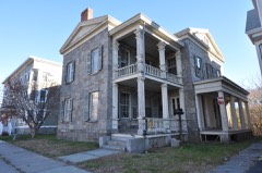 John I. Howe Houselisted 1989
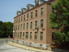 Kraus Corset Factorylisted 1987
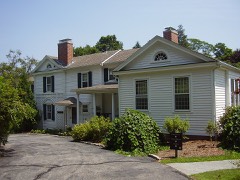 Osbornedalelisted 1986
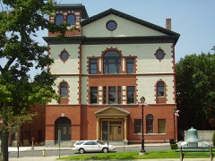 Sterling Opera Houselisted 1968
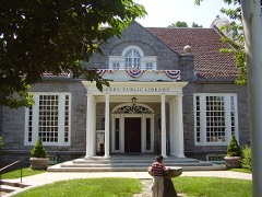 Harcourt Wood Memorial Librarylisted 1982
- Birmingham Green Historic Districtlisted 2000
Population over time
2 figuresDerby fell from 12,902 to 12,325 between 2010 and 2020. These are the recorded population figures Wikidata holds for this place, reached through the Geographic Names Information System number this page is keyed on rather than by name, so they belong to this place and not to another of the same name. Most are census counts, but not all are: an early figure may be a founding or settlement estimate, and an estimate published within five years of a census is left out. The change column is computed, and is left blank where more than 20 years separate a figure from the one before it, because a gap that long is not a change between two counts.
| Year | People | Change |
|---|---|---|
| 2010 | 12,902 | |
| 2020 | 12,325 | -577 (-4%) |
Topographic sheets covering this place
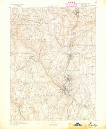
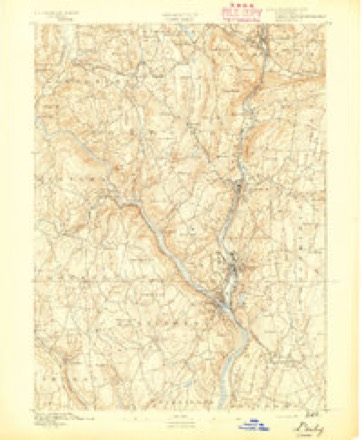
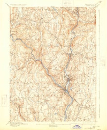
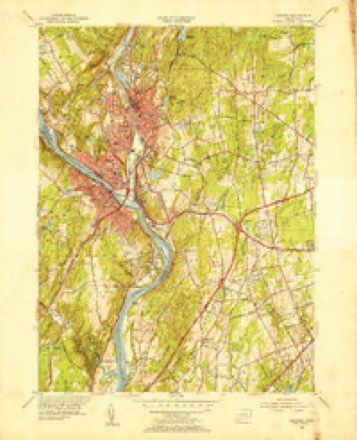
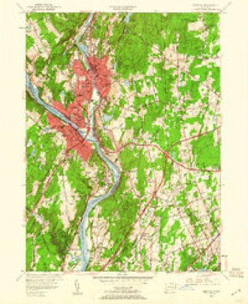
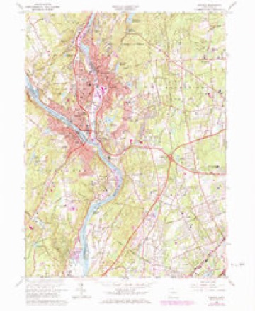
12 surveys from 31 printed sheetsMatched by testing this settlement's coordinate against the published boundary of every sheet in the United States Geological Survey's historical collection. Each opens the scanned sheet at the Survey.
- 1889 USGS Derby quadrangle1:62500
- 1891 USGS Derby quadrangle1:62500
- 1893 USGS Derby quadrangle1:62500, 9 printings
- 1947 USGS Hartford quadrangle1:250000, 2 printings
- 1948 USGS Hartford quadrangle1:250000, 2 printings
- 1953 USGS Ansonia quadrangle1:31680
- 1953 USGS Ansonia quadrangle1:24000, 2 printings
- 1961 USGS Hartford quadrangle1:250000
- 1962 USGS Hartford quadrangle1:250000, 3 printings
- 1964 USGS Ansonia quadrangle1:24000, 4 printings
- 1965 USGS Hartford quadrangle1:250000, 2 printings
- 1986 USGS Bridgeport quadrangle1:100000, 3 printings






In the county-history sources
18,454 words on this townshipHistory of New Haven County, Connecticut, published 1892 names this settlement in its chapter on Derby Town. These are the passages that mention it, exactly as the scans read.
THE town of Derby is on the western border of the county, about nine miles northwest from New Haven and a little more than that distance north of Long Island sound. As created by the charter of 1675, it extended 12 miles north from the Two Mile brook, and the northeastern corner was seven and a half miles east from a point on the Housatonic; the southeastern corner was two and a half miles east from that stream, the river forming the southwestern boundary and separating the town from Fairfield county. This area of about 14,000 acres of land has been reduced to about one-fourth that number of acres, by the formation of new towns, only the southeastern part of the old town remaining. Here, where is the junction of the Naugatuck with the Housatonic, the first settlements were made. Adjoining the present Derby are Ansonia, on the north; Woodbridge and Orange on the east and southeast.
Passage source: History of New Haven County, Connecticut, published 1892.
In aboriginal times this locality was known as Paugasuck, which name was corrupted by the English into Paugassett. The general features are variable, hilly lands predominating, the level lands being confined mainly to the areas along the streams, and are small in extent. Ascending the Housatonic from the point of confluence a mile or two, at a marked bend of the river is the point which from the first has been called Derby Neck, where some lands were early tilled. Southeast are the pleasantly elevated lands on which is located Birmingham, with the intervale along the Naugatuck, on the east, as meadows or lowlands. Beyond the Naugatuck the ground ascends gradually until it culminates in a beautiful elevation, called Sentinel hill, which is cultivated to its summit, and which is a most attractive object, with its orchards and verdant fields. Southwest is another elevation, called Turkey hill, which appears to have been a favorite resort of the Indians. North from this are hills encroaching upon it was desired to know"whether Paugassetl should be attached to their town." But before the proprietors of thi posl gave answer, their interests were sold to Richard Baldwin and others, of Milford, and thenceforth the interests oJ this locality wen practically controlled by that town. Hence, when th< : ral court gave liberty to the people of Paugassett to form themselves into a separate villag Milford di clared that such a such a step would be injurious to its interests, and opposed th( measun ; and this opposition Milford successfully maintained more than 20 years, n tarding the di vi lopmi nt of this section.
Passage source: History of New Haven County, Connecticut, published 1892.
From his early Paugassett records we learn that tin- Milford nun who had purchased the interests of Stephen I .oodyear and his New Haven associates were: John Burwell, Richard Baldwin, Samuel Hopkins, Edward Riggs, Thomai Langdon, Edward Wooster, Francis French, John Brown, Isaac Piatt, Roberl Denison. In a short time, the Burw li interest passed to Henry Bottsford, and Hopkins' to John Smith. Soon after L665 a village was officially founded, after the manner of : hose times, and the first division of lands made. Each one of the ten proprietors received a home lot oi about one and half acres; uplands about four acres; and meadow lands about three aeres. This village was in that pari of Derby called " Old Town " or "Up-town." But not all the proprietors lived there. Edward Riggs and Francis
Passage source: History of New Haven County, Connecticut, published 1892.
Machine-read from a century-old scan, so expect the errors a machine makes: misspelled names, dropped words, stray characters.
Read the whole chapter on Derby Town - it names this place 68 more 68 times.
Fires near this place
231 since 1992Regional context, not property-specific evidence. The federal wildfire occurrence database lists 231 fires within 5 miles of Derby between 1992 and 2020, burning about 95 acres in total. None started naturally. 46 were recorded as arson. Distance is straight-line from the map coordinates, so a fire counted here may appear on a neighbouring settlement's page as well.
| Reported cause | Fires |
|---|---|
| Missing data/not specified/undetermined | 96 |
| Arson/incendiarism | 46 |
| Misuse of fire by a minor | 31 |
| Recreation and ceremony | 30 |
| Debris and open burning | 17 |
| Equipment and vehicle use | 8 |
| Smoking | 3 |
The most recent of them, most recent first, with the day each was reported and the service that recorded it.
| Date | Cause | Size | Reported by | Name on the report |
|---|---|---|---|---|
| 7 September 2017 | Missing data/not specified/undetermined | under an acre | Connecticut Division of Forestry | HUBBELL AVE |
| 4 September 2017 | Missing data/not specified/undetermined | under an acre | Connecticut Division of Forestry | DIVISION ST |
| 4 September 2015 | Missing data/not specified/undetermined | under an acre | Connecticut Division of Forestry | not named |
| 3 September 2017 | Missing data/not specified/undetermined | 1.2 acres | Connecticut Division of Forestry | JAY LN |
| 21 September 2017 | Missing data/not specified/undetermined | under an acre | Connecticut Division of Forestry | MAIN ST |
| 15 September 1994 | Misuse of fire by a minor | under an acre | Connecticut Division of Forestry | not named |
| 12 September 1994 | Debris and open burning | under an acre | Connecticut Division of Forestry | not named |
| 1 September 2017 | Missing data/not specified/undetermined | under an acre | Connecticut Division of Forestry | NEW HAVEN AVE |
Settlements close enough to share some of these fires:
Mines and quarries near this place
10 of 37 shownRegional context, not property-specific evidence. The federal mineral resources record lists 37 workings within 5 miles of Derby: 33 past producers, 2 producers, 1 unknown, 1 occurrence. 2 still produce. What was taken out: Stone, Dimension, Stone, Sand and Gravel, Construction, Quartz. Distance is straight-line from the map coordinates, so a quarry counted here may appear on a neighbouring settlement's page as well.
| Where | Site | Commodity | Status | Recorded |
|---|---|---|---|---|
| Bassett's Arsenopyrite Mine | Arsenic, Iron, Sulfur, Quartz, Lead, Zinc | Occurrence | Galena, Pyrite, Sphalerite | |
| Booth's Mine | Bismuth | Past Producer | ||
| Davidson Granite Gneiss Rock Quarry | Stone, Crushed/Broken | Past Producer | Unknown | |
| Marble Lime Rock Quarry No. Ek-009 | Limestone, General | Past Producer | Marble | |
| Marble Quarry | Marble, Dimension | Past Producer | ||
| Seymour Arsenic & Nickel Mine | Nickel | Past Producer | ||
| Seymour Nickel Mine Brook Arsenic and Nickel Mine. | Nickel, Arsenic, Iron, Sulfur | Past Producer | ||
| Silver Mine | Silver | Past Producer | ||
| Bassett Arsenopyrite Mine | Arsenic | Past Producer | ||
| Davidson Quarry | Granite | Past Producer |
Storms near this place
5 since 1998Regional context, not property-specific evidence. The National Weather Service names Derby in 5 storm reports between 1998 and 2011: 3 thunderstorm wind, 1 hail, 1 funnel cloud. No death or injury is recorded in these reports. Each account below is quoted exactly as the forecast office filed it, from the NOAA Storm Events Database, and each date opens the federal record of that event.
| When | Event | Place named | Harm | What the report says |
|---|---|---|---|---|
| June 2011 | Thunderstorm Wind | Derby | $7,500 | Numerous trees were reported down in Derby. |
| August 2004 | Thunderstorm Wind | Derby | - | Trees and wires were downed. |
| May 2002 | Thunderstorm Wind | Derby | - | A severe thunderstorm produced high winds that downed 3 trees on Prospect Street in Derby. |
| May 2002 | Funnel Cloud | Derby | - | no account filed |
| May 1998 | Hail | Derby | - | no account filed |
Nearest settlements
The eight closest, with where each one stands in the county. Distances are straight-line, computed from the Geographic Names Information System coordinates.
| Map | Place | Distance | Sheets |
|---|---|---|---|
| East Derby | 0.8 miles | 31 | |
| Ansonia | 1.8 miles | 31 | |
| Kinneytown | 3.2 miles | 31 | |
| Orange | 4.4 miles | 31 | |
| Woodbridge | 4.8 miles | 31 | |
| West Seymour | 5.1 miles | 35 | |
| Seymour | 5.3 miles | 35 | |
| Baldwins Crossing | 5.6 miles | 31 |
Elsewhere
Matched on this settlement's Geographic Names Information System number rather than its name, so it cannot be a different place of the same name in another state.
| Wikipedia article on Derby | An encyclopaedic summary. Its text is share-alike, so it is linked here rather than copied. |
| Wikidata item Q755197 | The structured record the population and elevation above come from. Public domain (CC0). |
Provenance
This settlement is recorded in the Geographic Names Information System as feature 206671. The sheet list is computed by point-in-boundary test against the United States Geological Survey's historical topographic inventory. Both are works of the United States government and carry no copyright under 17 U.S.C. 105.
Wildfire. Short, Karen C. 2022. Spatial wildfire occurrence data for the United States, 1992-2020 [FPA_FOD_20221014]. 6th Edition. Fort Collins, CO: Forest Service Research Data Archive. https://doi.org/10.2737/RDS-2013-0009.6 Collected with United States Government funding and usable without additional permissions or fees.
Mines and quarries. USGS Mineral Resources Data System (MRDS) https://mrdata.usgs.gov/mrds/ A work of the United States government, no copyright under 17 U.S.C. 105.
Storms. NOAA National Centers for Environmental Information, Storm Events Database https://www.ncei.noaa.gov/stormevents/ A work of the United States government, no copyright under 17 U.S.C. 105. Narratives are quoted verbatim from the National Weather Service report and are not edited or summarised.