 Block
Ansonia, Connecticut
31 topographic sheets cover this place, the earliest surveyed in 1889 and the latest in 1986. It stands in Ansonia town. It lies in ZIP code area 06401. It lies near Windy Hill. The Survey maps it on the Ansonia quadrangle. 18,918 people lived here at the 2020 count. It stands 82 feet above sea level.
On record in Ansonia
Buildings and businesses the archive holds for this place. Each opens its own page, with the source record it came from.
On the National Register 5 records
 Ansonia Librarylisted 1985
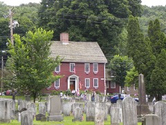 Gen. David Humphreys Houselisted 1972
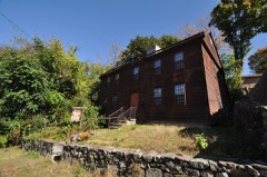 Richard Mansfield Houselisted 1971
 US Post Office-Ansonia Mainlisted 1985
- Upper Main Street Historic Districtlisted 1982
Population over time
2 figuresAnsonia fell from 19,249 to 18,918 between 2010 and 2020. These are the recorded population figures Wikidata holds for this place, reached through the Geographic Names Information System number this page is keyed on rather than by name, so they belong to this place and not to another of the same name. Most are census counts, but not all are: an early figure may be a founding or settlement estimate, and an estimate published within five years of a census is left out. The change column is computed, and is left blank where more than 20 years separate a figure from the one before it, because a gap that long is not a change between two counts.
| Year | People | Change |
|---|---|---|
| 2010 | 19,249 | |
| 2020 | 18,918 | -331 (-2%) |
Topographic sheets covering this place
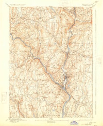
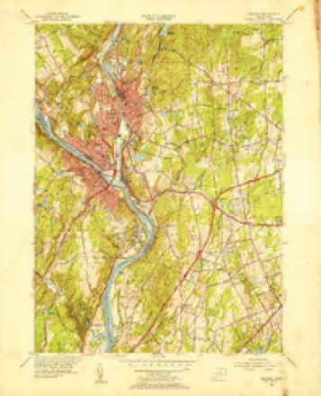
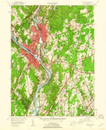
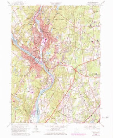
12 surveys from 31 printed sheetsMatched by testing this settlement's coordinate against the published boundary of every sheet in the United States Geological Survey's historical collection. Each opens the scanned sheet at the Survey.
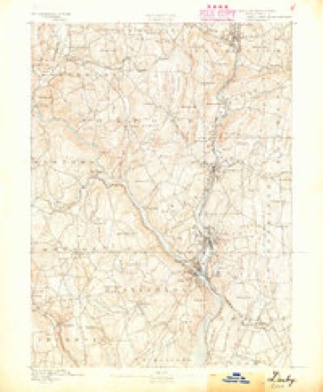
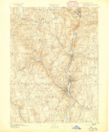
- 1889 USGS Derby quadrangle1:62500
- 1891 USGS Derby quadrangle1:62500
- 1893 USGS Derby quadrangle1:62500, 9 printings
- 1947 USGS Hartford quadrangle1:250000, 2 printings
- 1948 USGS Hartford quadrangle1:250000, 2 printings
- 1953 USGS Ansonia quadrangle1:31680
- 1953 USGS Ansonia quadrangle1:24000, 2 printings
- 1961 USGS Hartford quadrangle1:250000
- 1962 USGS Hartford quadrangle1:250000, 3 printings
- 1964 USGS Ansonia quadrangle1:24000, 4 printings
- 1965 USGS Hartford quadrangle1:250000, 2 printings
- 1986 USGS Bridgeport quadrangle1:100000, 3 printings






In the county-history sources
27,174 words on this townshipHistory of New Haven County, Connecticut, published 1892 names this settlement in its chapter on Ansonia Town. These are the passages that mention it, exactly as the scans read.
Higher up Beaver brook were also farming lands, less fertile, at a point on that stream, half a mile east from Cliff street, in the borough of Ansonia, and at what was called the upper end of Plum Meadows the first grist mill in old Derby was built, in 1681, by Doctor John Hull. This naturally caused a small settlement to spring up at that place. In October, 1684, the town granted to Doctor John Hull and John Griffin " each of them a home lot in the Little Neck, near the ponds." No doubt this referred to the ponds made by the mill dam. Doctor Hull removed to Wallino-ford five vears later, but members of his family remained at the mill, which was here discontinued sometime about 1700. and the interest transferred to a power on the Naugatuck, in the lower part of the town. Thereafter the power was probably devoted to lesser use, Doctor Beardsley being of the opinion that many years later James Humphreys had a hat shop at that place, which he removed to Humphreysville.
Passage source: History of New Haven County, Connecticut, published 1892.
Along the Naugatuck, north of the meadows, the land was of the nature of a sandy plain, and not adapted for the uses of agriculture. But the hills, though high and not free from rocks, were to some extent utilized for farming purposes. On the west side were the Samuel Durand and the Bassett farms, each having a generous acreage. They have long since been devoted to suburban uses, Ansonia having become distinctively a manufacturing town, which was called into existence less than half a century ago. Its most interesting history consequently is confined to the present population, accounts of which are given in the following pages.
Passage source: History of New Haven County, Connecticut, published 1892.
On the 30th of November, 1888, 1,100 inhabitants of the upper part of Derby petitioned the general assembly, asking that they might become a separate town corporation. After a full consideration of the matter by that body, in which the lower part of Derby presented counter petitions, the prayer was granted April 17th, 1889, and the town of Ansonia was, by legislative enactment, at that time created. The old Derby Neck and Town roads and Clark avenue were made the lines of division between the two towns. The bridge across the Naugatuck was held to belong to the towns in common, and the almshouse and poor farm of Derby, falling within the limits of Ansonia, were assumed by this town, at a valuation of $5,907. The debts of the old town were divided on a basis of the list of 1888, and by these arrangements Ansonia began its civil existence with an indebtedness of $51,347.49.
Passage source: History of New Haven County, Connecticut, published 1892.
Machine-read from a century-old scan, so expect the errors a machine makes: misspelled names, dropped words, stray characters.
Read the whole chapter on Ansonia Town - it names this place 140 more 140 times.
Fires near this place
313 since 1992Regional context, not property-specific evidence. The federal wildfire occurrence database lists 313 fires within 5 miles of Ansonia between 1992 and 2019, burning about 264 acres in total. None started naturally. 79 were recorded as arson. Distance is straight-line from the map coordinates, so a fire counted here may appear on a neighbouring settlement's page as well.
| Reported cause | Fires |
|---|---|
| Missing data/not specified/undetermined | 119 |
| Arson/incendiarism | 79 |
| Recreation and ceremony | 43 |
| Misuse of fire by a minor | 34 |
| Debris and open burning | 26 |
| Equipment and vehicle use | 8 |
| Smoking | 4 |
The most recent of them, most recent first, with the day each was reported and the service that recorded it.
| Date | Cause | Size | Reported by | Name on the report |
|---|---|---|---|---|
| 7 September 2017 | Missing data/not specified/undetermined | under an acre | Connecticut Division of Forestry | HUBBELL AVE |
| 7 September 2002 | Arson/incendiarism | 2.0 acres | Connecticut Division of Forestry | not named |
| 4 September 2017 | Missing data/not specified/undetermined | under an acre | Connecticut Division of Forestry | DIVISION ST |
| 4 September 2015 | Missing data/not specified/undetermined | under an acre | Connecticut Division of Forestry | not named |
| 3 September 2017 | Missing data/not specified/undetermined | 1.2 acres | Connecticut Division of Forestry | JAY LN |
| 3 September 2017 | Missing data/not specified/undetermined | under an acre | Connecticut Division of Forestry | SKOKORAT ST |
| 21 September 2017 | Missing data/not specified/undetermined | under an acre | Connecticut Division of Forestry | MAIN ST |
| 15 September 1994 | Misuse of fire by a minor | under an acre | Connecticut Division of Forestry | not named |
Settlements close enough to share some of these fires:
Mines and quarries near this place
10 of 37 shownRegional context, not property-specific evidence. The federal mineral resources record lists 37 workings within 5 miles of Ansonia: 31 past producers, 3 producers, 2 occurrences, 1 unknown. 3 still produce. What was taken out: Stone, Dimension, Stone, Sand and Gravel, Construction, Quartz. Distance is straight-line from the map coordinates, so a quarry counted here may appear on a neighbouring settlement's page as well.
| Where | Site | Commodity | Status | Recorded |
|---|---|---|---|---|
| Bassett's Arsenopyrite Mine | Arsenic, Iron, Sulfur, Quartz, Lead, Zinc | Occurrence | Galena, Pyrite, Sphalerite | |
| Copper Occurrences No. Ek-003 | Copper, Iron | Occurrence | Disseminations In Metamor | |
| Davidson Granite Gneiss Rock Quarry | Stone, Crushed/Broken | Past Producer | Unknown | |
| Marble Lime Rock Quarry No. Ek-009 | Limestone, General | Past Producer | Marble | |
| Marble Quarry | Marble, Dimension | Past Producer | ||
| Seymour Arsenic & Nickel Mine | Nickel | Past Producer | ||
| Seymour Nickel Mine Brook Arsenic and Nickel Mine. | Nickel, Arsenic, Iron, Sulfur | Past Producer | ||
| Silver Mine | Silver | Past Producer | ||
| Bassett Arsenopyrite Mine | Arsenic | Past Producer | ||
| Davidson Quarry | Granite | Past Producer |
Storms near this place
16 since 1997Regional context, not property-specific evidence. The National Weather Service names Ansonia in 16 storm reports between 1997 and 2024: 7 flash flood, 6 thunderstorm wind, 2 hail, 1 lightning. The reports record 1 injury. Each account below is quoted exactly as the forecast office filed it, from the NOAA Storm Events Database, and each date opens the federal record of that event.
| When | Event | Place named | Harm | What the report says |
|---|---|---|---|---|
| June 2011 | Lightning | Ansonia | 1 hurt | A woman was struck by lightning at a home along South Benham Road in Seymour. |
| August 2011 | Thunderstorm Wind | Ansonia | $15,000 | Trees and numerous wires were reported down throughout Ansonia, including wires reported down on a house along Wakelee Avenue, near Hull Street, and a large tree along Farther Salemi Drive, and a tree on a car on Platt Street. The roof of the Ansonia Armory was also damaged. |
| June 2011 | Thunderstorm Wind | Ansonia | $7,500 | Numerous trees were reported down in Ansonia. |
| May 2018 | Thunderstorm Wind | Ansonia | $3,000 | Power lines down, 1 inch hail reported. |
| July 2012 | Thunderstorm Wind | Ansonia | $1,500 | A tree and wires were reported down closing Tremont Street. |
| June 2024 | Flash Flood | Ansonia | - | Route 334 closed between Wakelee Avenue and Riggs Street due to a washout caused by flooding. |
| August 2024 | Flash Flood | Ansonia | - | Franklin Street closed at Wakelee Ave due to flooding. |
| July 2023 | Flash Flood | Ansonia | - | Five to ten impassible roads from high water. A few homes flooded in Ansonia. |
| September 2018 | Flash Flood | Ansonia | - | Crescent Street in Ansonia caved in due to flood waters. |
| September 2018 | Flash Flood | Ansonia | - | There were multiple road closures across the town of Ansonia due to flood waters. |
| September 2012 | Flash Flood | Ansonia | - | In Ansonia, Wakelee Ave. near Clarkson St. was closed due to flooding. Beaver St. was also closed due to flooding. |
| August 2011 | Flash Flood | Ansonia | - | The public reported street and basement flash flooding in Ansonia, CT. |
| August 2011 | Hail | Ansonia | - | Quarter size hail was reported along Clifton Avenue in Ansonia. |
| August 2011 | Hail | Ansonia | - | no account filed |
| September 1998 | Thunderstorm Wind | Ansonia | - | no account filed |
| July 1997 | Thunderstorm Wind | Ansonia | - | no account filed |
Nearest settlements
The eight closest, with where each one stands in the county. Distances are straight-line, computed from the Geographic Names Information System coordinates.
| Map | Place | Distance | Sheets |
|---|---|---|---|
| Kinneytown | 1.6 miles | 31 | |
| Derby | 1.8 miles | 31 | |
| East Derby | 2.2 miles | 31 | |
| West Seymour | 3.3 miles | 35 | |
| Seymour | 3.5 miles | 35 | |
| Woodbridge | 3.8 miles | 31 | |
| Paynes Corners | 4.7 miles | 35 | |
| Orange | 5.5 miles | 31 |
Elsewhere
Matched on this settlement's Geographic Names Information System number rather than its name, so it cannot be a different place of the same name in another state.
| Wikipedia article on Ansonia | An encyclopaedic summary. Its text is share-alike, so it is linked here rather than copied. |
| Wikidata item Q570044 | The structured record the population and elevation above come from. Public domain (CC0). |
Provenance
This settlement is recorded in the Geographic Names Information System as feature 205107. The sheet list is computed by point-in-boundary test against the United States Geological Survey's historical topographic inventory. Both are works of the United States government and carry no copyright under 17 U.S.C. 105.
Wildfire. Short, Karen C. 2022. Spatial wildfire occurrence data for the United States, 1992-2020 [FPA_FOD_20221014]. 6th Edition. Fort Collins, CO: Forest Service Research Data Archive. https://doi.org/10.2737/RDS-2013-0009.6 Collected with United States Government funding and usable without additional permissions or fees.
Mines and quarries. USGS Mineral Resources Data System (MRDS) https://mrdata.usgs.gov/mrds/ A work of the United States government, no copyright under 17 U.S.C. 105.
Storms. NOAA National Centers for Environmental Information, Storm Events Database https://www.ncei.noaa.gov/stormevents/ A work of the United States government, no copyright under 17 U.S.C. 105. Narratives are quoted verbatim from the National Weather Service report and are not edited or summarised.