BlockBefore

Muscogee County, Georgia

69 topographic sheets and 18 fire insurance atlases across 1 place.

Research this county

From the record

141 National Register listings published here, 3 of them National Historic Landmarks · the county-history sources name 1 person · people the book names include The Increase Of Population (Columbus, 1887) (machine-read).

Sources: the county history on the Internet Archive · the National Register database, National Park Service

Georgia within the United States
Muscogee County within Georgia
Explore by year 1886 1900

What the record shows

  • 1 place in this county was surveyed for fire insurance: Columbus, between 1885 and 1958.
  • 18 fire insurance atlases survive for the county. Topographic coverage is national; fire insurance survey reached only incorporated places with something worth insuring.
  • 4,363 topographic sheet readings cover the county's settlements.
  • 141 properties here are on the National Register of Historic Places: 122 buildings, 16 districts, 2 sites and 1 structure.
  • 25 of the 141 listings were added during the 1970s.
  • The Geographic Names Information System records 192 populated places in this county; 192 are covered by at least one topographic sheet.

Photographs

55 photographs, 1939 to 1941

Taken for the Office of War Information and the Farm Security Administration, who photographed the country between 1935 and 1944. Works of United States government photographers, with no known restriction on use. Each opens its catalogue record.

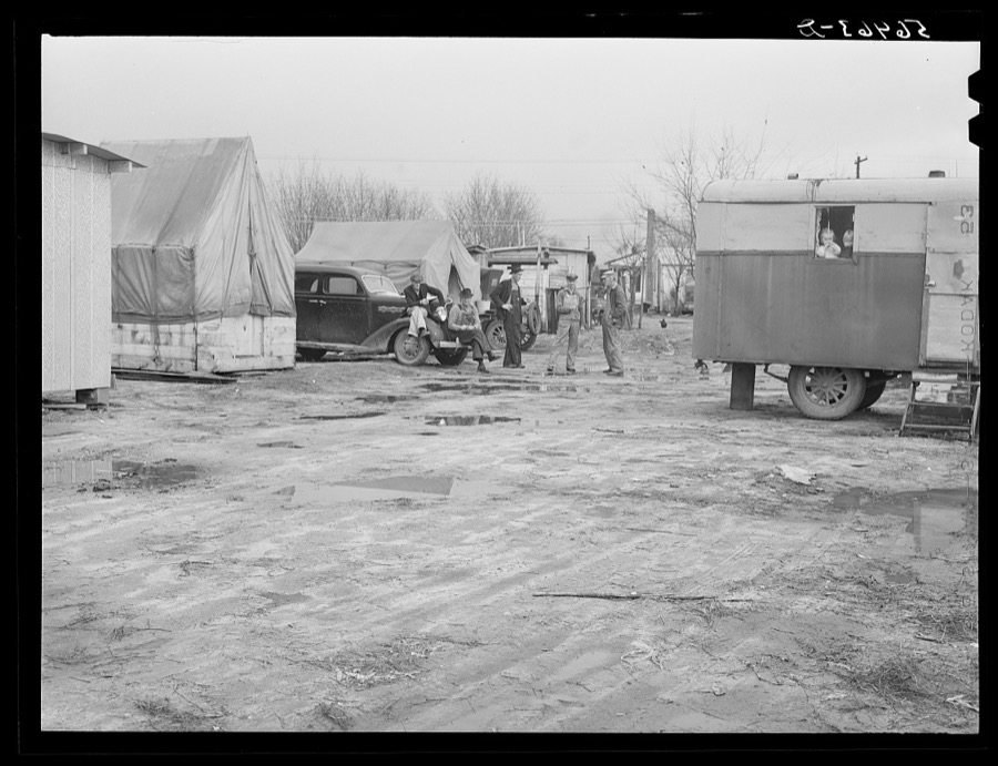
Metal shelters, tents, trailers of construction workers and Army families.  Metal shelters rent for ten dollars a month, and trailer space is two dollars a week. Near Fort Benning, Columbus, Georgia
Metal shelters, tents, trailers of construction workers and Army families. Metal shelters rent for ten dollars a month, and trailer space is two dollars a week. Near Fort Benning, Columbus, Georgia
Wolcott, Marion Post, 1940. Library of Congress
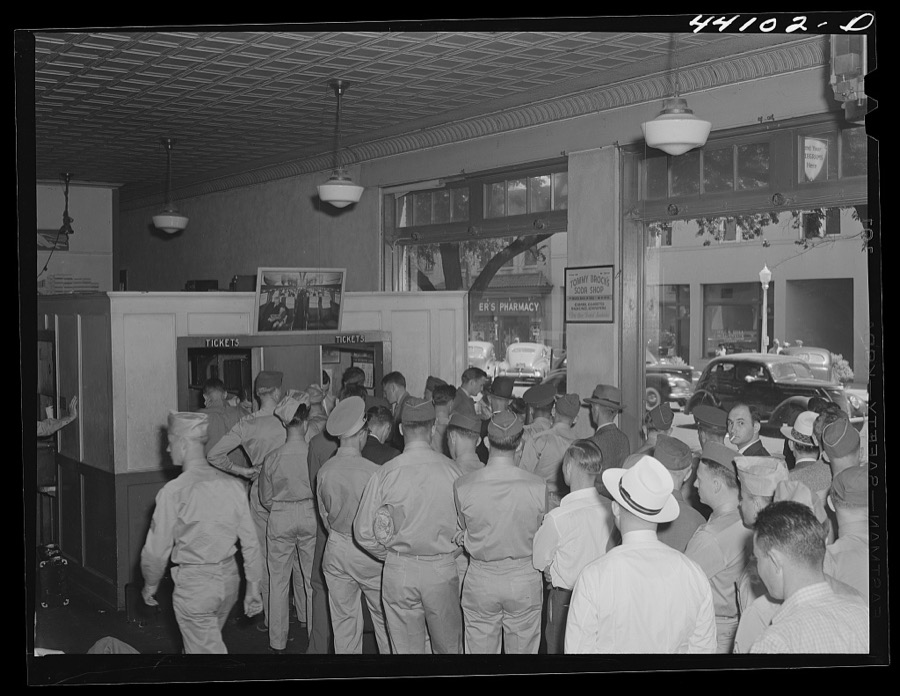
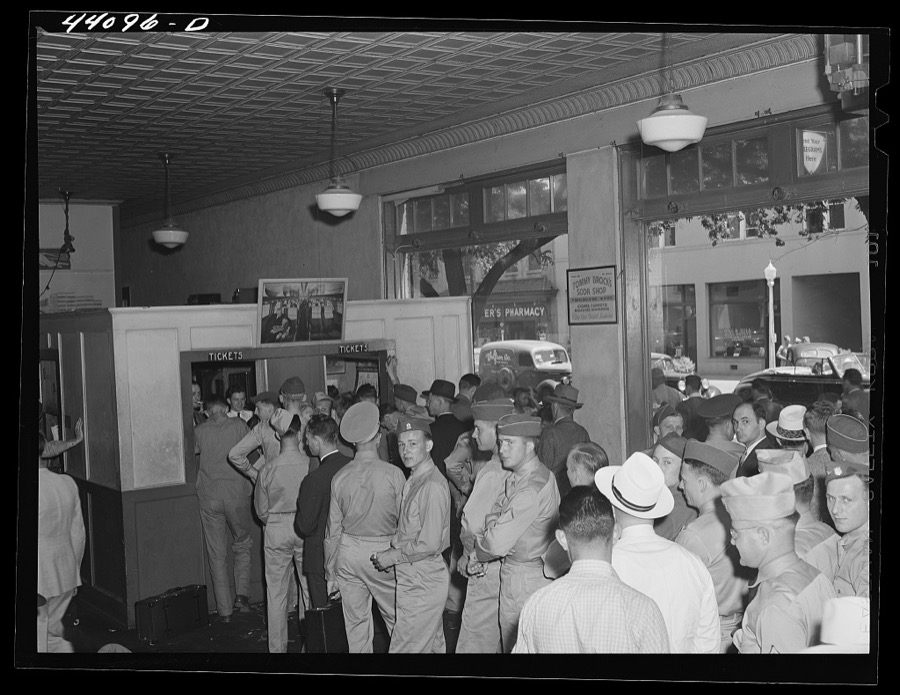
The crowded bus terminal in Columbus, Georgia. Soldiers flock the station going away for weekends
Delano, Jack, 1941. Library of Congress
The crowded bus terminal in Columbus, Georgia. Soldiers flock the station going away for weekends
Delano, Jack, 1941. Library of Congress
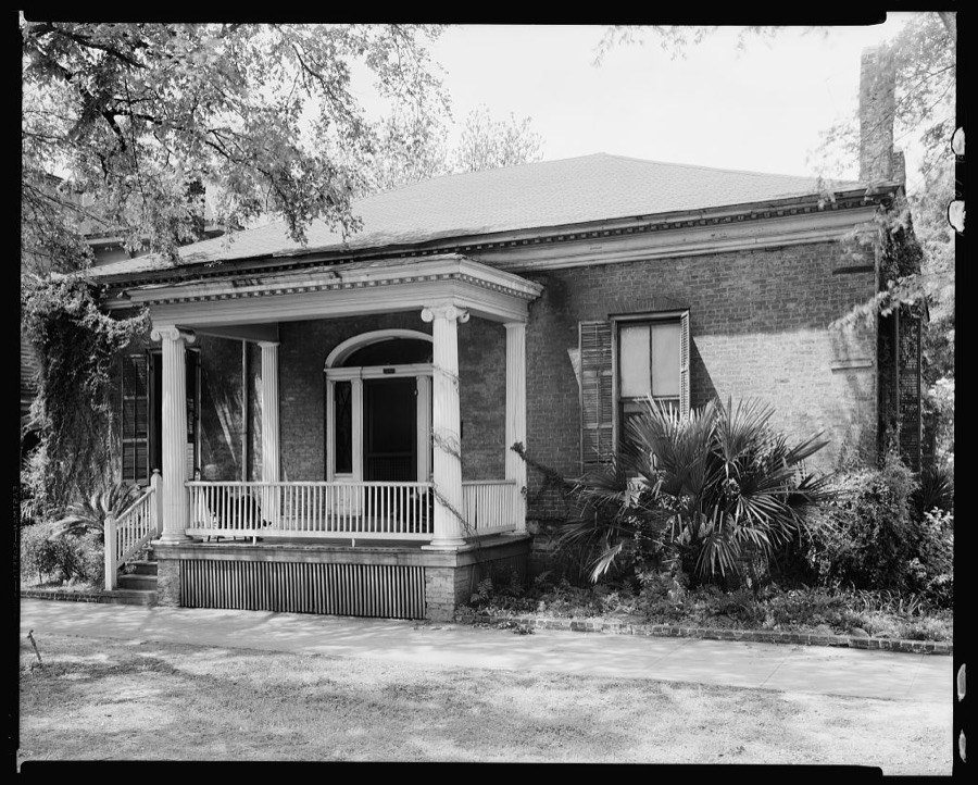
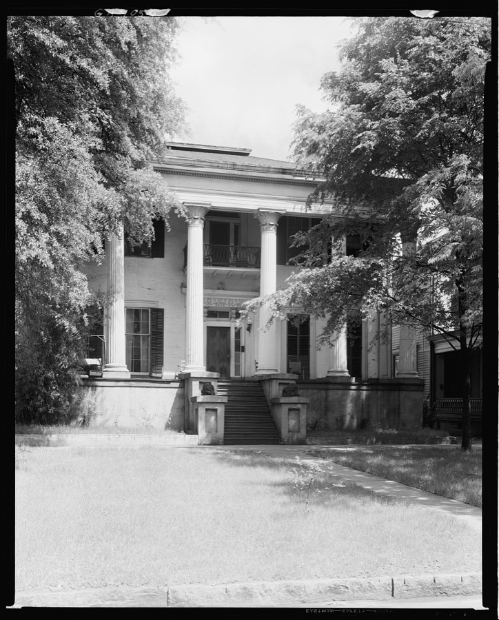
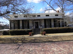
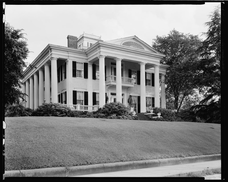
Pease House, 908 Broad St. at 9th., Columbus, Muscogee County, Georgia
Johnston, Frances Benjamin, 1939. Library of Congress
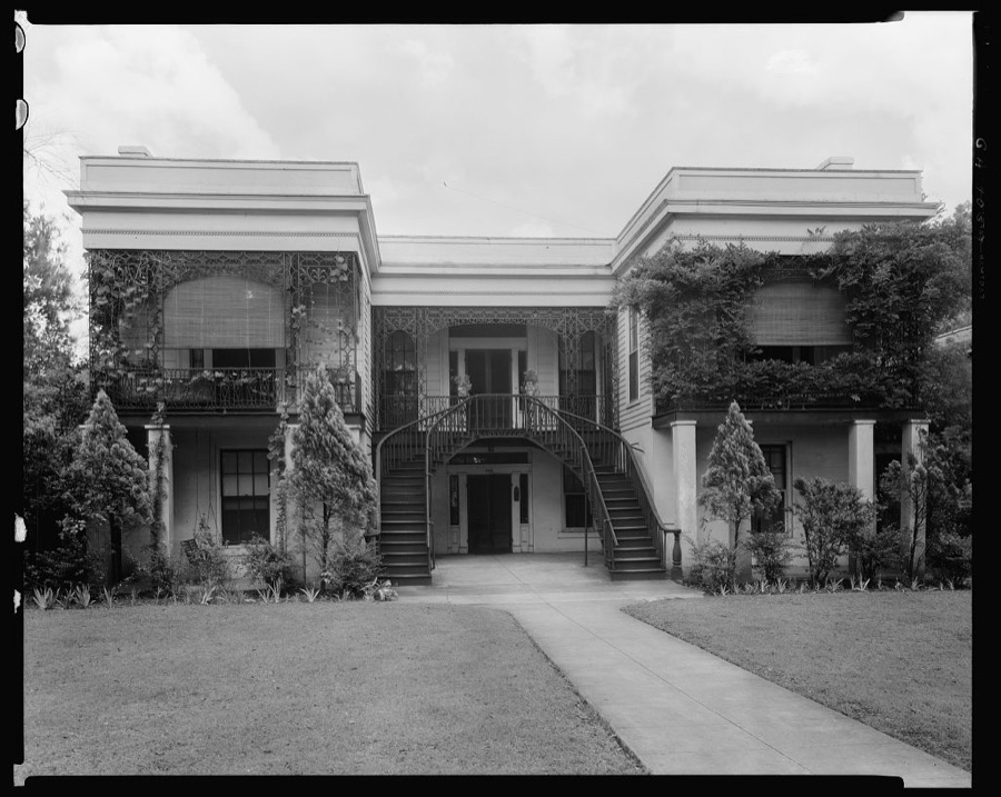
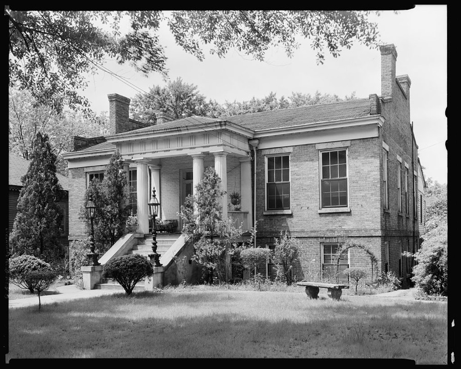
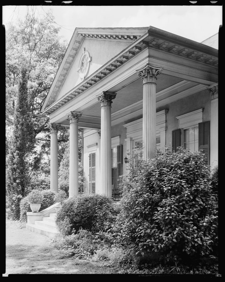
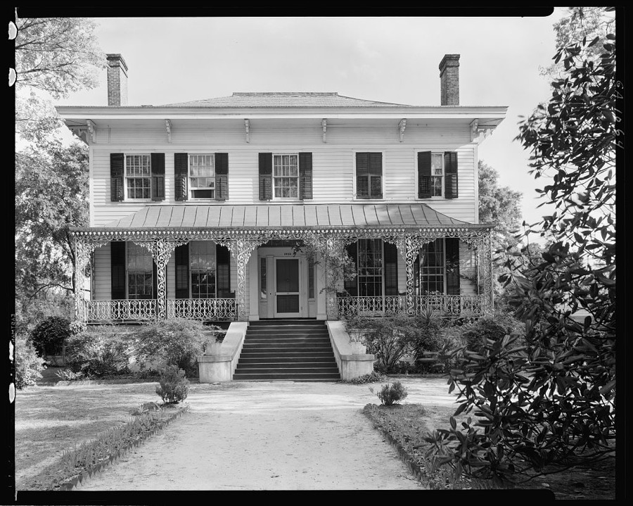
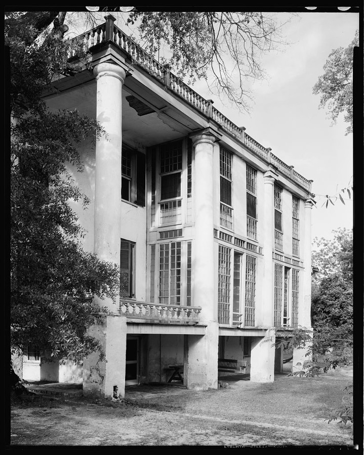
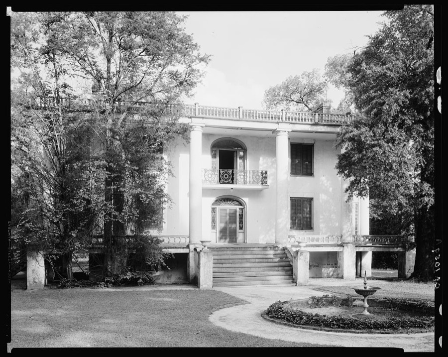
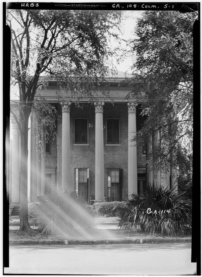
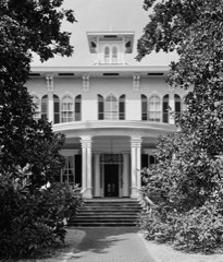
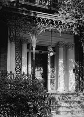
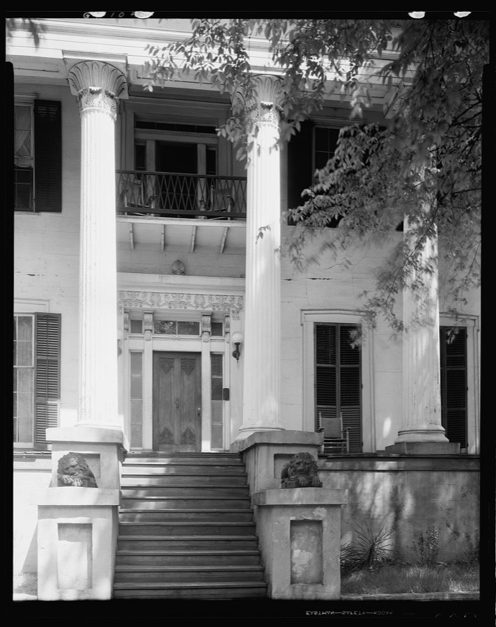
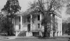
Alexander-McGehee-Woodall House, 16th St. 2nd Ave., Columbus, Muscogee County, Georgia
Johnston, Frances Benjamin, 1939. Library of Congress
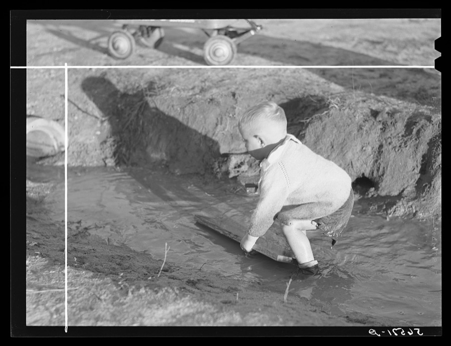
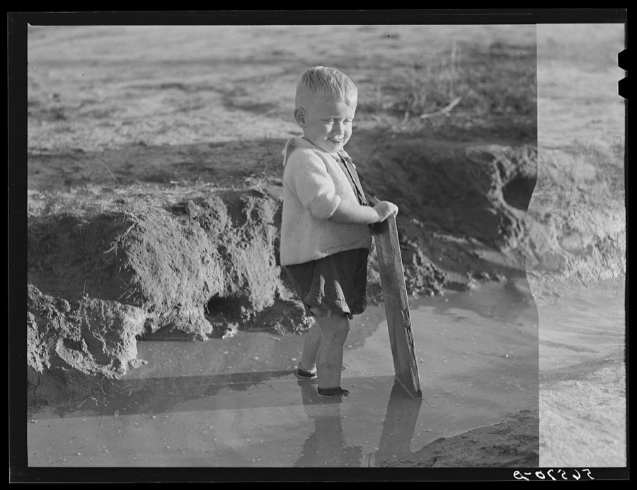
Child playing in front of his home on Milstead Avenue about five miles outside of Columbus, Georgia. Near Fort Benning. His father is at Fort Benning
Wolcott, Marion Post, 1940. Library of Congress
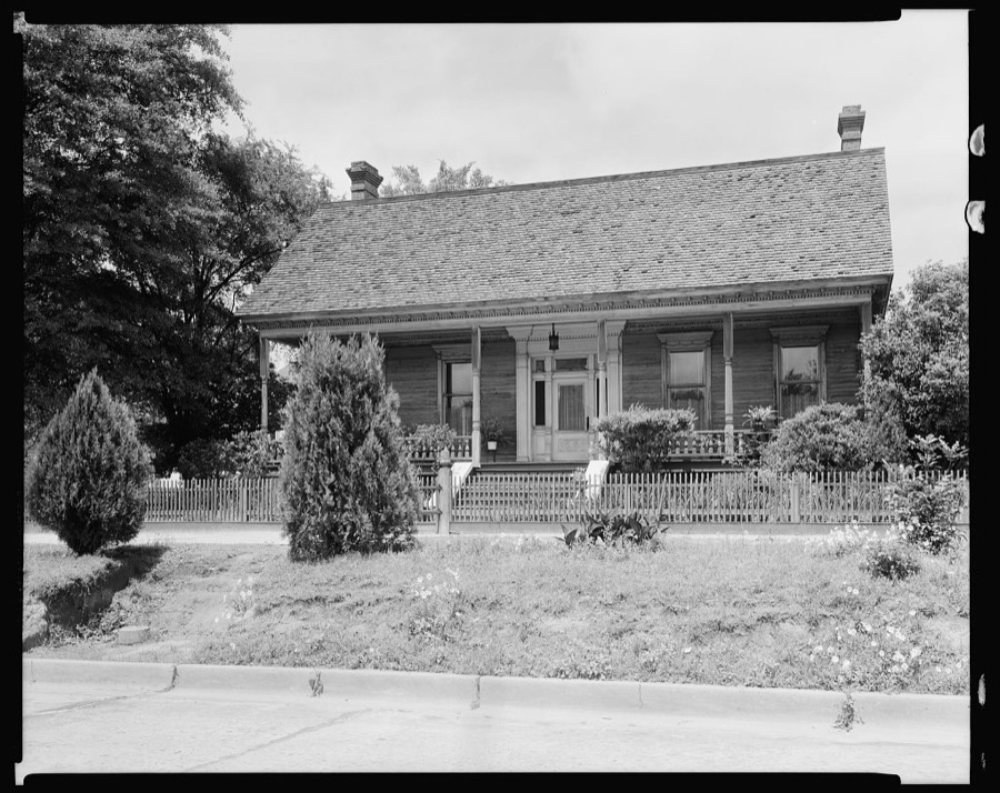
Modern House, Columbus, Muscogee County, Georgia
Johnston, Frances Benjamin, 1939. Library of Congress
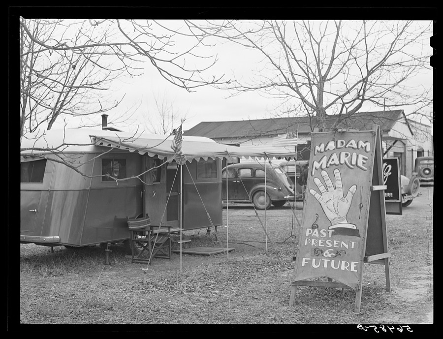
Fortune teller's sign and trailer near trailer camps where Army men and construction workers live on highway near Fort Benning, Columbus, Georgia
Wolcott, Marion Post, 1940. Library of Congress
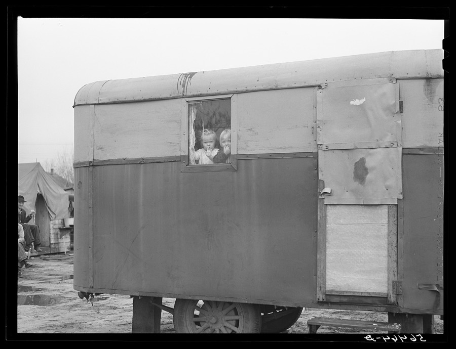
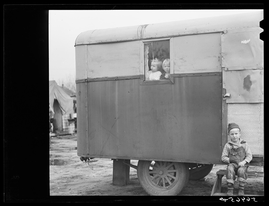
Children looking out of trailer window. Trailer where C.E. Children and family live in highway about three miles from Fort Benning. He is an auto mechanic and came up to Columbus, Georgia two weeks ago from Albany, Georgia and now works at Columbus Motor Company. They couldn't find any other place to live so had to get a trailer. They pay two dollars a week for space in W.T. Mullis' backyard. Never lived in a trailer before, don't like it, difficult with children and wet weather
Wolcott, Marion Post, 1940. Library of Congress
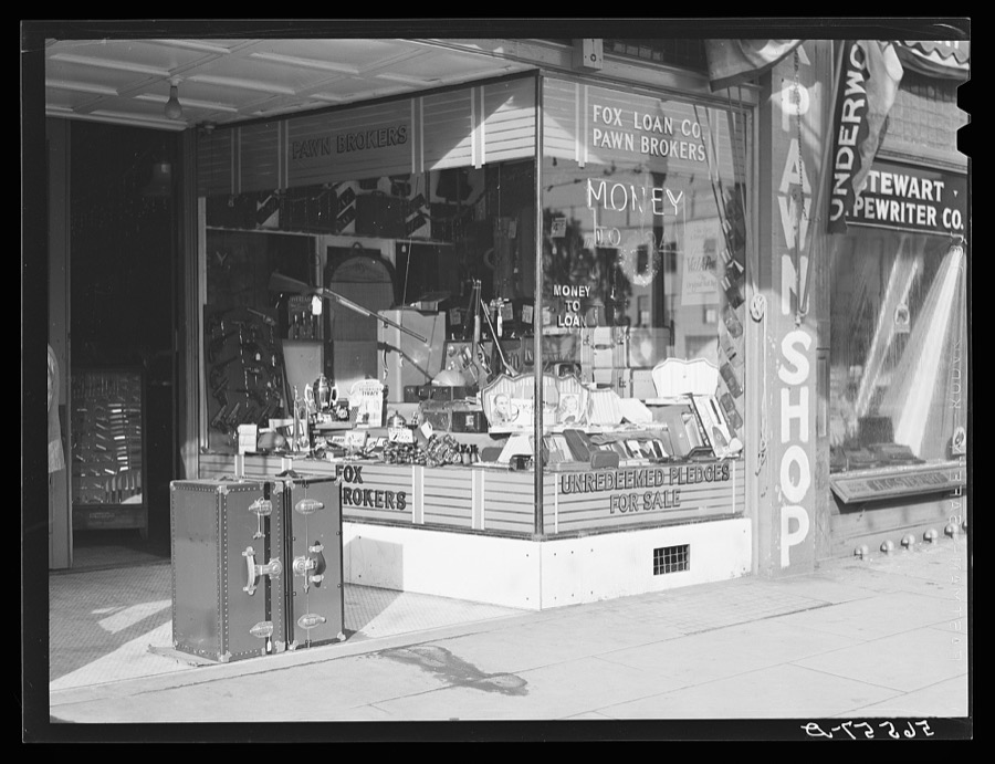
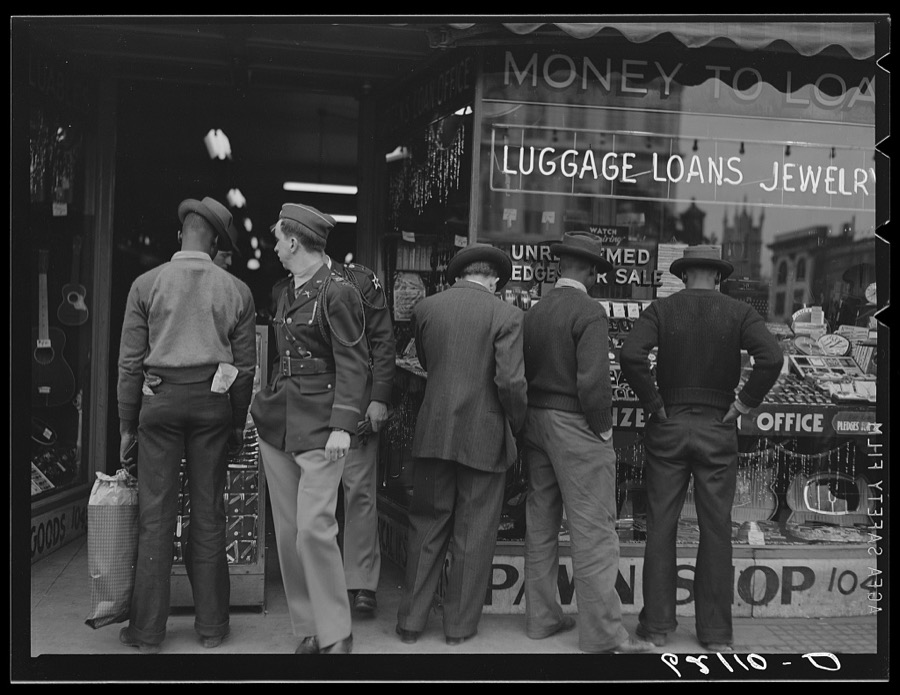
Pawn shop with trunks and boots displayed on main street in Columbus, Georgia
Wolcott, Marion Post, 1940. Library of Congress
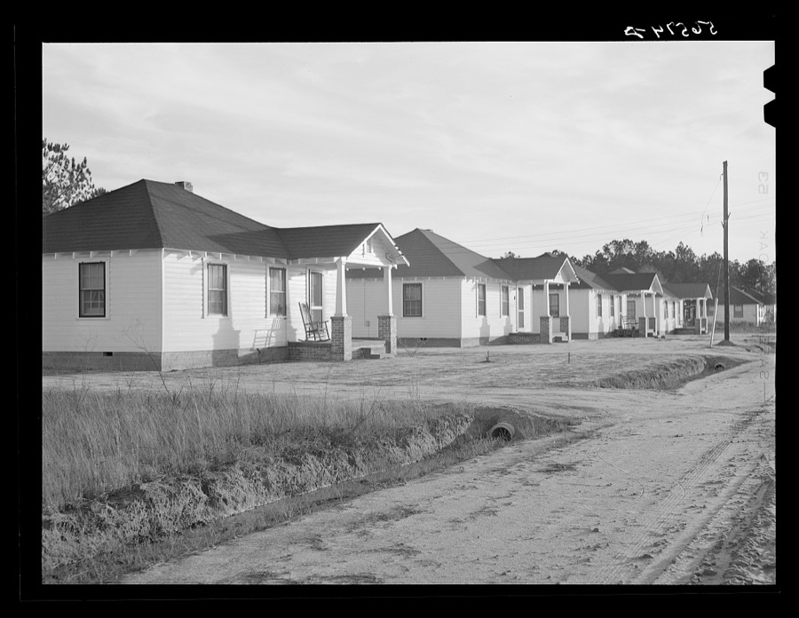
New homes of Army men's families on Milstead Avenue, about five miles outside of Columbus, Georgia. They were built this past September
Wolcott, Marion Post, 1940. Library of Congress
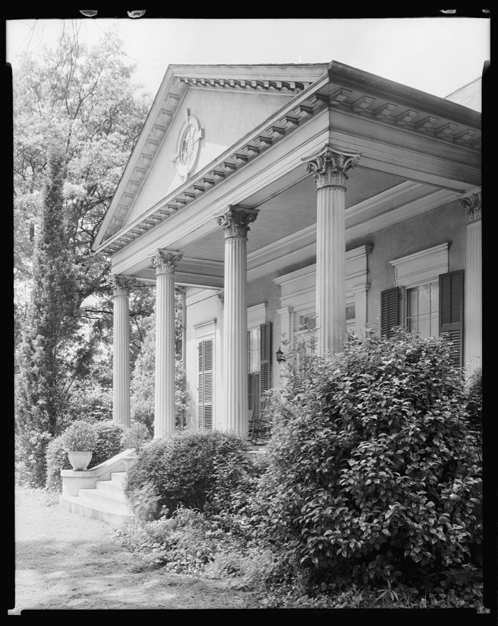
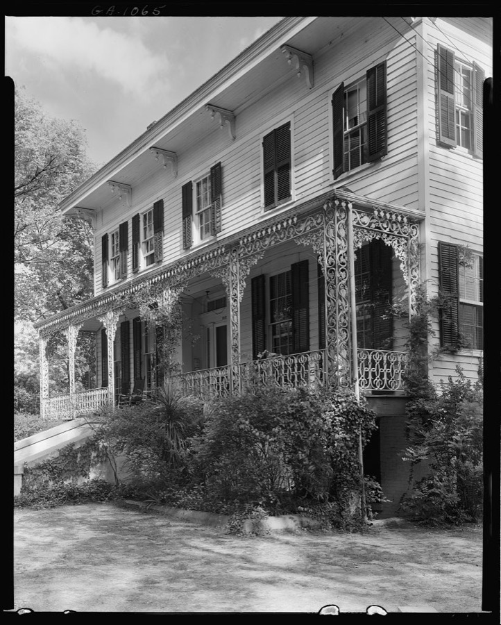
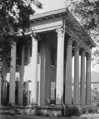
George Foster Peabody House, 2nd Ave. & 15th St. S.W. corner, Columbus, Muscogee County, Georgia
Johnston, Frances Benjamin, 1939. Library of Congress
Child playing in front of his home on Milstead Avenue about five miles outside of Columbus, Georgia. Near Fort Benning. His father is at Fort Benning
Wolcott, Marion Post, 1940. Library of Congress
Dr. Baird House, Wynnton Road at Lockwood St., Columbus, Muscogee County, Georgia
Johnston, Frances Benjamin, 1939. Library of Congress
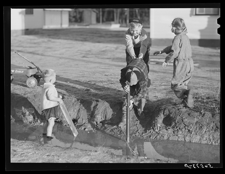
Children of Army men's families on Milstead Avenue playing in water in front of their new homes five miles outside of Columbus, Georgia
Wolcott, Marion Post, 1940. Library of Congress
Children looking out of trailer window. Trailer where C.E. Children and family live in highway about three miles from Fort Benning. He is an auto mechanic and came up to Columbus, Georgia two weeks ago from Albany, Georgia and now works at Columbus Motor Company. They couldn't find any other place to live so had to get a trailer. They pay two dollars a week for space in W.T. Mullis' backyard. Never lived in a trailer before, don't like it, difficult with children and wet weather
Wolcott, Marion Post, 1940. Library of Congress
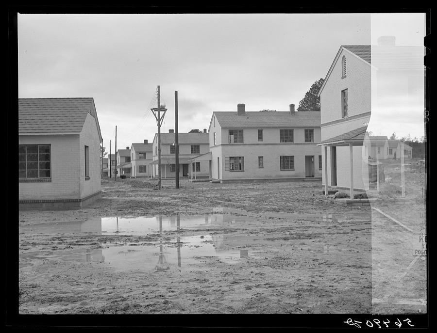
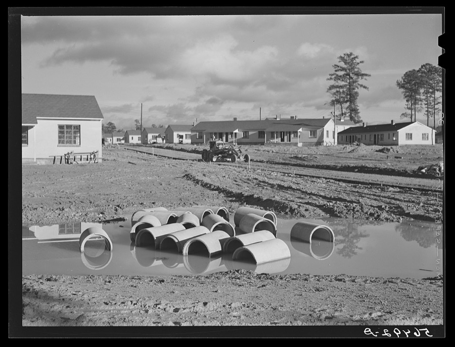
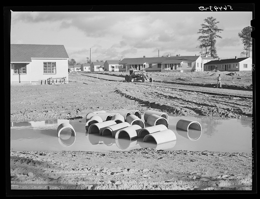
Defense housing project, Newton D. Baker Village, under authority of housing commission of Columbus, Georgia. Construction delayed on account of heavy rains
Wolcott, Marion Post, 1940. Library of Congress
Dr. Baird House, Wynnton Road at Lockwood St., Columbus, Muscogee County, Georgia
Johnston, Frances Benjamin, 1939. Library of Congress
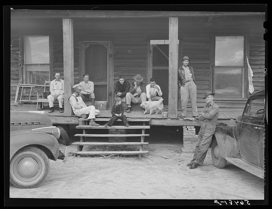
Construction workers on porch of local boarding house on highway near Fort Benning, Columbus, Georgia. They pay six dollars a week, several in a room. They are employed on Belair Construction job building defense housing project
Wolcott, Marion Post, 1940. Library of Congress
Columbus, Georgia
Columbus, Georgia
Vachon, John, 1940. Library of Congress
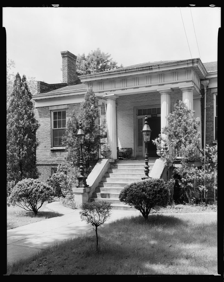
Mrs. C.M. Wolfolk House, Wynnton Road at Monroe St., Columbus, Muscogee County, Georgia
Johnston, Frances Benjamin, 1939. Library of Congress
Mrs. C.M. Wolfolk House, Wynnton Road at Monroe St., Columbus, Muscogee County, Georgia
Johnston, Frances Benjamin, 1939. Library of Congress
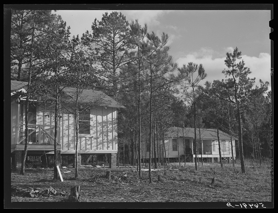
Army men's new homes in Pine Woods on outskirts of Columbus, Georgia, near Fort Benning
Wolcott, Marion Post, 1940. Library of Congress
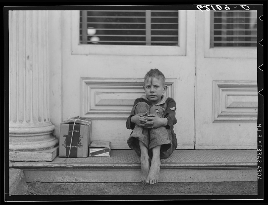
Shoeshine boy. Columbus, Georgia
Vachon, John, 1940. Library of Congress
Hoxey-Cargill-DeLauney House, 13th & 3rd Ave., Columbus, Muscogee County, Georgia
Johnston, Frances Benjamin, 1939. Library of Congress
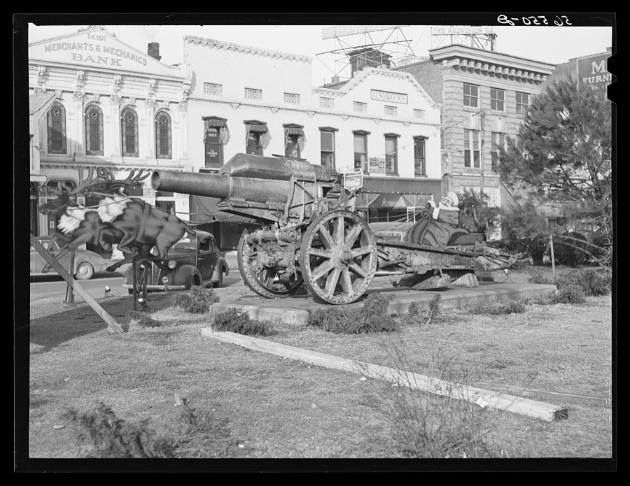
Santa Claus and cannons in square in center of town. Columbus, Georgia
Wolcott, Marion Post, 1940. Library of Congress
Pawnshop. Columbus, Georgia
Vachon, John, 1940. Library of Congress
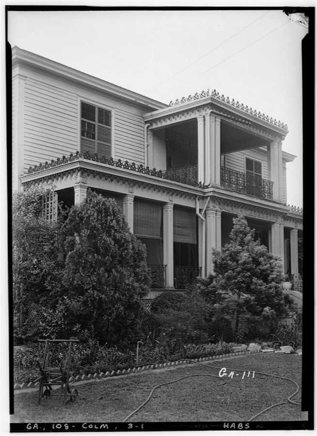
St. Elmo, Talbottan Ave. at 29 th St., Columbus, Muscogee County, Georgia
Johnston, Frances Benjamin, 1939. Library of Congress
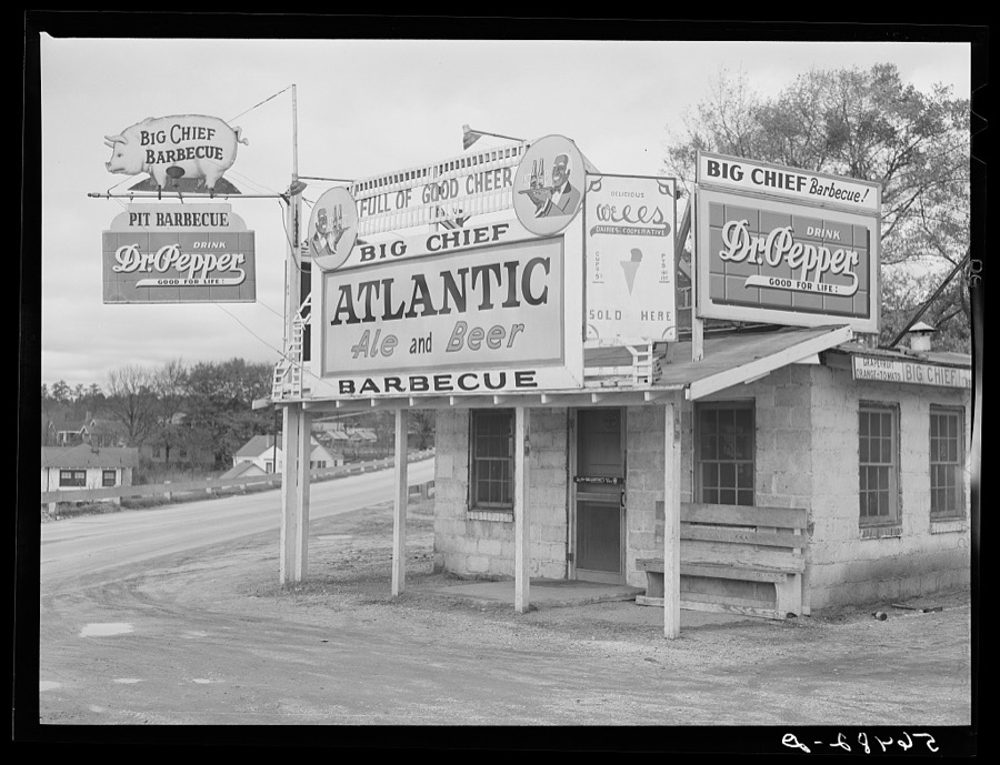
Barbecue stand near Fort Benning, Columbus, Georgia
Wolcott, Marion Post, 1940. Library of Congress
Defense housing project, Newton D. Baker Village, under authority of housing commission of Columbus, Georgia. Construction delayed on account on account of heavy rains
Wolcott, Marion Post, 1940. Library of Congress
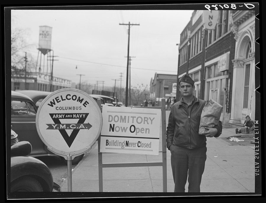
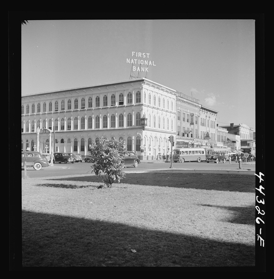
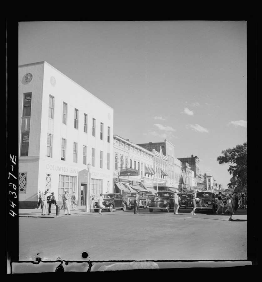
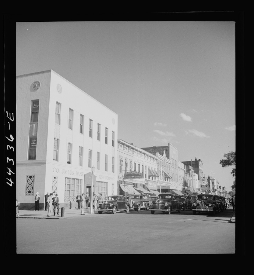
On a main street in Columbus, Georgia
Delano, Jack, 1941. Library of Congress
St. Elmo, Talbottan Ave. at 29 th St., Columbus, Muscogee County, Georgia
Johnston, Frances Benjamin, 1939. Library of Congress
Hoxey-Cargill-DeLauney House, 13th & 3rd Ave., Columbus, Muscogee County, Georgia
Johnston, Frances Benjamin, 1939. Library of Congress
Cooper House, Wynnton Rd. & Cooper Ave., Columbus, Muscogee County, Georgia
Johnston, Frances Benjamin, 1939. Library of Congress
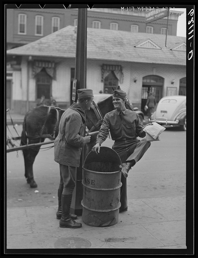
Soldiers talking on street corner. Columbus, Georgia
Vachon, John, 1940. Library of Congress
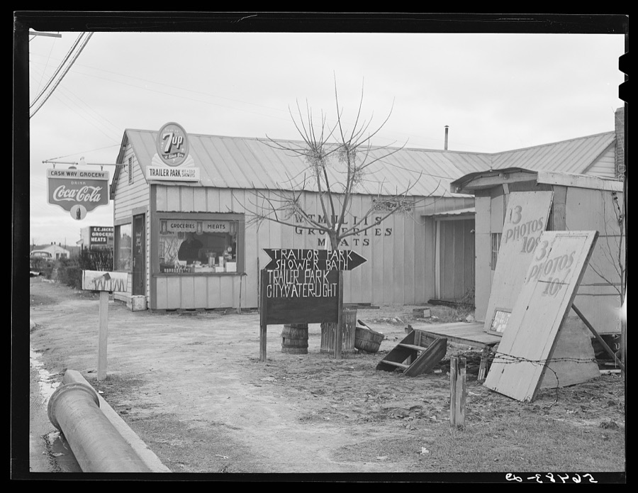
New sign in front of trailer park, and Itinerant photographer's trailer on highway near Fort Benning, Columbus, Georgia. Mr. W.T. Mullis owns property and grocery store and rents trailer space for two dollars a week to construction workers and Army men
Wolcott, Marion Post, 1940. Library of Congress
Alexander-McGehee-Woodall House, 16th St. 2nd Ave., Columbus, Muscogee County, Georgia
Johnston, Frances Benjamin, 1939. Library of Congress
Defense housing project, Newton D. Baker Village, under authority of housing commission of Columbus, Georgia. Construction delayed on account of heavy rains
Wolcott, Marion Post, 1940. Library of Congress
A main street in Columbus, Georgia
Delano, Jack, 1941. Library of Congress
A main street in Columbus, Georgia
Delano, Jack, 1941. Library of Congress
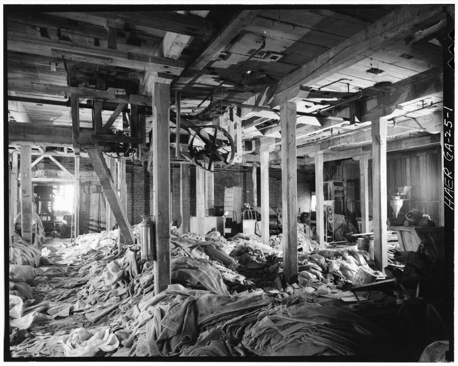
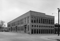
City Mills Company, Eighteenth Street & First Avenue, Columbus, Muscogee County, GA
Photographer not recorded. Library of Congress
May's Folly, 527 First Avenue, Columbus, Muscogee County, GA
Photographer not recorded. Library of Congress
Bibb Company (Columbus Plant), Thirty-eighth Street & First Avenue (Columbus vicinity), Columbus, Muscogee County, GA
Photographer not recorded. Library of Congress
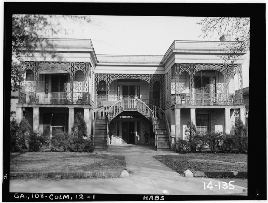
Pease Home, 908 Broadway, Columbus, Muscogee County, GA
Photographer not recorded. Library of Congress
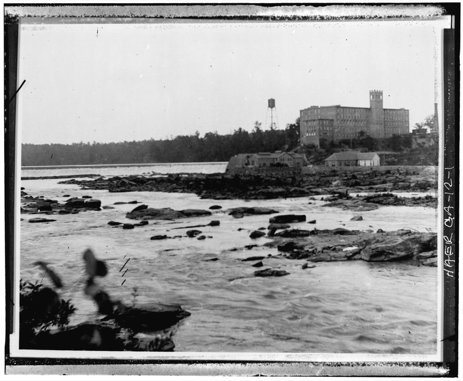
Muscogee Mills, Columbus, Muscogee County, GA
Photographer not recorded. Library of Congress
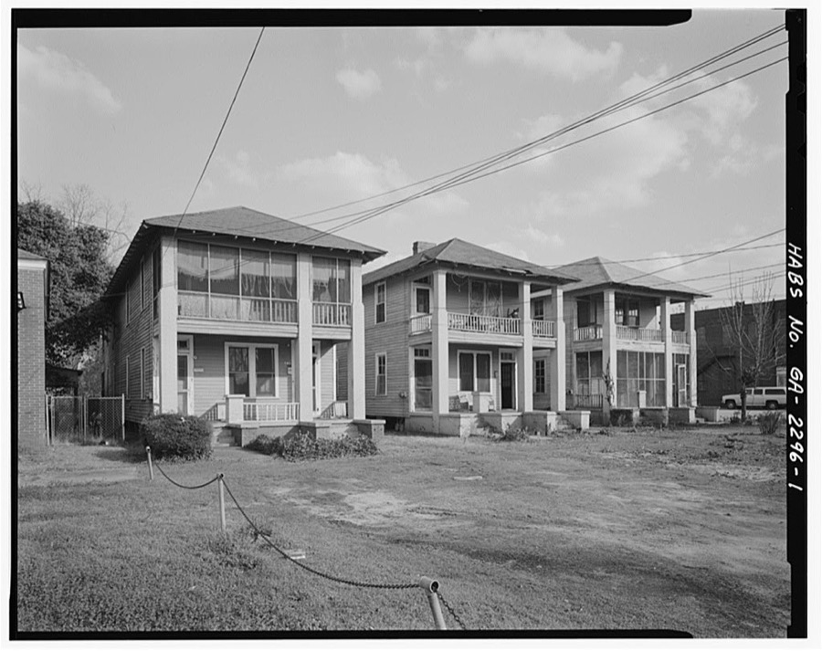
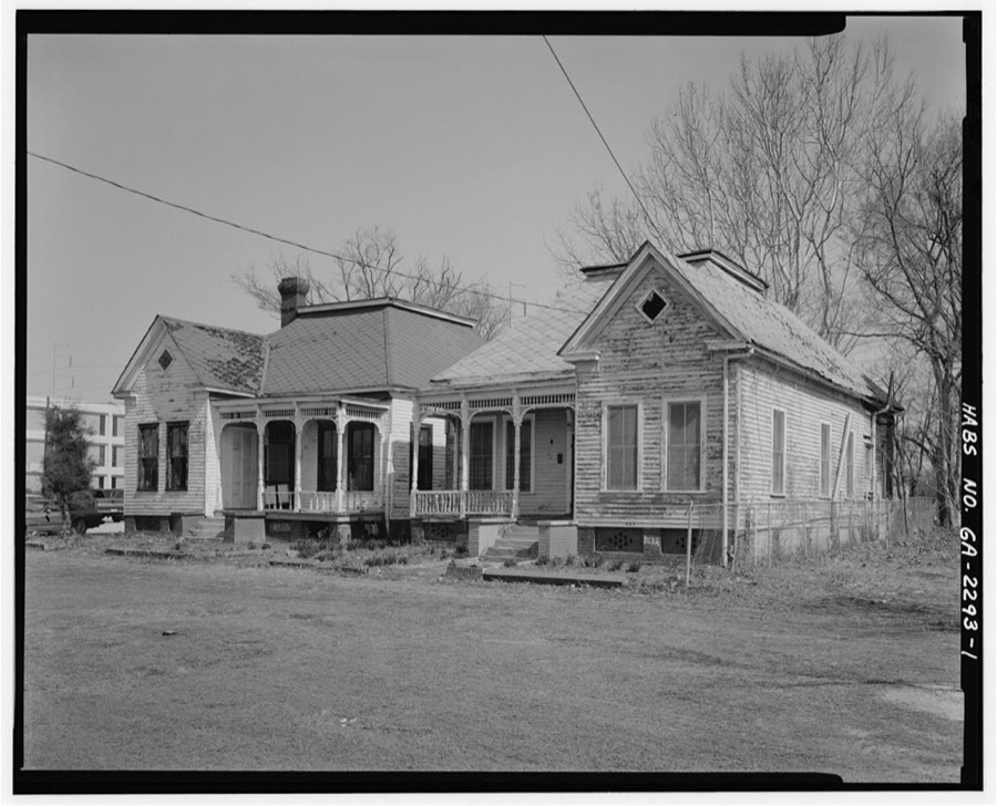
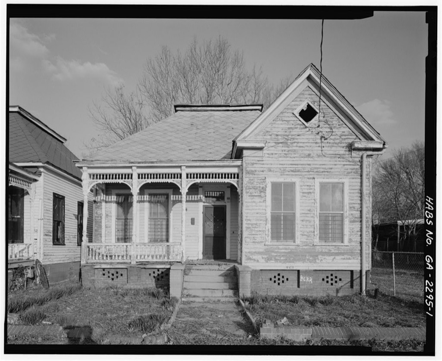
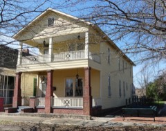
916-918 Fifth Avenue (House), Columbus, Muscogee County, GA
Photographer not recorded. Library of Congress
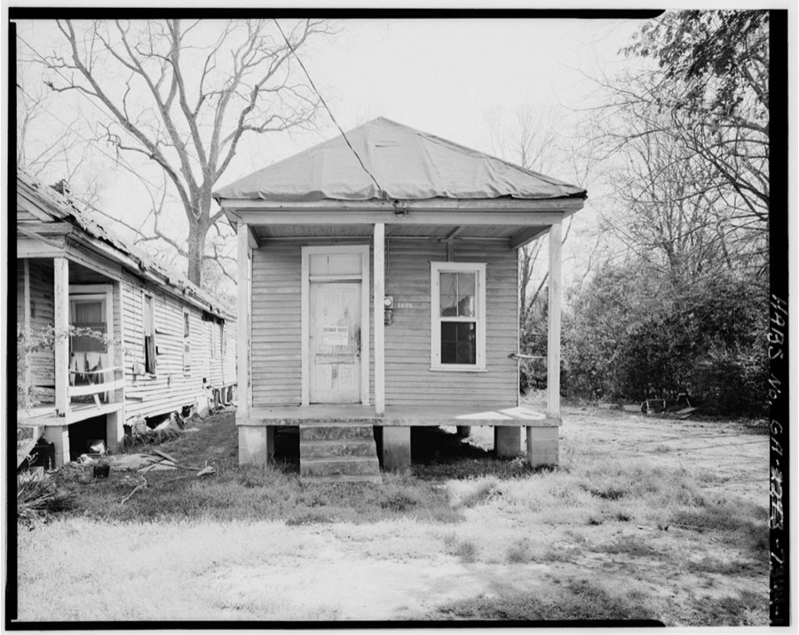
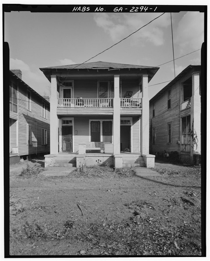
1636 Fourth Street (House), Columbus, Muscogee County, GA
Photographer not recorded. Library of Congress
Springer-Bize-Farley House, 934 Fifth Avenue, Columbus, Muscogee County, GA
Photographer not recorded. Library of Congress
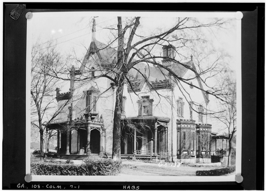
Swift Mansion, Columbus, Muscogee County, GA
Photographer not recorded. Library of Congress
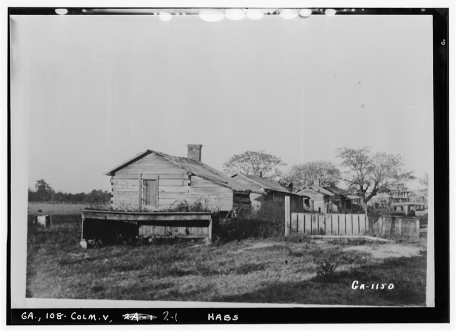
Bass Place (Slave Cabins), Columbus, Muscogee County, GA
Photographer not recorded. Library of Congress
Cook-Thomas House, Columbus, Muscogee County, GA
Photographer not recorded. Library of Congress
Springer-Bize-Coffee House, 930 Fifth Avenue, Columbus, Muscogee County, GA
Photographer not recorded. Library of Congress
McCrary House, 914 Fifth Avenue, Columbus, Muscogee County, GA
Photographer not recorded. Library of Congress
Redd House, Columbus, Muscogee County, GA
Photographer not recorded. Library of Congress
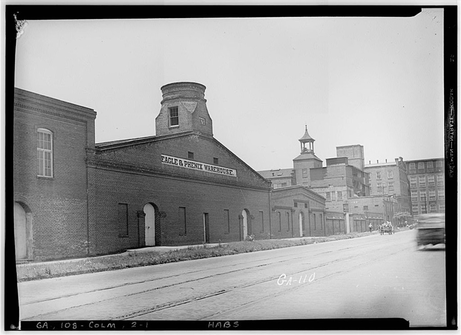
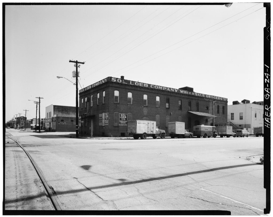
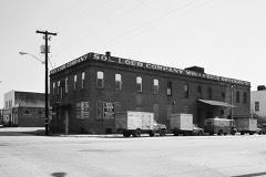
Sol Loeb Warehouse, 900 Front Avenue, Columbus, Muscogee County, GA
Photographer not recorded. Library of Congress

Places on the National Register

141

Every property in this county listed on the National Register of Historic Places, with the year it was listed and the federal nomination document.

Photograph PropertyType ListedReference
1238 Professional Buildingbuilding2022100007851
Adams Cotton Gin Buildingbuilding198484001205
George O. Berry Housebuilding198080001124
Bibb City Historic Districtdistrict201010000037
Broad Street Methodist Episcopal Church Southbuilding198080001125
Building at 1007 Broadwaybuilding198080001130
Building at 1009 Broadwaybuilding198080001131
Building at 1400 Third Avenuebuilding198080001132
Building at 1519 3rd Avenuebuilding198080001126
Building at 1531 3rd Avenuebuilding198080001127
Building at 1612 3rd Avenuebuilding198080001128
Building at 1617 Third Avenuebuilding198080001137
Building at 1619 Third Avenuebuilding198080001138
Building at 1625 Third Avenuebuilding198080001139
Building at 215 Ninth Streetbuilding198080001140
Building at 221 Ninth Streetbuilding198080001141
Building at 303 11th St.building198080001129
Building at 920 Ninth Avenuebuilding198080001142
Building at 921 Fifth Avenuebuilding198080001143
Building at 944 Second Avenuebuilding198080001144
Bullard-Hart Housebuilding197777000439
Bush-Philips Hardware Co.building198080001145
Thomas V. Butts Housebuilding198080001146
C.S.S. MUSCOGEE AND CHATTAHOOCHEE (gunboats)structure197070000212
Cargill, Walter Hurtbuilding198080001147
Carter and Bradley, Cotton Factors and Warehousemanbuilding198080001148
Cedars, Thebuilding197171000282
Central of Georgia Railroad Terminalbuilding198080001150
Central of Georgia Railroad Terminalbuilding198080001149
Church Squarebuilding198080001151
Church of the Holy Familybuilding198080001152
City Fire Departmentbuilding198080001153
Claflin Schoolbuilding201515000813
Cole-Hatcher-Hampton Wholesale Grocersbuilding198080001154
Colored Cemeterysite198080001155
Columbian Lodge No. 7 Free and Accepted Masonsbuilding198080001156
Columbus Coca-Cola Bottling Companybuilding2022100008016
Columbus High Schoolbuilding198080001157
Columbus Historic Districtdistrict196969000045
Columbus Historic District (Boundary Increase)district198888002048
Columbus Historic Riverfront Industrial Districtdistrict197878000995
Columbus Investment Company Buildingbuilding198080001158
Columbus Ironworksbuilding196969000046
Columbus Manufacturing Companydistrict200707000699
Columbus Stockadebuilding198080001159
Wm. L. Cooke Housebuilding198080001210
William H. Denson Housebuilding198080001162
Depot Business Buildingsbuilding198080001163
Dinglewoodbuilding197272000389
Dinglewood Historic Districtdistrict200101001248
Robert E. Dismukes Sr. Housebuilding197979000736
Elisha P. Dismukes Housebuilding198080001164
First African Baptist Churchbuilding198080001165
First African Baptist Church Parsonagebuilding198080001166
First National Bankbuilding197474000697
First Presbyterian Churchbuilding198080001167
John T. Fletcher Housebuilding198080001168
Fontaine Buildingbuilding198080001169
Forston Housebuilding199999000657
Frank Brothersbuilding198080001170
Gann's Pharmacybuilding198080001171
Garrett-Bullock Housebuilding198080001172
Girard Colored Missionbuilding198080001173
Goetchius-Wellborn Housebuilding196969000047
Golden Brothers, Founders and Machinstsbuilding198080001174
Green Island Ranchdistrict199797000030
Harrison-Gibson Housebuilding198080001175
High Uptown Historic Districtdistrict200404000669
Highland Hallbuilding198080004459
Hillcrest-Wildwood Circle Historic Districtdistrict200202001748
Hiltonbuilding197272000390
Hofflin & Greentree Buildingbuilding198282002457
Illges Housebuilding197373000634
John Paul Illges Housebuilding198080001178
Isaac Maund Housebuilding198080001179
Joseph Housebuilding196969000048
Kressbuilding198080001180
Abraham Lafkowitz Housebuilding198080001181
Ledger-Enquirer Buildingbuilding198080001183
Lewis-Rothchild Buildingbuilding200404000239
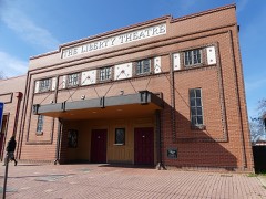
Liberty Theaterbuilding198484001208
Lion Housebuilding197272000391
Sol Loeb Building-Garrett-Joy Buildingbuilding200505000141
McArdle Housebuilding198080001184
McGehee-Woodall Housebuilding197272000392
Methodist Tabernaclebuilding198080001186
Mott Housebuilding197474000698
Mott-Fox-Huguley Housebuilding201212000093
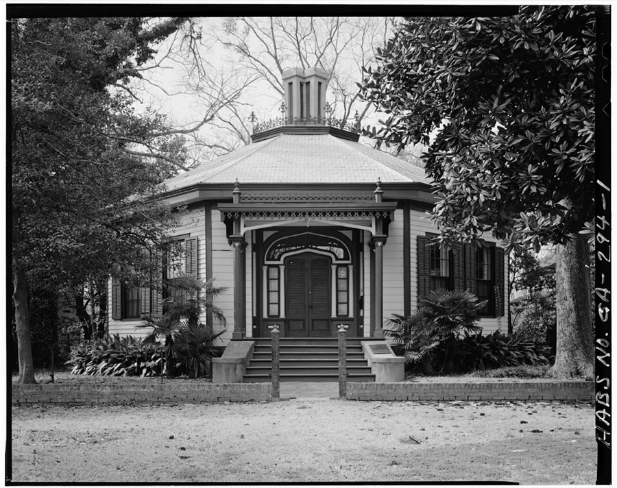
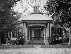
Octagon Housebuilding196969000049
Old City Cemeterysite198080001188
Old Dawson Placebuilding197979000737
Peabody-Warner Housebuilding197070000213
Peacock Woods-Dimon Circle Historic Districtdistrict200303000134
Pemberton Housebuilding197171000283
George Phillips Housebuilding198080001190
George Pond Housebuilding198080001191
Power and Baird, Wholesale Dry Goods and Notionsbuilding198080001193
Gertrude Ma Pridgett Rainey Housebuilding199292001530
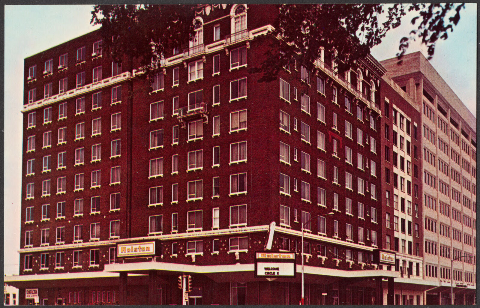
Ralston Hotelbuilding2025100011529
Rankin Housebuilding197272000393
Rankin Squaredistrict197777000440
Reich Dry Goods Companybuilding200404000240
Ridgewoodbuilding198080001215
John Spencer Roberts Housebuilding198080001195
Rose Hill Schoolbuilding2022100007533
Max Rosenberg Housebuilding198080001196
David Rothschild's Wholesale Dry Goodsbuilding198080001197
David Rothschild Housebuilding198080001198
Secondary Industrial Schoolbuilding198080001199
Silver's Five and Dime Store-H.L. Green Co.building200505000794
Sixteenth Street Schoolbuilding198080001200
Southern Railway Freight Depotbuilding199797000922
William Henry Spencer Housebuilding197878000996
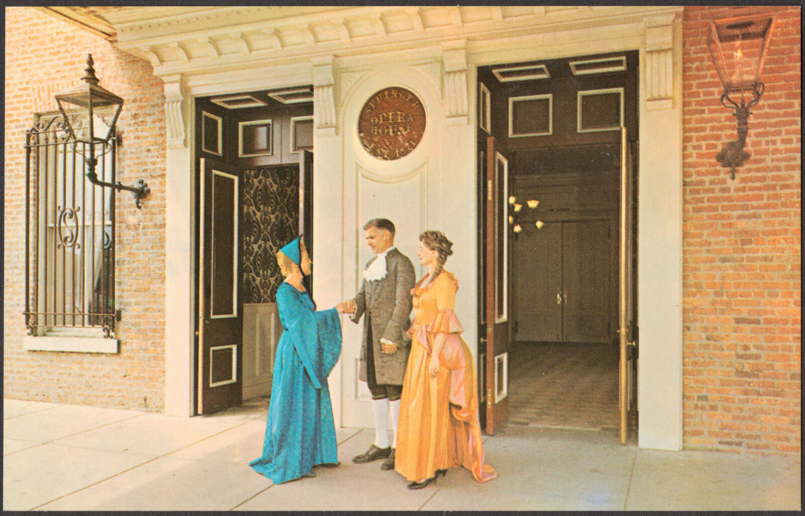
Springer Opera Housebuilding197070000214
St. Christoper's Normal and Industrial Parish Schoolbuilding198080001201
St. Elmobuilding197171000284
St. John Chapelbuilding198080001202
Swift Manufacturing Companydistrict201414000173
Swift-Kyle Housebuilding197373000635
C.B. Tarver Buildingbuilding200505000793
Alma Thomas Housebuilding200909000270
Triangle Buildingbuilding198080001204
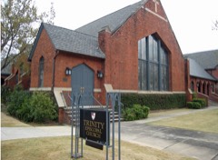
Trinity Episcopal Churchbuilding198080001205
Charles E. Turner Housebuilding198080001206
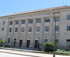
U.S. Post Office and Courthousebuilding198080001207
W. Jacob Burrus Housebuilding198080001208
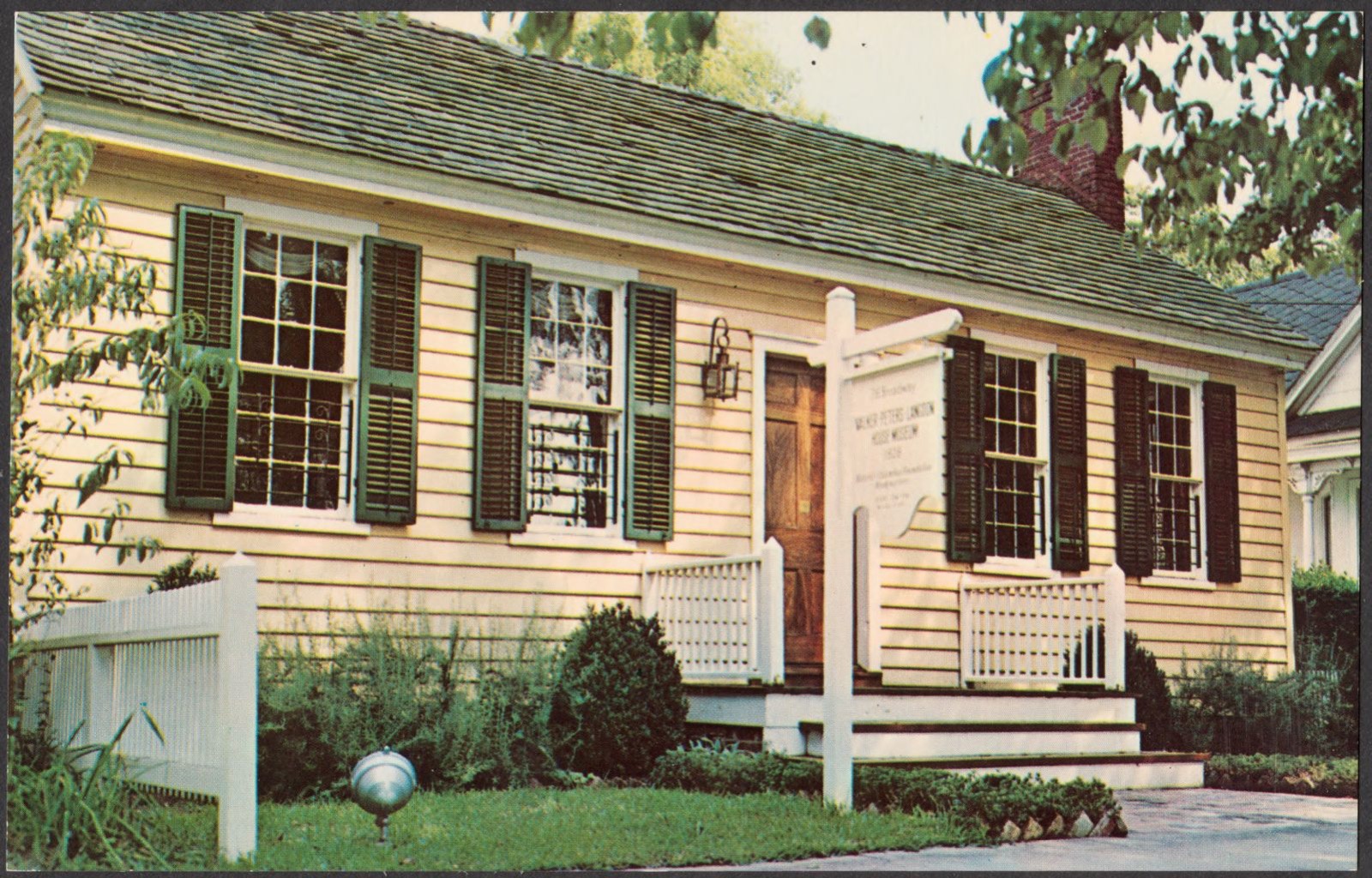
Walker-Peters-Langdon Housebuilding196969000050
Waverly Terracedistrict198383003598
Wells-Bagley Housebuilding196969000051
Weracoba-St. Elmo Historic Districtdistrict199494000665
Wolfson Printing and Paper Co.building198080001211
Ernest Woodruff Housebuilding198080001212
Henry Lindsay Woodruff Housebuilding198080001176
Henry Lindsay Woodruff Second Housebuilding198080001213
John W. Woolfolk Housebuilding197979000738
Wynn Housebuilding197272000394
Wynn's Hill-Overlook-Oak Circle Historic Districtdistrict200505000403
Wynnton Academybuilding197272000395
Wynnton Village Historic Districtdistrict200505000622
Wynnwoodbuilding197272000396
Y.M.C.A.building198080001214

Digitised newspapers

1 issue

Sampled issues, machine-read from the Library of Congress scan and published page by page, so every headline and column is searchable text.

Columbus Chronicle

Columbus, Ga., 1895 to 1900. Machine-read from the Library of Congress scan.

Bird's-eye views and land ownership maps

1

Drawn when these were printed as single large sheets: the town seen from the air, and the county divided into its farms with every owner named. Each opens the original at the Library of Congress.

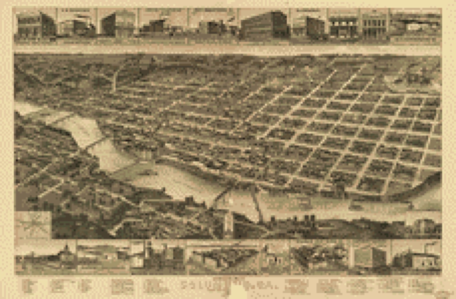
Bird's-eye view, 1886 - Perspective map of Columbus, Ga., county seat [of Muscogee Cou]nty, 188[6]
Bird's-eye view (1886) - Perspective map of Columbus, Ga., county seat [of Muscogee Cou]nty, 188[6]. Library of Congress.

Photographs from libraries nationwide

21 of 30 shown

Selected from the Digital Public Library of America's 30 image records catalogued for this county. Every one shown here carries a public-domain status or a licence that permits reuse on a site that carries advertising; non-commercial, share-alike and restricted images are excluded. The selection is spread across the county's towns (at most eight per town), so no single institution's bulk upload crowds out the rest. Each opens the holding library's record, and the complete set at the Digital Public Library of America is one click away.

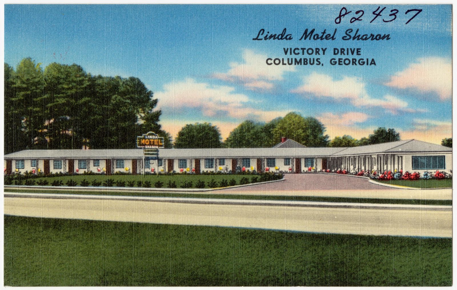
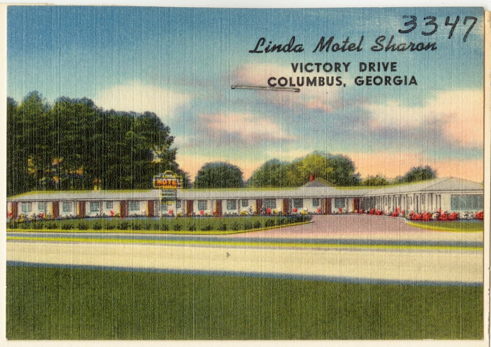
Linda Motel Sharon, Victory Drive, Columbus, Georgia, Boston Public Library - undated
Linda Motel Sharon, Victory Drive, Columbus, Georgia. Boston Public Library, via the Digital Public Library of America.
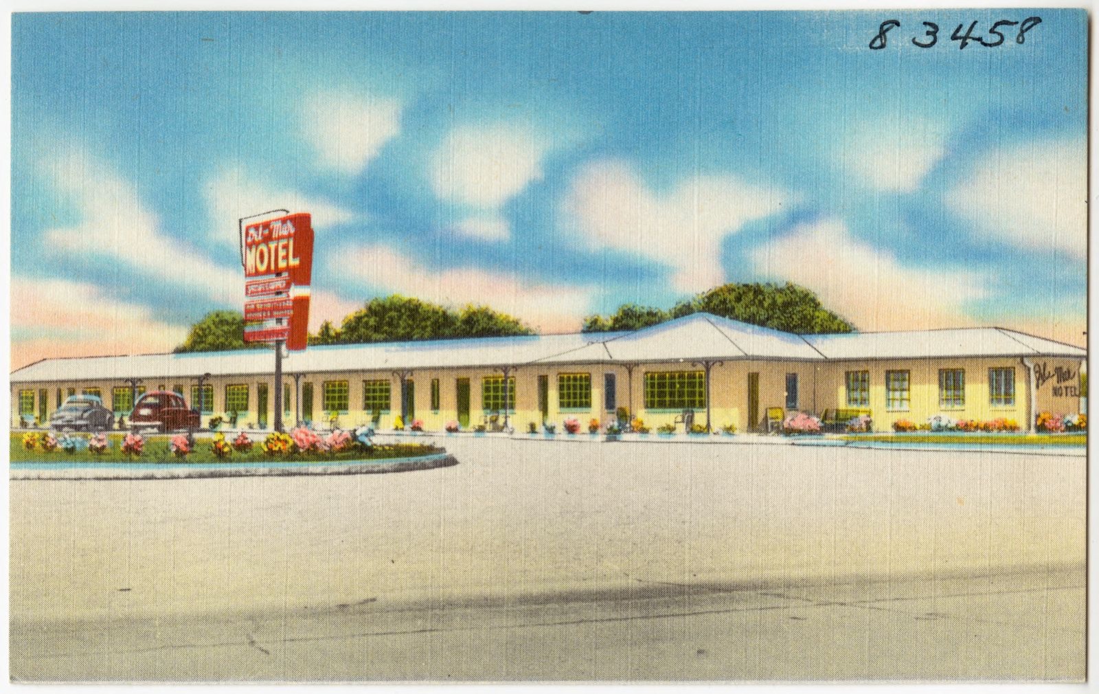
Del-Mar Motel, Boston Public Library - undated
Del-Mar Motel. Boston Public Library, via the Digital Public Library of America.
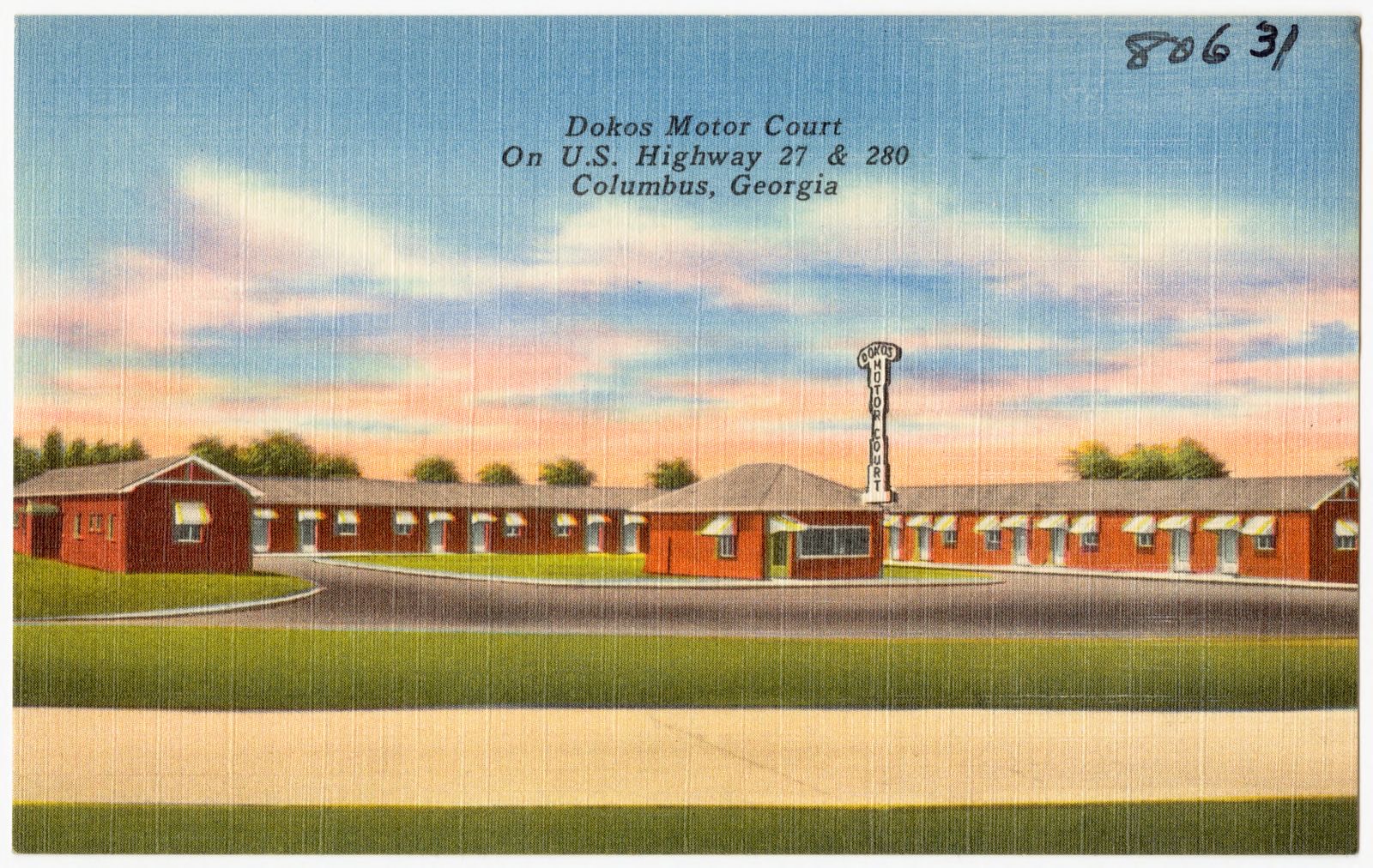
Dakos Motor court on U.S. Highway 27 & 280, Columbus, Georgia, Boston Public Library - undated
Dakos Motor court on U.S. Highway 27 & 280, Columbus, Georgia. Boston Public Library, via the Digital Public Library of America.
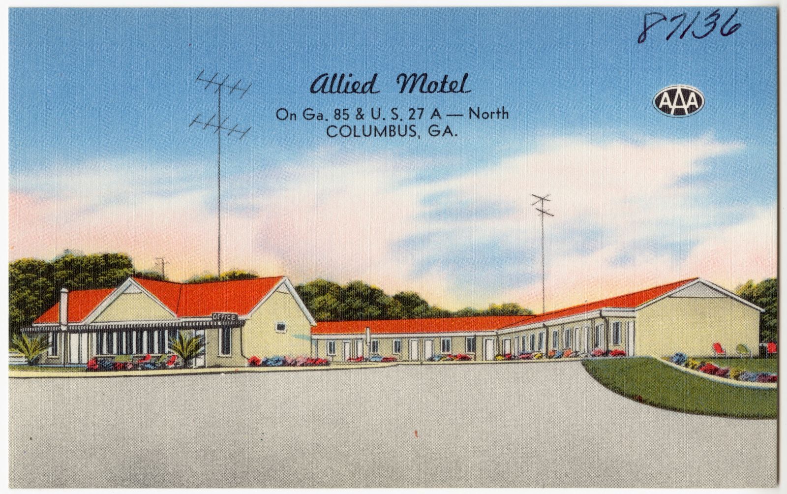
Allied Motel, on Ga. 85 & U. S. 27 A - north, Columbus, Ga., Boston Public Library - undated
Allied Motel, on Ga. 85 & U. S. 27 A - north, Columbus, Ga.. Boston Public Library, via the Digital Public Library of America.
Columbus, Ga., Boston Public Library - undated
Columbus, Ga.. Boston Public Library, via the Digital Public Library of America.
Columbus, Ga., Boston Public Library - undated
Columbus, Ga.. Boston Public Library, via the Digital Public Library of America.
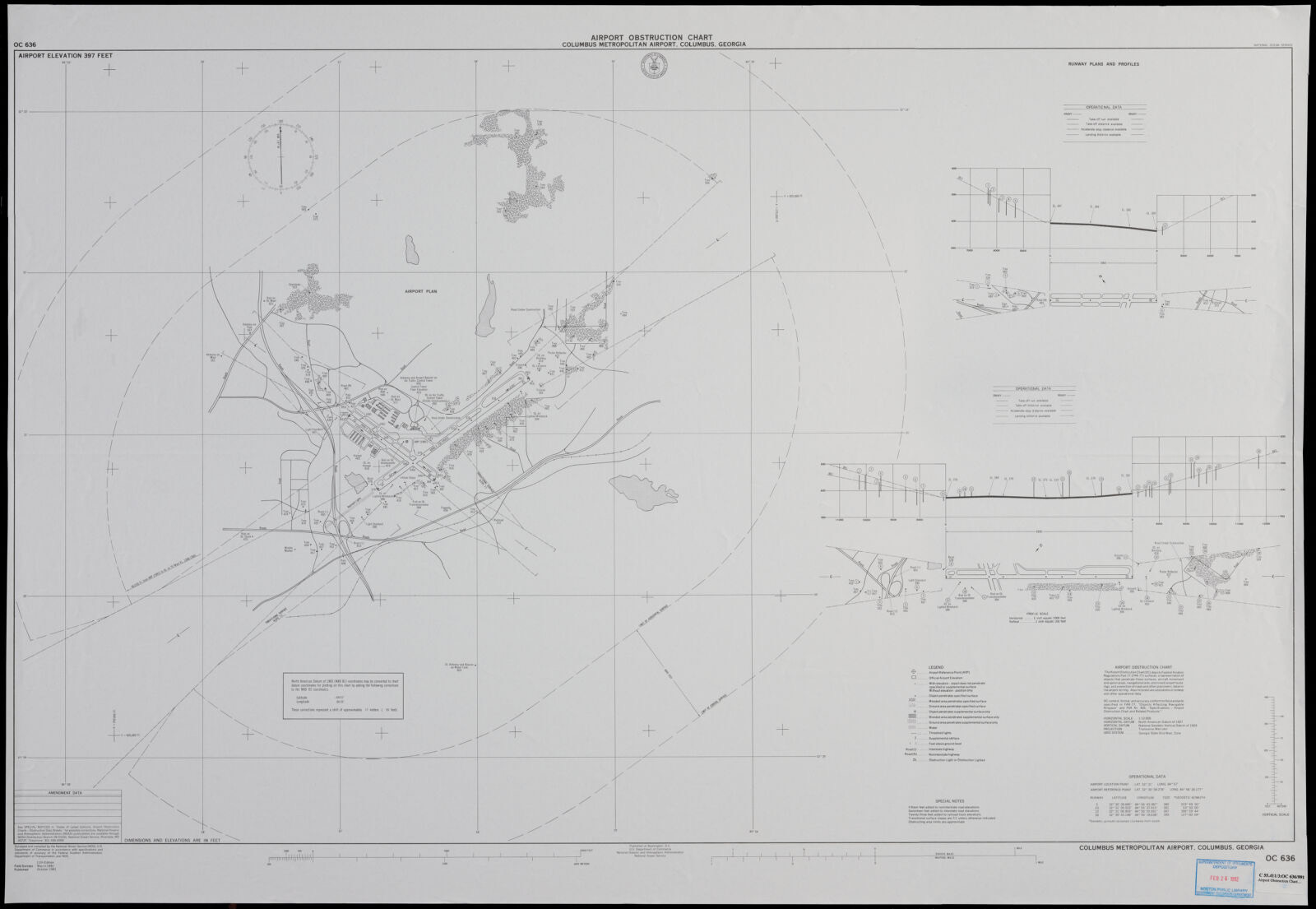
Airport obstruction chart, OC 636, Columbus Metropolitan Airport, Columbus, Georgia, Boston Public Library - undated
Airport obstruction chart, OC 636, Columbus Metropolitan Airport, Columbus, Georgia. United States. National Ocean Service, Boston Public Library, via the Digital Public Library of America.
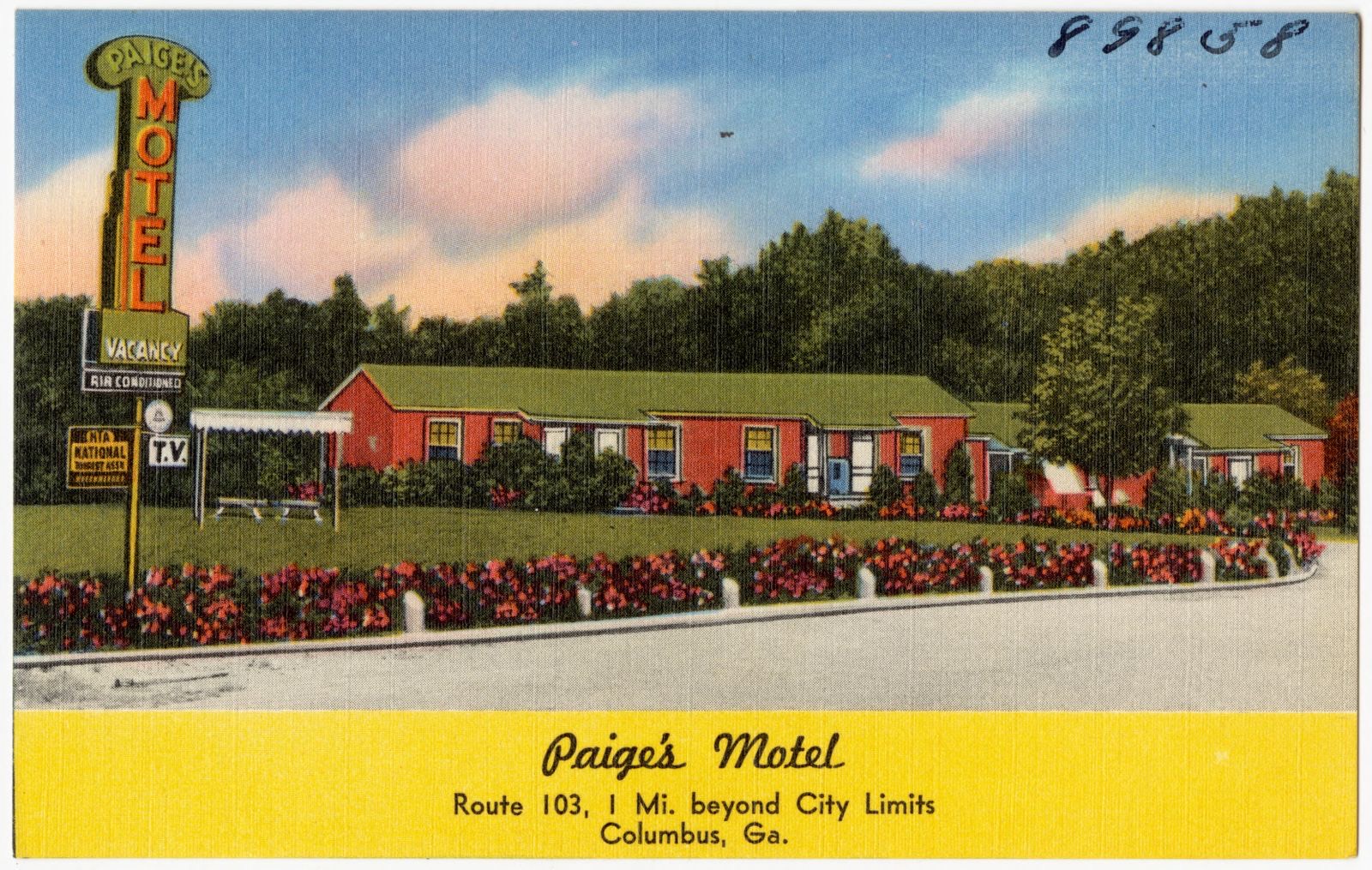
Paige's Motel, Route 103, 1 mi. beyond city limits, Columbus, Ga., Boston Public Library - undated
Paige's Motel, Route 103, 1 mi. beyond city limits, Columbus, Ga.. Boston Public Library, via the Digital Public Library of America.
Linda Motel Sharon, Victory Drive, Columbus, Georgia, Boston Public Library - undated
Linda Motel Sharon, Victory Drive, Columbus, Georgia. Boston Public Library, via the Digital Public Library of America.
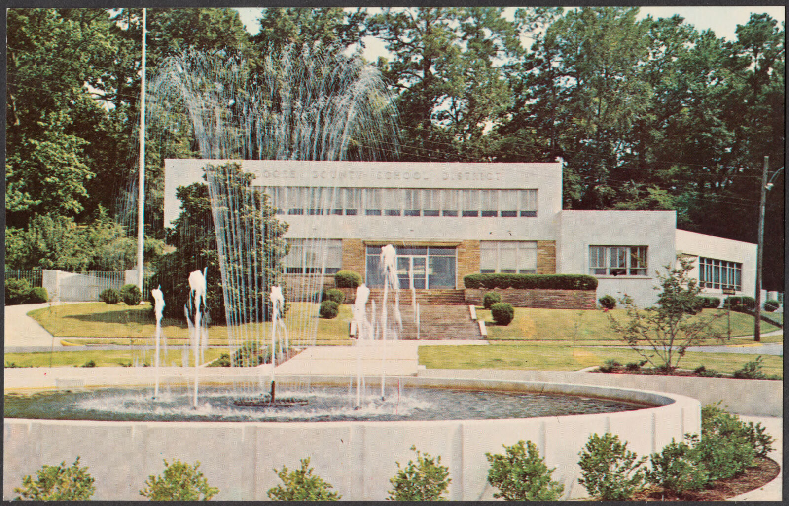
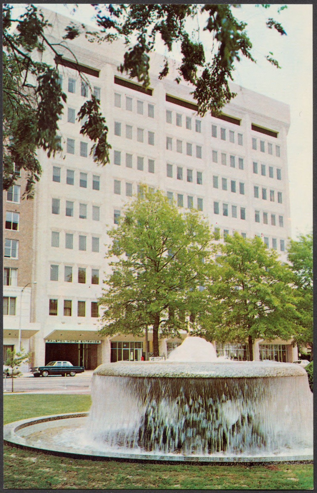
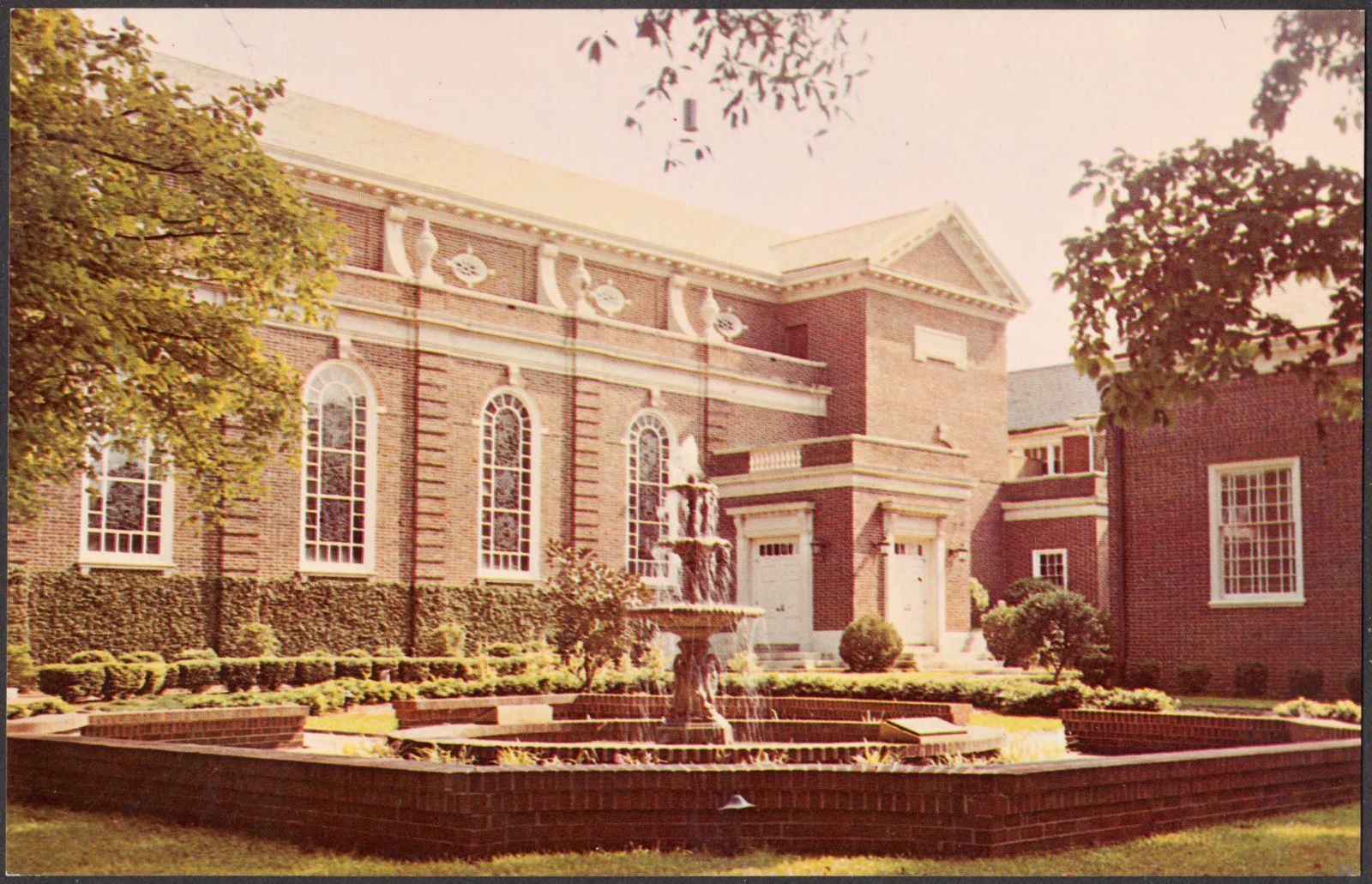
Columbus, Ga. - the fountain city, Boston Public Library - undated
Columbus, Ga. - the fountain city. Boston Public Library, via the Digital Public Library of America.
Columbus, Ga. - the fountain city, Boston Public Library - undated
Columbus, Ga. - the fountain city. Boston Public Library, via the Digital Public Library of America.
Columbus, Ga. - the fountain city, Boston Public Library - undated
Columbus, Ga. - the fountain city. Boston Public Library, via the Digital Public Library of America.
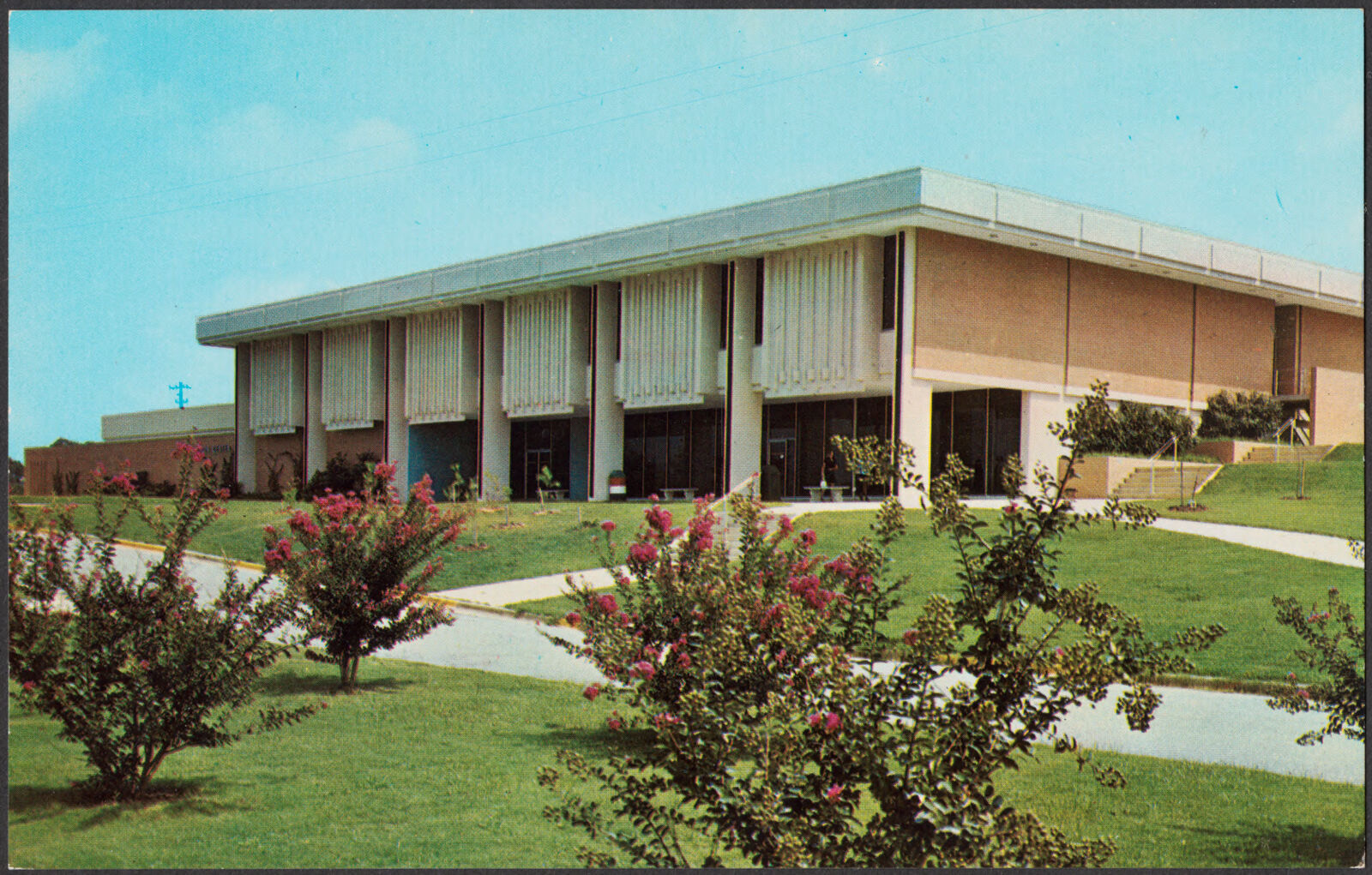
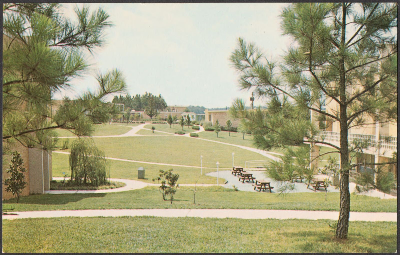
Columbus College, Columbus, Ga., Boston Public Library - undated
Columbus College, Columbus, Ga.. Boston Public Library, via the Digital Public Library of America.
Columbus, Ga., Boston Public Library - undated
Columbus, Ga.. Boston Public Library, via the Digital Public Library of America.
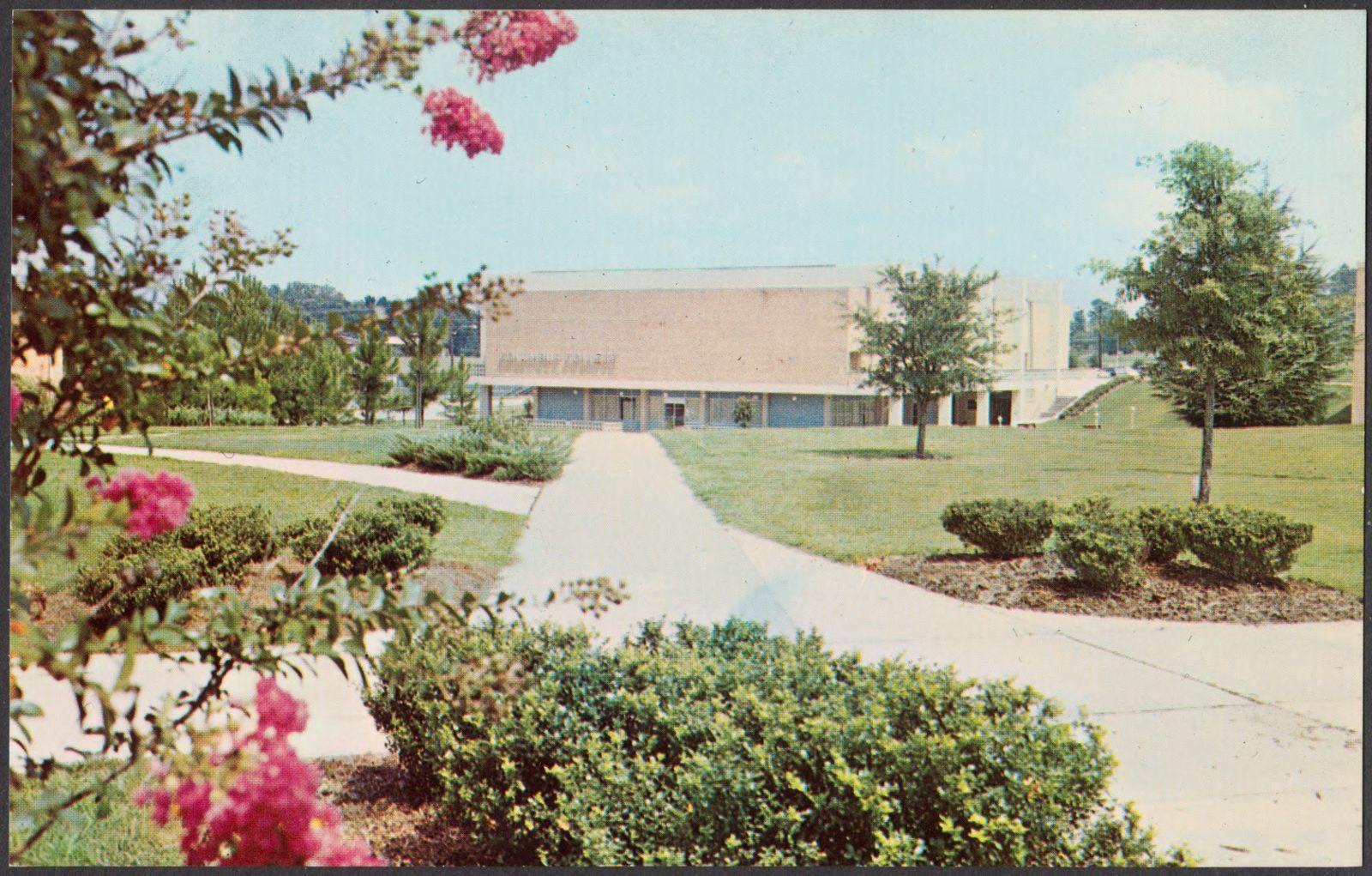
Columbus College, Columbus, Ga., Boston Public Library - undated
Columbus College, Columbus, Ga.. Boston Public Library, via the Digital Public Library of America.
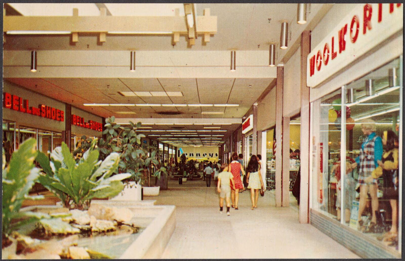
Columbus Square Shopping Center, Macon Rd. and Rigdon Rd, Columbus, Ga., Boston Public Library - undated
Columbus Square Shopping Center, Macon Rd. and Rigdon Rd, Columbus, Ga.. Boston Public Library, via the Digital Public Library of America.
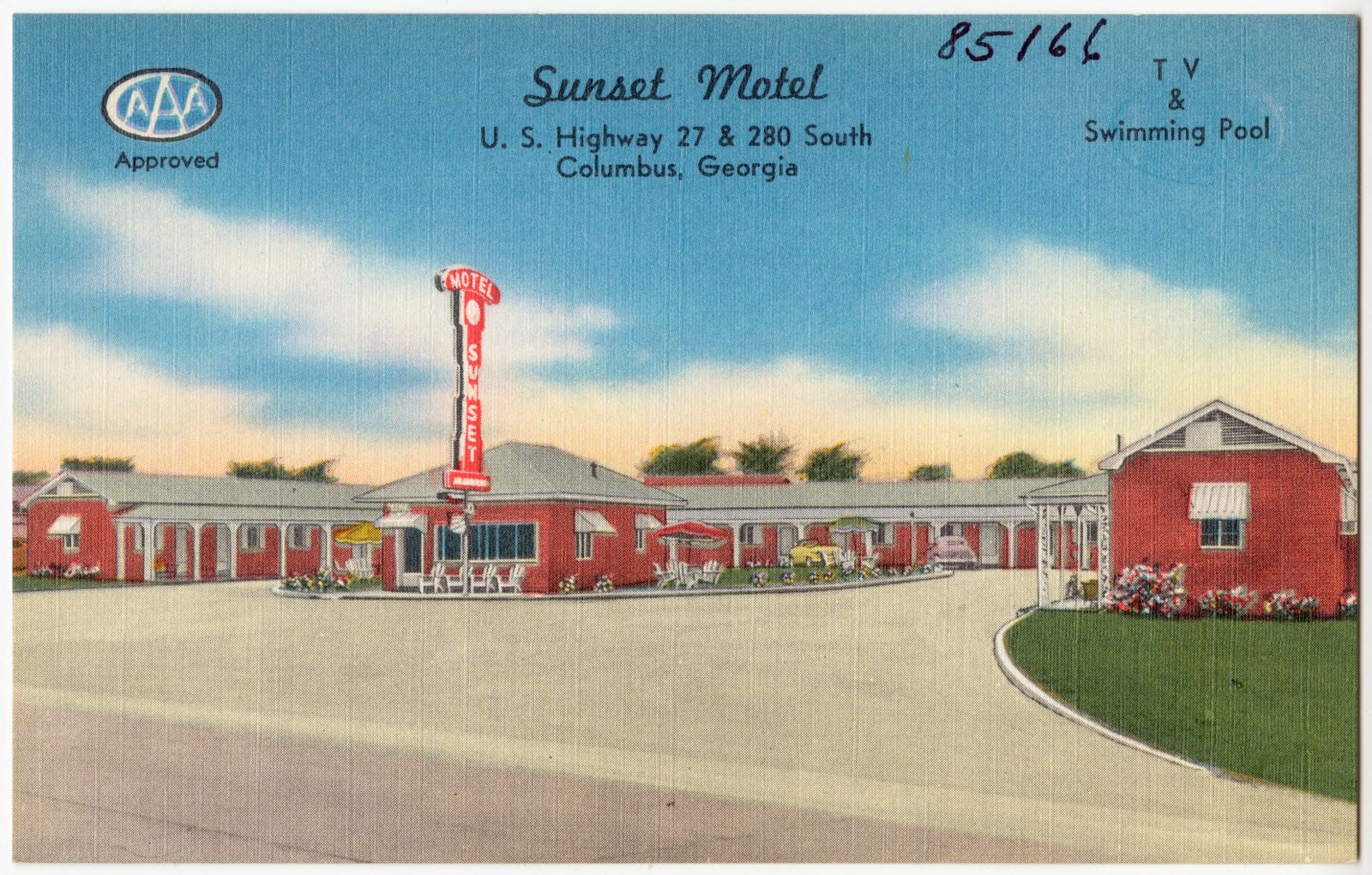
Sunset Motel, U. S. Highway 27 & 280 south, Columbus, Georgia, Boston Public Library - undated
Sunset Motel, U. S. Highway 27 & 280 south, Columbus, Georgia. Boston Public Library, via the Digital Public Library of America.
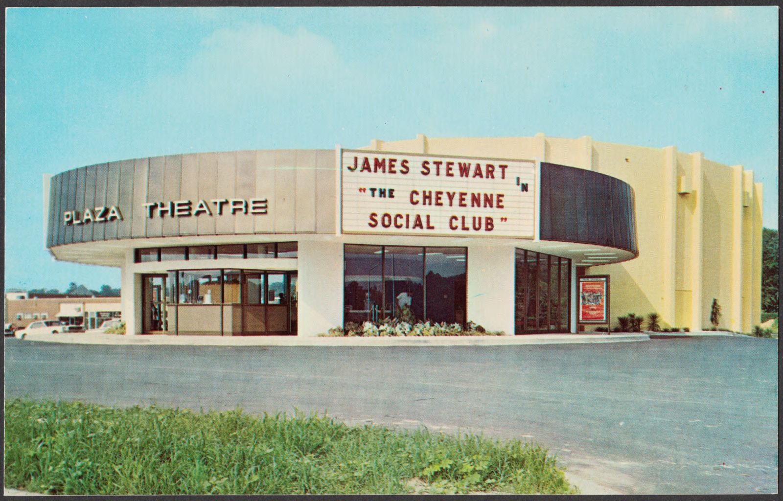
Columbus, Ga., Boston Public Library - undated
Columbus, Ga.. Boston Public Library, via the Digital Public Library of America.
Columbus, Ga., Boston Public Library - undated
Columbus, Ga.. Boston Public Library, via the Digital Public Library of America.
Columbus, Ga., Boston Public Library - undated
Columbus, Ga.. Boston Public Library, via the Digital Public Library of America.
Columbus, Georgia, Boston Public Library - undated
Columbus, Georgia. Boston Public Library, via the Digital Public Library of America.

The county from the air

12 shown

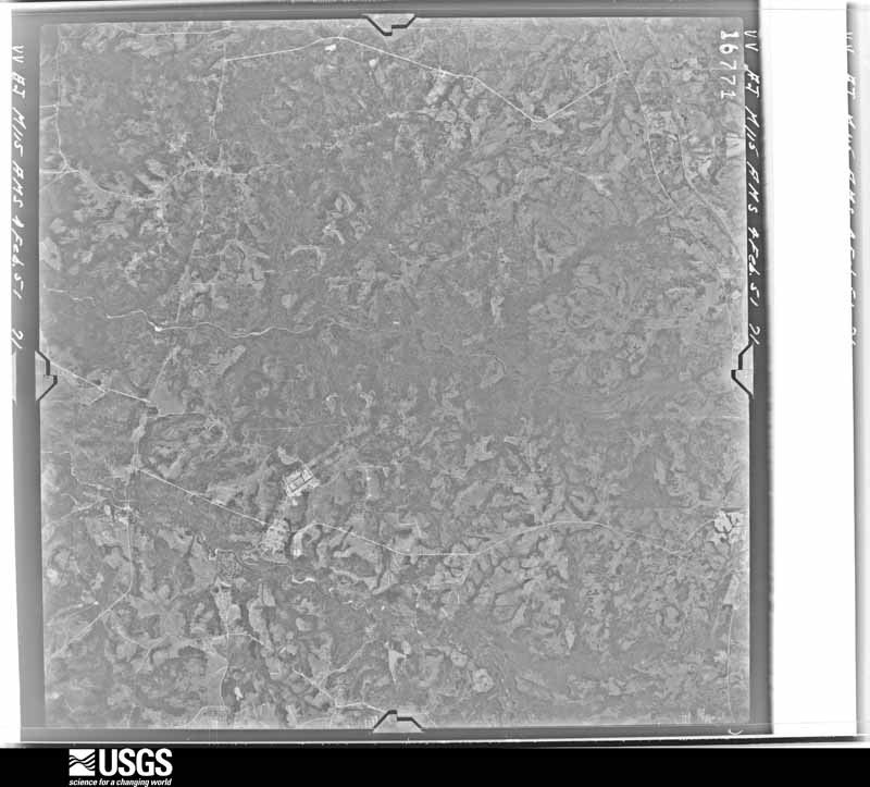
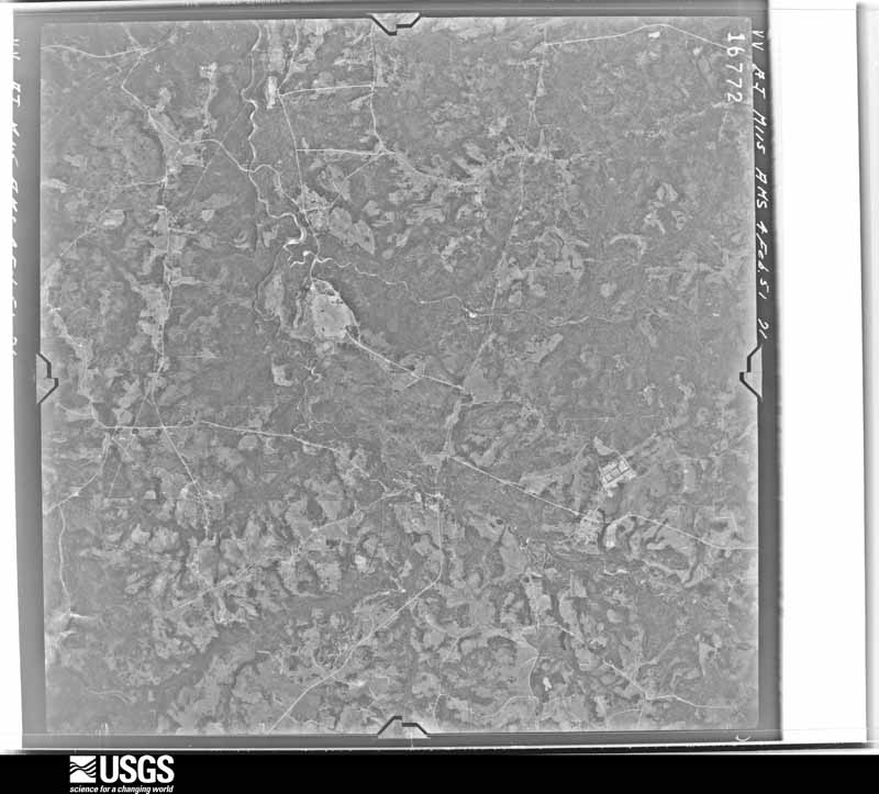
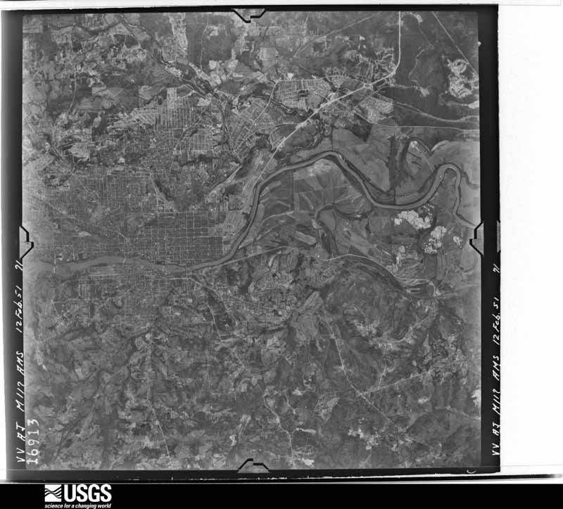
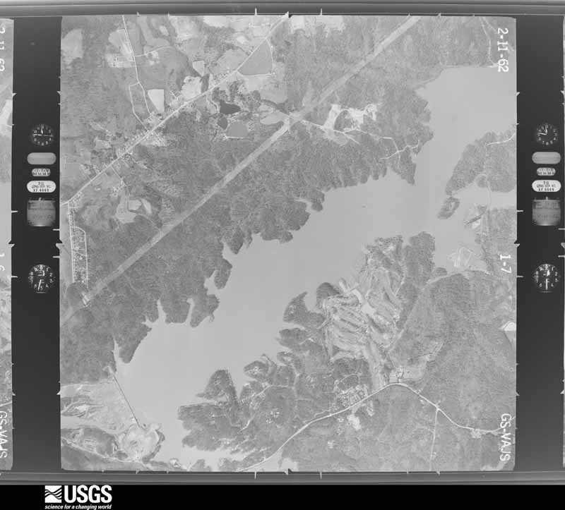
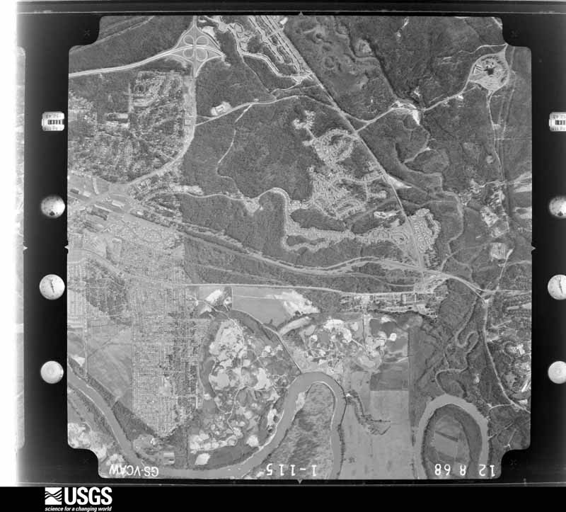
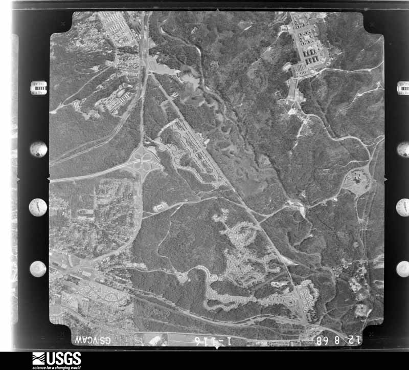
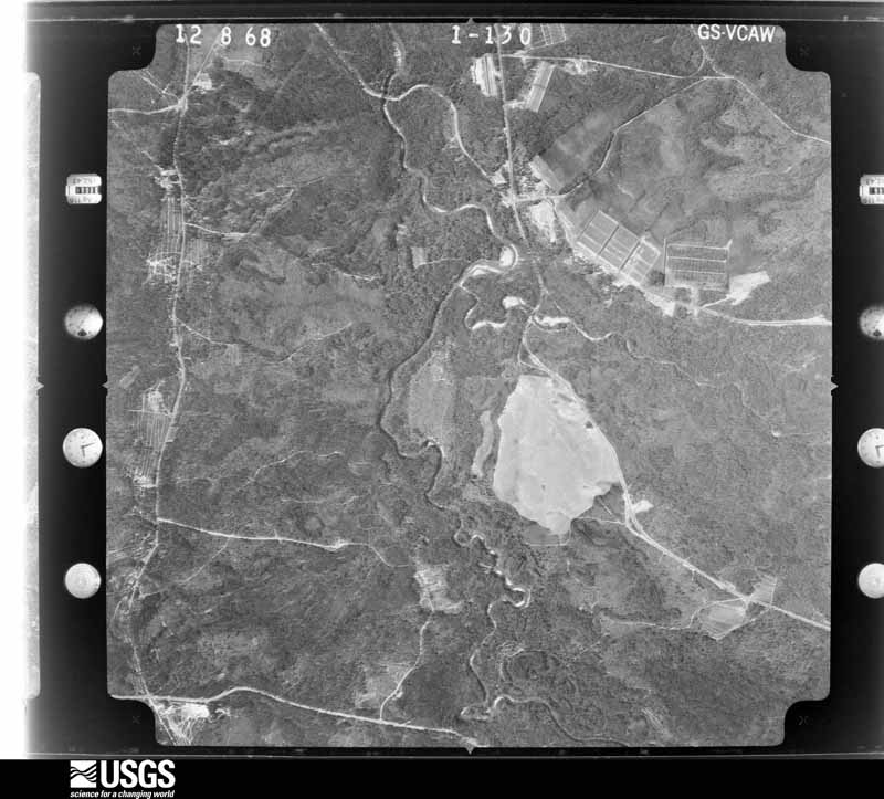
Flown by the U.S. Geological Survey between 1937 and 1989, the Aerial Photo Single Frames collection is the definitive mid-century view of the land: fields, roads and rivers as the camera saw them. The Survey holds 253 frames inside the rectangle that bounds this county; the 12 frames below were taken over the county itself, chosen across the decades of flights (at most four a year from that rectangle), so one flight cannot crowd out the rest. The full set is free to browse and download at EarthExplorer under the dataset Aerial Photo Single Frames.

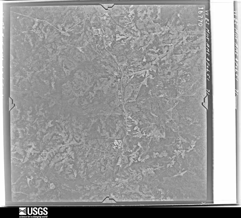
U.S. Geological Survey aerial photograph, 1951-02-04, scale 1:60000
1951-02-04, scale 1:60000. U.S. Geological Survey aerial photograph.
U.S. Geological Survey aerial photograph, 1951-02-04, scale 1:60000
1951-02-04, scale 1:60000. U.S. Geological Survey aerial photograph.
U.S. Geological Survey aerial photograph, 1951-02-04, scale 1:60000
1951-02-04, scale 1:60000. U.S. Geological Survey aerial photograph.
U.S. Geological Survey aerial photograph, 1951-02-12, scale 1:60000
1951-02-12, scale 1:60000. U.S. Geological Survey aerial photograph.
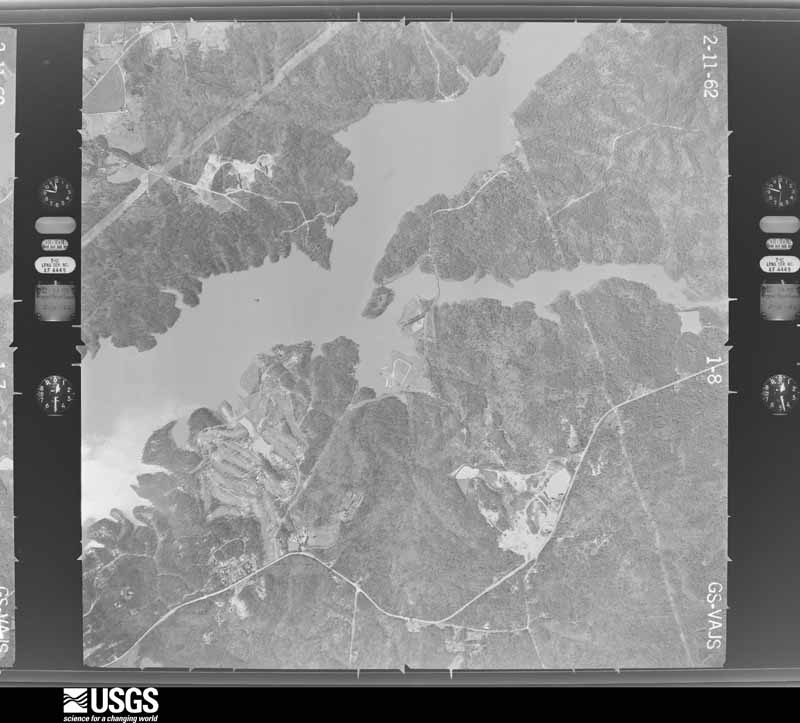
U.S. Geological Survey aerial photograph, 1962-02-11, scale 1:19000
1962-02-11, scale 1:19000. U.S. Geological Survey aerial photograph.
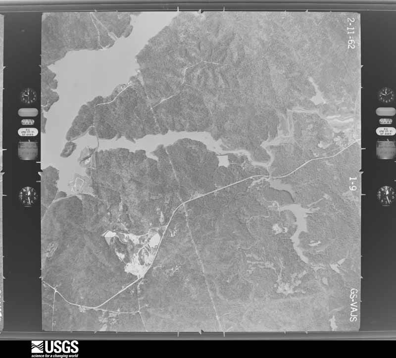
U.S. Geological Survey aerial photograph, 1962-02-11, scale 1:19000
1962-02-11, scale 1:19000. U.S. Geological Survey aerial photograph.
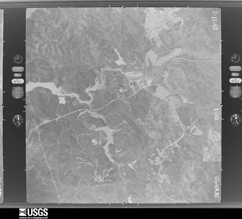
U.S. Geological Survey aerial photograph, 1962-02-11, scale 1:19000
1962-02-11, scale 1:19000. U.S. Geological Survey aerial photograph.
U.S. Geological Survey aerial photograph, 1962-02-11, scale 1:19000
1962-02-11, scale 1:19000. U.S. Geological Survey aerial photograph.
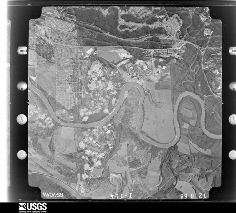
U.S. Geological Survey aerial photograph, 1968-12-08, scale 1:24800
1968-12-08, scale 1:24800. U.S. Geological Survey aerial photograph.
U.S. Geological Survey aerial photograph, 1968-12-08, scale 1:24800
1968-12-08, scale 1:24800. U.S. Geological Survey aerial photograph.
U.S. Geological Survey aerial photograph, 1968-12-08, scale 1:24800
1968-12-08, scale 1:24800. U.S. Geological Survey aerial photograph.
U.S. Geological Survey aerial photograph, 1968-12-08, scale 1:24800
1968-12-08, scale 1:24800. U.S. Geological Survey aerial photograph.

Weather records

6 stations, 6 gages

The thermometers that kept this county's weather, and the gages that measured the flow of its streams, as the federal records hold them. The extremes below are measured values from those records, not estimates.

The 1950 census, district by district

155 districts

Who lived here in 1950, one enumeration district at a time, as the Census Bureau described each district. Each row opens its official National Archives result, with Population Schedules and ED Maps available there.

  • 162-1Columbus city, comprising Militia Districts 668, Lower Town, 773, Upper Town, and parts of Militia Districts 772, McCrary and 921, Bozemans Columbus city - That part in Militia District 668, Lower Town, excluding Cardinal Hotel in Block 586 Bounded by 12th; 10th Ave.; 11th, 6th Ave., 10th; 4th Ave. This Enumeration District consists of the following blocks: 585, 586-part, 587, 588, 589, 590, 612
  • 162-2Columbus city - That part in Militia District 668, Lower Town, comprising Cardinal Hotel in Block 586
  • 162-3Columbus city - That part in Militia District 668, Lower Town Bounded by 10th, 6th Ave., 11th; 10th Ave.; 9th; 4th Ave. This Enumeration District consists of the following blocks: 609, 610, 611, 626, 627, 628, 629, 630, 631
  • 162-4Columbus city - That part in Militia District 668, Lower Town Bounded by 12th; 4th Ave.; 9th; 2nd Ave. This Enumeration District consists of the following blocks: 583, 584, 614, 615, 624, 625
  • 162-5Columbus city - That part in Militia District 668, Lower Town Bounded by 12th; 2nd Ave., 11th, 1st Ave.; 10th; Broadway. This Enumeration District consists of the following blocks: 581, 582, 617
  • 162-6Columbus city - That part in Militia District 668, Lower Town Bounded by Militia District Line, 12th; Broadway, 10th, 1st Ave., 11th, 2nd Ave.; 9th, Bay Ave., Dillingham, Dillingham Bridge; City limits. This Enumeration District consists of the following blocks: 578, 579, 580, 616, 618, 619, 620, 621, 622, 623, 715, 716
  • 162-7Columbus city - That part in Militia District 668, Lower Town Bounded by Dillingham Bridge, Dillingham, Bay Ave., 9th; 1st Ave., 8th, 2nd Ave.; 7th, Front Ave., 6th; City limits. This Enumeration District consists of the following blocks: 713, 714, 717, 718, 719, 720, 721, 889, 890
  • 162-8Columbus city - That part in Militia District 668, Lower Town Bounded by 9th; 4th Ave.; 7th; 2nd Ave., 8th, 1st Ave. This Enumeration District consists of the following blocks: 710, 711, 712, 722, 723, 724
  • 162-9Columbus city - That part in Militia District 668, Lower Town Bounded by 9th; 7th Ave.; 8th; 4th Ave. This Enumeration District consists of the following blocks: 707, 708, 709
  • 162-10Columbus city - That part in Militia District 668, Lower Town Bounded by 8th; 7th Ave.; 7th; 4th Ave. This Enumeration District consists of the following blocks: 725, 726, 727
  • 162-11Columbus city - That part in Militia District 668, Lower Town Bounded by 9th; 10th Ave.; 7th; 7th Ave. This Enumeration District consists of the following blocks: 704, 705, 706, 728, 729, 730
  • 162-12Columbus city - That part in Militia District 668, Lower Town Bounded by 7th; 10th Ave.; 6th, 5th Ave., 5th; 4th Ave. This Enumeration District consists of the following blocks: 780, 781, 782, 783, 784, 785, 797
  • 162-13Columbus city - That part in Militia District 668, Lower Town Bounded by 7th; 4th Ave.; 6th; Front Ave. This Enumeration District consists of the following blocks: 786, 787, 788, 789, 790
  • 162-14Columbus city - That part in Militia District 668, Lower Town Bounded by 6th; 4th Ave.; 5th; City limits. This Enumeration District consists of the following blocks: 791, 792, 793, 794, 795, 796
  • 162-15Columbus city - That part in Militia District 668, Lower Town Bounded by 5th; 4th Ave., 4th, 3rd Ave., Lumpkin Blvd., Militia District line; City limits; City limits. This Enumeration District consists of the following blocks: 862, 863, 864, 865, 866, 867, 868, 869, 870, 871
  • 162-16Columbus city - That part in Militia District 668, Lower Town Bounded by 6th; 10th Ave.; Lumpkin Blvd.; 3rd Ave., 4th, 4th Ave., 5th, 5th Ave. This Enumeration District consists of the following blocks: 798, 799, 800, 801, 802, 860, 861, 872
  • 162-17Columbus city - That part in Militia District 772, McCrary Bounded by City limits; City limits; Rosemont School Rd., Rosemont Dr., Phelts, 18th Ave., 39th; 17th Ave. This Enumeration District consists of the following blocks: 1, 32, 54, 55, 56, 58, 59, 60, 61, 95
  • 162-18Columbus city - That part in Militia District 772, McCrary Bounded by City limits; 17th Ave.; 35th; Howard Ave., 40th, 14th Ave., Hamilton Rd. This Enumeration District consists of the following blocks: 2, 3, 4, 5, 27, 28, 29, 30, 31, 33
  • 162-19Columbus city - That part in Militia District 772, McCrary Bounded by 43rd; Hamilton Rd.; 38th; River Rd., Dozier, Buck Ave. This Enumeration District consists of the following blocks: 23, 24, 25, 26, 34, 49, 50, 51, 64, 65, 66, 68, 90
  • 162-20Columbus city - That part in Militia District 772, McCrary Bounded by City limits; Hamilton Rd., 43rd, Buck Ave.; Dozier; River Rd. This Enumeration District consists of the following blocks: 6, 7, 8, 9, 10, 21, 22, 35, 36, 47, 48, 67
  • 162-21Columbus city - That part in Militia District 772, McCrary Bounded by City limits; River Rd.; 38th; Oates Ave. This Enumeration District consists of the following blocks: 11, 18, 19, 20, 37, 45, 46, 69
  • 162-22Columbus city - That part in Militia District 772, McCrary Bounded by City limits; Oates Ave.; 38th; Hickory Ave., 40th, 3rd Ave. This Enumeration District consists of the following blocks: 12, 42, 43, 44, 70, 71, 72, 73, 74, 75, 76, 77, 78, 79, 80, 81
  • 162-23Columbus city - That part in Militia District 772, McCrary Bounded by City limits; 3rd Ave., 40th, Hickory Ave.; 38th; City limits. This Enumeration District consists of the following blocks: 13, 14, 15, 16, 17, 38, 39, 40, 41, 82, 83
  • 162-24Columbus city - That part in Militia District 772, McCrary Bounded by 38th; 5th Ave.; 35th; City limits. This Enumeration District consists of the following blocks: 84, 85, 86
  • 162-25Columbus city - That part in Militia District 772, McCrary Bounded by City limits, 35th; 5th Ave.; 32nd; 1st Ave., City limits. This Enumeration District consists of the following blocks: 133, 134, 135, 136
  • 162-26Columbus city - That part in Militia District 772, McCrary Bounded by 38th; 7th Ave.; 33rd, 6th Ave., 32nd; 5th Ave. This Enumeration District consists of the following blocks: 87, 88, 124, 132
  • 162-27Columbus city - That part in Militia District 772, McCrary Bounded by 38th; River Rd., 35th, Central of Georgia Railroad; 33rd; 7th Ave. This Enumeration District consists of the following blocks: 89, 121, 122, 123
  • 162-28Columbus city - That part in Militia District 772, McCrary Bounded by 38th, Hamilton Rd.; 14th Ave., 40th, Howard Ave.; 35th, Hamilton Rd., 35th; River Rd. This Enumeration District consists of the following blocks: 52, 53, 62, 63, 91, 92, 93, 104, 105, 106, 107, 108, 109, 110, 111, 112, 113, 114
  • 162-29Columbus city - That part in Militia District 772, McCrary Bounded by 35th; 17th Ave.; Woodlawn Dr., 32nd; 14th Ave. This Enumeration District consists of the following blocks: 155, 159, 160, 161, 162
  • 162-30Columbus city - That part in Militia District 772, McCrary Bounded by 39th, 18th Ave., Phelts, Rosemont Dr., Rosemont School Rd.; City limits; Southern Railway, Hilton Ave., Spencer Blvd., Cherokee Ave., Slade Dr.; 17th Ave. This Enumeration District consist of the following blocks: 57, 94, 96, 97, 98, 99, 100, 101, 102, 103, 163, 164, 165, 166
  • 162-31Columbus city - That part in Militia District 772, McCrary Bounded by Southern Railway; City limits; Militia District line; Cherokee Ave., Spencer Blvd., Hilton Ave. This Enumeration District consists of the following blocks: 167, 168, 169, 170, 171, 172, 173, 174, 175, 176, 177, 178, 179N, 180, 181, 182, 183, 184, 266N, 267, 268, 269, 270N, 271N
  • 162-32Columbus city - That part of Militia District 772, McCrary Bounded by Slade Dr.; Cherokee Ave.; 27th; 17th Ave., Edgewood Rd. This Enumeration District consists of the following blocks: 185, 186, 201
  • 162-33Columbus city - That part in Militia District 772, McCrary Bounded by 32nd; Woodlawn Dr.; Edgewood Rd.; 14th Ave. Extended, 14th Ave. This Enumeration District consists of the following blocks: 187, 188, 189, 196, 197, 198, 208
  • 162-34Columbus city - That part in Militia District 772, McCrary Bounded by 35th, Hamilton Rd., 35th; 14th Ave.; 31st; Hamilton Rd., River Rd. This Enumeration District consists of the following blocks: 115, 116, 117, 118, 119, 148, 149, 150, 151, 152, 153, 154, 156, 157, 158, 190, 191, 192
  • 162-35Columbus city - That part in Militia District 772, McCrary Bounded by 32nd, 6th Ave., Belmont, Central of Georgia Railroad, 35th; River Rd., Hamilton Rd.; 29th; 5th Ave. This Enumeration District consists of the following blocks: 120, 143, 144, 232, 233, 234
  • 162-36Columbus city - That part in Militia District 772, McCrary Bounded by 33rd; Central of Georgia Railroad; Belmont; 6th Ave. This Enumeration District consists of the following blocks: 125, 126, 127, 128, 129, 130, 131
  • 162-37Columbus city - That part in Militia District 772, McCrary Bounded by 32nd; 5th Ave., 29th, 4th Ave.; 28th; 3rd Ave. This Enumeration District consists of the following blocks: 141, 142, 239
  • 162-38N/A
  • 162-39Columbus city - That part in Militia District 772, McCrary Bounded by City limits, Gordon Blvd.; 1st Ave., 28th, 2nd Ave., 25th, 1st Ave.; 22nd, Militia District line; City limits. This Enumeration District consists of the following blocks: 242N, 243, 290, 291, 292, 293, 877, 878, 879, 880
  • 162-40Columbus city - That part in Militia District 772, McCrary Bounded by 28th; 3rd Ave.; 22nd; 1st Ave., 25th, 2nd Ave. This Enumeration District consists of the following blocks: 244, 289, 294, 324, 325, 326, 327, 334, 335
  • 162-41Columbus city - That part in Militia District 772, McCrary Bounded by 28th; 4th Ave.; 23rd; 3rd Ave. This Enumeration District consists of the following blocks: 238, 345, 346, 395, 875, 876
  • 162-42Columbus city - That part in Militia District 772, McCrary Bounded by 29th; Hamilton Rd.; 25th; 4th Ave. This Enumeration District consists of the following blocks: 235, 236, 237, 247, 248, 288
  • 162-43Columbus city - That part in Militia District 772, McCrary Bounded by 29th; 14th Ave., 14th Ave. extended; Edgewood Rd., Talbotton Rd, 27th; Hamilton Rd. This Enumeration District consists of the following blocks: 223, 224, 225, 226, 227, 228, 229, 230, 231, 249, 250, 251, 252, 253, 254, 255
  • 162-44Columbus city - That part in Militia District 772, McCrary Bounded by 31st; 14th Ave.; 29th; Hamilton Rd. This Enumeration District consists of the following blocks: 145, 146, 147, 193, 194, 195, 209, 210, 211, 212, 213, 214, 215, 216, 217, 218, 219, 220, 221, 222
  • 162-45Columbus city - That part in Militia District 772, McCrary Bounded by Talbotton Rd., Edgewood Rd.; 17th Ave.; 25th, 16th Ave., 27th, 14th Ave., 24th; 12th Ave. This Enumeration District consists of the following blocks: 199, 200, 205, 206, 207
  • 162-46Columbus city - That part in Militia District 772, McCrary Bounded by 27th, 16th Ave., 25th, 17th Ave., 27th; Cherokee Ave.; 23rd; 15th Ave. This Enumeration District consists of the following blocks: 202, 203, 204, 257, 258, 261, 262, 263, 264, 265, 279
  • 162-47Columbus city - That part in Militia District 772, McCrary Bounded by 24th, 14th Ave., 27th; 15th Ave.; 23rd; 12th Ave. This Enumeration District consists of the following blocks: 256, 259, 260, 280, 281, 282
  • 162-48Columbus city - That part in Militia District 772, McCrary Bounded by 27th, Talbotton Rd.; 12th Ave.; 23rd, Militia District line; Comer Ave., Olive. This Enumeration District consists of the following blocks: 283, 284N, 285, 300N, 301N, 302N
  • 162-49Columbus city - That part in Militia District 772, McCrary Bounded by 27th; Olive, Comer Ave.; Militia District line; North Ave. This Enumeration District consists of the following blocks: 286, 299, 318N
  • 162-50Columbus city - That part in Militia District 772, McCrary Bounded by 27th; North Ave.; 22nd; Hamilton Rd. This Enumeration District consists of the following blocks: 287, 298, 319, 328, 329
  • 162-51Columbus city - That part in Militia District 772, McCrary Bounded by 25th; Hamilton Rd.; 22nd, Militia District line, 22nd; 3rd Ave., 23rd, 4th Ave. This Enumeration District consists of the following blocks: 296, 297, 320, 321, 322, 323, 330, 331, 332, 333, 339N, 340N
  • 162-52Columbus city - That part in Militia District 773, Upper Town Bounded by 17th, 5th Ave., 17th; 10th Ave.; 15th; 3rd Ave. This Enumeration District consists of the following blocks: 428, 429, 430, 463, 464, 465, 466, 467, 468, 469, 470, 476, 477, 478, 479
  • 162-53Columbus city - That part in Militia District 773, Upper Town Bounded by Militia District line, 17th; 3rd Ave., 16th, 2nd Ave.; 15th; City limits. This Enumeration District consists of the following blocks: 426, 427, 471, 472, 473, 474, 886, 887
  • 162-54Columbus city - That part in Militia District 773, Upper Town Bounded by 15th, 2nd Ave., 16th; 3rd Ave.; 14th, 14th St. Bridge; City limits. This Enumeration District consists of the following blocks: 475, 529, 530, 531, 532, 888
  • 162-55Columbus city - That part in Militia District 773, Upper Town, excluding Waverly Hotel in Block 536 Bounded by 14th; 3rd; 13th; Front Ave. This Enumeration District consists of the following blocks: 534, 535, 536-part, 537, 538
  • 162-56Columbus city - That part in Militia District 773, Upper Town, comprising Waverly Hotel in Block 536
  • 162-57Columbus city - That part in Militia District 773, Upper Town Bounded by 15th; 10th Ave.; 14th, 5th Ave., 13th; 3rd Ave.; Tnis Enumeration District consists of the following blocks: 522, 523, 524, 525, 526, 527, 528, 539, 540
  • 162-58Columbus city - That part in Militia District 773, Upper Town Bounded by 13th, 5th Ave., 14th; 10th Ave.; 12th; 3rd Ave. This Enumeration District consists of the following blocks: 541, 542, 543, 544, 545, 567, 568, 569, 570, 571, 572, 573
  • 162-59Columbus city - That part in Militia District 773, Upper Town excluding Ralston Hotel in Block 574 Bounded by 14th St. Bridge, Front Ave., 13th; 3rd; 12th, Militia District line; City limits. This Enumeration District consists of the following blocks: 533, 574-part, 575, 576, 577
  • 162-60Columbus city - That part in Militia District 773, Upper Town, comprising Ralston Hotel in Block 574
  • 162-61AColumbus city - That part in Militia District 921, Bozemans Bounded by Militia District line; City limits; Wynnton Rd., 15th, Hilton Ave., 17th; Carter Ave., 19th, Wildwood Ave., Sonora, Oak Ave. This Enumeration District consists of the following blocks: 179S, 270S, 271S, 403, 404, 444, 445, 448, 500
  • 162-61BColumbus city - That part in Militia District 921, Bozemans Bounded by Militia District line; Oak Ave., Sonora, Wildwood Ave., 19th, Carter Ave.; 17th; Cherokee Ave. This Enumeration District consists of the following blocks: 266S, 272, 273, 274, 399, 400, 401, 402, 405, 406, 407
  • 162-62Columbus city - That part in Militia District 921, Bozemans Bounded by 23rd; Cherokee Ave.; 17th; 15th Ave., 22nd, 14th Ave. This Enumeration District consists of the following blocks: 275, 276, 277, 278, 306, 307, 308, 370, 371, 372, 373, 396, 397, 398, 408, 409
  • 162-63Columbus city - That part in Militia District 921, Bozemans Bounded by 23rd; 14th Ave., 22nd, 15th Ave.; 19th; 13th Ave. This Enumeration District consists of the following blocks: 305, 309, 310, 368, 369, 374, 375
  • 162-64Columbus city - That part in Militia District 921, Bozemans Bounded by Militia District line, 23rd; 13th Ave.; 19th; 11th Ave. This Enumeration District consists of the following blocks: 284S, 302S, 303, 304, 311, 312, 366, 367, 376, 377
  • 162-65Columbus city - That part in Militia District 921, Bozemans Bounded by Militia District line; 11th Ave.; 19th; 10th Ave., Talbotton Rd. This Enumeration District consists of the following blocks: 301S, 313, 314, 315, 316, 317, 363, 364, 365
  • 162-66Columbus city - That part in Militia District 921, Bozemans Bounded by 22nd, Militia District line; Talbotton Rd., 10th Ave.; 19th; 7th Ave., 20th, Hamilton Rd. This Enumeration District consists of the following blocks: 300S, 318S, 342, 343, 344, 345, 358, 359, 360, 361, 362, 378, 379, 380
  • 162-67Columbus city - That part in Militia District 921, Bozemans Bounded by 22nd, Militia District line, 22nd; Hamilton Rd.; Hamilton Rd., 5th Ave., 20th; 3rd Ave. This Enumeration District consists of the following blocks: 338, 339S, 340S, 341, 346, 347, 348, 349, 356
  • 162-68Columbus city - That part in Militia District 921, Bozemans Bounded by 22nd; 3rd Ave.; 17th; 2nd Ave. This Enumeration District consists of the following blocks: 337, 350, 353, 383, 424
  • 162-69Columbus city - That part in Militia District 921, Bozemans Bounded by Militia District line, 22nd; 2nd Ave.; 17th, Militia District line; City limits. This Enumeration District consists of the following blocks: 242S, 336, 351, 352, 382, 425, 881, 882, 883, 884, 885
  • 162-70Columbus city - That part in Militia District 921, Bozemans Bounded by 20th; 5th Ave., Hamilton Rd.; 17th; 3rd Ave. This Enumeration District consists of the following blocks: 354, 355, 384, 385, 423
  • 162-71Columbus city - That part in Militia District 921, Bozemans Bounded by 20th; 7th Ave.; 17th, 5th Ave., 17th; Hamilton Rd. This Enumeration District consists of the following blocks: 357, 381, 386, 419, 420, 421, 422
  • 162-72Columbus city - That part in Militia District 921, Bozemans Bounded by 19th; 10th Ave.; 17th; 7th Ave. This Enumeration District consists of the following blocks: 387, 388, 389, 390, 415, 416, 417, 418
  • 162-73Columbus city - That part in Militia District 921, Bozemans Bounded by 19th; 12th Ave.; Linwood Blvd.; 10th Ave. This Enumeration District consists of the following blocks: 391, 392, 413, 414, 431, 432
  • 162-74Columbus city - That part in Militia District 921, Bozemans Bounded by 19th; 15th Ave.; 17th, Linwood Blvd.; 12th Ave. This Enumeration District consists of the following blocks: 393, 394, 395, 410, 411, 412, 433
  • 162-75Columbus city - That part in Militia District 921, Bozemans Bounded by Linwood Blvd.; 13th Ave.; 15th; 10th Ave. This Enumeration District consists of the following blocks: 458, 459, 460, 461, 462, 480
  • 162-76Columbus city - That part in Militia District 921, Bozemans Bounded by 17th; 15th Ave.; 15th; 13th Ave. This Enumeration District consists of the following blocks: 434, 435, 456, 457, 481, 482, 486, 487, 488
  • 162-77Columbus city - That part in Militia District 921, Bozemans Bounded by 17th; 18th Ave.; 15th; 15th Ave. This Enumeration District consists of the following blocks: 436, 437, 438, 454, 455, 483, 484, 485
  • 162-78Columbus city - That part in Militia District 921, Bozemans Bounded by 17th; Wildwood Ave.; 13th, Peacock Ave., 13th; 18th Ave. This Enumeration District consists of the following blocks: 439, 440, 441, 442, 451, 452, 453, 495, 496, 498, 513, 514, 515
  • 162-79Columbus city - That part in Militia District 921, Bozemans Bounded by 17th; Hilton Ave., 15th; Wynnton Rd.; Wildwood Ave. This Enumeration District consists of the following blocks: 443, 449, 450, 498, 499, 501, 508, 509
  • 162-80Columbus city - That part in Militia District 921, Bozemans Bounded by Wynnton Rd.; City limits; E. Wynnton Lane; Lawyers Lane, Marion, Briarwood Ave. This Enumeration District consists of the following block: 446
  • 162-81Columbus city - That part in Militia District 921, Bozemans Bounded by Wynnton Rd.; Briarwood Ave.; Marion; Lawyers Lane. This Enumeration District consists of the following blocks: 447, 502, 503, 504, 505, 506, 507
  • 162-82Columbus city - That part in Militia District 921, Bozemans Bounded by Wynnton Rd.; Lawyers Lane; Gould; Henry Ave. This Enumeration District consists of the following blocks: 594, 595, 647, 648, 649, 650, 651, 652
  • 162-83Columbus city - That part in Militia District 921, Bozemans Bounded by 13th, Peacock Ave., 13th; Wildwood Ave.; Wynnton Rd.; 18th Ave. This Enumeration District consists of the following blocks: 510, 511, 512, 553, 554, 555, 556, 557, 558, 559, 593
  • 162-84Columbus city - That part in Militia District 921, Bozemans Bounded by 15th; 18th Ave.; 13th; 13th Ave., 14th, 11th Ave. This Enumeration District consists of the following blocks: 489, 490, 491, 492, 493, 494, 516, 517, 518, 519
  • 162-85Columbus city - That part in Militia District 921, Bozemans Bounded by 15th; 11th Ave., 14th, 13th Ave.; 13th; 10th Ave. This Enumeration District consists of the following blocks: 520, 521, 546, 547, 548, 549, 550, 551
  • 162-86Columbus city - That part in Militia District 921, Bozemans Bounded by 13th; Buena Vista Rd.; Wynnton Rd.; 10th Ave. This Enumeration District consists of the following blocks: 564, 565, 566, 591
  • 162-87Columbus city - That part in Militia District 921, Bozemans Bounded by 13th; 18th Ave.; Wynnton Rd.; Buena Vista Rd. This Enumeration District consists of the following blocks: 552, 592, 560, 561, 562, 563
  • 162-88Columbus city - That part in Militia District 921, Bozemans Bounded by Wynnton Rd.; Britt Ave.; Buena Vista Rd. This Enumeration District consists of the following blocks: 597, 598, 599, 600, 601, 642, 643, 660
  • 162-89Columbus city - That part in Militia District 921, Bozemans Bounded by Wynnton Rd.; Henry Ave.; Buena Vista Rd.; Britt Ave. This Enumeration District consists of the following blocks: 596, 644, 645, 646, 659, 661, 662
  • 162-90Columbus city - That part in Militia District 921, Bozemans Bounded by Gould; Lawyers Lane; Buena Vista Rd.; Henry Ave. This Enumeration District consists of the following blocks: 653, 658, 663
  • 162-91Columbus city - That part in Militia District 921, Bozemans Bounded by E. Wynnton Lane; City limits; City limits, 9th, Spencer Ave., Thomas; Lawyers Lane. This Enumeration District consists of the following blocks: 554, 655, 656, 664, 665, 666, 667, 668, 669, 672, 673
  • 162-92Columbus city - That part in Militia District 921, Bozemans Bounded by Thomas, Spencer Ave., 9th; City limits; Buena Vista Rd.; Lawyers Lane. This Enumeration District consists of the following blocks: 670, 671, 674, 675, 676, 677, 688, 689, 690, 691, 692
  • 162-93Columbus city - That part in Militia District 921, Bozemans Bounded by 8th, Lawyers Lane; Buena Vista Rd., Radcliff Ave.; Willow, Holland, 7th; Brown Ave. This Enumeration District consists of the following blocks: 763, 687, 693, 694
  • 162-94Columbus city - That part in Militia District 921, Bozemans Bounded by Buena Vista Rd.; Lawyers Lane; 8th; Brown Ave. This Enumeration District consists of the following blocks: 678, 679, 680, 681, 682, 683, 684, 685, 686
  • 162-95N/A
  • 162-96N/A
  • 162-97N/A
  • 162-98N/A
  • 162-99Columbus city - That part in Militia District 921, Bozemans Bounded by 9th, Central of Georgia Railroad; 7th, 12th Ave., Cusseta Rd., 11th Ave.; South; 10th Ave. This Enumeration District consists of the following blocks: 731, 732, 803, 804
  • 162-100Columbus city - That part in Militia District 921, Bozemans Bounded by 8th; Palmetto Ave.; William; Central of Georgia Railroad, Oak View Ave. This Enumeration District consists of the following blocks: 738 739 740 741742 743 744
  • 162-101Columbus city - That part in Militia District 921, Bozemans Bounded by 7th, Holland, Willow; Radcliff Ave., 5th, City limits; City limits, Seaboard Air Line Railroad; Brown Ave. This Enumeration District consists of the following blocks: 750 751 725 753 754 755 756 757 758 759 760 761 762 769 816
  • 162-102Columbus city - That part in Militia District 921, Bozemans Bounded by Buena Vista Rd.; City limits; 5th; Radcliff Ave. This Enumeration District consists of the following blocks: 764, 765, 766, 767, 768
  • 162-103Columbus city - That part in Militia District 921, Bozemans Bounded by Seaboard Air Line Railroad; City limits; Mellon, Clover Lane, Andrews Rd., Cusseta Rd.; 19th Ave. This Enumeration District consists of the following blocks: 771, 772, 814, 815, 817, 818
  • 162-104Columbus city - That part in Militia District 921, Bozemans Bounded by 7th, Central of Georgia Railroad; 15th Ave., Cusseta Rd., 15th Ave.; Werecoba Creek; Cusseta Rd., 12th Ave. This Enumeration District consists of the following blocks: 775, 776, 777, 778, 779, 806, 807, 808, 809, 837
  • 162-105Columbus city - That part in Militia District 921, Bozemans Bounded by South, 11th Ave., Cusseta Rd., Werecoba Creek, 15th Ave., Cusseta Rd., 15th Ave., Central of Georgia Railroad; 19th Ave., Cusseta Rd., 19th Ave., Werecoba Creek; City limits; Militia District line, 10th Ave. This Enumeration District consists of the following blocks: 773, 774, 805, 810, 811, 812, 834, 835, 836, 838, 839, 840, 841, 856, 857, 858, 859, 873, 874
  • 162-106Columbus city - That part in Militia District 921, Bozemans Bounded by Cusseta Rd; Glade Rd.; City limits; Werecoba Creek, 19th Ave. This Enumeration District consists of the following blocks: 813; 831, 832, 833, 842, 843, 844, 845, 854, 855
  • 162-107Columbus city - That part in Militia District 921, Bozemans Bounded by Andrews Rd., Clover Lane, Mellon; 28th Ave.; Cusseta Rd. This Enumeration District consists of the following blocks: 820, 821, 822, 823, 824, 825, 826, 827, 828, 829, 830
  • 162-108Columbus city - That part in Militia District 921, Bozemans Bounded by City limits; City limits; Cusseta Rd.; 28th Ave. This Enumeration District consists of the following blocks: 819
  • 162-109Columbus city - That part in Militia District 921, Bozemans Bounded by Cusseta Rd.; City limits; Glade Rd. This Enumeration District consists of the following blocks: 846, 847, 848, 849, 850, 851, 852, 85
  • 106-1Militia District 675, Upatoie: Militia District 675, Upatoie, excluding Fort Benning (part)
  • 106-2Fort Benning - That part in Militia District 675, Upatoie (Remainder of Fort Benning comprises parts of Militia Districts 774, Steam Mill, 921, Bozemans, and That part not in any Militia District; That part of Chattahoochee County not in any Militia District; parts of Militia Districts 948, Brantley, and 1339, Pine Knot, in Marion County; part of Militia District 688, Box Springs, in Talbot County; and parts of Precincts 1, Phenix City, and 8, Oswichee, in Russell County, Alabama)
  • 106-3Militia District 772, McCrary, outside Columbus city: Bibb City town: Bibb City town - That part Bounded by Town limits; Town limits, 1st Ave., Hemlock Ave., Park Ave., Porter Dr., Hanson Ave., 38th, Town limits; Town limits; Town limits
  • 106-4Bibb City town - That part Bounded by Hemlock Ave., 1st Ave., Town limits; Town limits; Town limits, 38th; Hanson Ave., Porter Dr., Park Ave.
  • 106-5Militia District 772, McCrary - That part Bounded by County line; County line, Militia District line; State Hwy. 85, Kavanaugh Rd., Morningside Dr., Weems Rd., U.S. Hwy. 27, Whittlesey Rd.; Central of Georgia Railway
  • 106-6Militia District 772, McCrary - That part Bounded by County line; Central of Georgia Railway; Whitesville Rd.
  • 106-7Militia District 772, McCrary - That part Bounded by County line; Whitesville Rd.; Central of Georgia Railway, Columbus city limits; State Hwy. 103
  • 106-8Militia District 772, McCrary - That part Bounded by County line; State Hwy. 103, Heiferhorn Creek, Standing Boy Creek, Chattahoochee River; County line (Chattahoochee liver)
  • 106-9Militia District 772, McCrary - That part outside Bibb City town Bounded by State Hwy. 103; Columbus city limits, Bibb City town limits, Columbus city limits; County line (Chattahoochee River), Chattahoochee River, Standing Boy Creek, Heiferhorn Creek
  • 106-10Militia District 772, McCrary - That part Bounded by Weems Rd., Morningside Dr., Kavanaugh Rd., Warm Springs Rd.; Militia District Line; Southern Railway; Gentian Blvd., Warm Springs Rd., Rogers Dr., Private Road, Moon Rd.
  • 106-11Militia District 772, McCrary - That part Bounded by Whittlesey Rd., Hamilton Rd, Weems Rd.; Moon Rd., Unnamed road, Britt - David Rd., Carlton Ave., Ogletree extended, Ogletree, Spring Hill Ave., Lorrain, Hamilton Rd., Britt - David Rd., Lorenzo Dr., Whitesville Rd., Hamilton Rd., Britt - David Rd., Armor Rd., 49th, Rosemont Dr.; Yarborough Rd., Columbus city limits; 17th Ave., 48th, Hamilton Rd., 54th, Central of Georgia Railway
  • 106-12Militia District 772, McCrary - That part Bounded by Lorrain, Spring Hill Ave., Ogletree, Ogletree extended; Carlton Ave.; Britt - David Rd.; Hamilton Rd.
  • 106-13Militia District 772, McCrary - That part Bounded by Lorenzo Dr.; Britt - David Rd.; Hamilton Rd.; Whitesville Rd.
  • 106-14Militia District 772, McCrary - That part Bounded by Britt - David Rd., Muscogee County Airport property line, Lindsey Creek, Glenn Rd. extended; Boyd Dr., Boyd Dr. extended, Warm Springs Rd., Gentian Blvd, Cody Rd., Unnamed street, Sellers Cir., Cody Rd., Norris Rd., Avendale Dr., Norris Rd., Macon Rd., Elm Dr., Edgewood Cir., Macon Rd., Cooper Creek; Militia District Line; Columbus city limits, Rosemont School Rd., Unnamed road, Rosemont School Rd., Yarbrough Rd., Armor Rd.
  • 106-15Militia District 772, McCrary - That part Bounded by Britt - David Rd., Unnamed Rd., Moon Rd., Private road; Rogers Dr., Warm Springs Rd., Gentian Blvd, Anglin Rd.; Anglin Rd., Cody Rd., Sellers Cir.; Unnamed street, Cody Rd., Gentian Blvd, Warm Springs Rd., Boyd Dr. extended, Boyd Dr., Glen Rd. extended, Lindsey Creek, Muscogee County Airport property line
  • 106-16Militia District 772, McCrary - That part Bounded by Southern Railway; Militia District line; Militia District line; Cooper Creek, Macon Rd., Edgewood Dr., Oak Circle, Cody Rd., Anglin Rd., Gentian Blvd.
  • 106-17Militia District 772, McCrary - That part Bounded by 49th; Armor Rd.; Yarbrough Rd.; Rosemont Dr.
  • 106-18Militia District 772, McCrary - That part Bounded by North; Hamilton Rd., 48th, 17th Ave.; Columbus city limits; Beallwood Ave., 14th Ave., 48th, 15th Ave.
  • 106-19Militia District 772, McCrary - That part Bounded by North; 15th Ave.; 44th; 12th Ave.
  • 106-20Militia District 772, McCrary - That part Bounded by 54th; Hamilton Rd., North, 12th Ave., 44th, 15th Ave., 48th, 14th Ave., Beallwood Ave.; Columbus City limits; Central of Georgia Railway
  • 106-21Militia District 772, McCrary - That part Bounded by Yarbrough Rd.; Rosemont School Rd., Unnamed road, Rosemont School Rd.; Columbus City limits
  • 106-22Militia District 772, McCrary - That part Bounded by Avondale Dr., Norris Rd., Cody Rd.; Oak Circle, Edgewood Dr., Macon Rd.; Edgewood Circle, Elm Dr., Macon Rd.; Norris Rd. (Remainder of Militia District 772 is in Columbus city)
  • 106-23Militia District 774, Steam Mill: Militia District 774, Steam Mill - That part southeast and east of Southern Railway, excluding Fort Berning (part)
  • 106-24Fort Benning - That part in Militia District 774, Steam Mill (Remainder of Fort Benning comprises parts of Militia Districts 675, Upatoie, 921, Bozemans, and that part not in any Militia District; that part of Chattahoochee County not in any Militia District; parts of Militia Districts 948, Brantley, and 1339, Pine Knot, in Marion County; part of Militia District 668, Box Springs, in Talbot County; and parts of Precincts 1, Phenix City, and 8, Oswichee, in Russell County, Alabama)
  • 106-25Militia District 774, Steam Mill - That part west and northwest of Southern Railway
  • 106-26N/A
  • 106-27Militia District 921, Dozemans - That part, excluding Fort Benning (part) Bounded by State Hwy. 103; Militia District line; Steam Mill Rd.; Dogwood Dr.
  • 106-28Militia District 921, Bozemans - That part, excluding Muscogee County Work Camp and Fort Benning (part) Bounded by Steam Mill Rd.; Militia District line; County line; Seaboard Air Line Railroad, Central of Georgia Railway, Brennan Rd., Buena Vista Rd.
  • 106-29Muscogee County Work Camp (in Militia District 921, Bozemans)
  • 106-30Militia District 921, Bozemans - That part, excluding Fort Benning (part) Bounded by Columbus city limits, State Hwy. 85, Glade; Columbus city limits, Bull Creek, State Hwy. 85, Torch Hill Rd., Matthews Dr., Victory Dr., Collins Dr., Lanier Dr., Engineer Dr., Munson Dr., Shelby, Benning Rd., Central of Georgia Railway; Seaboard Air Line Railway; County line; County line
  • 106-31Fort Benning - That part in Militia District 921, Bozemans (Remainder of Fort Benning comprises parts of Militia Districts 675, Upatoie, 774, Steam Mill, and that part not in any Militia District; that part of Chattahoochee County not in any Militia District; parts of Militia Districts 948, Brantley, and 1339, Pine Knot, in Marion County; part of Militia District 688, Box Springs, in Talbot County; and parts of Precincts 1, Phenix City, and 8, Oswichee, in Russell County, Alabama)
  • 106-32Militia District 921, Bozemans - That part Bounded by Militia District line, Morris Rd., Langdon, Central of Georgia Railway, Cooper Creek, Lamour extended, Lamour, Spring, Militia District line, Forrest Rd.; Floyd Rd.; Buena Vista Rd., Unnamed stream, Bull Creek, Buena Vista Rd.; Columbus city limits
  • 106-33Militia District 921, Bozemans - That part Bounded by Militia District line; Spring, Lamour, Lamour extended, Cooper Creek; Central of Georgia Railway, Langdon; Morris Rd.
  • 106-34Militia District 921, Bozemans - That part Bounded by Buena Vista Rd., Bull Creek, Unnamed Stream, Buena Vista Rd., Brennan Rd., Central of Georgia Railway, Armour Fertilizer Works property line; Seaboard Air Line Railroad; Columbus city limits
  • 106-35Militia District 921, Bozemans - That part Bounded by Buena Vista Rd.; Dogwood Dr.; Steam Mill Rd
  • 106-36Militia District 921, Bozemans - That part Bounded by Seaboard Air Line Railroad, Armour Fertilizer Works property line; Central of Georgia Railway; Benning Rd., Cusseta Rd.; Columbus city limits
  • 106-37Militia District 921, Bozemans - That part Bounded by Cusseta Rd.; Benning Rd.; Batrance; Benning Rd.
  • 106-38AMilitia District 921, Bozemans - That part Bounded by Cusseta Rd.; Benning Dr., Allison Ave., Winston Rd., Allison Ave., Barry Ave., Fox Ave., Winston Rd., Fox Ave., Benning Dr., Levy Rd., Central of Georgia Railroad; Victory Dr., Marathon Dr. extended, Marathon Dr.; State Hwy. 85, Victory Dr., Bull Creek
  • 106-38BMilitia District 921, Bozemans - That part Bounded by Allison Ave., Winston Rd., Allison Ave.; Benning Dr.; Fox Ave., Winston Rd., Fox Ave.; Barry Ave.
  • 106-39Militia District 921, Bozemans - That part Bounded by Columbus city limits; Glade Rd.; Victory Dr.
  • 106-40BMilitia District 921, Bozemans - That part Bounded by Circle Dr., Center Dr., Entrance #2 Rd.; Fort Benning Blvd., Central of Georgia Railroad; Levy Rd.; Benning Dr.
  • 106-40AMilitia District 921, Bozemans - That part Bounded by Entrance #1 Rd.; Fort Benning Blvd.; Entrance #2 Rd., Center Dr., Circle Dr.; Benning Dr.
  • 106-41Militia District 921, Bozemans - That part Bounded by Marathon Dr., Marathon Dr. extended, Victory Dr., Central of Georgia Railway; Benning Rd.; Torch Mill Rd.; State Hwy. 85
  • 106-42Militia District 921, Bozemans - That part Bounded by Shelby Dr., Munson Dr., Engineer Dr., Lanier Dr.; Collins Dr., Victory Dr., Matthews, Torch MIll Rd; Benning Rd. (Remainder of Militia District 921, Bozemans is in Columbus city)
  • 106-43Fort Benning and Lawson Air Force Base - That part not in any Militia District (Remainder of Fort Benning is in Militia Districts 675, Upatoie, 774, Steam Mill, and 921, Bozemans; that part of Chattahoochee County not in any Militia District; parts of Militia Districts 948, Brantly, and 1339, Pine Knot, in Marion County; part of Militia District 688, Box Springs, in Talbot County; and parts of Precincts 1, Phenix city, and 8, Oswichee County, Alabama)

Wildfire, 1992 to 2019

144 fires

Every wildfire the federal occurrence database records inside this county: 144 of them, burning about 914 acres. 5 started naturally and 69 were recorded as arson. Each settlement page carries the fires within five miles of it.

Reported cause Fires
Arson/incendiarism69
Debris and open burning37
Misuse of fire by a minor16
Smoking6
Natural5
Recreation and ceremony5
Equipment and vehicle use3
Missing data/not specified/undetermined3

The five largest, by the area the report gives. Five of them were set deliberately.

DateCause SizeReported by Name on the report
14 April 1994Arson/incendiarism46 acresGeorgia Forestry Commissionnot named
11 September 2002Smoking34 acresGeorgia Forestry CommissionFY2003-MUSCOGEE-001
23 May 2007Arson/incendiarism29 acresGeorgia Forestry Commissionnot named
14 February 2015Misuse of fire by a minor29 acresGeorgia Forestry CommissionFY2015-MUSCOGEE-002
23 August 1996Arson/incendiarism27 acresGeorgia Forestry Commissionnot named
23 May 1995Arson/incendiarism23 acresGeorgia Forestry Commissionnot named
14 February 2015Recreation and ceremony22 acresGeorgia Forestry CommissionFY2015-MUSCOGEE-003
26 March 1994Arson/incendiarism22 acresGeorgia Forestry Commissionnot named

Every settlement page carries the fires within five miles of it - see the settlement index below.

Storms, 1953 to 2026

60 of 349 shown

The NOAA Storm Events Database holds 349 reports for this county, causing 3 deaths, 329 injuries and about $71,119,500 in recorded property damage. Each settlement page carries the reports that name it.

Kind of event Reports
Thunderstorm Wind221
Hail75
Flash Flood21
Tornado18
Lightning6
Heavy Rain4
Flood3
Funnel Cloud1

The most serious of them, by death, then injury, then recorded damage. The accounts are quoted exactly as the forecast office filed them.

WhenEvent Place namedHarm What the report says
April 1953Tornado (F3)not stated2 killed, 300 hurt, $25,000,000no account filed
July 2013Thunderstorm WindColumbus1 killed, $5,000Broadcast media and newspaper articles reported numerous trees and power lines down on the northeast side of Columbus, near the Lake Bottom area. A 57-year-old woman was killed when a tree limb fell on her in her back yard at the 1200 block of 16th Street.
May 1966Tornado (F1)not stated11 hurt, $2,500,000no account filed
February 1990Thunderstorm Windnot stated5 hurtno account filed
May 1978Tornado (F2)not stated3 hurt, $2,500,000no account filed
April 2011Thunderstorm WindFlat Rock2 hurt, $350,000Meteorologists with WRBL and WTVM Television in Columbus reported that a microburst or downburst had caused considerable damage in a small area on the northeast side of Columbus, or approximately one mile northeast of Kenwood. The worst damage was near the intersection of Macon Road and Crystal Road where the Crystal Valley Mobile Home Park was located. Other damage was noted from the Willow Bend residential area to Corporate Ridge Industrial Park. Over 100 large mature trees, many oaks and pines, were either uprooted or split within a two to three square mile-wide area. Several mobile homes were heavily damaged, including two of which were destroyed when large trees crushed them. Several fences and metal gates were also destroyed when smashed by the large fallen trees. WRBL Television reported that two injuries occurred at one of the mobile homes crushed by a large tree. WTVM also noted wind damage just northeast of Bibb City as well, where a few more large trees were down, one of which crushed a fence.
November 1983Tornado (F1)not stated2 hurt, $250,000no account filed
February 1990Thunderstorm Windnot stated2 hurtno account filed
March 2007Tornado (EF2)Bibb City1 hurt, $28,000,000A survey conducted by the National Weather Service in Peachtree City and the National Weather Service in Calera, Alabama, concluded that an EF2 tornado, that originated in Russell county, Alabama, tracked across northwest and north central Muscogee county. The tornado first touched down in extreme northeast Russell county, Alabama about three miles from the Georgia border, then crossed into extreme southeast Lee county, Alabama, and then entered Georgia as it moved across the north end of Lake Oliver, about 1.5 miles west-southwest of Green Island Hills. The tornado continued to travel east-northeast across north Muscogee county, including the north suburbs of Columbus (Green Island Hills, Brookstone, Autumn Ridge, Hamilton Station, and Old Moon Road), before finally lifting three miles west of Midland in north central Muscogee county. The overall tornado path length was approximately 12 miles, with about nine miles of the tornado path within Georgia. The maximum path width was 300 yards. The heaviest damage occurred in the 6200 block of Brookstone Boulevard just north of U.S. Highway 80 in the northwest part of Columbus. Several homes in this area suffered heavy damage and at least one injury was confirmed. In addition, several commercial buildings on Veterans Parkway sustained substantial structural damage. Windows were blown out, large air conditioning units were tossed about, large metal business signs were blown down, and power poles were twisted and blown down. The Hawthorn Suites on North Lake Parkway was destroyed from roof and water damage. Nearby, the Ramada Inn under construction also suffered considerable damage while a nearby Holiday Inn Express sustained minor damage. In addition, several churches, including Wynnbrook Baptist, Saint Mark's United Methodist, and Old Moon Road Churches were heavily damaged. Hundreds of trees were down in the area, a number of which fell on parked cars. Many power lines were down and thousands were left without power, some for over a day.
March 1997Tornado (F1)Columbus1 hurt, $750,000no account filed
March 2001Thunderstorm WindColumbus1 hurt, $300,000The Columbus Ledger Enquirer newspaper, Columbus television station WTVM, as well as local emergency management officials reported widespread storm damage to much of the Historic District and surroundings areas of Columbus. The damage was caused by a strong gust front preceding a line of early morning thunderstorms. Wind gusts of 61 mph were measured by the ASOS unit at the Columbus airport, but winds were believed to have gusted to near 80 mph in the downtown Historic District of Columbus. Extensive and widespread damage occurred to trees, power lines, and structures throughout the Columbus area, particular in the Martin Luther King Jr. Boulevard and Brown Avenue areas. Martin Luther King Boulevard, as well as Columbus thoroughfares north of Victory Drive and south of Peachtree Mall, were strewn with fallen oaks, splintered pines, and other debris, temporarily blocking traffic. Damage consisted of 47 trees, some of which were very large, old oak trees, 17 power lines, and 20 traffic lights. One home was badly damaged when a large oak tree fell across the roof, barely missing the occupant sleeping inside. Damage was also reported at the Columbus RedStixx baseball park where the awning of the office was ripped off, 2 dugouts roofs were damaged, and 3 sets of bleachers were blown on to the playing field. In addition, a firefighter on his way to a call was injured when a power line junction box was blown down and through the window of his fire truck.
June 1998Thunderstorm WindColumbus1 hurt, $45,000Numerous trees and power lines were down in Columbus. A gust to 69 mph was reported at the Columbus airport. At least 60,000 residents were without power. One person was injured in the storm. Several trees blocked roads. Three or four small planes were damaged at the Columbus airport.
April 2009Tornado (EF1)Columbus$3,000,000A damage survey conducted by the National Weather Service Forecast Office in Peachtree City, Georgia confirmed that an EF1 tornado, which initially touched down in Phenix City - Russell County, Alabama as an EF2 tornado at the intersection of Dillingham and Broad Streets, continued into Muscogee county, Georgia and the city of Columbus. The total tornado path was determined to be approximately four miles in length, two of which fell within Muscogee county, Georgia. The maximum path width was determined to be 250 yards with maximum winds estimated at 105 mph. Damage within Georgia was first observed at Columbus State University. Significant damage was observed to buildings and trees on the campus. The Old Rankin Building, an older building which had been converted to dormitories, suffered substantial damage. From this point, spotty tree, roof, and window damage was observed along the path of the tornado and it continued moving eastward. At the intersection of 13th Street and 13th Avenue, a small utility truck used at a nursery had been picked up and moved at least 25 feet and through a neighboring fence. Minor damage to displays, trees, and plants was also observed in the adjacent nursery. From here to where the tornado lifted near the intersection of Macon Road and Preston Drive in Columbus, hundreds of large mature oak trees were either snapped or uprooted through Lake Bottom Park and Hilton Avenue and Harding Drive. Extensive damage was observed to homes throughout this area, largely a result of the downed trees. Many power lines were down along the path of the tornado as well. Over 100 structures, including homes and businesses, suffered minor to moderate damage.
March 2013HailAvondale$2,790,000The public and broadcast media reported large hail 1 to 2 inches in diameter across the Columbus area. The hail fell for 10 minutes and covered the ground.
January 2012HailGreen Is Hills$2,440,000Broadcast media and the Muscogee County 911 Center reported numerous reports of large hail across the northern part of the county, ranging in size from 1.00 to 1.75 inches.
March 2019Tornado (EF3)Double Churches$500,000A National Weather Service survey found that the deadly EF4 tornado that crossed Macon and Lee Counties in Alabama moved across the Chattahoochee River into Muscogee County Georgia with an EF1 intensity. The tornado entered the county in the Standing Boy Creek State Park, moving east northeast along Winding Ridge Road, Old River Road and Biggers Road causing extensive damage in forested areas. Large swaths of softwood trees were uprooted or snapped near their bases. The tornado continued east northeast crossing Winding Ridge Road and I-185 southwest of Fortson. As the tornado crossed U.S. Highway 27 between Woodridge Road and Almond Road, it reached EF3 intensity, toppling a large cell tower along with a swath of pine trees with wind speeds estimated to be around 140 mph. Around a dozen metal guidewires attached to the tower, and measuring over one inch in diameter, were snapped. The tornado crossed into Harris County after crossing Highway 27. No injuries were reported along the Muscogee County portion of the tornado path. [03/03/19: Tornado #2, County #1/3, EF3, Muscogee, 2019:007].
June 2005Thunderstorm WindColumbus$250,000The Columbus Ledger-Inquirer reported that at least 26 trees were blown down or uprooted around the city by thunderstorm winds. Several of these were large trees. Damage was reported to homes and vehicles in the area. Several large trees fell through mobile homes in the Pine Grove Mobile Home Park off Plateau Drive. A 40-50 foot branch fell through the back of one site-built home and another home was split in two by a large downed tree. The tree also damaged an adjacent vehicle. Several large trees were down in the city. Two trees were down on homes, one on Steam Mills Road, and several trees were down in yards. Up to 15,000 residents in the area lost power during the storm.
November 1992Tornado (F1)not stated$250,000no account filed
May 1991Tornado (F1)not stated$250,000no account filed
March 2003Thunderstorm WindColumbus$225,000The Muscogee county 911 center reported that over 17 reports of trees blown down were received from residents in the city of Columbus. The Columbus-Ledger Inquirer newspaper reported that one home in the historic district of Columbus was destroyed by a large tree that fell on the structure. Most of the homes damaged were on Schomberg Road, Mayo Drive, and Oates Avenue in Columbus. In addition, traffic lights and several power lines were also blown down. Other damage reports from the public included a tree down on a house causing damage and the side blown off a mobile home. Winds on the Columbus airport observation were measured at 39 knots, but most of the damage occurred in the city which is southeast of the airport. At least 3000 homes were left without power during the event.
April 2019Tornado (EF0)Avondale$150,000A National Weather Service survey determined that an EF0 tornado with maximum wind speeds 85 mph and a maximum path width of 50 yards crossed the Chattahoochee river from Phenix City Alabama into Columbus Georgia. The tornado crossed the river between Rotary Park and 22nd Avenue snapping trees limbs between Victory Drive and Blanchard Boulevard. The tornado moved north damaging a metal awning and several gas pumps at a gas station along Martin Luther King Jr. Boulevard as well as a metal warehouse on Cusseta Road in the Avondale community. Further north a large tree was blown down on 17th Street near 15th Avenue bringing down power lines. No injuries were reported. [04/14/19: Tornado #1, County #1/1, EF-0, Muscogee, 2019:021].
April 2017Tornado (EF1)Muscogee$100,000A National Weather Service survey team found that an EF-1 tornado touched down in Columbus along Cusseta Road and traveled east crossing Clover Lane, Brennan |Road and into a mobile home community south of St. Mary's Road. Numerous trees were downed and damage occurred to the roofs and skirting of a few trailers in the mobile home community. The tornado crossed St. Mary's Road into another neighborhood where numerous trees were snapped or uprooted along Vivian Lane, Hawaii Way and North Oakley drive where an apartment complex had more than 20 percent of its roof removed. The tornado crossed I-185 a few hundred feet north of the St. Mary's Road exit into the Sunset Trace Neighborhood where numerous trees were snapped or uprooted Some of these trees fell onto homes and cars. The tornado continued east crossing Wickham Drive and Mays Avenue onto Dorado Circle where the most extensive home damage occurred from falling trees. The tornado began to weaken as it crossed Northstar Drive narrowly missing a school and snapping a few |trees nearby before ending along RC Allen Drive prior to crossing onto the Ft. Benning Army Reservation. No injuries were reported. [04/03/17: Tornado #3, County #1/1, EF-1, Muscogee, 2017:035].
July 2016Thunderstorm WindColumbus$100,000Numerous trees and power lines blown down in the East Highlands and Dinglewood areas of Columbus. A sign was also blown down and several glass bus stop shelters were blown over outside of the WRBL TV studios on 13th Street. Several businesses received minor damage and at least 3500 customers were without power for several hours.
July 2012Thunderstorm WindAlta Vista$75,000The Muscogee County 911 Center reported that 10 to 20 trees were blown down across the south side of Columbus, including on Wynnton Road and Matthew Street, where one tree fell on a house. At least 10 power lines were down as well, mostly across Fort Benning Road.
April 2013Thunderstorm WindAlta Vista$60,000A National Weather Service storm survey confirmed that straight-line wind damage with estimated winds of 80 to 90 MPH resulted in dozens of trees down and uprooted with large limbs twisted off. One tree was blown down through a house and another on a car. Glass was blown out of a Circle-K store with part of the roof blown off. A restaurant along victory drive suffered damage to the building and a sign out front. Three traffic lights were blown down. Most of the damage ocucrred near the intersection of Elm Drive, Macon Road, and University Avenue.
January 2017Flash FloodColumbus$50,000The Ledger Enquirer reported isolated areas of street flooding in Columbus, a mudslide along the left bank of the Chattahoochee River near Bulldog Bait and Tackle, and flooding of streets in the Battle Park area. Several cars were stalled in flooded roadways, particularly along 13th Avenue. In total, 2.5 to 3.0 inches of rainfall occurred in a short period of time.
August 2004Flash FloodColumbus$50,000The Muscogee County Emergency Management Director, along with several calls from the public, reported that very heavy rain, up to five inches in the north central areas of the county, fell from thunderstorms between 10 am and noon EDT. Several roads in Columbus were flooded and impassable with water flowing over the roads. Several vehicles were stranded in the high water. Two homes were also flooded. One creek on the north side of Columbus was out of its banks and threatened another home and swimming pool.
July 2003Flash FloodColumbus$50,000The Muscogee county 911 center reported that several homes and business across the south end of the city were flooded. In one instance during the height of the storm, water rose of to the level of the doors on a county ambulance.
May 2003Flash FloodColumbus$50,000The Columbus Ledger-Enquirer reported that very heavy rain quickly forced the Holland Creek in Columbus to overflow its banks and cause damage to an adjacent sewer line. Damage was also reported as a result of flooding to the Columbus Convention & Trade Center expansion project, which was well under way.
May 1998LightningColumbus$40,000Lightning struck the Whisperwood Apartments and caused smoke and fire damage to one apartment and minor smoke damage to another.
January 2017Flash FloodGlenns$35,000The Ledger Enquirer reported isolated areas of street flooding, particularly along portions of Veterans Parkway resulting in several stalled vehicles. Flooding also occurred at Heath Lake Park and Cooper Creek Park, closing the parks. In total, 2.5 to 3.0 inches of rainfall occurred in a short period of time.
August 2013Flash FloodAllendale$30,000Muscogee County officials reported the Cooper Creek Reservoir around 5 miles northeast of Columbus was overflowing and flooding Cooper Creek downstream from the dam. At least four roads were affected by flood waters and closed such as Fairview Drive, Roland Avenue, Northgate Drive and Reese Road. Flood waters entered a home in the Northgate subdivision and heavily damaged culvert pipes under residential driveways.
July 2008Thunderstorm WindColumbus$30,000The public reported that several homes sustained minor roof damage from strong thunderstorm winds. In addition, several street, highway signs, and even some traffic signals were blown down by strong winds. The Muscogee County 911 Center reported that at least ten trees were down in the south central part of the county from Columbus into the northern part of Fort Benning.
July 1995Thunderstorm WindColumbus$30,000Thunderstorm winds knocked down several trees and a corrugated tin and steel beam wall of a building. The wall fell onto a parking lot, resulting in extensive damage.
April 2019Tornado (EF0)Upatoi$25,000A National Weather Service survey determined that an EF0 tornado with maximum wind speeds 80 mph and a maximum path width of 100 yards touched down in extreme northern Muscogee County near Deerwood Court snapping a few pine trees and causing damage to shingles one the roof of a home. The tornado moved northeast quickly crossing into Harris County. No injuries were reported. [04/14/19: Tornado #2, County #1/3, EF-0, Muscogee, 2019:022].
June 2016Thunderstorm WindNankipooh$25,000The Muscogee County 911 center reported numerous, over 25, trees blown down across western portions of the county including 14 in the downtown Columbus area.
April 2011Thunderstorm WindGreen Is Hills$25,000The Muscogee County 911 Center reported that more than six trees and at least one power line were down, mainly across the southern part of Columbus. One home in the south part of Columbus sustained damage from a downed tree.
June 2009Heavy RainColumbus$25,000Columbus television stations reported that extensive street flooding was observed throughout the Columbus metropolitan area. A number of cars stalled out when people attempted to drive them through areas of high water.
March 2006Thunderstorm WindColumbus$25,000The Muscogee County Emergency Management Director reported that a number of large trees, several power lines, and even some traffic signals were down, especially in the city of Columbus. A couple of trees and power lines were also down on homes causing minor damage.
June 2006Thunderstorm WindColumbus$25,000The Muscogee County 911 Center reported that a thunderstorm downburst downed a number of trees throughout the western portion of the county, including much of the Columbus metropolitan area and the northern portions of Fort Benning. The storm tracked roughly along and just east of the Alabama state line. Several power lines were also down as a result of the downed trees and a few homes had also sustained minor structural damage as a result of downed trees. Nearly 4800 people in the Columbus area were left without power for several hours after the storm.
June 2004Thunderstorm WindColumbus$25,000The public and the Muscogee County 911 reported that numerous large trees were blown down in the city. The Walden Chase Apartments on Memorial Parkway in Columbus sustained considerable wind damage. The siding was damaged and shingles were blown off the roof.
July 2004Thunderstorm WindColumbus$25,000The Columbus Ledger - Enquirer reported that thunderstorm winds knocked down several trees as well as several large tree branches. One large tree fell on a home on Shannon Drive and another fell on power lines on Cherokee Avenue. At least 10,000 residents in the county were without power for part of the evening.
July 2002Thunderstorm WindColumbus$25,000The Columbus Ledger-Enquirer and several reports from the public indicated that numerous trees were blown down in the Columbus and Upatoi area. In Columbus, several large trees were blown down, some landing on homes causing minor to major damage. Trees also blocked several roads in the area. In Upatoi, a few trees were blown down and a metal awning was blown off a bay window at a home. Some trees were also blown down and minor structural damage was noted east of Upatoi in extreme eastern Muscogee county near the Talbot county line and just west of Box Springs. During the peak of the storm, some 12,000 customers were without electricity across the northern portions of Muscogee county.
July 2000Thunderstorm WindCountywide$25,000The Columbus Enquirer and the public reported numerous trees down countywide, with some on roads and power lines. At least 16 trees were reported down along Chattsworth Road in Columbus, and a large tree blocked traffic at 14th Street and Third Avenue in downtown Columbus. A storm spotter in Columbus clocked the winds at 73 mph with a hand-held Davis turbometer, while the ASOS at the Columbus airport clocked the winds at 53 mph.
November 1997HailColumbus$25,000Hail up to teacup size, shaped in a discus, was reported in Columbus. There were numerous reports of cars being damaged and store windows being knocked out because of the hail.
March 1961Tornado (F3)not stated$25,000no account filed
February 1961Tornado (F1)not stated$25,000no account filed
March 2025Thunderstorm WindColumbus$20,000Numerous trees down stretching from just northeast of downtown columbus towards the northeast to the offramp of columbus manchester expressway and county line rd.
January 2008Thunderstorm WindColumbus$20,000The Muscogee County 911 Center reported that at least five trees and two power lines were down across mainly the northern and eastern end of the county. One 45-50 foot 16-inch diameter tree was down across a sport utility vehicle at a private residence in the north part of Columbus. Several shingles were blown off a home in Green Island Hills near the Alabama border.
June 2015Thunderstorm WindColumbus$16,000The Muscogee County 911 Center reported about a dozen large trees blown down in Columbus, some onto power lines.
February 2017Thunderstorm WindNankipooh$15,000An amateur radio operator reported multiple trees and large limbs blown down, some on structures, near the intersection of U.S. Highway 27 and Old Moon Road.
February 2008LightningSchatulga$15,000The Columbus Ledger-Inquirer reported that lightning struck a home at 506 Avis Court setting fire to the chimney and living room area.
May 2006Heavy RainColumbus$15,000The Columbus Ledger-Inquirer reported that very heavy rain, combined with wind gusts of 65 to 70 mph, caused a home in Columbus on Merle Avenue to become flooded with up to a foot of water. The water poured into the house through the windows and doors, largely a result of the combination of strong wind gusts and very heavy rain. In excess of two inches of rain fell throughout much of Muscogee county during the storm, much of which occurred in less than an hour.
May 2006Thunderstorm WindCountywide$15,000The Muscogee County 911 Center reported widespread damage throughout the county to trees, power lines, and some structures from thunderstorm winds. The Columbus Ledger-Inquirer reported that over 20,000 people in the area were left without power. Dozens of trees were down in the county, with the worst damage reported in the western and northern part of the county. The public reported that a portion of the roof was blown off the Golden Foundries in the north part of Columbus, with at least seven trees down in the vicinity, one on a car. Another tree fell on a trailer home. Wind gusts were measured at 68 mph at the Fort Benning.
June 1996Thunderstorm WindColumbus$15,000no account filed
March 1996Thunderstorm WindColumbus$15,000no account filed
August 2020Thunderstorm WindAllendale$12,000The local broadcast media and social media reported trees blown down across northwest Columbus from just east of the Columbus Airport to the Edgewood neighborhood. One tree fell onto a house on Yates Drive, no injuries were reported.
July 2019Thunderstorm WindAvondale$10,000The local broadcast media reported thunderstorm wind damage to the roof of a storage facility on Blanchard Boulevard between 22nd and 25th Avenues. A tree was blown down in a neighborhood just behind this facility resulting in a power outage.
June 2019Thunderstorm WindBibb City$10,000The broadcast media and social media reported trees blown down from around exit 1 on the J.R. Allen Parkway to around the intersection of 41st Street and 16th Avenue, where one tree fell onto a car. No injuries were reported.
June 2018Thunderstorm WindWynnton$10,000The Muscogee County 911 center reported numerous trees and a few power lines blown down across the Columbus area. Some locations include Hilton Avenue at 17th Street, Dupree Drive and Laney Drive, and in the Hearthstone neighborhood.

Town by town, in the county's histories

12,691 words

The part of each published history that is about one town: 1 chapter, each reproduced complete.

TownChapter FromLength
ColumbusThe Industries of Columbus, Georgia. Her Advantages As a Business CentThe Industries of Columbus, Georgia. Her Advantages As a Business Centre, Manufacturing Locality and Healthful Habitation (1887)12,691 words

The people it describes

1 named

Everyone The Industries of Columbus, Georgia. Her Advantages As a Business Centre, Manufacturing Locality and Healthful Habitation stops to write about, with the section that describes them. Among them are the men who founded the place and governed the Territory. Each name opens the passage itself, in the words of 1887.

Every populated place in the county

192

Named settlements recorded in the Geographic Names Information System, each with the topographic sheets covering it. Villages, hamlets and abandoned places alike. Each is shown with the nearest named watercourse or landform and the survey quadrangle it falls on. The 1 place that was also surveyed for fire insurance comes first, with the number of atlases and photographs held for them.

The vanished settlements of Muscogee County: the places named above that are no longer on the map.

Recorded here

Columbus, Georgia

26 topographic sheets and 18 fire insurance atlases, 1885 to 1958

Everything this county holds

The complete index, with nothing left out. Each of these is a separate record with its own page: a federal survey report, or the case file that argued a property on to the National Register. Both are public domain and reproduced word for word.

Surveyed structures

52 structures

The vanished settlements of Muscogee County, the places these records name that are no longer on the map.

Provenance

  • Topographic sheets. USGS Historical Topographic Map Collection, county index, measured from the bulk metadata.
  • Fire insurance maps. Library of Congress Sanborn collection, faceted to this county.
  • Photographs. Each place queried individually against the Library of Congress Prints and Photographs search.
  • Wildfire. Short, Karen C. 2022. Spatial wildfire occurrence data for the United States, 1992-2020 [FPA_FOD_20221014]. 6th Edition. Fort Collins, CO: Forest Service Research Data Archive. https://doi.org/10.2737/RDS-2013-0009.6 Collected with United States Government funding and usable without additional permissions or fees.
  • Mines and quarries. USGS Mineral Resources Data System (MRDS) https://mrdata.usgs.gov/mrds/ A work of the United States government, no copyright under 17 U.S.C. 105.
  • Storms. NOAA National Centers for Environmental Information, Storm Events Database https://www.ncei.noaa.gov/stormevents/ A work of the United States government, no copyright under 17 U.S.C. 105. Narratives are quoted verbatim from the National Weather Service report and are not edited or summarised.