 Block
Chemung, Illinois
16 topographic sheets cover this place, the earliest surveyed in 1932 and the latest in 1981. It stands in Chemung Township. It lies in ZIP code area 60033. It stands on West Branch Piscasaw Creek. The Survey maps it on the Capron quadrangle. 276 people lived here at the 2020 count.
Population over time
2 figuresChemung fell from 308 to 276 between 2010 and 2020. These are the recorded population figures Wikidata holds for this place, reached through the Geographic Names Information System number this page is keyed on rather than by name, so they belong to this place and not to another of the same name. Most are census counts, but not all are: an early figure may be a founding or settlement estimate, and an estimate published within five years of a census is left out. The change column is computed, and is left blank where more than 20 years separate a figure from the one before it, because a gap that long is not a change between two counts.
| Year | People | Change |
|---|---|---|
| 2010 | 308 | |
| 2020 | 276 | -32 (-10%) |
Topographic sheets covering this place
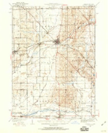
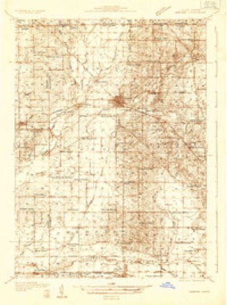
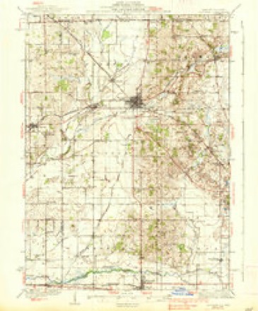
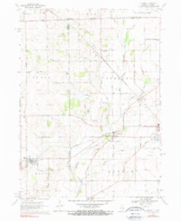
9 surveys from 16 printed sheetsMatched by testing this settlement's coordinate against the published boundary of every sheet in the United States Geological Survey's historical collection. Each opens the scanned sheet at the Survey.
- 1932 USGS Harvard quadrangle1:62500, 2 printings
- 1932 USGS Harvard quadrangle1:48000
- 1937 USGS Harvard quadrangle1:62500, 2 printings
- 1954 USGS Rockford quadrangle1:250000
- 1955 USGS Rockford quadrangle1:250000
- 1958 USGS Rockford quadrangle1:250000, 4 printings
- 1963 USGS Rockford quadrangle1:250000
- 1970 USGS Capron quadrangle1:24000, 3 printings
- 1981 USGS Elgin quadrangle1:100000





In the county-history sources
37,091 words on this townshipHistory of McHenry County, Illinois : Together with Sketches of Its Cities, Villages and Towns : Educational, Religious, Civil, Military, and Political History : Portraits of Prominent Persons, and Biographies of Representative Citizens, Also a Condensed History of Illinois .., published 1885 names this settlement in its chapter on Chemung Township. These are the passages that mention it, exactly as the scans read.
Not till after the village of Chemung had become a point of business and this township was pretty well settled did it receive a name. It is understood that Chemung Village was named by a Mr. Seward, who came from Chemung County, N. Y., and the township was afterward named for the village.
Passage source: History of McHenry County, Illinois : Together with Sketches of Its Cities, Villages and Towns : Educational, Religious, Civil, Military, and Political History : Portraits of Prominent Persons, and Biographies of Representative Citizens, Also a Condensed History of Illinois .., published 1885.
The first settlements were made in this township in 1836. Among the first settlers we find the names of George Trumbull, M. Wheeler, Wesley Diggins, Alonzo Riley, and William Hart. It is claimed by some that the first parties who resided in the township were two brothers, by the name of David and Ransley Shaw, who came from Indiana, and after partially erecting a saw-mill, sold out to a Mr. Lewis, and they moved away. David Smith came from New York State and made Chemung Township his home till about ten years ago, when be moved to Iowa. The date of Wesley Diggins's arrival was 1838. He located where Harvard now stands. He moved to California about twenty-five years ago, and there died about the year 1879. T. B. Wakeman came in 1838. He was a lawyer, and died in Chicago about six years ago. Daniel and A.dolphus Hutchinson were among the first settlers. Adolphus died at his home in the township some twenty years ago, and Daniel is still a resident of the township.
Passage source: History of McHenry County, Illinois : Together with Sketches of Its Cities, Villages and Towns : Educational, Religious, Civil, Military, and Political History : Portraits of Prominent Persons, and Biographies of Representative Citizens, Also a Condensed History of Illinois .., published 1885.
At the village of Chemung is to be found one of the oldest burying grounds in the county, but it is seldom that a burial takes place there now; the grounds have become forsaken, both in fact and appearance; the new grounds in the same village, but situated in Dunham Township, are being used instead of the old. A small burying ground was laid at Lawrence about the time the town was laid out.
Passage source: History of McHenry County, Illinois : Together with Sketches of Its Cities, Villages and Towns : Educational, Religious, Civil, Military, and Political History : Portraits of Prominent Persons, and Biographies of Representative Citizens, Also a Condensed History of Illinois .., published 1885.
Machine-read from a century-old scan, so expect the errors a machine makes: misspelled names, dropped words, stray characters.
Read the whole chapter on Chemung Township - it names this place 64 more 64 times.
Fires near this place
1 since 2015Regional context, not property-specific evidence. The federal wildfire occurrence database lists 1 fire within 5 miles of Chemung in 2015, burning about 10 acres in total. None started naturally. None was recorded as arson. Distance is straight-line from the map coordinates, so a fire counted here may appear on a neighbouring settlement's page as well.
| Reported cause | Fires |
|---|---|
| Debris and open burning | 1 |
The most recent of them, most recent first, with the day each was reported and the service that recorded it.
| Date | Cause | Size | Reported by | Name on the report |
|---|---|---|---|---|
| 28 April 2015 | Debris and open burning | 10 acres | Illinois Division of Forestry Resources | 15-382 |
Settlements close enough to share some of these fires:
Mines and quarries near this place
2 within 5 milesRegional context, not property-specific evidence. The federal mineral resources record lists 2 workings within 5 miles of Chemung: 1 past producer, 1 producer. 1 still produces. What was taken out: Sand and Gravel, Construction. Distance is straight-line from the map coordinates, so a quarry counted here may appear on a neighbouring settlement's page as well.
| Where | Site | Commodity | Status | Recorded |
|---|---|---|---|---|
| Harvard Pit & Mill | Sand and Gravel, Construction | Producer | ||
| Mchenry Pit | Sand and Gravel, Construction | Past Producer |
Storms near this place
9 since 2008Regional context, not property-specific evidence. The National Weather Service names Chemung in 9 storm reports between 2008 and 2024: 4 tornado, 3 thunderstorm wind, 1 flash flood, 1 flood. The reports record 1 injury. Each account below is quoted exactly as the forecast office filed it, from the NOAA Storm Events Database, and each date opens the federal record of that event.
| When | Event | Place named | Harm | What the report says |
|---|---|---|---|---|
| January 2008 | Tornado (EF3) | Chemung | 1 hurt, $2,000,000 | A tornado touched down at 330 pm CST about 1.2 miles north of Poplar Grove in Boone County and ended at 348 pm about 3.2 miles north northeast of Harvard in McHenry County. The tornado crossed the Boone McHenry County line near Hunter Road, about 2.1 miles west northwest of Chemung. The tornado crossed Hunter Road into McHenry County and continued to track northeast across Ryan Road as an EF0 and caused mainly minor tree damage. It crossed White Oaks Road then it uprooted a hardwood tree and snapped off pine trees at their base along Maxon Road. This damage continued to be EF0 damage with winds estimated to 80 mph. The tornado intensified as it moved toward the town of Lawrence, where it produced the worst damage in McHenry County. Significant damage occurred in the town of Lawrence, particularly at a house that had more than half of its roof ripped off and garage blown down. The tornado then moved across the Chicago and Northwestern Railroad where it blew 12 railroad freight cars off of the track. The train was moving at the time the tornado hit it, so as the main engine stopped, the remaining cars on the track continued along it and slammed into the front part of the train. This caused a few more cars to derail, including one containing hazardous materials that caused the evacuation of the town of Lawrence. The damage in Lawrence was rated as EF2 with winds up to 110 mph. As the tornado moved east of Lawrence it once again started to weaken with some tree damage and shingles off of a few houses on the northeast side of town. It then ran along Oak Grove Road for a stretch where it produced EF1 damage with a hardwood tree snapped at its base and knocked over an old, weakly structured barn. The tornado headed across farm fields and headed for Highway 14 where it damaged a metal barn and sheared a few trees. As it crossed Highway 14, it flipped a semi-trailer and injured the driver at a truck stop weigh station. It continued across Oak Grove Road where it lifted. The maximum width of the tornado in McHenry County was around 50 yards. One injury was reported in McHenry County. |
| May 2024 | Tornado (EF0) | Chemung | - | A tornado that touched down in Boone County crossed into McHenry County just north of Perkins Road. The tornado produced scattered tree damage along its path. A barn collaspsed along Weidner Road. Several sheep were inside the barn when the tornado struck and two of the sheep were killed. It is at this location where the tornado was likely at peak intensity with estimated wind speeds of 85 mph. The tornado continued moving northeast and crossed into Walworth County in southern Wisconsin west of Lilja Road where a silo and barn were damaged. |
| March 2023 | Thunderstorm Wind | Chemung | - | Strong wind blew a residential corrugated steel garage door inward. Wind magnitude and time were estimated based on radar. |
| July 2022 | Flood | Chemung | - | Several thunderstorms moved across McHenry County during the evening of July 5th into the early morning of July 6th producing very heavy rain. Additional thunderstorms had moved across the same areas a day earlier, from the late evening of July 4th into the early morning of July 5th. Once the heavy rain began on the evening of July 5th, flooding begin in several locations across south central McHenry County. Minor ponding of water was reported on Route 120 east of Woodstock. Significant ponding of water was reported on Route 47 south of Route 176. Several inches of standing water was reported on Route 23, three miles south of Marengo. A photo showed multiple feet of standing water at the Illinois Railway Museum in Union. A nearby private weather station southeast of Union measured 2.25 inches of rain in just 30 minutes and a two day storm total of 6.59 inches of rain. Many locations in southwest McHenry County received two day rainfall totals between 4 and 7 inches. A two day total of 5.35 inches was measured in Harvard. The flooding continued in some areas through much of July 6th. |
| November 2020 | Thunderstorm Wind | Chemung | - | Several barns and outbuildings were compromised by winds gusting to 80 mph, causing their doors and roofs to be blown off. A few of these structures were also blown off their foundations. |
| May 2017 | Tornado (EF1) | Chemung | - | This is a continuation of a tornado that began in Boone County two miles south of Poplar Grove. The tornado crossed into McHenry County south of Hunter Road. Softwood trees were snapped on Hunter Road. Hardwood trees were snapped or sheared on White Oaks Road. |
| June 2017 | Flash Flood | Chemung | - | Heavy rain caused flooding across parts of southern McHenry County including flash flooding on Route 23 in Marengo and Algonquin Road in Algonquin. Storm total rainfall amounts included 3.36 inches 1 mile east southeast of Lake In The Hills; 3.21 inches 1 mile north of Algonquin; 3.17 inches in Cary and 2.68 inches in Crystal Lake. |
| June 2014 | Thunderstorm Wind | Chemung | - | A six inch diameter tree was blown down on White Oaks Road approximately six miles south of the state line. |
| November 2010 | Tornado (EF0) | Chemung | - | A tornado touched down in eastern Winnebago County, moved northeast across Boone County and then crossed into northwest McHenry County. Damage consisted of mainly sporadic tree damage across McHenry County where the tornado appears to have dissipated at 325 pm CST. |
Nearest settlements
The eight closest, with where each one stands in the county. Distances are straight-line, computed from the Geographic Names Information System coordinates.
| Map | Place | Distance | Sheets |
|---|---|---|---|
| Lawrence | 2.2 miles | 16 | |
| Harvard | 2.9 miles | 15 | |
| Big Foot Prairie | 6.6 miles | 15 | |
| Alden | 8.4 miles | 15 | |
| Hartland | 9.2 miles | 15 | |
| Marengo | 11.9 miles | 13 | |
| Indian Trails | 11.9 miles | 13 | |
| Franklinville | 12.6 miles | 15 |
Elsewhere
Matched on this settlement's Geographic Names Information System number rather than its name, so it cannot be a different place of the same name in another state.
| Wikipedia article on Chemung | An encyclopaedic summary. Its text is share-alike, so it is linked here rather than copied. |
| Wikidata item Q5090674 | The structured record the population and elevation above come from. Public domain (CC0). |
Provenance
This settlement is recorded in the Geographic Names Information System as feature 406004. The sheet list is computed by point-in-boundary test against the United States Geological Survey's historical topographic inventory. Both are works of the United States government and carry no copyright under 17 U.S.C. 105.
Wildfire. Short, Karen C. 2022. Spatial wildfire occurrence data for the United States, 1992-2020 [FPA_FOD_20221014]. 6th Edition. Fort Collins, CO: Forest Service Research Data Archive. https://doi.org/10.2737/RDS-2013-0009.6 Collected with United States Government funding and usable without additional permissions or fees.
Mines and quarries. USGS Mineral Resources Data System (MRDS) https://mrdata.usgs.gov/mrds/ A work of the United States government, no copyright under 17 U.S.C. 105.
Storms. NOAA National Centers for Environmental Information, Storm Events Database https://www.ncei.noaa.gov/stormevents/ A work of the United States government, no copyright under 17 U.S.C. 105. Narratives are quoted verbatim from the National Weather Service report and are not edited or summarised.