 Block
Duncan, Illinois
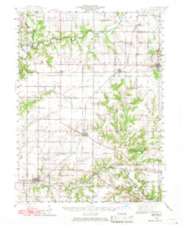
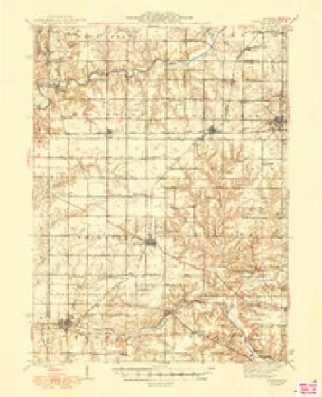
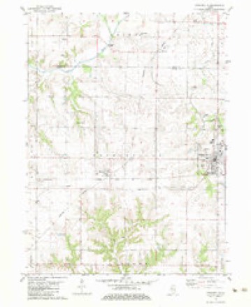
14 topographic sheets cover this place, the earliest surveyed in 1944 and the latest in 1990. It stands in Essex Township. It lies in ZIP code area 61559. The Survey maps it on the Princeville quadrangle. It stands 659 feet above sea level.
Topographic sheets covering this place
9 surveys from 14 printed sheetsMatched by testing this settlement's coordinate against the published boundary of every sheet in the United States Geological Survey's historical collection. Each opens the scanned sheet at the Survey.
- 1944 USGS Elmwood quadrangle1:62500, 2 printings
- 1948 USGS Elmwood quadrangle1:62500, 2 printings
- 1958 USGS Peoria quadrangle1:250000, 4 printings
- 1961 USGS Peoria quadrangle1:250000
- 1963 USGS Peoria quadrangle1:250000
- 1982 USGS Princeville quadrangle1:24000
- 1985 USGS Peoria quadrangle1:100000
- 1989 USGS Peoria quadrangle1:100000
- 1990 USGS Peoria quadrangle1:250000






In the county-history sources
18,996 words on this townshipDocuments and Biography Pertaining to the Settlement and Progress of Stark County, Illinois : Containing an Authentic Summary of Records, Documents, Historical Works and Newspapers Relating to Indian History, Original Settlement, Organization and Politics ..., published 1887 names this settlement in its chapter on Essex Township. These are the passages that mention it, exactly as the scans read.
I II IS division of the county was settled in 1829 by the Essex family, in whose honor the name was given to it in 1853, by Calvin Eastman, Henry Breese and T. F. Hurd, the commissioners under the act of 1851 for dividing the county into townships. Essex forms the center of the trio of Stark's southern divisions. It is a full congressional township ; but owing to the fact that the vagrant Spoon river and rambling Indian creek selected it as a special section for their wanderings, the area under cultivation is not of equal extent. The population in 1880, including part of Wyoming village, was 1,452, the village claiming 434. The villages of Duncan, Slackwater, and Stringtown form the leading settlements. Moulton on its northern border, and Massillon on its western border long since passed away, and their sites were plowed over by the modern husbandman. Princeville township, adjoining on the south, was settled by Daniel Prince, in 1822, but the family of Stephen French was the first there. Miss Esther Stoddard taught'the first school ; Theodore F. Hurd was the first male teacher. Rev. Robert Stewart, a Presbyterian, was the first preacher, while the first death was that of Isaac Essex's father-inlaw. Princeville village was platted for W. C. Stevens, in 1837, where the Presbyterian church of 1834 was built. Monica is a new village. About the time the first settlers came into this district of Spoon river, the Indians were residents. Subsequently they moved some miles westward and did not return until 1830, when they remained a few years. At this time the forest presented its huge trees without underbrush, with Indian trails stretching out in every direction.
Passage source: Documents and Biography Pertaining to the Settlement and Progress of Stark County, Illinois : Containing an Authentic Summary of Records, Documents, Historical Works and Newspapers Relating to Indian History, Original Settlement, Organization and Politics ..., published 1887.
Duncan. The town of Duncan Avas surveyed by Edwin Butler for Alfred H. Castle in June, 1870. Monroe, Adams and Jefferson streets running north and south ; Main, Washington and Galena streets running east and west, were represented ; but block one forming the extreme northwestern part of the village and all Galena street with northern extensions of Monroe and Adams, have been vacated. The first purchasers of lots at Duncan were the Scotts, of Wyoming, in 1871 ; Davis Lowman, Albert D. White, F. F. Brockway, S. Berg, John T. Fox, in block one, W. O. Cox, Joseph Buck, J. H. Francis, Joab Graves, Rebecca Alford, Nancy Barber, Alex Ivens, Emmett Illingworth, Samuel M. Adams, Benj. F. Gharrett, John H. Slater, W. S. Brockway, and others in blocks two, three, four and live ; Geo. Fautz, Peter Olson, Olof Bergguist, Geo. Colwell, Louisa Plummer, S. N. F. Westerfield in blocks four and five ; C. M. Jacques, W. J. Alford, Wm. Hobbs, Chris. Gingrich, Jos. P. Paul, Day Bros, k, Cvj , W. H. Nickerson, the Dixons, Slaters, Gharretts, Scotts and Scott & Wrigley, Artemus W. Wheeler, in block six. Duncan l)usiness circle comprises F. F. Brockawa}^ and John H. Slater, merchants ; A. J. Scott, grain and lumber; Geo. Fautz it Co., hardware; Wm. Heath, grocer and hotel ; T. C. Thomas, physician ; E. L. Marvin, R. R. agent ; John Barker, blacksmith, with H. G. Slater, postmaster. W. H. Miller was postmaster at Duncan in 1870.
Passage source: Documents and Biography Pertaining to the Settlement and Progress of Stark County, Illinois : Containing an Authentic Summary of Records, Documents, Historical Works and Newspapers Relating to Indian History, Original Settlement, Organization and Politics ..., published 1887.
Camp run, on Spoon river, where his desire to do what was right brought him hosts of customers and won him many friends. In 1858 Mrs. Cox died. Of her eight children, seven are hving and four residents of this county. A few years later Mr. Cox transferred the mill to W. K., the present operator. The old gentleman married a second time, his wife dying in 1880. For eight years his own healtli has shown signs of failure, so that now the great old pioneer miller of Indian creek is only a shadow of the strong man whom the pioneers and old settlers knew so well. W. K. Cox resided with his parents until 1850, when he became a cattle-buyer. Some years later he resumed farming, and prior to the war took charge of his father's mill. In 1860 he married Miss J. E. Miller, born in 1842 in Hocking count}', O., and came to tliis county with her parents in 1844. For twelve years after this marriage Mr. Cox continued milling, but owing to the radical change in machinery he discontinued this industiy, and has since devoted his attention to stock growing and agriculture. Of six children born to Mr. and Mrs. Cox, five are living - Mrs. Brock way, of Duncan ; Orrin W., deceased ; Plessie E., Mrs. E. Miller, of Essex ; Nettie M., Mrs. L. Brockway ; Ilarley G. and Herman C. In politics Mr, Cox is Ilepul)lican, and liberal in all ideas.
Passage source: Documents and Biography Pertaining to the Settlement and Progress of Stark County, Illinois : Containing an Authentic Summary of Records, Documents, Historical Works and Newspapers Relating to Indian History, Original Settlement, Organization and Politics ..., published 1887.
Machine-read from a century-old scan, so expect the errors a machine makes: misspelled names, dropped words, stray characters.
Read the whole chapter on Essex Township - it names this place 8 more 8 times.
Mines and quarries near this place
5 within 5 milesRegional context, not property-specific evidence. The federal mineral resources record lists 5 workings within 5 miles of Duncan: 4 past producers, 1 producer. 1 still produces. What was taken out: Sand and Gravel, Construction, Stone, Crushed/Broken, Clay. Distance is straight-line from the map coordinates, so a quarry counted here may appear on a neighbouring settlement's page as well.
| Where | Site | Commodity | Status | Recorded |
|---|---|---|---|---|
| Prince Run Creek Shale Exposure | Clay | Past Producer | ||
| Chipman Pit | Sand and Gravel, Construction | Past Producer | ||
| Long Rock Quarry | Stone, Crushed/Broken | Producer | ||
| Princeville Stone Co. Quarry | Stone, Crushed/Broken | Past Producer | ||
| Stoekers Pit | Sand and Gravel, Construction | Past Producer |
Storms near this place
2 since 1997Regional context, not property-specific evidence. The National Weather Service names Duncan in 2 storm reports between 1997 and 2004: 1 tornado, 1 thunderstorm wind. No death or injury is recorded in these reports. Each account below is quoted exactly as the forecast office filed it, from the NOAA Storm Events Database, and each date opens the federal record of that event.
| When | Event | Place named | Harm | What the report says |
|---|---|---|---|---|
| May 2004 | Thunderstorm Wind | Duncan | - | Several trees were blown down. |
| April 1997 | Tornado (F0) | Duncan | - | no account filed |
Nearest settlements
The eight closest, with where each one stands in the county. Distances are straight-line, computed from the Geographic Names Information System coordinates.
| Map | Place | Distance | Sheets |
|---|---|---|---|
| Slackwater (historical) | 1.7 miles | 14 | |
| Stark | 2.5 miles | 21 | |
| Wyoming | 5.5 miles | 10 | |
| Speer | 7.4 miles | 21 | |
| West Jersey | 7.7 miles | 10 | |
| Toulon | 8.6 miles | 10 | |
| Castleton | 10.3 miles | 12 | |
| Modena | 10.6 miles | 10 |
Elsewhere
Matched on this settlement's Geographic Names Information System number rather than its name, so it cannot be a different place of the same name in another state.
| Wikipedia article on Duncan | An encyclopaedic summary. Its text is share-alike, so it is linked here rather than copied. |
| Wikidata item Q5314222 | The structured record the population and elevation above come from. Public domain (CC0). |
Provenance
This settlement is recorded in the Geographic Names Information System as feature 407481. The sheet list is computed by point-in-boundary test against the United States Geological Survey's historical topographic inventory. Both are works of the United States government and carry no copyright under 17 U.S.C. 105.
Mines and quarries. USGS Mineral Resources Data System (MRDS) https://mrdata.usgs.gov/mrds/ A work of the United States government, no copyright under 17 U.S.C. 105.
Storms. NOAA National Centers for Environmental Information, Storm Events Database https://www.ncei.noaa.gov/stormevents/ A work of the United States government, no copyright under 17 U.S.C. 105. Narratives are quoted verbatim from the National Weather Service report and are not edited or summarised.