 Block
Eleroy, Illinois
14 topographic sheets cover this place, the earliest surveyed in 1937 and the latest in 1981. It stands in Erin Township. It lies in ZIP code area 61027. The Survey maps it on the Pearl City quadrangle. It stands 909 feet above sea level.
On record in Eleroy
Buildings and businesses the archive holds for this place. Each opens its own page, with the source record it came from.
On the National Register 2 records
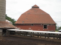 Gerald Harbach Round Barnlisted 1984
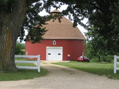 Dennis Otte Round Barnlisted 1984
Topographic sheets covering this place
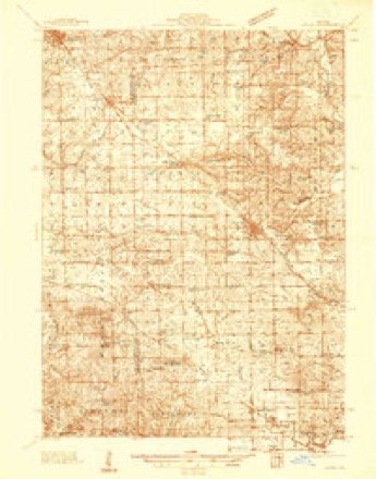
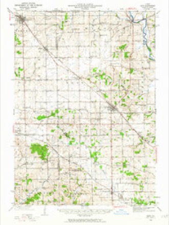
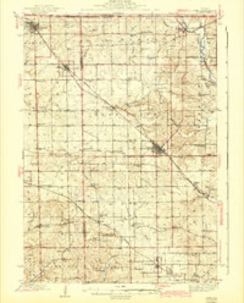
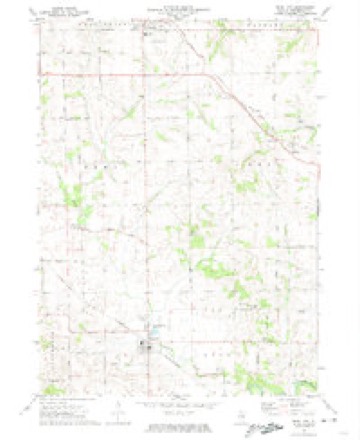
9 surveys from 14 printed sheetsMatched by testing this settlement's coordinate against the published boundary of every sheet in the United States Geological Survey's historical collection. Each opens the scanned sheet at the Survey.
- 1937 USGS Lena quadrangle1:48000
- 1942 USGS Lena quadrangle1:62500
- 1943 USGS Lena quadrangle1:62500, 2 printings
- 1954 USGS Rockford quadrangle1:250000
- 1955 USGS Rockford quadrangle1:250000
- 1958 USGS Rockford quadrangle1:250000, 4 printings
- 1963 USGS Rockford quadrangle1:250000
- 1971 USGS Pearl City quadrangle1:24000
- 1981 USGS Rockford quadrangle1:100000, 2 printings





In the county-history sources
11,150 words on this townshipThe History of Stephenson County, Illinois : Containing ... Biographical Sketches ... War Record ... Statistics ... Portraits of Early Settlers ... History of the Northwest, History of Illinois, &c. .., published 1880 names this settlement in its chapter on Erin Township. These are the passages that mention it, exactly as the scans read.
Doyle, who remained on his claim sufficiently long to enable him to complete a limited improvement and donate three acres thereof for the site of St. Mary's Church, sold out his domain to Robert Franey, and moved west about half a mile, where he again began the opening and improvement of a farm. Soon after these adventurous travelers from the Green Sod had made claims and established the beginning of a life in the West, free from the trammels and discouragements encountered at home, they were followed hither by brothers and kin from the land of their birth, through whose labors and intelligence the little spot of land known as Dublin has been made a veritable Paradise.
Passage source: The History of Stephenson County, Illinois : Containing ... Biographical Sketches ... War Record ... Statistics ... Portraits of Early Settlers ... History of the Northwest, History of Illinois, &c. .., published 1880.
The first death was Mrs. Aseneth, wife of N. J. Churchill, who died August 17, 1858, and, there being no cemetery laid out at Eleroy, her body was interred at Lena. With regard to the first birth, the chronicles are silent.
Passage source: The History of Stephenson County, Illinois : Containing ... Biographical Sketches ... War Record ... Statistics ... Portraits of Early Settlers ... History of the Northwest, History of Illinois, &c. .., published 1880.
To-day, as already stated, Eleroy is a village of 100 population, according to the enumerations for 1880, and a shipping-point for grain and live stock, appreciating yearly. During 1879, there were 500 car loads of wheat and hogs shipped from this station. Within the village proper there are an elevator attached to the depot and operated by horse-power, two stores, a blacksmithshop, school, church, and a number of private residences, which attract by their modest beauty and appearance of comfort. The "madding crowd" will scarcely ever run wild in the sunshine of Eleroy 's prosperity, but want and distress, the attendant concomitants of riches and pretentiousness, "will never be known within her bills of mortality.
Passage source: The History of Stephenson County, Illinois : Containing ... Biographical Sketches ... War Record ... Statistics ... Portraits of Early Settlers ... History of the Northwest, History of Illinois, &c. .., published 1880.
Machine-read from a century-old scan, so expect the errors a machine makes: misspelled names, dropped words, stray characters.
Read the whole chapter on Erin Township - it names this place 26 more 26 times.
Fires near this place
8 since 2004Regional context, not property-specific evidence. The federal wildfire occurrence database lists 8 fires within 5 miles of Eleroy between 2004 and 2017, burning about 23 acres in total. None started naturally. None was recorded as arson. Distance is straight-line from the map coordinates, so a fire counted here may appear on a neighbouring settlement's page as well.
| Reported cause | Fires |
|---|---|
| Debris and open burning | 3 |
| Smoking | 2 |
| Recreation and ceremony | 2 |
| Missing data/not specified/undetermined | 1 |
The most recent of them, most recent first, with the day each was reported and the service that recorded it.
| Date | Cause | Size | Reported by | Name on the report |
|---|---|---|---|---|
| 14 May 2013 | Debris and open burning | 4.0 acres | Illinois Division of Forestry Resources | 13-0000038 |
| 5 April 2004 | Recreation and ceremony | 12 acres | Illinois State Fire Marshal's Office | not named |
| 17 April 2008 | Debris and open burning | under an acre | Illinois Division of Forestry Resources | 8010 |
| 11 April 2014 | Smoking | 1.0 acres | Illinois Division of Forestry Resources | 14-0000033 |
| 1 April 2010 | Smoking | under an acre | Illinois Division of Forestry Resources | 1024 |
| 22 March 2004 | Recreation and ceremony | 5.0 acres | Illinois State Fire Marshal's Office | not named |
| 1 December 2017 | Debris and open burning | under an acre | Illinois Division of Forestry Resources | 17-0000125 |
| 13 October 2010 | Missing data/not specified/undetermined | under an acre | Illinois Division of Forestry Resources | 1090 |
Settlements close enough to share some of these fires:
Mines and quarries near this place
10 of 14 shownRegional context, not property-specific evidence. The federal mineral resources record lists 14 workings within 5 miles of Eleroy: 10 past producers, 2 producers, 1 occurrence, 1 prospect. 2 still produce. What was taken out: Stone, Crushed/Broken, Copper. Distance is straight-line from the map coordinates, so a quarry counted here may appear on a neighbouring settlement's page as well.
| Where | Site | Commodity | Status | Recorded |
|---|---|---|---|---|
| Erin Mound | Copper | Occurrence | ||
| Erin Mound | Copper | Prospect | ||
| Finkbinder | Stone, Crushed/Broken | Past Producer | ||
| H. Homan Quarry | Stone, Crushed/Broken | Past Producer | ||
| Lobdell Quarry | Stone, Crushed/Broken | Producer | ||
| R. E. Cox Quarry | Stone, Crushed/Broken | Producer | ||
| Unnamed Limestone Quarry | Stone, Crushed/Broken | Past Producer | ||
| Unnamed Limestone Quarry | Stone, Crushed/Broken | Past Producer | ||
| Unnamed Limestone Quarry | Stone, Crushed/Broken | Past Producer | ||
| Unnamed Limestone Quarry | Stone, Crushed/Broken | Past Producer |
Storms near this place
9 since 1998Regional context, not property-specific evidence. The National Weather Service names Eleroy in 9 storm reports between 1998 and 2022: 4 hail, 2 flash flood, 1 tornado, 1 heavy rain. No death or injury is recorded in these reports. Each account below is quoted exactly as the forecast office filed it, from the NOAA Storm Events Database, and each date opens the federal record of that event.
| When | Event | Place named | Harm | What the report says |
|---|---|---|---|---|
| August 2003 | Hail | Eleroy | $20,000 | no account filed |
| April 2006 | Hail | Eleroy | $2,000 | Jct of U.S. 20 & Bus 20; covered the ground |
| May 1998 | Tornado (F0) | Eleroy | $1,000 | Brief tornado damaged and uprooted trees. |
| August 2022 | Thunderstorm Wind | Eleroy | - | A trained spotter reported several 8 to 10 inch branches down. Some trampolines were also turned over. The time of the event was estimated using radar. |
| September 2019 | Flash Flood | Eleroy | - | The Emergency Manager reported water 4 inches deep was over Highway 20. Law Enforcement was advising motorists to avoid that stretch of Highway 20. |
| July 2011 | Heavy Rain | Eleroy | - | As of 909 am CDT July 28, the 15 hour rainfall total about 5 miles west northwest of Freeport, IL was 7.00 inches. |
| August 2002 | Flash Flood | Eleroy | - | Intersection of Highway 20 and Dameier Road flooded and impassable. |
| April 2014 | Hail | Eleroy | - | no account filed |
| May 2004 | Hail | Eleroy | - | no account filed |
Nearest settlements
The eight closest, with where each one stands in the county. Distances are straight-line, computed from the Geographic Names Information System coordinates.
| Map | Place | Distance | Sheets |
|---|---|---|---|
| Salem | 1.3 miles | 14 | |
| Damascus | 4.0 miles | 15 | |
| Lena | 4.6 miles | 15 | |
| Scioto Mills | 5.1 miles | 15 | |
| Yellow Creek | 5.4 miles | 14 | |
| West Junction | 5.5 miles | 15 | |
| Pearl City | 5.8 miles | 14 | |
| Red Oak | 6.3 miles | 13 |
Elsewhere
Matched on this settlement's Geographic Names Information System number rather than its name, so it cannot be a different place of the same name in another state.
| Wikipedia article on Eleroy | An encyclopaedic summary. Its text is share-alike, so it is linked here rather than copied. |
| Wikidata item Q5359455 | The structured record the population and elevation above come from. Public domain (CC0). |
Provenance
This settlement is recorded in the Geographic Names Information System as feature 407857. The sheet list is computed by point-in-boundary test against the United States Geological Survey's historical topographic inventory. Both are works of the United States government and carry no copyright under 17 U.S.C. 105.
Wildfire. Short, Karen C. 2022. Spatial wildfire occurrence data for the United States, 1992-2020 [FPA_FOD_20221014]. 6th Edition. Fort Collins, CO: Forest Service Research Data Archive. https://doi.org/10.2737/RDS-2013-0009.6 Collected with United States Government funding and usable without additional permissions or fees.
Mines and quarries. USGS Mineral Resources Data System (MRDS) https://mrdata.usgs.gov/mrds/ A work of the United States government, no copyright under 17 U.S.C. 105.
Storms. NOAA National Centers for Environmental Information, Storm Events Database https://www.ncei.noaa.gov/stormevents/ A work of the United States government, no copyright under 17 U.S.C. 105. Narratives are quoted verbatim from the National Weather Service report and are not edited or summarised.