 Block
Lena, Illinois
15 topographic sheets cover this place, the earliest surveyed in 1937 and the latest in 1981. It stands in West Point Township. It lies in ZIP code area 61048. The Survey maps it on the Lena quadrangle. 2,772 people lived here at the 2020 count. It stands 948 feet above sea level.
On record in Lena
Buildings and businesses the archive holds for this place. Each opens its own page, with the source record it came from.
On the National Register 2 records
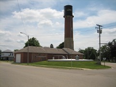 Lena Water Towerlisted 1997
- Chris Jensen Round Barnlisted 1984
Population over time
3 figuresLena fell from 2,887 to 2,772 between 2000 and 2020. These are the recorded population figures Wikidata holds for this place, reached through the Geographic Names Information System number this page is keyed on rather than by name, so they belong to this place and not to another of the same name. Most are census counts, but not all are: an early figure may be a founding or settlement estimate, and an estimate published within five years of a census is left out. The change column is computed, and is left blank where more than 20 years separate a figure from the one before it, because a gap that long is not a change between two counts.
| Year | People | Change |
|---|---|---|
| 2000 | 2,887 | |
| 2010 | 2,912 | +25 (+1%) |
| 2020 | 2,772 | -140 (-5%) |
Topographic sheets covering this place
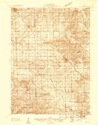
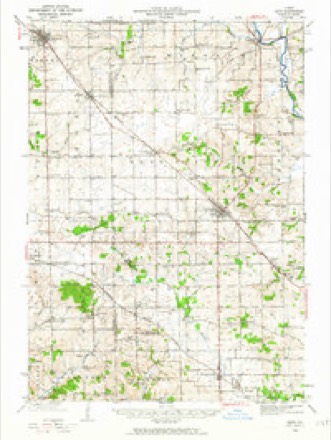
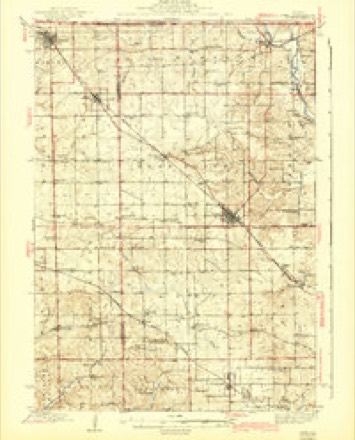
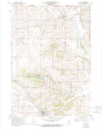
9 surveys from 15 printed sheetsMatched by testing this settlement's coordinate against the published boundary of every sheet in the United States Geological Survey's historical collection. Each opens the scanned sheet at the Survey.
- 1937 USGS Lena quadrangle1:48000
- 1942 USGS Lena quadrangle1:62500
- 1943 USGS Lena quadrangle1:62500, 2 printings
- 1954 USGS Rockford quadrangle1:250000
- 1955 USGS Rockford quadrangle1:250000
- 1958 USGS Rockford quadrangle1:250000, 4 printings
- 1963 USGS Rockford quadrangle1:250000
- 1971 USGS Lena quadrangle1:24000, 2 printings
- 1981 USGS Rockford quadrangle1:100000, 2 printings





In the county-history sources
11,776 words on this townshipThe History of Stephenson County, Illinois : Containing ... Biographical Sketches ... War Record ... Statistics ... Portraits of Early Settlers ... History of the Northwest, History of Illinois, &c. .., published 1880 names this settlement in its chapter on West Point Township. These are the passages that mention it, exactly as the scans read.
JACOB ACKER, farmer; P.O. Lena; born Sept. 28, 1814, in Mifflin Co., Penn.; he learned the carpenter trade in Union Co., Penn., following the business until 1843, when he came to Stephenson Co. ; he has followed farming and the carpenter's trade since coming to this county ; he now owns 65 acres ; part of this land is inside the corporation, and he owns other town property ; he has been Justice of the Peace and County Superintendent ; he was Postmaster in Lowell, Jefferson Township ; he also was School Treasurer and Director. Married Amelia Himes in 1839 ; she was born in Union Co., Penn., in 1818; they had nine children, six living - George H., Mary E., Kate, Margaret A., Jane and Viola F. ; George H. enlisted in 1861, in the 92d T. V. I.; served about one year, and was discharged on account of sickness.
Passage source: The History of Stephenson County, Illinois : Containing ... Biographical Sketches ... War Record ... Statistics ... Portraits of Early Settlers ... History of the Northwest, History of Illinois, &c. .., published 1880.
H. W. ALLEN, nursery and farmer, Sec. 32 ; P. 0. Lena ; born Aug. 4, 1842, in Galena, 111.; when about three years of age, he came with his parents to his present locality ; his father formerly owned about 400 acres of land ; part of this land is now occupied by the lumber yard, depot, etc.; they own now 80 acres, and he is largely engaged in the nursery business, consisting of fruit and ornamental trees, it is equal to any nursery in the county. Married Miss Cordelia Aurand, in 1865 ; she was born in Carlisle, Penn.; they have six children, three sons and three daughters. He enlisted in 1864, in Co. A, 14:2d I. V. I., as Sergeant, and served about six months. His father died in November, 1864, aged 50 years.
Passage source: The History of Stephenson County, Illinois : Containing ... Biographical Sketches ... War Record ... Statistics ... Portraits of Early Settlers ... History of the Northwest, History of Illinois, &c. .., published 1880.
LEWIS B. ANDREWS, farmer, Sec. 35; P. 0. Lena; born Oct. 9, 1850, in West Point Township; his father settled on this farm in about 1839 ; is now a resident of Cleveland, Ohio ; this farm consists of 238 acres of land, well improved. He married Miss Lizzie Moffett, March 20, 1878 ; she was born in Jo Daviess Co., where her parents now reside.
Passage source: The History of Stephenson County, Illinois : Containing ... Biographical Sketches ... War Record ... Statistics ... Portraits of Early Settlers ... History of the Northwest, History of Illinois, &c. .., published 1880.
Machine-read from a century-old scan, so expect the errors a machine makes: misspelled names, dropped words, stray characters.
Read the whole chapter on West Point Township - it names this place 65 more 65 times.
Fires near this place
6 since 2004Regional context, not property-specific evidence. The federal wildfire occurrence database lists 6 fires within 5 miles of Lena between 2004 and 2008, burning about 99 acres in total. None started naturally. 1 was recorded as arson. Distance is straight-line from the map coordinates, so a fire counted here may appear on a neighbouring settlement's page as well.
| Reported cause | Fires |
|---|---|
| Recreation and ceremony | 4 |
| Debris and open burning | 1 |
| Arson/incendiarism | 1 |
The most recent of them, most recent first, with the day each was reported and the service that recorded it.
| Date | Cause | Size | Reported by | Name on the report |
|---|---|---|---|---|
| 7 April 2004 | Recreation and ceremony | 20 acres | Illinois State Fire Marshal's Office | not named |
| 5 April 2004 | Recreation and ceremony | 12 acres | Illinois State Fire Marshal's Office | not named |
| 17 April 2008 | Debris and open burning | under an acre | Illinois Division of Forestry Resources | 8010 |
| 17 April 2004 | Recreation and ceremony | 2.0 acres | Illinois State Fire Marshal's Office | not named |
| 10 April 2004 | Arson/incendiarism | 60 acres | Illinois State Fire Marshal's Office | not named |
| 22 March 2004 | Recreation and ceremony | 5.0 acres | Illinois State Fire Marshal's Office | not named |
Settlements close enough to share some of these fires:
Mines and quarries near this place
10 of 14 shownRegional context, not property-specific evidence. The federal mineral resources record lists 14 workings within 5 miles of Lena: 9 past producers, 3 producers, 1 occurrence, 1 prospect. 3 still produce. What was taken out: Stone, Crushed/Broken, Copper, Sand and Gravel, Construction. Distance is straight-line from the map coordinates, so a quarry counted here may appear on a neighbouring settlement's page as well.
| Where | Site | Commodity | Status | Recorded |
|---|---|---|---|---|
| Kent Gravel Pit | Sand and Gravel, Construction | Producer | ||
| Erin Mound | Copper | Occurrence | ||
| Erin Mound | Copper | Prospect | ||
| Lena Quarry | Stone, Crushed/Broken | Past Producer | ||
| Lobdell Quarry | Stone, Crushed/Broken | Producer | ||
| R. E. Cox Quarry | Stone, Crushed/Broken | Producer | ||
| Stich Quarry | Stone, Crushed/Broken | Past Producer | ||
| Unnamed Limestone Quarry | Stone, Crushed/Broken | Past Producer | ||
| Unnamed Limestone Quarry | Stone, Crushed/Broken | Past Producer | ||
| Unnamed Limestone Quarry | Stone, Crushed/Broken | Past Producer |
Storms near this place
43 since 1997Regional context, not property-specific evidence. The National Weather Service names Lena in 43 storm reports between 1997 and 2026: 19 thunderstorm wind, 7 heavy rain, 7 hail, 6 flash flood. No death or injury is recorded in these reports. Each account below is quoted exactly as the forecast office filed it, from the NOAA Storm Events Database, and each date opens the federal record of that event.
| When | Event | Place named | Harm | What the report says |
|---|---|---|---|---|
| July 2008 | Thunderstorm Wind | Lena | $50,000 | Wind gusts estimated to be 65 mph blew down four utility poles near the intersection of N 5 Corners Rd and Highway 20 about 2 miles south southwest of Lena, IL around 9:30 pm July 7. A power outage was observed in several surrounding communities. This report was relayed by the Freeport Journal Standard newspaper. |
| September 2000 | Lightning | Lena | $30,000 | Lightning struck a home and ignited a fire. |
| August 2007 | Flash Flood | Lena | $10,000 | Heavy rains of 3 to 7 inches fell across Stephenson County during the early morning hours of August 7th resulting in flash flooding. Two feet of water was coving parts of Highway 20 east of Highway 73. Some motorists were stranded in high water in Freeport, IL. Several gravel roads east of the Highway 20 and Highway 73 intersection were washed out. The US Bank and Health Department buildings in Freeport had flooded basements. |
| June 2004 | Flash Flood | Lena | $10,000 | Yellow Creek out of banks; Sunnyside Rd closed due to high water. |
| June 2004 | Flash Flood | Lena | $10,000 | Wagner Rd closed due to high water. |
| June 2004 | Flash Flood | Lena | $10,000 | Waddams Creek out of banks; Jct of Unity and Louisa Rds closed due to high water |
| June 2005 | Thunderstorm Wind | Lena | $8,000 | Tree down on a house; power lines down in city. |
| October 2004 | Thunderstorm Wind | Lena | $3,000 | Downburst leveled several trees 2.5 to 3 feet in diameter along with power lines. The trees were solid but had been weakened by severe storms back in August. |
| April 2026 | Tornado (EF2) | Lena | - | A high-end EF2, possible multi-vortex, tornado with estimated peak winds around 130 mph started along Highway 20, southwest of Lena IL, and tracked through Lena before lifting just southwest of Orangeville. The tornado caused significant damage to trees along its path, including uprooting and snapping trees. When the tornado begun it immediately caused EF1 damage to trees, gaining strength to an EF2 tornado snapping many power poles southwest of Lena. The tornado turned to the right, into town causing a lot of roof damage and tree damage. A lot of houses had shingle and siding damage. The most significant damage occurred on Grove Street, where three houses lost their entire roof structure. Two of the homes experienced partial exterior wall collapses. Damage in this area is consistent with 130 MPH winds. In Lena, the damage footprint in Lena is approximately 1250 yards wide. As the tornado moved to the northeast, damage to farm structures was noted. Even towards the end of the path, the tornado was causing EF1 damage to trees. |
| May 2024 | Thunderstorm Wind | Lena | - | Several pine trees were blown down. Limbs down on other trees as well on west side of Lena, Illinois. |
| July 2024 | Thunderstorm Wind | Lena | - | A public report of a measured 93 MPH wind gust. |
| July 2022 | Thunderstorm Wind | Lena | - | A public report via social media of a large section of a tree blown down. The time of the event was estimated using radar. |
| July 2017 | Flood | Lena | - | A trained spotter reported widespread flooding. A road was underwater for at least the length of a football field in a location does not normally flood. |
| July 2017 | Flash Flood | Lena | - | Local law enforcement reported 4 road closures in Stephenson County due to flash flooding. Highway 20 west was closed at Damier Road. Highway 20 was closed at Kiever Road. Highway 20 was closed west of Galena Road to the county line. Highway 73 was closed west of Louisa Road. |
| July 2016 | Thunderstorm Wind | Lena | - | The emergency manager reported trees were down in the area. The time was estimated by radar. |
| June 2014 | Thunderstorm Wind | Lena | - | Law enforcement reported power lines down in Lena. |
| August 2012 | Thunderstorm Wind | Lena | - | Emergency Manager estimated winds speeds of 60 mph. |
| June 2011 | Thunderstorm Wind | Lena | - | Wind gusts estimated to be 60 mph blew down several tree branches in Lena, IL at 932 pm CDT June 8. |
| June 2011 | Thunderstorm Wind | Lena | - | Wind gusts estimated to be 60 mph were observed in Lena, IL at 932 pm CDT June 8. |
| July 2011 | Heavy Rain | Lena | - | As of 550 am CDT July 28, the 10 hour rainfall total in Lena, IL was 4.85 inches. |
| July 2011 | Heavy Rain | Lena | - | As of 810 am CDT July 28, the rainfall total in Lena, IL was 5.58 inches. |
| August 2011 | Heavy Rain | Lena | - | Storm total rainfall from 500 pm cdt to 545 pm cdt. |
| August 2011 | Heavy Rain | Lena | - | Heavy rain fell in a period of 30 minutes. Rain continues to fall in Lena. |
| August 2008 | Thunderstorm Wind | Lena | - | Wind gusts estimated to be 60 mph blew down some 1 to 2 inch diameter tree branches in Lena, IL at 620 pm August 4. |
| June 2008 | Thunderstorm Wind | Lena | - | Winds estimated to be 70 mph blew down some trees in Lena, IL around 2:02 pm June 28. |
| August 2007 | Thunderstorm Wind | Lena | - | Winds estimated to be 65 mph blew down a dead tree onto Highway 73 north of Lena, IL. |
| August 2006 | Hail | Lena | - | Penny size hail was reported on the Stephenson/Jo Daviess line. |
| June 2004 | Heavy Rain | Lena | - | Water ponding on road |
| June 2004 | Heavy Rain | Lena | - | Water ponding on Unity Rd and intersection of Range and Rink Rds |
| June 2004 | Heavy Rain | Lena | - | Water ponding on Sunnyside Rd |
| May 2002 | Thunderstorm Wind | Lena | - | Trees down. |
| August 2002 | Flash Flood | Lena | - | Several homes inundated with water. |
| September 2001 | Thunderstorm Wind | Lena | - | Thunderstorm winds gusting to 60 mph downed trees and damaged crops. Reported by Emergency Management. |
| September 2000 | Thunderstorm Wind | Lena | - | Large tree down on Route 73 at Hershey Road. |
| May 1998 | Tornado (F0) | Lena | - | Brief tornado touched down in open farm land. |
| March 2026 | Hail | Lena | - | no account filed |
| March 2026 | Hail | Lena | - | no account filed |
| March 2026 | Hail | Lena | - | no account filed |
| May 2024 | Hail | Lena | - | no account filed |
| June 2015 | Hail | Lena | - | no account filed |
| May 2010 | Hail | Lena | - | no account filed |
| June 2002 | Thunderstorm Wind | Lena | - | no account filed |
| April 1997 | Thunderstorm Wind | Lena | - | no account filed |
Nearest settlements
The eight closest, with where each one stands in the county. Distances are straight-line, computed from the Geographic Names Information System coordinates.
| Map | Place | Distance | Sheets |
|---|---|---|---|
| Salem | 3.3 miles | 14 | |
| Waddams Grove | 4.2 miles | 14 | |
| Eleroy | 4.6 miles | 14 | |
| Sunnyside | 5.1 miles | 14 | |
| Yellow Creek | 5.4 miles | 14 | |
| McConnell | 6.1 miles | 13 | |
| Damascus | 6.2 miles | 15 | |
| Kent | 6.5 miles | 14 |
Elsewhere
Matched on this settlement's Geographic Names Information System number rather than its name, so it cannot be a different place of the same name in another state.
| Wikipedia article on Lena | An encyclopaedic summary. Its text is share-alike, so it is linked here rather than copied. |
| Wikidata item Q1778940 | The structured record the population and elevation above come from. Public domain (CC0). |
Provenance
This settlement is recorded in the Geographic Names Information System as feature 411944. The sheet list is computed by point-in-boundary test against the United States Geological Survey's historical topographic inventory. Both are works of the United States government and carry no copyright under 17 U.S.C. 105.
Wildfire. Short, Karen C. 2022. Spatial wildfire occurrence data for the United States, 1992-2020 [FPA_FOD_20221014]. 6th Edition. Fort Collins, CO: Forest Service Research Data Archive. https://doi.org/10.2737/RDS-2013-0009.6 Collected with United States Government funding and usable without additional permissions or fees.
Mines and quarries. USGS Mineral Resources Data System (MRDS) https://mrdata.usgs.gov/mrds/ A work of the United States government, no copyright under 17 U.S.C. 105.
Storms. NOAA National Centers for Environmental Information, Storm Events Database https://www.ncei.noaa.gov/stormevents/ A work of the United States government, no copyright under 17 U.S.C. 105. Narratives are quoted verbatim from the National Weather Service report and are not edited or summarised.