 Block
Garrett, Illinois
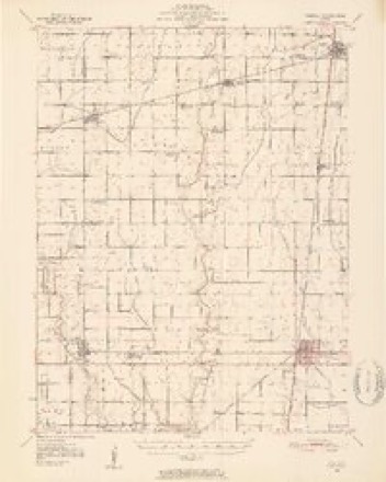
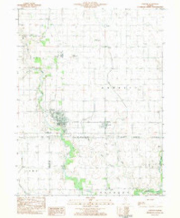
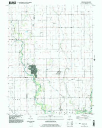
14 topographic sheets cover this place, the earliest surveyed in 1950 and the latest in 1998. It stands in Garrett Township. It lies in ZIP code area 61913. The Survey maps it on the Atwood quadrangle. 122 people lived here at the 2020 count. It stands 667 feet above sea level.
Population over time
2 figuresGarrett fell from 162 to 122 between 2010 and 2020. These are the recorded population figures Wikidata holds for this place, reached through the Geographic Names Information System number this page is keyed on rather than by name, so they belong to this place and not to another of the same name. Most are census counts, but not all are: an early figure may be a founding or settlement estimate, and an estimate published within five years of a census is left out. The change column is computed, and is left blank where more than 20 years separate a figure from the one before it, because a gap that long is not a change between two counts.
| Year | People | Change |
|---|---|---|
| 2010 | 162 | |
| 2020 | 122 | -40 (-25%) |
Topographic sheets covering this place
7 surveys from 14 printed sheetsMatched by testing this settlement's coordinate against the published boundary of every sheet in the United States Geological Survey's historical collection. Each opens the scanned sheet at the Survey.
- 1950 USGS Tuscola quadrangle1:62500, 4 printings
- 1958 USGS Decatur quadrangle1:250000, 3 printings
- 1961 USGS Decatur quadrangle1:250000, 2 printings
- 1975 USGS Tuscola SW quadrangle1:24000
- 1983 USGS Atwood quadrangle1:24000
- 1985 USGS Decatur quadrangle1:100000, 2 printings
- 1998 USGS Atwood quadrangle1:24000




What happened here
An account from the chapter on Garrett township. The inset identifies its exact source book and publication year.
Douglas Countt
In the early days a principal part of the living was venison. Thomas Goodson once killed two deer with a single ball, on what is now the large farm of William Brian. He also assisted in exterminating the last family of wild cats in the Okaw timber. He relates having cut a large tree for rail timber in the exact spot where he had cut a similar one thirty-six years before, as if the timber is holding its own notwithstanding the large quantities used for fuel and improvement.
In the county-history sources
1,650 words on this townshipHistory of Douglas County, Illinois, published 1876 names this settlement in its chapter on Garrett Township. These are the passages that mention it, exactly as the scans read.
Garrett Township is situated in the northwest part of the county: has forty-eight sections of land, equal to 49 square miles, or about 31,344 acres. It receives its name from the Garretts, Isom and his sons, Cale1^ and Nathan. Isom Garrett is living- and able to attend to business at the advanced age of Si years. Caleb Garrett represented the county of Vigo in the Legislature of Indiana in 1S42, at the age of 26 years, and was re-elected. He settled in Douglas county in 1S47, and served on the first Grand Jury of the county: was Justice of the peace for some years and the first Supervisor of the township. He is the fit representative of a family of giants, being six feet in height and weighing considerably over 300 pounds.
Passage source: History of Douglas County, Illinois, published 1876.
Garrett is the fourth township in the county, with regard to population per 9th Census, 1S70, the number of inhabitants being put down at 1,599. It contains an area of 49 square miles in 4S sections of land, several of the sections having considerablv over 1,000 acres. Sulphur Spring, on the farm of Thomas Brian, on the Okaw, section 14, 16, 7, is a fine fountain of living water and a favorite resort for open air meetings.
Passage source: History of Douglas County, Illinois, published 1876.
elected Sheriff in the fall of 1S64; Caleb Garrett, the first Supervisor, 1S6S, succeeded by Win. Ellars, 1S69, who was re-elected in 1S70-1-2. He was followed by J. W. Hackett in 1873; Thomas Owen, 1S74; fosiah Hoots, 1S75, and Wm. Howe, 1S76, the present Supervisor. All of these were old settlers at the time of the institution of the new county in 1859 and were active in its business and politics.
Passage source: History of Douglas County, Illinois, published 1876.
Machine-read from a century-old scan, so expect the errors a machine makes: misspelled names, dropped words, stray characters.
Storms near this place
22 since 1993Regional context, not property-specific evidence. The National Weather Service names Garrett in 22 storm reports between 1993 and 2026: 10 thunderstorm wind, 6 flash flood, 3 flood, 2 tornado. The reports record 1 injury. Each account below is quoted exactly as the forecast office filed it, from the NOAA Storm Events Database, and each date opens the federal record of that event.
| When | Event | Place named | Harm | What the report says |
|---|---|---|---|---|
| April 1994 | Thunderstorm Wind | Garrett | 1 hurt | Thunderstorm winds extensively damaged a home one mile west of Garrett, causing minor injuries to one person. |
| December 2015 | Flood | Garrett | $2,200,000 | An extended period of heavy rain during the late evening of December 26th in Douglas County combined with an already saturated ground to produce flash flooding. Rainfall amounts ranged from 4.00 to 4.25 inches in less than six hours. Most rural roads and state highways were flooded and impassable. Tuscola, Arcola, Villa Grove and Newman were the most impacted with severely flooded streets and basements. The flooding continued through all of December 27th. Additional rainfall of 1.50 to 2.75 from December 28th into the 29th aggravated the flooding situation significantly. More than 120 buildings and homes were damaged in various locations across the county, 23 of which sustained major flood damage. Every rural road and most state highways and city streets were flooded for nearly four days. The flood water finally subsided by the afternoon of December 31st. |
| November 2013 | Tornado (EF1) | Garrett | $825,000 | This tornado crossed into Douglas County from Moultrie County about 5 miles north of Arthur at 12:37 PM CST, then tracked northeastward before lifting 0.8 miles east of Garrett at 12:41 PM CST. The tornado damaged the roofs of 3 homes and 5 outbuildings, as well as, numerous trees and power poles in rural western Douglas County. It then crossed U.S. Highway 36 and tracked into the town of Garrett where it damaged the roofs of about two dozen homes and mobile homes before dissipating. |
| June 2008 | Flood | Garrett | $510,000 | Extensive flooding across Douglas County was the result of 8 to 9 inches of rain that occurred between June 2nd and June 6th. More than 100 homes and businesses sustained damage from the flooding. Many county roads were closed for more than a week. Douglas County was declared a disaster area as a result of the flooding. |
| March 2005 | Thunderstorm Wind | Garrett | $70,000 | Numerous reports of wind damage in and near the east side of Atwood. Damage at the East Forest Estates Mobile Home Park included a mobile home blown off its foundation and numerous other homes with windows and doors blown out. A large tree was blown over onto a garage and caused significant damage to the structure and its contents in the Oaks subdivision on the southeast corner of Atwood. Numerous trees and power lines were blown down in the area. |
| September 1996 | Thunderstorm Wind | Garrett | $25,000 | no account filed |
| June 2011 | Thunderstorm Wind | Garrett | $20,000 | Numerous tree limbs and power lines were blown down in Garrett. |
| May 1998 | Thunderstorm Wind | Garrett | $5,000 | Thunderstorm winds blew down numerous power lines, trees, and tree limbs. Also, two barns were damaged, one just southeast of Arthur and another 1 mile south of Arcola. Some homes sustained siding damage. No injuries were reported. |
| August 2000 | Thunderstorm Wind | Garrett | $1,000 | Widespread crop and tree damage extends from Atwood south to 4.5 miles south southeast of Arthur. |
| March 2026 | Thunderstorm Wind | Garrett | - | Small patches of shingles were blown off of a school building. |
| August 2022 | Thunderstorm Wind | Garrett | - | Strong thunderstorm wind gusts caused minor siding and gutter damage on homes. The roof of a shed was also damaged. |
| August 2021 | Flash Flood | Garrett | - | One foot of water flooded the intersection of Main Street and Birch Avenue in Atwood. A weather observer in Atwood measured rainfall of 4.11. |
| May 2017 | Flash Flood | Garrett | - | Heavy rainfall of 2.00 to 2.50 inches during the early morning hours of May 4th, on already saturated ground, resulted in flash flooding across much of Douglas County. Officials reported that most roads were impassable and numerous creeks rapidly flooded. Illinois Route 130 was closed from Camargo to the Champaign County line. Nearly all rural roads north of U.S. Highway 36 in the northeast part of the county were also closed. |
| May 2017 | Flood | Garrett | - | Heavy rainfall of 2.00 to 2.50 inches during the early morning hours of May 4th, on already saturated ground, resulted in flash flooding across much of Douglas County. Officials reported that most roads were impassable and numerous creeks rapidly flooded. Illinois Route 130 was closed from Camargo to the Champaign County line. Nearly all rural roads north of U.S. Highway 36 in the northeast part of the county were also closed. Additional rainfall around 1.00 inch later in the day May 4th into May 5th caused creeks and roads to stay flooded for nearly 48 hours. Flood waters subsided by the afternoon on May 6th. |
| December 2015 | Flash Flood | Garrett | - | An extended period of heavy rain during the late evening of December 26th in Douglas County combined with an already saturated ground to produce flash flooding. Rainfall amounts ranged from 4.00 to 4.25 inches in less than six hours. Most rural roads and state highways were flooded and impassable. Tuscola, Arcola, Villa Grove and Newman were the most impacted with severely flooded streets and basements. |
| June 2011 | Flash Flood | Garrett | - | Thunderstorms with heavy rainfall produced 2.00 to 3.00 of rain in much of Douglas County during the pre-dawn hours of June 27th. Several rural roads were flooded and impassable as a result of the rainfall accumulations. Streets were also flooded in Tuscola, Arcola and Villa Grove, and standing water was reported along parts of U.S. Highways 36 and 45. |
| July 2010 | Flash Flood | Garrett | - | Heavy rain, with rainfall rates of 1.50 per hour, were reported in much of Douglas County. Roads were flooded in the city of Tuscola with water around one foot deep, which stranded several motorists. |
| May 2009 | Flash Flood | Garrett | - | Heavy rain of 3.00 to 4.00 inches within three hours produced significant flash flooding of most roads in northern Douglas County. Much of U.S. Route 36, U.S. Route 45, and several rural roads were closed to traffic. |
| April 2006 | Thunderstorm Wind | Garrett | - | Minor damage to a home and garage. Storage shed destroyed and machine shed roof damaged. |
| May 2002 | Thunderstorm Wind | Garrett | - | Numerous trees were blown down. Also, in Villa Grove a window on a business was blown out, an unoccupied camper was destroyed, and awnings on a car wash were damaged. No injuries were reported. |
| August 1993 | Tornado (F0) | Garrett | - | A tornado briefly touched down in a field 4 miles north of Garrett. No damage was reported. |
| April 1999 | Hail | Garrett | - | no account filed |
Nearest settlements
The eight closest, with where each one stands in the county. Distances are straight-line, computed from the Geographic Names Information System coordinates.
| Map | Place | Distance | Sheets |
|---|---|---|---|
| Atwood | 2.0 miles | 14 | |
| Ficklin | 3.7 miles | 14 | |
| Chicken Bristle | 4.0 miles | 14 | |
| Bourbon | 4.4 miles | 13 | |
| Fillmore (historical) | 6.3 miles | 13 | |
| Arthur | 6.3 miles | 13 | |
| Chesterville | 6.8 miles | 13 | |
| Parkview | 7.4 miles | 14 |
Elsewhere
Matched on this settlement's Geographic Names Information System number rather than its name, so it cannot be a different place of the same name in another state.
| Wikipedia article on Garrett | An encyclopaedic summary. Its text is share-alike, so it is linked here rather than copied. |
| Wikidata item Q2045097 | The structured record the population and elevation above come from. Public domain (CC0). |
Provenance
This settlement is recorded in the Geographic Names Information System as feature 408910. The sheet list is computed by point-in-boundary test against the United States Geological Survey's historical topographic inventory. Both are works of the United States government and carry no copyright under 17 U.S.C. 105.
Storms. NOAA National Centers for Environmental Information, Storm Events Database https://www.ncei.noaa.gov/stormevents/ A work of the United States government, no copyright under 17 U.S.C. 105. Narratives are quoted verbatim from the National Weather Service report and are not edited or summarised.