 Block
Potomac, Illinois
13 topographic sheets cover this place, the earliest surveyed in 1936 and the latest in 1987. It stands in Middlefork Township. It lies in ZIP code area 61865. It stands on Bluegrass Creek. The Survey maps it on the Potomac quadrangle. 689 people lived here at the 2020 count. It stands 669 feet above sea level.
Population over time
3 figuresPotomac grew from 681 to 689 between 2000 and 2020. These are the recorded population figures Wikidata holds for this place, reached through the Geographic Names Information System number this page is keyed on rather than by name, so they belong to this place and not to another of the same name. Most are census counts, but not all are: an early figure may be a founding or settlement estimate, and an estimate published within five years of a census is left out. The change column is computed, and is left blank where more than 20 years separate a figure from the one before it, because a gap that long is not a change between two counts.
| Year | People | Change |
|---|---|---|
| 2000 | 681 | |
| 2010 | 750 | +69 (+10%) |
| 2020 | 689 | -61 (-8%) |
Topographic sheets covering this place
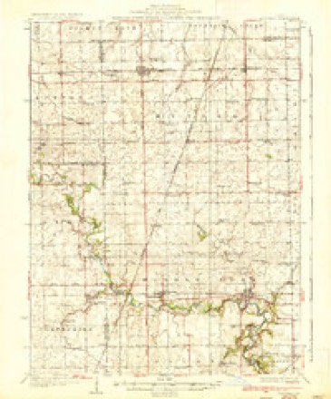
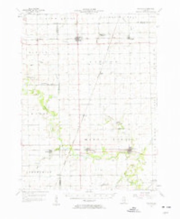
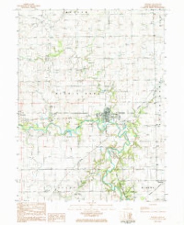
8 surveys from 13 printed sheetsMatched by testing this settlement's coordinate against the published boundary of every sheet in the United States Geological Survey's historical collection. Each opens the scanned sheet at the Survey.
- 1936 USGS Potomac quadrangle1:62500, 3 printings
- 1953 USGS Danville quadrangle1:250000, 3 printings
- 1955 USGS Danville quadrangle1:250000
- 1956 USGS Danville quadrangle1:250000
- 1957 USGS Potomac quadrangle1:62500, 2 printings
- 1984 USGS Danville quadrangle1:100000
- 1984 USGS Potomac quadrangle1:24000
- 1987 USGS Danville quadrangle1:100000





In the county-history sources
19,922 words on this townshipHistory of Vermilion County, Together with Historic Notes on the Northwest, Gleaned from Early Authors, Old Maps and Manuscripts, Private and Official Correspondence, and Other Authentic, Though, for the Most Part, Out-of-the-way Sources, published 1879 names this settlement in its chapter on Middlefork Township. These are the passages that mention it, exactly as the scans read.
The first settlers found corn growing here. Their method of planting and cultivating differed somewhat from that in vogue since Brown invented his corn-planter, and can be easily described. No plow was known to Indian farming. The corn was planted in hills, little less distant than now, and was hoed by the women, and hilled up about as we do potatoes. The next year the hills were planted between the rows of last year's stalks, and the earth which had been hilled up around the former was removed, as needed, to the growing hills, to "hill them up." The only variety of corn they were known to use here was the peculiarly spotted ears, red and white. When the corn was harvested it was not cribbed in pine lumber brought from Green Bay, but caves were dug in the dry knolls, in which it was buried until it was wanted.
Passage source: History of Vermilion County, Together with Historic Notes on the Northwest, Gleaned from Early Authors, Old Maps and Manuscripts, Private and Official Correspondence, and Other Authentic, Though, for the Most Part, Out-of-the-way Sources, published 1879.
The successive postmasters at Marysville have been Dr. Ingalls, Joseph Jameson, John Smith ; then for awhile the office was suspended. When it was reinstated the department changed the name to Potomac, because of the near proximity of Myersville, which name was so readily confounded with that of the name which this office bore. Charles
Passage source: History of Vermilion County, Together with Historic Notes on the Northwest, Gleaned from Early Authors, Old Maps and Manuscripts, Private and Official Correspondence, and Other Authentic, Though, for the Most Part, Out-of-the-way Sources, published 1879.
Joseph Moss, Potomac, farmer and stock-raiser, section 29, was born near Madison, Ohio, on the 20th of March, 1820. When he was but four years of age he came with his parents to this state. His father died when he was but six years old. His mother then married the second time, and he remained at home until he reached the age of nineteen. He was married to Delila Staar on the 17th of April, 1845. She was born in Ohio on the 6th of January, 1828. They have had three children : Sarah A., John B. and an infant now deceased. Mr. Moss is regarded as one of the best citizens of Vermilion county. He has been school director ten years, and commissioner of highways for several years. From fifty to sixty head of cattle are fattened b}T him yearly. He clearly recollects seeing plenty of wolves and Indians when he came to this county. In his politics he is a republican; in religion, a Methodist.
Passage source: History of Vermilion County, Together with Historic Notes on the Northwest, Gleaned from Early Authors, Old Maps and Manuscripts, Private and Official Correspondence, and Other Authentic, Though, for the Most Part, Out-of-the-way Sources, published 1879.
Machine-read from a century-old scan, so expect the errors a machine makes: misspelled names, dropped words, stray characters.
Read the whole chapter on Middlefork Township - it names this place 39 more 39 times.
Fires near this place
1 since 2010Regional context, not property-specific evidence. The federal wildfire occurrence database lists 1 fire within 5 miles of Potomac in 2010, burning about 2 acres in total. None started naturally. None was recorded as arson. Distance is straight-line from the map coordinates, so a fire counted here may appear on a neighbouring settlement's page as well.
| Reported cause | Fires |
|---|---|
| Missing data/not specified/undetermined | 1 |
The most recent of them, most recent first, with the day each was reported and the service that recorded it.
| Date | Cause | Size | Reported by | Name on the report |
|---|---|---|---|---|
| 28 August 2010 | Missing data/not specified/undetermined | 2.0 acres | Illinois Division of Forestry Resources | 2750 |
Settlements close enough to share some of these fires:
Mines and quarries near this place
2 within 5 milesRegional context, not property-specific evidence. The federal mineral resources record lists 2 workings within 5 miles of Potomac: 1 past producer, 1 producer. 1 still produces. What was taken out: Sand and Gravel, Construction. Distance is straight-line from the map coordinates, so a quarry counted here may appear on a neighbouring settlement's page as well.
| Where | Site | Commodity | Status | Recorded |
|---|---|---|---|---|
| Allison Sand & Gravel Pit | Sand and Gravel, Construction | Producer | ||
| Potomac Gravel Pit | Sand and Gravel, Construction | Past Producer |
Storms near this place
21 since 1995Regional context, not property-specific evidence. The National Weather Service names Potomac in 21 storm reports between 1995 and 2024: 11 thunderstorm wind, 9 hail, 1 flash flood. No death or injury is recorded in these reports. Each account below is quoted exactly as the forecast office filed it, from the NOAA Storm Events Database, and each date opens the federal record of that event.
| When | Event | Place named | Harm | What the report says |
|---|---|---|---|---|
| July 2011 | Thunderstorm Wind | Potomac | $8,000 | A tree and power pole were blown down on South Vermilion Street in Potomac. |
| June 2023 | Thunderstorm Wind | Potomac | - | A 12-inch diameter tree limb was blown down. |
| July 2022 | Thunderstorm Wind | Potomac | - | Power lines down. |
| August 2022 | Thunderstorm Wind | Potomac | - | Trees and a power pole were blown down near the 100 block of Grant Street. |
| August 2019 | Thunderstorm Wind | Potomac | - | Several trees were blown down in Potomac. |
| June 2003 | Flash Flood | Potomac | - | Very heavy rain fell in a short amount of time over the northern portions of Vermilion County. U.S. Route 136 was briefly flooded with 6 to 8 inches of water near Potomac. |
| July 2001 | Thunderstorm Wind | Potomac | - | Several power lines were blown down in Potomac. |
| May 2000 | Thunderstorm Wind | Potomac | - | Numerous power poles and power lines were blown down between Potomac and Rossville. Also, a tree was blown down onto a home in Potomac causing minor damage. In Danville, several trees and tree limbs were blown down. Also, 6 sheets of aluminum (30 feet high) were ripped off of a building. One tree fell onto a truck causing minor damage and one mobile home sustained minor damage and another sustained major damage after being tipped over. No injuries were reported. |
| June 1998 | Thunderstorm Wind | Potomac | - | Thunderstorm winds blew down several trees, tree limbs, and power lines in Potomac, Danville and Catlin. No injuries or structural damage were reported. |
| June 1995 | Hail | Potomac | - | Thunderstorm winds blew down a large tree onto a house and caused substantial damage. No damage estimate was available. |
| June 1995 | Thunderstorm Wind | Potomac | - | Thunderstorm winds blew down a large tree onto a house and caused substantial damage. No damage estimate was available. |
| July 2024 | Hail | Potomac | - | no account filed |
| June 2024 | Thunderstorm Wind | Potomac | - | no account filed |
| May 2019 | Hail | Potomac | - | no account filed |
| May 2019 | Hail | Potomac | - | no account filed |
| August 2018 | Hail | Potomac | - | no account filed |
| April 2001 | Hail | Potomac | - | no account filed |
| March 2000 | Hail | Potomac | - | no account filed |
| May 2000 | Hail | Potomac | - | no account filed |
| May 1998 | Hail | Potomac | - | no account filed |
| October 1996 | Thunderstorm Wind | Potomac | - | no account filed |
Nearest settlements
The eight closest, with where each one stands in the county. Distances are straight-line, computed from the Geographic Names Information System coordinates.
| Map | Place | Distance | Sheets |
|---|---|---|---|
| Blue Grass (historical) | 3.9 miles | 13 | |
| Jamesburg | 4.0 miles | 12 | |
| Armstrong | 4.1 miles | 13 | |
| Higginsville | 4.9 miles | 15 | |
| Henning | 5.3 miles | 12 | |
| Collison | 5.5 miles | 15 | |
| Ellis | 5.7 miles | 13 | |
| Vernal | 6.1 miles | 12 |
Elsewhere
Matched on this settlement's Geographic Names Information System number rather than its name, so it cannot be a different place of the same name in another state.
| Wikipedia article on Potomac | An encyclopaedic summary. Its text is share-alike, so it is linked here rather than copied. |
| Wikidata item Q2243257 | The structured record the population and elevation above come from. Public domain (CC0). |
Provenance
This settlement is recorded in the Geographic Names Information System as feature 416074. The sheet list is computed by point-in-boundary test against the United States Geological Survey's historical topographic inventory. Both are works of the United States government and carry no copyright under 17 U.S.C. 105.
Wildfire. Short, Karen C. 2022. Spatial wildfire occurrence data for the United States, 1992-2020 [FPA_FOD_20221014]. 6th Edition. Fort Collins, CO: Forest Service Research Data Archive. https://doi.org/10.2737/RDS-2013-0009.6 Collected with United States Government funding and usable without additional permissions or fees.
Mines and quarries. USGS Mineral Resources Data System (MRDS) https://mrdata.usgs.gov/mrds/ A work of the United States government, no copyright under 17 U.S.C. 105.
Storms. NOAA National Centers for Environmental Information, Storm Events Database https://www.ncei.noaa.gov/stormevents/ A work of the United States government, no copyright under 17 U.S.C. 105. Narratives are quoted verbatim from the National Weather Service report and are not edited or summarised.