 Block
Rankin, Illinois
13 topographic sheets cover this place, the earliest surveyed in 1936 and the latest in 1987. It stands in Butler Township. It lies in ZIP code area 60960. The Survey maps it on the Rankin quadrangle. 495 people lived here at the 2020 count. It stands 722 feet above sea level.
Population over time
3 figuresRankin fell from 617 to 495 between 2000 and 2020. These are the recorded population figures Wikidata holds for this place, reached through the Geographic Names Information System number this page is keyed on rather than by name, so they belong to this place and not to another of the same name. Most are census counts, but not all are: an early figure may be a founding or settlement estimate, and an estimate published within five years of a census is left out. The change column is computed, and is left blank where more than 20 years separate a figure from the one before it, because a gap that long is not a change between two counts.
| Year | People | Change |
|---|---|---|
| 2000 | 617 | |
| 2010 | 561 | -56 (-9%) |
| 2020 | 495 | -66 (-12%) |
Topographic sheets covering this place
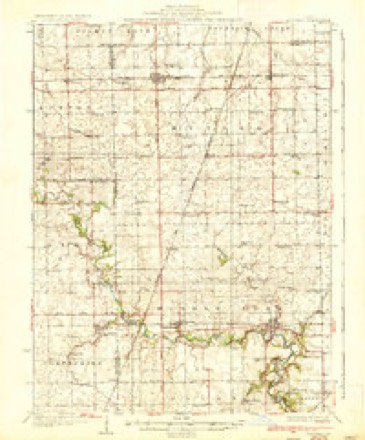
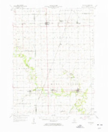
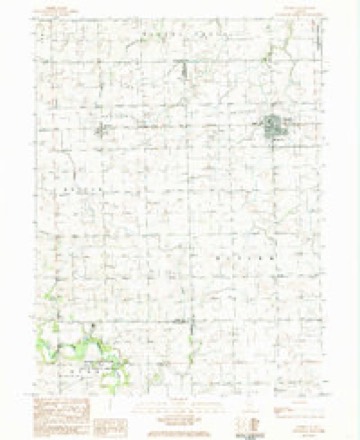
8 surveys from 13 printed sheetsMatched by testing this settlement's coordinate against the published boundary of every sheet in the United States Geological Survey's historical collection. Each opens the scanned sheet at the Survey.
- 1936 USGS Potomac quadrangle1:62500, 3 printings
- 1953 USGS Danville quadrangle1:250000, 3 printings
- 1955 USGS Danville quadrangle1:250000
- 1956 USGS Danville quadrangle1:250000
- 1957 USGS Potomac quadrangle1:62500, 2 printings
- 1984 USGS Danville quadrangle1:100000
- 1984 USGS Rankin quadrangle1:24000
- 1987 USGS Danville quadrangle1:100000





In the county-history sources
11,551 words on this townshipHistory of Vermilion County, Together with Historic Notes on the Northwest, Gleaned from Early Authors, Old Maps and Manuscripts, Private and Official Correspondence, and Other Authentic, Though, for the Most Part, Out-of-the-way Sources, published 1879 names this settlement in its chapter on Butler Township. These are the passages that mention it, exactly as the scans read.
Butler township embraces all the northwest corner of the county which is in town 23 north, range 13 west, of the 2d principal meridian, all the east half of town 23, range 14, two tiers of sections off" the north end of town 22 north, range 13, and six sections in the northeast corner of town 22, range 14, making in all seven t}M;wo sections, or equal to two full congressional townships. The land was originally entirely prairie, and, although embracing some of the finest land in the county, did not come into cultivation till 1855, and as late as 1872 broad strips of its rich prairie had not been vexed with the plow; indeed, as late as this present writing some of the beautiful high rolling prairie along the line separating towns 23 and 22 is yet in prairie-grass, and scores of the farms south and southeast of Rankin are guiltless of either fence or hedge to mark their boundary lines. No considerable stream crosses the town. From its southern side the little streams and rivulets stretch away toward the middle fork of the Vermilion, from its eastern border they run into the North Fork, while from its northern half the water sheds to the head-waters of the Illinois River. High, rolling, rich and healthy, it can but seem wonderful, and must ever remain in a great measure mysterious, how the land of such eligible portions of the county were left uninhabited until long after the western half of the state, and Missouri, Iowa, and portions of Kansas and Nebraska, were largely filling up with settlers. People living along the Middle Fork, not twenty miles away, pulled up and moved to Missouri, on poorer land than could be found within half a day's ride of their homes, and this, after it had been demonstrated that people could live on the open prairie with less labor, just as much comfort, more health, and surer returns for their labor, than on timber farms. It cannot be pleaded in this case that these prairies were unknown. The Chicago road, the great highway of travel before railroads were built, passed directly over this beautiful tract, and the road leading from Danville to Ottawa, along- which thousands of men went from the Illinois River country to Danville to enter land, and the road from Attica to Bloomington, along which hundreds of people passed each year, visiting their old homes in Indiana and Ohio, both crossed this arm of the Grand Prairie. The old scholars had an adage which, being liberally translated, runs, "In matters of taste there is no use in disputing." Just so; there is no law against a man's going through the woods and picking up a crooked stick beyond.
Passage source: History of Vermilion County, Together with Historic Notes on the Northwest, Gleaned from Early Authors, Old Maps and Manuscripts, Private and Official Correspondence, and Other Authentic, Though, for the Most Part, Out-of-the-way Sources, published 1879.
The Lafayette, Bloomington & Muncie railroad runs directly through the township from east to west, on a line nearly one and one half miles from its northern line, having on it the three little villages of East Lynne, named from the charming novel of Mrs. Anna S. Stephens, Rankin, named from Hon. David Rankin, the proprietor of a portion of the town and of a large amount of land in the neighborhood, and Pellsville, named from W. H. Pells, who was co-proprietor of it.
Passage source: History of Vermilion County, Together with Historic Notes on the Northwest, Gleaned from Early Authors, Old Maps and Manuscripts, Private and Official Correspondence, and Other Authentic, Though, for the Most Part, Out-of-the-way Sources, published 1879.
Daniel Stamp came from New York and bought land in section 14 (23-14), in 1855. He sold to A. B. Lucas, and he to Samuel Johnson. Lucas lives in Pellsville. Johnson sold to Williams, and went to Kansas. Fred Stamp settled about the same time, and made a farm on section 15. He lives now in Paxton. James Dixon settled on section 11, where Mrs. Johnson now resides. John Jones the same time made a farm on section 19, just north of Schwartz. Caleb T. Beals came in 1856, and took land in section 3 (22-13). He still lives near there, in section 9. John Dopps commenced farming in section 15 (23-14) in 1855. He afterward sold out and went to Kansas. David Dopps commenced a farm in the same section. These men were pioneers of the Methodist church, and the first class was formed at the house of their brother Eli, across the line in Ford county.
Passage source: History of Vermilion County, Together with Historic Notes on the Northwest, Gleaned from Early Authors, Old Maps and Manuscripts, Private and Official Correspondence, and Other Authentic, Though, for the Most Part, Out-of-the-way Sources, published 1879.
Machine-read from a century-old scan, so expect the errors a machine makes: misspelled names, dropped words, stray characters.
Read the whole chapter on Butler Township - it names this place 37 more 37 times.
Storms near this place
17 since 2004Regional context, not property-specific evidence. The National Weather Service names Rankin in 17 storm reports between 2004 and 2021: 8 flash flood, 5 hail, 4 thunderstorm wind. No death or injury is recorded in these reports. Each account below is quoted exactly as the forecast office filed it, from the NOAA Storm Events Database, and each date opens the federal record of that event.
| When | Event | Place named | Harm | What the report says |
|---|---|---|---|---|
| May 2011 | Thunderstorm Wind | Rankin | $75,000 | Numerous trees and powerlines were blown down in Rankin. |
| August 2018 | Thunderstorm Wind | Rankin | $15,000 | Numerous tree branches were blown down, some of which blocked roadways. |
| May 2009 | Thunderstorm Wind | Rankin | $7,000 | A tree was blown onto a house in Rankin. |
| June 2021 | Thunderstorm Wind | Rankin | - | A small grain bin was wrapped around a telephone pole. |
| February 2018 | Flash Flood | Rankin | - | Around 1.00 to 1.75 inches of rain fell onto frozen ground late on February 19th. This set the conditions for rapid flash flooding to occur on February 20th into the 21st when 3.00 to 5.00 of rain occurred. Numerous creeks and streams rapidly flooded in northern and central Vermilion County. Numerous roads in Hoopeston, Bismarck and Danville were impassable. |
| June 2018 | Flash Flood | Rankin | - | Heavy rain of more than 3.00 inches in an hour during the early afternoon of June 10th resulted in flash flooding in northern Vermilion County, primarily north of U.S. Highway 136. Most roads were closed in Hoopeston and a viaduct on Illinois Route 119 near Alvin was impassable. The flooding subsided by early evening. |
| May 2017 | Flash Flood | Rankin | - | Intense rainfall of 2.00 to 3.00 inches in 30 to 60 minutes produced rapid flash flooding in northern Vermilion County. The flooding on roads from East Lynn to Hoopeston was intensified by hail drifts 1.5 to 3 feet deep. Severe street flooding was reported in Hoopeston with water up to 3 feet deep. Illinois Route 1 was impassable from near the Iroquois County line to 3 miles southwest of Hoopeston. The combination of additional rainfall during the late evening hours and slowly melting hail drifts kept flash flood conditions in place until the early morning hours of May 27th. |
| February 2014 | Flash Flood | Rankin | - | Rainfall of 0.50 to 1.00 combined with 2 of snow depth and a frozen ground to produce flash flooding across much of Vermilion County. Many streets in Danville were flooded and most rural roads were impassable. |
| May 2010 | Flash Flood | Rankin | - | Training thunderstorm cells produced an area of flash flooding in northwest Vermilion County. Rainfall rates of 1.50 inches per hour for nearly 2.5 hours were reported. Many roads were inundated, particularly Illinois Route 49 and U.S. Route 136 west of Potomac. |
| May 2010 | Flash Flood | Rankin | - | A slow moving thunderstorm produced 2.50 inches of rain in one hour in a small part of northwest Vermilion County. Many rural roads were inundated around the town of Rankin, including a small part of Illinois Route 9 and Illinois Route 49. |
| May 2009 | Flash Flood | Rankin | - | Heavy rain of 1.50 to 2.00 inches fell within two hours, on already saturated ground, across northern Vermilion County. This produced extensive flash flooding, particularly on rural roads. Multiple streets were flooded in the city of Danville, and Illinois Route 9 near Hoopeston was impassible. |
| August 2004 | Flash Flood | Rankin | - | Very heavy rain caused Illinois Routes 49 and 9 to become flooded in Rankin. |
| May 2017 | Hail | Rankin | - | no account filed |
| May 2013 | Hail | Rankin | - | no account filed |
| August 2009 | Hail | Rankin | - | no account filed |
| June 2009 | Hail | Rankin | - | no account filed |
| June 2009 | Hail | Rankin | - | no account filed |
Nearest settlements
The eight closest, with where each one stands in the county. Distances are straight-line, computed from the Geographic Names Information System coordinates.
Elsewhere
Matched on this settlement's Geographic Names Information System number rather than its name, so it cannot be a different place of the same name in another state.
| Wikipedia article on Rankin | An encyclopaedic summary. Its text is share-alike, so it is linked here rather than copied. |
| Wikidata item Q2127767 | The structured record the population and elevation above come from. Public domain (CC0). |
Provenance
This settlement is recorded in the Geographic Names Information System as feature 416385. The sheet list is computed by point-in-boundary test against the United States Geological Survey's historical topographic inventory. Both are works of the United States government and carry no copyright under 17 U.S.C. 105.
Storms. NOAA National Centers for Environmental Information, Storm Events Database https://www.ncei.noaa.gov/stormevents/ A work of the United States government, no copyright under 17 U.S.C. 105. Narratives are quoted verbatim from the National Weather Service report and are not edited or summarised.