 Block
Roseville, Illinois
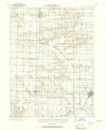
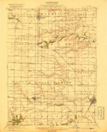
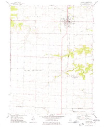
17 topographic sheets cover this place, the earliest surveyed in 1916 and the latest in 1998. It stands in Roseville Township. It lies in ZIP code area 61473. It stands on Town Branch. The Survey maps it on the Roseville quadrangle. 892 people lived here at the 2020 count. It stands 741 feet above sea level.
Population over time
3 figuresRoseville fell from 1,083 to 892 between 2000 and 2020. These are the recorded population figures Wikidata holds for this place, reached through the Geographic Names Information System number this page is keyed on rather than by name, so they belong to this place and not to another of the same name. Most are census counts, but not all are: an early figure may be a founding or settlement estimate, and an estimate published within five years of a census is left out. The change column is computed, and is left blank where more than 20 years separate a figure from the one before it, because a gap that long is not a change between two counts.
| Year | People | Change |
|---|---|---|
| 2000 | 1,083 | |
| 2010 | 989 | -94 (-9%) |
| 2020 | 892 | -97 (-10%) |
Topographic sheets covering this place
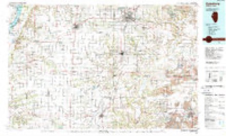
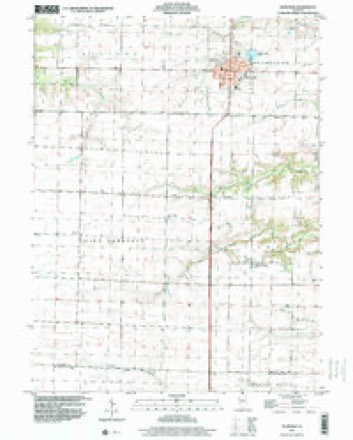
10 surveys from 17 printed sheetsMatched by testing this settlement's coordinate against the published boundary of every sheet in the United States Geological Survey's historical collection. Each opens the scanned sheet at the Survey.
- 1916 USGS Good Hope quadrangle1:62500, 2 printings
- 1918 USGS Good Hope quadrangle1:62500, 2 printings
- 1958 USGS Burlington quadrangle1:250000, 4 printings
- 1961 USGS Burlington quadrangle1:250000
- 1963 USGS Burlington quadrangle1:250000
- 1974 USGS Roseville quadrangle1:24000
- 1985 USGS Galesburg quadrangle1:100000, 2 printings
- 1989 USGS Galesburg quadrangle1:100000
- 1990 USGS Burlington quadrangle1:250000, 2 printings
- 1998 USGS Roseville quadrangle1:24000




In the county-history sources
3,741 words on this townshipPortrait and Biographical Album of Warren County, Illinois : Containing Full Page Portraits and Biographical Sketches of Prominent and Representative Citizens of the County, Together with Portraits and Biographies of All the Governors of Illinois, and of the Presidents of the United States ; Also Containing a History of the County, from Its Earliest Settlement Up to the Present Time, published 1886 names this settlement in its chapter on Roseville Township. These are the passages that mention it, exactly as the scans read.
Roseville Township is numbered 9 north, of range 2 west, of the 4th principal meridian, and is bounded on the north by Lenox, on the east by Berwick, the south by Swan, and the West by Ellison Township. It is watered by the north and south branches of Nigger Creek, which meanders easterly through the township. Bordering these water courses, there is a liberal growth of timber, with broad, rolling prairies predominating in the township. Along the eastern line, however, and particularly about the streams, the land is broken. Tne St. Louis branch of the Chicago, Burlington & Quincy Railroad enters the township on sections 5 and 6, passes south between these sections and sections 7 and 8, and deflecting a little westward, goes out about the middle of section 31. This road was completed through the township in the summer of 1870.
John and James Armstrong have the credit of being the first settlers in Roseville Township. They came in 1829, from the south part of the State, and located on section i. They did not remain long, but sold out to Thomas Pearce, who came in 1831. Mr. Pearce came from Ohio, with his wife and children - Andrew G., Thomas, Theodore, Melissa, Minerva, Mary E. and Sarah D. Andrew G. (see biography) still lives on the old homestead ; Theodore and Thomas died in their youth ; Minerva died when a woman; Melissa, who married R. E. Hill, died in Iowa; Mary E. was married to Judge Ivory Quinby, Feb. 17, 1848, and is still living in Monmouth ; Sarah T. was married to William Whitenack, and is living in Monmouth. Thomas Pearce died at his homestead Aug 22, 1853, aged 75 years. He was one of those sturdy pioneers so essential to the development of a new country. His widow died Feb. 29, 1869, at the advanced age of 78 years and five months.
John Murphy and W. Carr were the next to settle in the township. The former was from Kentucky, and located on section i, where he lived and died; the latter was from Indiana, and settled on section 13. These pioneers did not .remain long in their solitude, but were soon followed by many more families seeking homes in the West. Among these was Truman Eldridg, who located southwest, near the town of Roseville. (See biography.) . Mr. Carr's house was struck by lightning in 1838, killing two of his children. He died in 1879, at the age of 84 years, and his widow followed him in 1880.
Machine-read from a century-old scan, so expect the errors a machine makes: misspelled names, dropped words, stray characters.
Read the whole chapter on Roseville Township - it names this place 13 more 13 times.
Fires near this place
8 since 2013Regional context, not property-specific evidence. The federal wildfire occurrence database lists 8 fires within 5 miles of Roseville between 2013 and 2014, burning about 54 acres in total. None started naturally. None was recorded as arson. Distance is straight-line from the map coordinates, so a fire counted here may appear on a neighbouring settlement's page as well.
| Reported cause | Fires |
|---|---|
| Debris and open burning | 6 |
| Equipment and vehicle use | 2 |
The most recent of them, most recent first, with the day each was reported and the service that recorded it.
| Date | Cause | Size | Reported by | Name on the report |
|---|---|---|---|---|
| 5 September 2013 | Equipment and vehicle use | 7.0 acres | Illinois Division of Forestry Resources | 201353 |
| 9 June 2014 | Debris and open burning | 1.0 acres | Illinois Division of Forestry Resources | 201450 |
| 6 April 2013 | Debris and open burning | 19 acres | Illinois Division of Forestry Resources | 201329 |
| 4 April 2013 | Debris and open burning | 7.0 acres | Illinois Division of Forestry Resources | 201326 |
| 31 March 2013 | Debris and open burning | 6.0 acres | Illinois Division of Forestry Resources | 201324 |
| 30 March 2014 | Debris and open burning | under an acre | Illinois Division of Forestry Resources | 201425 |
| 27 October 2013 | Debris and open burning | 12 acres | Illinois Division of Forestry Resources | 201370 |
| 17 October 2013 | Equipment and vehicle use | 2.0 acres | Illinois Division of Forestry Resources | 201369 |
Settlements close enough to share some of these fires:
Storms near this place
40 since 1995Regional context, not property-specific evidence. The National Weather Service names Roseville in 40 storm reports between 1995 and 2024: 19 thunderstorm wind, 11 hail, 5 flood, 4 tornado. No death or injury is recorded in these reports. Each account below is quoted exactly as the forecast office filed it, from the NOAA Storm Events Database, and each date opens the federal record of that event.
| When | Event | Place named | Harm | What the report says |
|---|---|---|---|---|
| July 2003 | Thunderstorm Wind | Roseville | $20,000 | Trees down |
| June 2012 | Thunderstorm Wind | Roseville | $5,000 | Wind gusts estimated to be 75 mph blew down some trees and power lines about 2 miles west of Roseville, IL at 630 pm CDT June 16. |
| April 2010 | Thunderstorm Wind | Roseville | $5,000 | Wind gusts estimated to be 65 mph blew down several power poles in Roseville, IL at 508 pm April 30. |
| April 2006 | Thunderstorm Wind | Roseville | $2,000 | Trees down |
| March 1998 | Thunderstorm Wind | Roseville | $2,000 | Grain bin was blown over. |
| June 1998 | Tornado (F0) | Roseville | $2,000 | no account filed |
| July 2015 | Thunderstorm Wind | Roseville | $1,000 | Strong and gusty thunderstorm winds brought several tree limbs and roof shingles down. The tree limbs were about 2 inches in diameter and approximately 15 feet in length. This was a delayed report. The time of the event was estimated by local radar data. |
| April 2000 | Thunderstorm Wind | Roseville | $500 | Thunderstorm winds snapped a large tree limb on a power line, which caused a power outage in the community. |
| April 2006 | Hail | Roseville | $500 | no account filed |
| May 2024 | Hail | Roseville | - | Hail was slightly bigger than quarters for 5 minutes. |
| June 2023 | Thunderstorm Wind | Roseville | - | Several large tree branches snapped in Roseville. Winds estimated near 100 mph. |
| June 2023 | Thunderstorm Wind | Roseville | - | Several large tree branches snapped in Roseville. Winds estimated at 100 mph. |
| June 2022 | Hail | Roseville | - | There was also some crop and tree damage relayed with no detail. |
| May 2020 | Flash Flood | Roseville | - | Illinois State Police reported Highway 116 West of Roseville was flooded. |
| August 2019 | Thunderstorm Wind | Roseville | - | Several 8 inch diameter tree branches were blown down. |
| May 2019 | Thunderstorm Wind | Roseville | - | Power lines reported blown down in Roseville. |
| September 2015 | Hail | Roseville | - | Pea to penny sized hail was reported. |
| June 2015 | Thunderstorm Wind | Roseville | - | Time was estimated in the report of 2 inch diameter tree branches down. |
| June 2015 | Hail | Roseville | - | Law enforcement reported quarter size hail. |
| November 2015 | Thunderstorm Wind | Roseville | - | Local Fire Department reported in Ellison and Roseville Townships, power poles were snapped. Two porches were blown off two homes. Multiple grain bins were damaged. Multiple trees were down. |
| November 2015 | Thunderstorm Wind | Roseville | - | Wind speed was measured from their anemometer located at the fertilizer plant west of town. |
| November 2015 | Thunderstorm Wind | Roseville | - | Damage begins near the fertilizer plant and goes in a northeast direction where multiple large water tanks that were mainly empty were blown over. A machine shed and some grain bins were down with damage to a substation north of town on business 67, on 90th avenue B. |
| June 2009 | Thunderstorm Wind | Roseville | - | Wind gusts estimated to be 60 mph blew down some large tree limbs about 1 mile west of Roseville, IL around 705 pm June 27. |
| March 2002 | Thunderstorm Wind | Roseville | - | Several 6 to 8 inch diameter tree limbs down. |
| July 2001 | Tornado (F0) | Roseville | - | An F0 tornado touched down one half mile west of the Knox/Warren County line on Route 116, or approximately 11 miles east of Roseville. This was a brief touch down with no damage. WQAD TV-8 provided The Quad Cities National Weather Service with footage of this tornado. |
| September 2000 | Flood | Roseville | - | Several city streets were flooded. |
| August 1999 | Thunderstorm Wind | Roseville | - | Several 12 inch diameter tree limbs and power lines downed. |
| June 1999 | Thunderstorm Wind | Roseville | - | Several trees and power lines downed. |
| June 1999 | Flood | Roseville | - | Heavy rain flooded HIghway 116 west of town. |
| June 1999 | Flood | Roseville | - | Water over the Highway 67 bridge at 80th Avenue. |
| June 1999 | Flood | Roseville | - | Water over several roads in town. |
| May 2024 | Hail | Roseville | - | no account filed |
| August 2024 | Hail | Roseville | - | no account filed |
| May 2020 | Hail | Roseville | - | no account filed |
| March 2007 | Hail | Roseville | - | no account filed |
| May 2000 | Hail | Roseville | - | no account filed |
| April 1999 | Flood | Roseville | - | no account filed |
| April 1999 | Tornado (F0) | Roseville | - | no account filed |
| April 1997 | Tornado (F0) | Roseville | - | no account filed |
| May 1995 | Hail | Roseville | - | no account filed |
Nearest settlements
The eight closest, with where each one stands in the county. Distances are straight-line, computed from the Geographic Names Information System coordinates.
| Map | Place | Distance | Sheets |
|---|---|---|---|
| New Lancaster (historical) | 3.9 miles | 18 | |
| Swan Creek | 4.5 miles | 17 | |
| Youngstown | 5.5 miles | 17 | |
| Larchland | 6.1 miles | 18 | |
| Ellison (historical) | 6.2 miles | 17 | |
| Ponemah | 6.5 miles | 18 | |
| Greenbush | 7.0 miles | 17 | |
| Smithshire | 7.4 miles | 17 |
Elsewhere
Matched on this settlement's Geographic Names Information System number rather than its name, so it cannot be a different place of the same name in another state.
| Wikipedia article on Roseville | An encyclopaedic summary. Its text is share-alike, so it is linked here rather than copied. |
| Wikidata item Q2371210 | The structured record the population and elevation above come from. Public domain (CC0). |
Provenance
This settlement is recorded in the Geographic Names Information System as feature 416966. The sheet list is computed by point-in-boundary test against the United States Geological Survey's historical topographic inventory. Both are works of the United States government and carry no copyright under 17 U.S.C. 105.
Wildfire. Short, Karen C. 2022. Spatial wildfire occurrence data for the United States, 1992-2020 [FPA_FOD_20221014]. 6th Edition. Fort Collins, CO: Forest Service Research Data Archive. https://doi.org/10.2737/RDS-2013-0009.6 Collected with United States Government funding and usable without additional permissions or fees.
Storms. NOAA National Centers for Environmental Information, Storm Events Database https://www.ncei.noaa.gov/stormevents/ A work of the United States government, no copyright under 17 U.S.C. 105. Narratives are quoted verbatim from the National Weather Service report and are not edited or summarised.