 Block
Scales Mound, Illinois
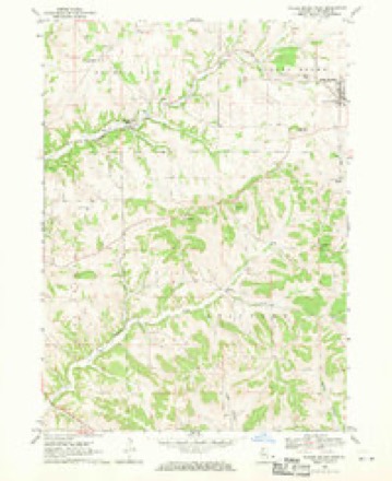
16 topographic sheets cover this place, the earliest surveyed in 1911 and the latest in 1984. It stands in Scales Mound Township. It lies in ZIP code area 61075. It stands on Scales Mound. The Survey maps it on the Scales Mound West quadrangle. 436 people lived here at the 2020 count. It stands 955 feet above sea level.
On record in Scales Mound
Buildings and businesses the archive holds for this place. Each opens its own page, with the source record it came from.
On the National Register 1 record
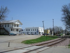 Scales Mound Historic Districtlisted 1990
Population over time
2 figuresScales Mound grew from 376 to 436 between 2010 and 2020. These are the recorded population figures Wikidata holds for this place, reached through the Geographic Names Information System number this page is keyed on rather than by name, so they belong to this place and not to another of the same name. Most are census counts, but not all are: an early figure may be a founding or settlement estimate, and an estimate published within five years of a census is left out. The change column is computed, and is left blank where more than 20 years separate a figure from the one before it, because a gap that long is not a change between two counts.
| Year | People | Change |
|---|---|---|
| 2010 | 376 | |
| 2020 | 436 | +60 (+16%) |
Topographic sheets covering this place
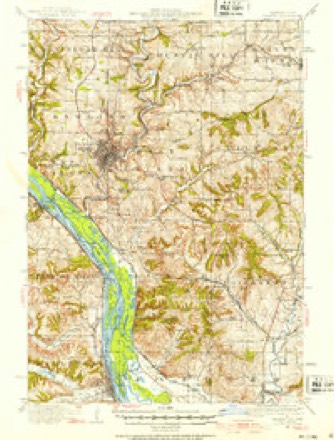
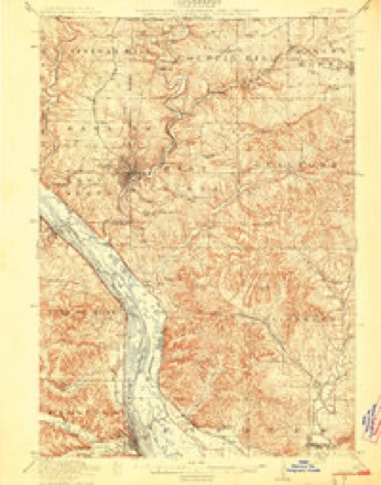
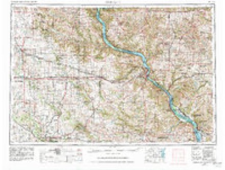
8 surveys from 16 printed sheetsMatched by testing this settlement's coordinate against the published boundary of every sheet in the United States Geological Survey's historical collection. Each opens the scanned sheet at the Survey.
- 1911 USGS Galena quadrangle1:62500, 3 printings
- 1913 USGS Galena quadrangle1:62500, 3 printings
- 1959 USGS Dubuque quadrangle1:250000
- 1961 USGS Dubuque quadrangle1:250000
- 1962 USGS Dubuque quadrangle1:250000, 2 printings
- 1968 USGS Scales Mound West quadrangle1:24000
- 1976 USGS Dubuque quadrangle1:250000
- 1984 USGS Dubuque South quadrangle1:100000, 4 printings
In the county-history sources
10,168 words on this townshipThe History of Jo Daviess County, Illinois, Containing a History of the County, Its Cities, Towns, Etc., a Biographical Directory of Its Citizens, War Record of Its Volunteers in the Late Rebellion ... History of the Northwest, History of Illinois ... Constitution of the United States, published 1878 names this settlement in its chapter on Scales Mound Township. These are the passages that mention it, exactly as the scans read.
In 1826, when the tide of immigration was drifting towards the lead mines of northwestern Illinois, a party of men, consisting of two brothers, named Watson, Joshua Streeter and three sons, John Wood, a Mr. Brigham, Mr. Blane and a few others, discovered the mines of the upper East Fork. They stopped there, built cabins and mined for four or five years. These men can not properly be considered as settlers of Scales Mound Township, as they left their families at other places, to which they would make frequent trips, and seemed to regard these mines as but a temporary location.
Passage source: The History of Jo Daviess County, Illinois, Containing a History of the County, Its Cities, Towns, Etc., a Biographical Directory of Its Citizens, War Record of Its Volunteers in the Late Rebellion ... History of the Northwest, History of Illinois ... Constitution of the United States, published 1878.
In 1830, Samuel H. Scales purchased the claim and cabin of John L. Sole, who had lived there nearly two years, and built a public house near the base of the mound, which is now known by his name. This tavern was on the historical " Sucker Trail " over which, afterwards, passed the Chicago & Galena stage line, and it was kept, in succession, by Scales, Moffett, Cowgill and Moppin. For many years after the village of Scales Mound was built, on the railroad, nearly a mile from the old tavern, the mound was generally distinguished by the name of " Maupin's Mound." It has now, however, reverted to its old title.
Passage source: The History of Jo Daviess County, Illinois, Containing a History of the County, Its Cities, Towns, Etc., a Biographical Directory of Its Citizens, War Record of Its Volunteers in the Late Rebellion ... History of the Northwest, History of Illinois ... Constitution of the United States, published 1878.
In the Fall of 1852, the people of Jo Daviess voted to adopt the township system. At a subsequent session of the county court, Messrs. Charles Bennett, G. N. Townsend and David T. Barr, were appointed Commissioners, for the purpose of dividing the county into townships and defining their several boundary lines. At a meeting of the Board of Supervisors, in 1855, some alterations were made in certain boundary lines, and a new township created, called Scales Mound, in honor of Samuel H. Scales, who was an enterprising and influential citizen, and who died in the Fall of 1877. The boundaries of this township were defined as follows :
Passage source: The History of Jo Daviess County, Illinois, Containing a History of the County, Its Cities, Towns, Etc., a Biographical Directory of Its Citizens, War Record of Its Volunteers in the Late Rebellion ... History of the Northwest, History of Illinois ... Constitution of the United States, published 1878.
Machine-read from a century-old scan, so expect the errors a machine makes: misspelled names, dropped words, stray characters.
Read the whole chapter on Scales Mound Township - it names this place 50 more 50 times.
Fires near this place
4 since 2010Regional context, not property-specific evidence. The federal wildfire occurrence database lists 4 fires within 5 miles of Scales Mound between 2010 and 2011, burning about 6 acres in total. None started naturally. None was recorded as arson. Distance is straight-line from the map coordinates, so a fire counted here may appear on a neighbouring settlement's page as well.
| Reported cause | Fires |
|---|---|
| Missing data/not specified/undetermined | 3 |
| Equipment and vehicle use | 1 |
The most recent of them, most recent first, with the day each was reported and the service that recorded it.
| Date | Cause | Size | Reported by | Name on the report |
|---|---|---|---|---|
| 19 April 2010 | Missing data/not specified/undetermined | under an acre | Illinois Division of Forestry Resources | SCHAMPER |
| 18 April 2010 | Missing data/not specified/undetermined | 1.0 acres | Illinois Division of Forestry Resources | JONES |
| 9 March 2011 | Equipment and vehicle use | 4.0 acres | Illinois Division of Forestry Resources | GRENDA |
| 19 March 2010 | Missing data/not specified/undetermined | 1.0 acres | Illinois Division of Forestry Resources | WATSON |
Settlements close enough to share some of these fires:
Mines and quarries near this place
10 of 45 shownRegional context, not property-specific evidence. The federal mineral resources record lists 45 workings within 5 miles of Scales Mound: 32 past producers, 6 unknowns, 3 producers, 2 occurrences. 3 still produce. What was taken out: Lead, Zinc, Stone, Crushed/Broken, Lead, Zinc. Distance is straight-line from the map coordinates, so a quarry counted here may appear on a neighbouring settlement's page as well.
| Where | Site | Commodity | Status | Recorded |
|---|---|---|---|---|
| Schullsburg Mine | Zinc, Lead, Barium-Barite, Iron | Producer | Barite, Galena, Marcasite, Pyrite, Sphalerite | |
| Magoon Prospect | Zinc, Lead | Occurrence | ||
| Mulcahy Mine | Zinc, Lead | Past Producer | 1950, 1952 | |
| Vinegar Hill Blackstone Mine | Zinc, Lead | Past Producer | 1950 | |
| Annie Walton Mine | Lead, Zinc | Past Producer | 1947 | |
| Magoon Prospect | Lead, Zinc | Prospect | ||
| New Longhorn Mine | Lead, Zinc | Past Producer | 1917, 1926 | |
| Rockford Mining and Milling Co. Mine | Lead, Zinc | Unknown | 1905, 1915 | |
| Shullsburg Mill | Lead, Zinc | Past Producer | ||
| Bahr Quarry | Stone, Crushed/Broken | Past Producer |
Storms near this place
11 since 2007Regional context, not property-specific evidence. The National Weather Service names Scales Mound in 11 storm reports between 2007 and 2024: 7 hail, 3 thunderstorm wind, 1 tornado. No death or injury is recorded in these reports. Each account below is quoted exactly as the forecast office filed it, from the NOAA Storm Events Database, and each date opens the federal record of that event.
| When | Event | Place named | Harm | What the report says |
|---|---|---|---|---|
| June 2010 | Thunderstorm Wind | Scales Mound | $25,000 | Wind gusts estimated to be 70 mph blew a roof off a house in Scales Mound, IL around 205 pm June 18. |
| May 2024 | Thunderstorm Wind | Scales Mound | - | Trees and power lines blown down. Time estimated from radar data. |
| March 2016 | Hail | Scales Mound | - | Dime size hail fell for 10 minutes. |
| June 2015 | Thunderstorm Wind | Scales Mound | - | A member of the public reported a tree down on a house, and several small branches down in town. |
| July 2009 | Hail | Scales Mound | - | Golf ball-sized hail fell in Scales Mound, IL around 535 pm July 24. |
| July 2009 | Hail | Scales Mound | - | Golf ball-sized hail fell 2 miles east of Scales Mound, IL around 538 pm July 24. |
| May 2008 | Hail | Scales Mound | - | Quarter-sized hail fell in Scales Mound, IL around 9:10 pm. |
| May 2008 | Hail | Scales Mound | - | Nickel to quarter-sized hail fell in Scales Mound, IL between 9:30 and 9:45 pm. |
| June 2008 | Hail | Scales Mound | - | Dime-sized hail fell in Scales Mound, IL at 1:14 pm June 28. |
| June 2007 | Tornado (EF0) | Scales Mound | - | A tornado briefly touched down about 2 miles south of Scales Mound, IL. Some trees were damaged. |
| November 2022 | Hail | Scales Mound | - | no account filed |
Nearest settlements
The eight closest, with where each one stands in the county. Distances are straight-line, computed from the Geographic Names Information System coordinates.
| Map | Place | Distance | Sheets |
|---|---|---|---|
| Council Hill Station | 4.5 miles | 16 | |
| Guilford | 4.7 miles | 16 | |
| Council Hill | 5.4 miles | 16 | |
| Schapville | 6.0 miles | 15 | |
| Apple Canyon Lake | 6.4 miles | 15 | |
| Millbrig (historical) | 8.0 miles | 19 | |
| Apple River | 8.4 miles | 12 | |
| Bremen | 10.0 miles | 19 |
Elsewhere
Matched on this settlement's Geographic Names Information System number rather than its name, so it cannot be a different place of the same name in another state.
| Wikipedia article on Scales Mound | An encyclopaedic summary. Its text is share-alike, so it is linked here rather than copied. |
| Wikidata item Q2672125 | The structured record the population and elevation above come from. Public domain (CC0). |
Provenance
This settlement is recorded in the Geographic Names Information System as feature 418055. The sheet list is computed by point-in-boundary test against the United States Geological Survey's historical topographic inventory. Both are works of the United States government and carry no copyright under 17 U.S.C. 105.
Wildfire. Short, Karen C. 2022. Spatial wildfire occurrence data for the United States, 1992-2020 [FPA_FOD_20221014]. 6th Edition. Fort Collins, CO: Forest Service Research Data Archive. https://doi.org/10.2737/RDS-2013-0009.6 Collected with United States Government funding and usable without additional permissions or fees.
Mines and quarries. USGS Mineral Resources Data System (MRDS) https://mrdata.usgs.gov/mrds/ A work of the United States government, no copyright under 17 U.S.C. 105.
Storms. NOAA National Centers for Environmental Information, Storm Events Database https://www.ncei.noaa.gov/stormevents/ A work of the United States government, no copyright under 17 U.S.C. 105. Narratives are quoted verbatim from the National Weather Service report and are not edited or summarised.