 Block
Shabbona, Illinois
9 topographic sheets cover this place, the earliest surveyed in 1934 and the latest in 1985. It stands in Shabbona Township. It lies in ZIP code area 60550. The Survey maps it on the Lee quadrangle. 863 people lived here at the 2020 count. It stands 899 feet above sea level.
On record in Shabbona
Buildings and businesses the archive holds for this place. Each opens its own page, with the source record it came from.
On the National Register 1 record
- Shabbona Hotellisted 2021
Population over time
2 figuresShabbona fell from 925 to 863 between 2010 and 2020. These are the recorded population figures Wikidata holds for this place, reached through the Geographic Names Information System number this page is keyed on rather than by name, so they belong to this place and not to another of the same name. Most are census counts, but not all are: an early figure may be a founding or settlement estimate, and an estimate published within five years of a census is left out. The change column is computed, and is left blank where more than 20 years separate a figure from the one before it, because a gap that long is not a change between two counts.
| Year | People | Change |
|---|---|---|
| 2010 | 925 | |
| 2020 | 863 | -62 (-7%) |
Topographic sheets covering this place
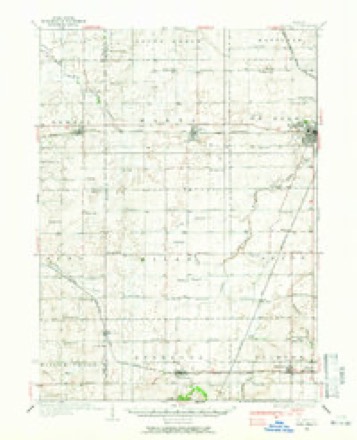
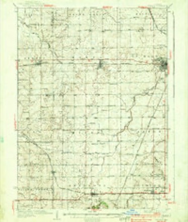
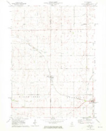
6 surveys from 9 printed sheetsMatched by testing this settlement's coordinate against the published boundary of every sheet in the United States Geological Survey's historical collection. Each opens the scanned sheet at the Survey.
- 1934 USGS De Kalb quadrangle1:62500
- 1937 USGS De Kalb quadrangle1:62500, 2 printings
- 1958 USGS Aurora quadrangle1:250000, 3 printings
- 1961 USGS Aurora quadrangle1:250000
- 1971 USGS Lee quadrangle1:24000
- 1985 USGS Aurora quadrangle1:100000



What happened here
An account from the chapter on Shabbona township. The inset identifies its exact source book and publication year.
Neighboring Indian Incidents
Through the research of John F. Steward the lost battleground, where three hundred Fox Indian warriors, with women and children, were besieged by 1,300 French and Indian allies, 1730, and killed, was located on Fox river near Piano. Mr. Steward made trips to Europe, examined the maps mi record, and believes that he has positively located the scene of this eventful affair.
In the county-history sources
66,247 words on this townshipPortrait and Biographical Album of DeKalb County, Illinois : Containing Full-page Portraits and Biographical Sketches of Prominent and Representative Citizens of the County : Together with Portraits and Biographies of All the Governors of Illinois, and of the Presidents of the United States : Also Containing a History of the County, from Its Earliest Settlement to the Present Time, published 1885 names this settlement in its chapter on Shabbona Township. These are the passages that mention it, exactly as the scans read.
HABBONA township is named in honor o the celebrated Indian chief, Shabbona. who long made his home at the beautiful grove which also bears his name. It is a fine body of land, comprising township 38, range 3 east. Big Indian Creek enters the township on section 31, runs in a northeasterly direction through sections 32, 29, 28, 22, 21, then taking a southeasterly direction, passes through sections 23, 26 and 36, into Paw Paw Township. The Kishwaukee River heads in the northern part of the township.
The first settlers were Edmond Towne and David Smith, who arrived here in December, 1835.* The former was a man of family, while the latter was a youth of 14, and a step-son of Mr. Towne. They raised a log house on the southwest quarter of section 25, on the first day of January, 1836. The next settler was Ira Parks, who located at the west end of the grove. He was from Ohio, and resided here till 1875, when he removed to Earlville, where he still resides. Next came Nathan Olmstead, followed a little later by his brothers William and Lewis. They were from Chemung Co., N. Y., and made their settlement on sections 25 and 36. The two latter are still residents of the township. Columan Olmsted and family came along about a year later and lo- cated on section 25. He subsequently removed to Missouri, but returned to De Kalb County and died at the residence of his son, D. D. Olmsted, in Clinton Township a few years ago. Among other early settlers were William, Lyman and Jeff. Sturtevant and Darius Horton.
During the next few years quite a number of settlers came in and a village was started on the south side of the grove on section 26, known as Shabbona Grove. John Olmstead opened the first store and Mr. Adams the second. The latter soon after sold out to Warren & Marks - S. B. Warren and Wm. Marks. A postofrke was established here about 1848, Mr. Marks being the first postmaster. Mr Marks, is said to have been one of the twelve apostles of Joseph Smith, the Mormon prophet. The office is still continued.
Machine-read from a century-old scan, so expect the errors a machine makes: misspelled names, dropped words, stray characters.
Read the whole chapter on Shabbona Township - it names this place 49 more 49 times.
Fires near this place
1 since 2018Regional context, not property-specific evidence. The federal wildfire occurrence database lists 1 fire within 5 miles of Shabbona in 2018, burning about 10 acres in total. None started naturally. None was recorded as arson. Distance is straight-line from the map coordinates, so a fire counted here may appear on a neighbouring settlement's page as well.
| Reported cause | Fires |
|---|---|
| Equipment and vehicle use | 1 |
The most recent of them, most recent first, with the day each was reported and the service that recorded it.
| Date | Cause | Size | Reported by | Name on the report |
|---|---|---|---|---|
| 25 September 2018 | Equipment and vehicle use | 10 acres | Illinois Division of Forestry Resources | DAVIS RD/SHABBONA RD FIELD FIRE |
Settlements close enough to share some of these fires:
Mines and quarries near this place
3 within 5 milesRegional context, not property-specific evidence. The federal mineral resources record lists 3 workings within 5 miles of Shabbona: 3 past producers. None of them still produces. What was taken out: Sand and Gravel, Construction, Stone, Crushed/Broken. Distance is straight-line from the map coordinates, so a quarry counted here may appear on a neighbouring settlement's page as well.
| Where | Site | Commodity | Status | Recorded |
|---|---|---|---|---|
| Inlet Quarry | Stone, Crushed/Broken | Past Producer | ||
| Purdy Pit | Sand and Gravel, Construction | Past Producer | ||
| Weidner Pit | Sand and Gravel, Construction | Past Producer |
Storms near this place
21 since 1999Regional context, not property-specific evidence. The National Weather Service names Shabbona in 21 storm reports between 1999 and 2024: 13 thunderstorm wind, 4 hail, 3 funnel cloud, 1 tornado. No death or injury is recorded in these reports. Each account below is quoted exactly as the forecast office filed it, from the NOAA Storm Events Database, and each date opens the federal record of that event.
| When | Event | Place named | Harm | What the report says |
|---|---|---|---|---|
| June 2013 | Thunderstorm Wind | Shabbona | $50,000 | Boats were tossed onto other boats at Shabbona Lake State Park. Large trees were snapped at the trunk or uprooted. Power poles were down near the state park office. |
| June 2013 | Tornado (EF1) | Shabbona | $20,000 | A National Weather Service storm survey determined an EF-1 tornado with maximum winds around 95 mph occurred near Shabbona. The maximum damage occurred along approximately a mile long path where the tornado snapped numerous utility poles and around 80 percent of the large hardwood trees. Along the remainder of the path there was minor tree damage and minor shingle peeling, but for the most part the tornado did not intersect any structures. |
| June 2013 | Thunderstorm Wind | Shabbona | $2,000 | Trees and power lines were blown down. |
| May 2011 | Thunderstorm Wind | Shabbona | $500 | Shingles were torn off the roof of a home just north of Route 30 in Shabbona. Tree limbs were also blown down nearby. |
| February 2024 | Hail | Shabbona | - | Photo received via social media shows 2 hail. |
| August 2022 | Thunderstorm Wind | Shabbona | - | A photo shared on social media showed a roughly 2 foot diameter tree blown down. |
| August 2021 | Funnel Cloud | Shabbona | - | A well developed funnel cloud formed between Lee and Shabbona and was observed from multiple locations, including the air traffic control tower at the Aurora Municipal Airport. |
| August 2020 | Thunderstorm Wind | Shabbona | - | Tree limbs and power lines were blown down in Shabbona. |
| August 2020 | Thunderstorm Wind | Shabbona | - | Wind gusts were estimated between 70 mph and 80 mph in Lee. |
| November 2020 | Thunderstorm Wind | Shabbona | - | Utility poles were damaged and 3 inch diameter tree limbs were blown down. |
| May 2018 | Hail | Shabbona | - | Golf ball size hail was reported in Lee. |
| June 2013 | Hail | Shabbona | - | Large hail was reported by the public. A storm survey by the NWS determined approximately one mile wide swath of major crop shredding due to hail. |
| June 2010 | Thunderstorm Wind | Shabbona | - | Wind gusts were estimated to 60 mph. |
| July 2009 | Funnel Cloud | Shabbona | - | A funnel cloud was reported near Lee in DeKalb County by several people. |
| July 2009 | Funnel Cloud | Shabbona | - | A funnel cloud was reported west of Shabbona Lake. |
| June 2008 | Thunderstorm Wind | Shabbona | - | Numerous trees, some 60 feet tall, were broke off around 10 feet above the ground. Most of the trees were 1 to 2 feet in diameter. The path of tree damage was in the southwest part of Shabbona Lake State Park. |
| August 2006 | Thunderstorm Wind | Shabbona | - | Trees were blown down. |
| March 2005 | Hail | Shabbona | - | no account filed |
| May 2003 | Thunderstorm Wind | Shabbona | - | no account filed |
| July 2002 | Thunderstorm Wind | Shabbona | - | no account filed |
| June 1999 | Thunderstorm Wind | Shabbona | - | no account filed |
Nearest settlements
The eight closest, with where each one stands in the county. Distances are straight-line, computed from the Geographic Names Information System coordinates.
| Map | Place | Distance | Sheets |
|---|---|---|---|
| Shabbona Grove | 2.7 miles | 9 | |
| McGirr | 5.2 miles | 10 | |
| Waterman | 5.5 miles | 10 | |
| Rollo | 6.6 miles | 8 | |
| Afton Center | 7.8 miles | 10 | |
| Elva | 8.5 miles | 10 | |
| Franks | 11.2 miles | 9 | |
| Malta | 11.2 miles | 10 |
Elsewhere
Matched on this settlement's Geographic Names Information System number rather than its name, so it cannot be a different place of the same name in another state.
| Wikipedia article on Shabbona | An encyclopaedic summary. Its text is share-alike, so it is linked here rather than copied. |
| Wikidata item Q2254872 | The structured record the population and elevation above come from. Public domain (CC0). |
Provenance
This settlement is recorded in the Geographic Names Information System as feature 422078. The sheet list is computed by point-in-boundary test against the United States Geological Survey's historical topographic inventory. Both are works of the United States government and carry no copyright under 17 U.S.C. 105.
Wildfire. Short, Karen C. 2022. Spatial wildfire occurrence data for the United States, 1992-2020 [FPA_FOD_20221014]. 6th Edition. Fort Collins, CO: Forest Service Research Data Archive. https://doi.org/10.2737/RDS-2013-0009.6 Collected with United States Government funding and usable without additional permissions or fees.
Mines and quarries. USGS Mineral Resources Data System (MRDS) https://mrdata.usgs.gov/mrds/ A work of the United States government, no copyright under 17 U.S.C. 105.
Storms. NOAA National Centers for Environmental Information, Storm Events Database https://www.ncei.noaa.gov/stormevents/ A work of the United States government, no copyright under 17 U.S.C. 105. Narratives are quoted verbatim from the National Weather Service report and are not edited or summarised.