 Block
Shabbona Grove, Illinois
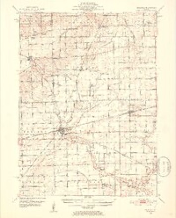
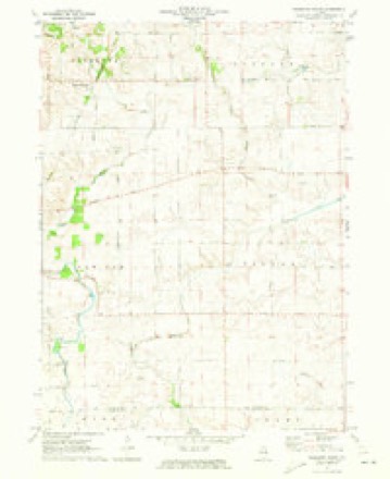
9 topographic sheets cover this place, the earliest surveyed in 1951 and the latest in 1985. It stands in Shabbona Township. It lies in ZIP code area 60550. The Survey maps it on the Shabbona Grove quadrangle. It stands 833 feet above sea level.
Topographic sheets covering this place
5 surveys from 9 printed sheetsMatched by testing this settlement's coordinate against the published boundary of every sheet in the United States Geological Survey's historical collection. Each opens the scanned sheet at the Survey.
- 1951 USGS Earlville quadrangle1:62500, 2 printings
- 1958 USGS Aurora quadrangle1:250000, 3 printings
- 1961 USGS Aurora quadrangle1:250000
- 1971 USGS Shabbona Grove quadrangle1:24000, 2 printings
- 1985 USGS Aurora quadrangle1:100000



What happened here
An account from the chapter on Shabbona township. The inset identifies its exact source book and publication year.
Neighboring Indian Incidents
Through the research of John F. Steward the lost battleground, where three hundred Fox Indian warriors, with women and children, were besieged by 1,300 French and Indian allies, 1730, and killed, was located on Fox river near Piano. Mr. Steward made trips to Europe, examined the maps mi record, and believes that he has positively located the scene of this eventful affair.
In the county-history sources
66,247 words on this townshipPortrait and Biographical Album of DeKalb County, Illinois : Containing Full-page Portraits and Biographical Sketches of Prominent and Representative Citizens of the County : Together with Portraits and Biographies of All the Governors of Illinois, and of the Presidents of the United States : Also Containing a History of the County, from Its Earliest Settlement to the Present Time, published 1885 names this settlement in its chapter on Shabbona Township. These are the passages that mention it, exactly as the scans read.
During the next few years quite a number of settlers came in and a village was started on the south side of the grove on section 26, known as Shabbona Grove. John Olmstead opened the first store and Mr. Adams the second. The latter soon after sold out to Warren & Marks - S. B. Warren and Wm. Marks. A postofrke was established here about 1848, Mr. Marks being the first postmaster. Mr Marks, is said to have been one of the twelve apostles of Joseph Smith, the Mormon prophet. The office is still continued.
In its best days Shabbona Grove contained three general stores, a tin shop, a boot and shoe shop, two wagon and blacksmith shops, a tailor shop, two hotels and two churches A large business was transacted.
In 1866 a lodge of I. O. O. F. was organized at Shabbona Grove, under the name of Fertile Lodge. It gained a membership of 30 in four years, but, on account of a want of harmony among its members, surrendered its charter. John Belden was the first N. G. and I. F. Morse the last.
Machine-read from a century-old scan, so expect the errors a machine makes: misspelled names, dropped words, stray characters.
Read the whole chapter on Shabbona Township - it names this place 8 more 8 times.
Fires near this place
1 since 2018Regional context, not property-specific evidence. The federal wildfire occurrence database lists 1 fire within 5 miles of Shabbona Grove in 2018, burning about 10 acres in total. None started naturally. None was recorded as arson. Distance is straight-line from the map coordinates, so a fire counted here may appear on a neighbouring settlement's page as well.
| Reported cause | Fires |
|---|---|
| Equipment and vehicle use | 1 |
The most recent of them, most recent first, with the day each was reported and the service that recorded it.
| Date | Cause | Size | Reported by | Name on the report |
|---|---|---|---|---|
| 25 September 2018 | Equipment and vehicle use | 10 acres | Illinois Division of Forestry Resources | DAVIS RD/SHABBONA RD FIELD FIRE |
Settlements close enough to share some of these fires:
Mines and quarries near this place
4 within 5 milesRegional context, not property-specific evidence. The federal mineral resources record lists 4 workings within 5 miles of Shabbona Grove: 4 past producers. None of them still produces. What was taken out: Sand and Gravel, Construction, Stone, Crushed/Broken. Distance is straight-line from the map coordinates, so a quarry counted here may appear on a neighbouring settlement's page as well.
| Where | Site | Commodity | Status | Recorded |
|---|---|---|---|---|
| Inlet Quarry | Stone, Crushed/Broken | Past Producer | ||
| Clinton Pit | Sand and Gravel, Construction | Past Producer | ||
| Purdy Pit | Sand and Gravel, Construction | Past Producer | ||
| Weidner Pit | Sand and Gravel, Construction | Past Producer |
Storms near this place
1 since 2003Regional context, not property-specific evidence. The National Weather Service names Shabbona Grove in 1 storm report in 2003: 1 tornado. No death or injury is recorded in these reports. Each account below is quoted exactly as the forecast office filed it, from the NOAA Storm Events Database, and each date opens the federal record of that event.
| When | Event | Place named | Harm | What the report says |
|---|---|---|---|---|
| June 2003 | Tornado (F0) | Shabbona Grove | - | A brief tornado touched down about two miles northeast of Shabbona Grove. The tornado damaged some crops but was only on the ground for about one minute. |
Nearest settlements
The eight closest, with where each one stands in the county. Distances are straight-line, computed from the Geographic Names Information System coordinates.
Elsewhere
Matched on this settlement's Geographic Names Information System number rather than its name, so it cannot be a different place of the same name in another state.
| Wikipedia article on Shabbona Grove | An encyclopaedic summary. Its text is share-alike, so it is linked here rather than copied. |
| Wikidata item Q14688074 | The structured record the population and elevation above come from. Public domain (CC0). |
Provenance
This settlement is recorded in the Geographic Names Information System as feature 422079. The sheet list is computed by point-in-boundary test against the United States Geological Survey's historical topographic inventory. Both are works of the United States government and carry no copyright under 17 U.S.C. 105.
Wildfire. Short, Karen C. 2022. Spatial wildfire occurrence data for the United States, 1992-2020 [FPA_FOD_20221014]. 6th Edition. Fort Collins, CO: Forest Service Research Data Archive. https://doi.org/10.2737/RDS-2013-0009.6 Collected with United States Government funding and usable without additional permissions or fees.
Mines and quarries. USGS Mineral Resources Data System (MRDS) https://mrdata.usgs.gov/mrds/ A work of the United States government, no copyright under 17 U.S.C. 105.
Storms. NOAA National Centers for Environmental Information, Storm Events Database https://www.ncei.noaa.gov/stormevents/ A work of the United States government, no copyright under 17 U.S.C. 105. Narratives are quoted verbatim from the National Weather Service report and are not edited or summarised.