 Block
Sherrard, Illinois
18 topographic sheets cover this place, the earliest surveyed in 1912 and the latest in 1991. It stands in Richland Grove Township. It lies in ZIP code area 61281. The Survey maps it on the Matherville quadrangle. 692 people lived here at the 2020 count. It stands 801 feet above sea level.
On record in Sherrard
Buildings and businesses the archive holds for this place. Each opens its own page, with the source record it came from.
On the National Register 1 record
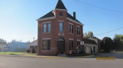 Sherrard Banking Companylisted 1996
Population over time
2 figuresSherrard grew from 640 to 692 between 2010 and 2020. These are the recorded population figures Wikidata holds for this place, reached through the Geographic Names Information System number this page is keyed on rather than by name, so they belong to this place and not to another of the same name. Most are census counts, but not all are: an early figure may be a founding or settlement estimate, and an estimate published within five years of a census is left out. The change column is computed, and is left blank where more than 20 years separate a figure from the one before it, because a gap that long is not a change between two counts.
| Year | People | Change |
|---|---|---|
| 2010 | 640 | |
| 2020 | 692 | +52 (+8%) |
Topographic sheets covering this place
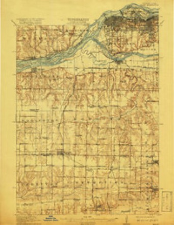
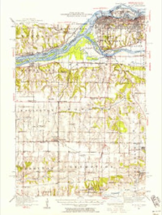
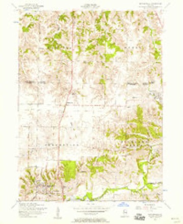
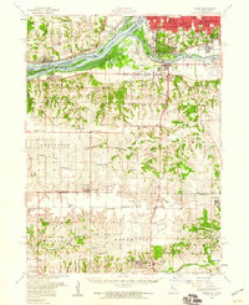
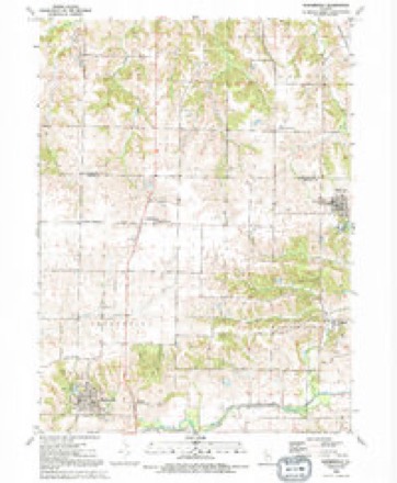
10 surveys from 18 printed sheetsMatched by testing this settlement's coordinate against the published boundary of every sheet in the United States Geological Survey's historical collection. Each opens the scanned sheet at the Survey.
- 1912 USGS Milan quadrangle1:62500, 7 printings
- 1944 USGS Milan quadrangle1:62500
- 1953 USGS Matherville quadrangle1:24000, 2 printings
- 1953 USGS Milan quadrangle1:62500
- 1958 USGS Davenport quadrangle1:250000, 2 printings
- 1961 USGS Davenport quadrangle1:250000
- 1962 USGS Davenport quadrangle1:250000
- 1984 USGS Aledo quadrangle1:100000
- 1989 USGS Aledo quadrangle1:100000
- 1991 USGS Matherville quadrangle1:24000





In the county-history sources
3,318 words on this townshipPast and Present of Mercer County, Illinois, published 1914 names this settlement in its chapter on Richland Grove Township. These are the passages that mention it, exactly as the scans read.
The Bank of Cable was conducted in the '90s by Evans & Jones, but assigned in December, 1895, and C. A. Samuelson of Sherrard was appointed to wind up the business. The assets were about twenty-one thousand dollars and the deposits amounted to sixteen thousand dollars. L. D. Thomason helped to wind up the affairs of the bank. Mr. Jones of the bank was finally arrested upon the charge of having received deposits after he knew the bank was insolvent. In recent years the town has not been as prosperous as it formerly was.
Passage source: Past and Present of Mercer County, Illinois, published 1914.
The Village of Sherrard was duly acknowledged May 1, 1894, and was laid out by Ransom R. Cable and H. B. Sudlow, and located on section 4. Since that date several additions to this town have been made. The coal branch of the Chicago, Rock Island 6c Pacific Railroad was extended east from Preemption to section 4, where the new coal shaft was sunk ninety-three feet deep, under the direction of David Sherrard, who platted forty-four acres there and commenced the Town of Sherrard about two and a half miles east of Cable. One of the first industries here was the Richland Grove Creamery, which ran during the cold weather of 1893-4, three days in the week. It ground feed for the farmers the other three days. During February, 1894, they paid $903 for cream and one day in April purchased 6.000 pounds of cream. Thev operated two separators. In the spring of 1894 it was made a postoffice. Other coal shafts were sunk, every one being about two hundred feet deep. In May, 1894, six houses were going up at one time. The first lots were sold in May, and by January 1, 1895, there were fifty houses, nearly all of them occupied by miners and their families. There were two lumber yards, two hotels, one livery stable, and a Congregational church was organized. P. L. Jones and G. M. Jones, of the firm of Evans & Jones, built a large hotel at that time. It was 44 by 50 feet, three stories high and contained twenty-eight rooms. It was steam heated and gas lighted. The banking firm of Evans & Jones started up at this time. In November, 1895, the village voted on the question of incorporation, there being cast forty-four votes for incorporation and fifty-five against it. The question was voted down because many of the voters did not desire to include within the town limits certain tracts of land which they thought should remain outside.
Passage source: Past and Present of Mercer County, Illinois, published 1914.
The Sherrard Banking Company began active operations early in 1896. David Sherrard was president; John A. Wilson, vice president; J. T. Vernon, cashier; directors, Charles Kinsey, T. A. Vernon, J. G. Clark, E. E. Sincox, Frank Sherrard and Alfred Lilliman. The bank formally opened for business on the first Monday in February. A Knights of Pythias lodge was organized here about this time. The Aledo knights went up there and carried into effect the organization.
Passage source: Past and Present of Mercer County, Illinois, published 1914.
Machine-read from a century-old scan, so expect the errors a machine makes: misspelled names, dropped words, stray characters.
Read the whole chapter on Richland Grove Township - it names this place 2 more 2 times.
Mines and quarries near this place
1 within 5 milesRegional context, not property-specific evidence. The federal mineral resources record lists 1 working within 5 miles of Sherrard: 1 producer. All of them still produce. What was taken out: Sand and Gravel, Construction. Distance is straight-line from the map coordinates, so a quarry counted here may appear on a neighbouring settlement's page as well.
| Where | Site | Commodity | Status | Recorded |
|---|---|---|---|---|
| Barstow Plant No. 1 Dredge | Sand and Gravel, Construction | Producer |
Storms near this place
19 since 2000Regional context, not property-specific evidence. The National Weather Service names Sherrard in 19 storm reports between 2000 and 2025: 8 hail, 8 thunderstorm wind, 1 lightning, 1 heavy rain. No death or injury is recorded in these reports. Each account below is quoted exactly as the forecast office filed it, from the NOAA Storm Events Database, and each date opens the federal record of that event.
| When | Event | Place named | Harm | What the report says |
|---|---|---|---|---|
| May 2003 | Hail | Sherrard | $100,000 | Covered the ground |
| August 2003 | Hail | Sherrard | $100,000 | no account filed |
| June 2009 | Thunderstorm Wind | Sherrard | $25,000 | Wind gusts were estimated to be 60 mph 1 mile west southwest of Sherrard, IL around 607 pm June 27. A power outage was also observed. |
| June 2006 | Lightning | Sherrard | $25,000 | Lightning strike at 441 Highland Drive in the Frye Lake area; half of the house was damaged |
| March 2006 | Hail | Sherrard | $5,000 | no account filed |
| May 2025 | Thunderstorm Wind | Sherrard | - | A public report of two 2 to 3 inch diameter tree branches snapped by thunderstorm winds. |
| July 2024 | Thunderstorm Wind | Sherrard | - | A public report of 3 inch tree limbs down. |
| July 2024 | Hail | Sherrard | - | A public report via Mping of penny size hail. |
| April 2024 | Hail | Sherrard | - | A public report of nickel to quarter size hail. |
| August 2021 | Flash Flood | Sherrard | - | A few roads were reported impassible due to water over roads. |
| February 2017 | Thunderstorm Wind | Sherrard | - | A public report of several 4 inch diameter tree branches down along the highway just south of Sherrard, Illinois was received. |
| August 2011 | Heavy Rain | Sherrard | - | Storm total rainfall from this mornings thunderstorms. |
| July 2008 | Thunderstorm Wind | Sherrard | - | Wind gusts estimated to be 70 mph blew down some large tree branches 1 mile west southwest of Sherrard, IL at 613 am July 21. |
| July 2008 | Thunderstorm Wind | Sherrard | - | Wind gusts estimated to be 60 mph were observed just west southwest of Sherrard, IL at 5:55 pm July 29. |
| July 2008 | Thunderstorm Wind | Sherrard | - | Wind gusts estimated to be 70 mph were observed 1 mile west southwest of Sherrard, IL at 613 am July 21. |
| June 2002 | Thunderstorm Wind | Sherrard | - | Trees down. |
| April 2023 | Hail | Sherrard | - | no account filed |
| April 2023 | Hail | Sherrard | - | no account filed |
| June 2000 | Hail | Sherrard | - | no account filed |
Nearest settlements
The eight closest, with where each one stands in the county. Distances are straight-line, computed from the Geographic Names Information System coordinates.
| Map | Place | Distance | Sheets |
|---|---|---|---|
| Cable | 2.4 miles | 18 | |
| Preemption | 4.2 miles | 18 | |
| Swedona | 4.2 miles | 12 | |
| Orangemans Hall | 5.4 miles | 18 | |
| Griffin | 5.5 miles | 11 | |
| Boden | 6.0 miles | 18 | |
| Matherville | 6.8 miles | 18 | |
| New Windsor | 8.7 miles | 11 |
Elsewhere
Matched on this settlement's Geographic Names Information System number rather than its name, so it cannot be a different place of the same name in another state.
| Wikipedia article on Sherrard | An encyclopaedic summary. Its text is share-alike, so it is linked here rather than copied. |
| Wikidata item Q2193504 | The structured record the population and elevation above come from. Public domain (CC0). |
Provenance
This settlement is recorded in the Geographic Names Information System as feature 418376. The sheet list is computed by point-in-boundary test against the United States Geological Survey's historical topographic inventory. Both are works of the United States government and carry no copyright under 17 U.S.C. 105.
Mines and quarries. USGS Mineral Resources Data System (MRDS) https://mrdata.usgs.gov/mrds/ A work of the United States government, no copyright under 17 U.S.C. 105.
Storms. NOAA National Centers for Environmental Information, Storm Events Database https://www.ncei.noaa.gov/stormevents/ A work of the United States government, no copyright under 17 U.S.C. 105. Narratives are quoted verbatim from the National Weather Service report and are not edited or summarised.