 Block
Viola, Illinois
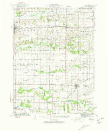
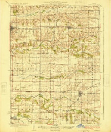
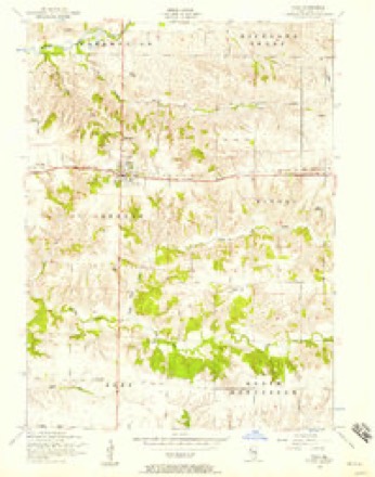
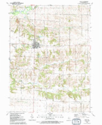
12 topographic sheets cover this place, the earliest surveyed in 1923 and the latest in 1992. It stands in Greene Township. It lies in ZIP code area 61486. The Survey maps it on the Viola quadrangle. 869 people lived here at the 2020 count. It stands 791 feet above sea level.
Population over time
2 figuresViola fell from 955 to 869 between 2010 and 2020. These are the recorded population figures Wikidata holds for this place, reached through the Geographic Names Information System number this page is keyed on rather than by name, so they belong to this place and not to another of the same name. Most are census counts, but not all are: an early figure may be a founding or settlement estimate, and an estimate published within five years of a census is left out. The change column is computed, and is left blank where more than 20 years separate a figure from the one before it, because a gap that long is not a change between two counts.
| Year | People | Change |
|---|---|---|
| 2010 | 955 | |
| 2020 | 869 | -86 (-9%) |
Topographic sheets covering this place
9 surveys from 12 printed sheetsMatched by testing this settlement's coordinate against the published boundary of every sheet in the United States Geological Survey's historical collection. Each opens the scanned sheet at the Survey.
- 1923 USGS Alexis quadrangle1:62500, 2 printings
- 1925 USGS Alexis quadrangle1:62500
- 1953 USGS Viola quadrangle1:24000, 2 printings
- 1958 USGS Davenport quadrangle1:250000, 2 printings
- 1961 USGS Davenport quadrangle1:250000
- 1962 USGS Davenport quadrangle1:250000
- 1984 USGS Aledo quadrangle1:100000
- 1989 USGS Aledo quadrangle1:100000
- 1992 USGS Viola quadrangle1:24000





In the county-history sources
3,804 words on this townshipPast and Present of Mercer County, Illinois, published 1914 names this settlement in its chapter on Greene Township. These are the passages that mention it, exactly as the scans read.
Greene Township has many interesting physical and geological features. The central part from east to west is a wide plateau, which is drained north to Edwards River and south to Pope Creek. The latter extends from east to west through the southern tier of sections and the former touches the few sections in the northwest. The township is well drained, has a good soil and the farmers raise large crops of grain, hay, etc. Of course the surface deposits belong to the quarternarv period; that is, alluvium, loess and drift. The drift here consists mostly of brown and blue clays, mixed often with sand, gravel and small pebbles and is spread over the entire surface of the township. Bowlders or metamorphic rocks lie scattered here and there mostly along the streams. The coal measures are the most valuable products of the soil. Bed No. 3 consists of limestone, sandstone, clay, shale and coal, and altogether have a thickness of from 100 to 1 qo feet. A well bored near Viola did not pass through the formation after 130 feet. Three seams of coal have been found and worked in the township - Nos. 3, 2 and 1 - 3 and 1 have been most extensively mined. The former has been found thus far on sections 31, 32 and perhaps others. Messrs. Martin, Morrow and others mined this bed at an early date. No. 2 was worked by them also. No. 3 is the thickest and contains coal of the best quality. It varies from three to five feet in thickness and furnishes an excellent fuel coal. Coal No. 2 is too thin a vein in this township to make profitable working. It has been mined on sections 23, 27, 31 and elsewhere. Almost the entire township contains these beds and in the end the township is bound to reap enormous wealth from marketing the product. It is in the shales adjoining these coal beds that the valuable fossils peculiar to the coal measures are found here. Coal No. 1 stretches across the township from east to west and is only a part of the great Edwards River seam. It has been mined extensively already on sections 2, 3, 4, 5, 6, 11 and 12. In recent years although a great deal is mined yet very little is taken out for shipping purposes. The mines are worked for local use mainly. In this township is found an excellent quality of whitish or pale blue clay, which is found to be first class for potter's work. This and other similar deposits are found in several places. Connected with coal No. i is a valuable bed of blue limestone, which upon being burned, furnishes a good quality of lime. However, it has to be sorted and screened carefully owing to impurities. Connected with coal No. 2 are valuable sandstone, parts of which though light at first, become yellowish upon exposure to the air and thus become very hard and serviceable. Several large quarries have been opened in the township and an inexhaustible supply of rock can be had. The limestone connected with coal No. 1 is drab colored and somewhat impure. It varies from eight to fifteen feet in thickness. It has been mined and used to some extent.
Passage source: Past and Present of Mercer County, Illinois, published 1914.
By 1840 there were probably twenty settlers in the township and by 1850 almost all the valuable land was taken up. By that date schools and churches were well organized and the people were in much better circumstances than they had been ten years before. Under the law of the early '50s Greene Township was organized and named for Gen. Nathaniel Greene of the Revolution. The name was suggested by John Collins. The first town meeting was held in a schoolhouse which stood near the present Village of Viola. John Collins served as chairman; Uri Smith as moderator; and Henry Hoagland as secretary. The following officers were then elected by ballot: Elisha Miles, supervisor; Henry Hoagland, town clerk; William P. Collins, assessor; John Frazier, overseer of the poor; Alexander McGauhey, collector; Samuel E. Russell, John H. Park, and David Summerville, Jr., commissioners of highways. William T. McGauhey and William P. Collins, constables; Jeremiah Boyer and David Summerville, Jr., pound masters; Alexander M. Stewart, Van R. Harriott and C. Doty, overseers of highways; John Griffin and Henry Hoagland, justices of the peace.
Passage source: Past and Present of Mercer County, Illinois, published 1914.
The Viola Vineyard, conducted near the Village of Viola, bv J. M. Erne, was a notable industry in the '70s. There were twentytwo acres devoted to the vineyard and people came many miles when the grapes were ripe to see the sight. He had at one time over six thousand vines growing and could show thirty different varieties of grapes. In 1880 he produced about fifty tons of the fruit. He likewise had an orchard of 600 apple trees, also pears and cherries and marketed large quantities of strawberries and raspberries. He is the originator of the Viola crab, which became known throughout western Illinois in after years. The Green Bower Nursery was another important industry in the '6os and '70s. In 1869 James Ferry opened this nursery. In the end it covered more than twentytwo acres and was on rolling land, and trees and shrubs therefrom were sent all over the western part of the state and the eastern part of Iowa. He raised large quantities of apples, raspberries, grapes, blackberries, strawberries, etc. Another early industry of the township was a steam mill, which was started at Viola in the '6os. In the end it was discontinued. The mill was built by contributions from about twenty persons and was not a corporation. It was operated at a loss and finally was closed out. During its existence one of the lessees of the mill purchased grain and got other credits and closed out without paying for the grain and other articles.
Passage source: Past and Present of Mercer County, Illinois, published 1914.
Machine-read from a century-old scan, so expect the errors a machine makes: misspelled names, dropped words, stray characters.
Read the whole chapter on Greene Township - it names this place 19 more 19 times.
Mines and quarries near this place
7 within 5 milesRegional context, not property-specific evidence. The federal mineral resources record lists 7 workings within 5 miles of Viola: 4 occurrences, 1 producer, 1 past producer, 1 plant. 2 still produce. What was taken out: Stone, Crushed/Broken, Clay. Distance is straight-line from the map coordinates, so a quarry counted here may appear on a neighbouring settlement's page as well.
| Where | Site | Commodity | Status | Recorded |
|---|---|---|---|---|
| Hydraulic-Press Brick Co. Shale Pit | Clay | Past Producer | ||
| Limestone Prospect | Stone, Crushed/Broken | Occurrence | ||
| Limestone Prospect | Stone, Crushed/Broken | Occurrence | ||
| Limestone Prospect | Stone, Crushed/Broken | Occurrence | ||
| Limestone Prospect | Stone, Crushed/Broken | Occurrence | ||
| Mercer Co. Stone Quarry | Stone, Crushed/Broken | Producer | ||
| Viola Quarry and Mill | Stone, Crushed/Broken | Plant |
Storms near this place
20 since 1995Regional context, not property-specific evidence. The National Weather Service names Viola in 20 storm reports between 1995 and 2026: 7 hail, 7 thunderstorm wind, 5 tornado, 1 funnel cloud. No death or injury is recorded in these reports. Each account below is quoted exactly as the forecast office filed it, from the NOAA Storm Events Database, and each date opens the federal record of that event.
| When | Event | Place named | Harm | What the report says |
|---|---|---|---|---|
| April 2003 | Tornado (F1) | Viola | $500,000 | Farm house damaged |
| April 2003 | Tornado (F1) | Viola | $300,000 | House pushed 6 feet off foundation |
| April 2003 | Tornado (F0) | Viola | $250,000 | House damaged |
| April 2006 | Hail | Viola | $5,000 | no account filed |
| July 1999 | Thunderstorm Wind | Viola | $500 | Thunderstorms produced downburst winds which downed power lines in Viola. |
| April 2026 | Tornado (EF0) | Viola | - | A brief EF0 tornado passed through Viola, IL, with maximum winds around 85 mph. Much of the damage noted along the short path was done to trees, uprooting and snapping some, with tree tops also sheared off others. Some structural damage was noted in town, where half of a house roof was uplifted with insulation scattered along the tornado path. Damage was also done to the north side of a business's brick facade. |
| March 2025 | Hail | Viola | - | A lot of nickel to dime size hail was seen, with a few quarter size hail observed. The time was estimated from radar data. |
| June 2018 | Funnel Cloud | Viola | - | A brief rotating wall cloud produced a funnel cloud which lasts about 30 seconds. |
| July 2018 | Thunderstorm Wind | Viola | - | The public reported microburst winds damaged a machine shed, topped trees, and flattened corn at a farmstead. |
| May 2004 | Hail | Viola | - | Accumulated 2 inches deep |
| May 2001 | Thunderstorm Wind | Viola | - | 60 mph wind gust estimated by public lasting for 2 to 3 minutes. |
| May 2001 | Hail | Viola | - | Penny sized hail lasted 2 to 3 minutes. Reported by public. |
| May 2001 | Hail | Viola | - | Quarter sized hail reported by public. |
| July 1997 | Thunderstorm Wind | Viola | - | Building damaged. |
| July 1997 | Thunderstorm Wind | Viola | - | Shed moved and car lifted off the road. |
| July 1997 | Thunderstorm Wind | Viola | - | Three foot diameter tree downed over highway 67. |
| June 1997 | Thunderstorm Wind | Viola | - | Trees down across route 67. |
| August 1995 | Hail | Viola | - | Evening thunderstorms produced brief downpours and isolated areas of damage across northwest Illinois. Commonwealth Edison of Sterling reported power outages began at around 1600 CST. Power to the local hospital was lost at around 1700 CST. Numerous trees were down plus minor street flooding. At around 1800 CST 1.5 inches of rain had fallen in a one hour period at Kewanee. This contributed to minor street flooding and stalled cars. Nine hundred residents were reported to be without power after the storm. Some power outages were also reported in Freeport but no damage estimates were provided. |
| June 1999 | Hail | Viola | - | no account filed |
| April 1998 | Tornado (F0) | Viola | - | no account filed |
Nearest settlements
The eight closest, with where each one stands in the county. Distances are straight-line, computed from the Geographic Names Information System coordinates.
| Map | Place | Distance | Sheets |
|---|---|---|---|
| Gilchrist | 2.0 miles | 12 | |
| Wanlock | 2.3 miles | 12 | |
| Old Gilchrist | 2.8 miles | 12 | |
| Shale City | 3.1 miles | 12 | |
| Boden | 3.8 miles | 18 | |
| Matherville | 4.1 miles | 18 | |
| Martin (historical) | 4.7 miles | 12 | |
| Griffin | 5.8 miles | 11 |
Elsewhere
Matched on this settlement's Geographic Names Information System number rather than its name, so it cannot be a different place of the same name in another state.
| Wikipedia article on Viola | An encyclopaedic summary. Its text is share-alike, so it is linked here rather than copied. |
| Wikidata item Q2405821 | The structured record the population and elevation above come from. Public domain (CC0). |
Provenance
This settlement is recorded in the Geographic Names Information System as feature 420326. The sheet list is computed by point-in-boundary test against the United States Geological Survey's historical topographic inventory. Both are works of the United States government and carry no copyright under 17 U.S.C. 105.
Mines and quarries. USGS Mineral Resources Data System (MRDS) https://mrdata.usgs.gov/mrds/ A work of the United States government, no copyright under 17 U.S.C. 105.
Storms. NOAA National Centers for Environmental Information, Storm Events Database https://www.ncei.noaa.gov/stormevents/ A work of the United States government, no copyright under 17 U.S.C. 105. Narratives are quoted verbatim from the National Weather Service report and are not edited or summarised.