 Block
Woodstock, Illinois
18 topographic sheets cover this place, the earliest surveyed in 1926 and the latest in 1992. It stands in Dorr Township. It lies in ZIP code area 60098. The Survey maps it on the Woodstock quadrangle. 25,630 people lived here at the 2020 count. It stands 915 feet above sea level.
On record in Woodstock
Buildings and businesses the archive holds for this place. Each opens its own page, with the source record it came from.
On the National Register 5 records
 Old McHenry County Courthouselisted 1974
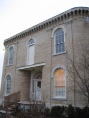 George Stickney Houselisted 1979
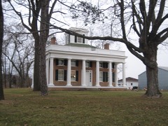 Terwilliger Houselisted 1979
 Woodstock Opera Houselisted 1974
 Woodstock Square Historic Districtlisted 1982
Population over time
2 figuresWoodstock grew from 24,770 to 25,630 between 2010 and 2020. These are the recorded population figures Wikidata holds for this place, reached through the Geographic Names Information System number this page is keyed on rather than by name, so they belong to this place and not to another of the same name. Most are census counts, but not all are: an early figure may be a founding or settlement estimate, and an estimate published within five years of a census is left out. The change column is computed, and is left blank where more than 20 years separate a figure from the one before it, because a gap that long is not a change between two counts.
| Year | People | Change |
|---|---|---|
| 2010 | 24,770 | |
| 2020 | 25,630 | +860 (+3%) |
Topographic sheets covering this place
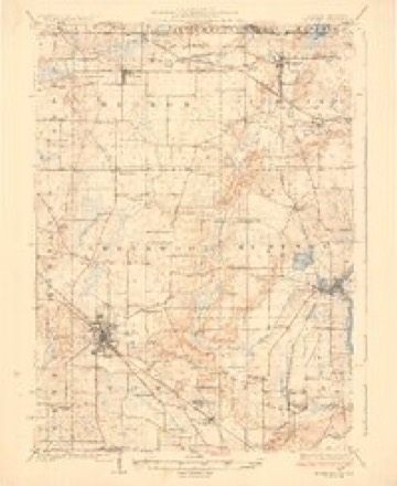
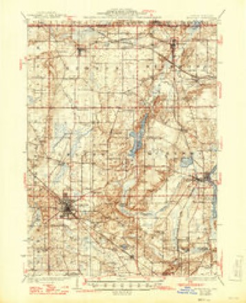
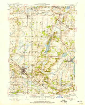
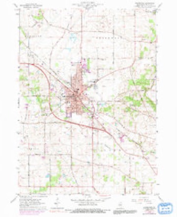
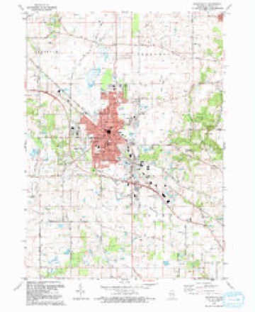
10 surveys from 18 printed sheetsMatched by testing this settlement's coordinate against the published boundary of every sheet in the United States Geological Survey's historical collection. Each opens the scanned sheet at the Survey.
- 1926 USGS Mc Henry quadrangle1:62500
- 1926 USGS McHenry quadrangle1:62500, 2 printings
- 1944 USGS McHenry quadrangle1:62500, 2 printings
- 1954 USGS Rockford quadrangle1:250000
- 1955 USGS Rockford quadrangle1:250000
- 1958 USGS Rockford quadrangle1:250000, 4 printings
- 1963 USGS Rockford quadrangle1:250000
- 1963 USGS Woodstock quadrangle1:24000, 3 printings
- 1981 USGS Elgin quadrangle1:100000
- 1992 USGS Woodstock quadrangle1:24000, 2 printings





In the county-history sources
3,039 words on this townshipHistory of McHenry County, Illinois, published 1922 names this settlement in its chapter on Dorr Township. These are the passages that mention it, exactly as the scans read.
Dorr Township is bounded on the north by Greenwood Township, a portion of which is included in the city of Woodstock; on the east by Xunda Township ; on the south by Grafton Township, and on the west by Seneca Township. Originally this township contained some very fine timber, but no prairie land, although it is level. It is watered by Hanley Creek, and a branch of the Kishwaukee.
Passage source: History of McHenry County, Illinois, published 1922.
Oakland Cemetery, located at the western limits of Woodstock, was purchased by the corporation, December 20, 1859, of M. T. Bryan, and then comprised ten acres. Two additional acres were added for a Potters' Field, and other additions have since been made, as increasing space was needed. The Catholic Cemetery, known as "Calvary, " is located just south of Oakland, across the highway, and both are kept in beautiful condition.
Passage source: History of McHenry County, Illinois, published 1922.
According to the United States census the population of Dorr Township has been as follows: In 1890, 1,113; in 1900, 968; in 1910, 1,004, which was exclusive of Woodstock, which in the latter year had a population of 4,331; and in 1920, 6,408, including a portion of the city of Woodstock, the remainder of the city, with its population of 5,523, lying in Greenwood Township.
Passage source: History of McHenry County, Illinois, published 1922.
Machine-read from a century-old scan, so expect the errors a machine makes: misspelled names, dropped words, stray characters.
Read the whole chapter on Dorr Township - it names this place 15 more 15 times.
Fires near this place
1 since 2014Regional context, not property-specific evidence. The federal wildfire occurrence database lists 1 fire within 5 miles of Woodstock in 2014, burning about 12 acres in total. None started naturally. None was recorded as arson. Distance is straight-line from the map coordinates, so a fire counted here may appear on a neighbouring settlement's page as well.
| Reported cause | Fires |
|---|---|
| Debris and open burning | 1 |
The most recent of them, most recent first, with the day each was reported and the service that recorded it.
| Date | Cause | Size | Reported by | Name on the report |
|---|---|---|---|---|
| 26 April 2014 | Debris and open burning | 12 acres | Savanna District, Upper Mississippi National Wildlife Refuge | HACKMATACK PETERSON TRACT |
Settlements close enough to share some of these fires:
Mines and quarries near this place
4 within 5 milesRegional context, not property-specific evidence. The federal mineral resources record lists 4 workings within 5 miles of Woodstock: 2 past producers, 1 plant, 1 producer. 2 still produce. What was taken out: Sand and Gravel, Construction. Distance is straight-line from the map coordinates, so a quarry counted here may appear on a neighbouring settlement's page as well.
| Where | Site | Commodity | Status | Recorded |
|---|---|---|---|---|
| Gavers Pit & Mill | Sand and Gravel, Construction | Plant | ||
| Reed Pit | Sand and Gravel, Construction | Past Producer | ||
| Rose Farm Pit | Sand and Gravel, Construction | Producer | ||
| Woodstock Pit | Sand and Gravel, Construction | Past Producer |
Storms near this place
60 of 69 shownRegional context, not property-specific evidence. The National Weather Service names Woodstock in 69 storm reports between 1996 and 2026: 38 thunderstorm wind, 20 hail, 5 lightning, 2 heavy rain. No death or injury is recorded in these reports. Each account below is quoted exactly as the forecast office filed it, from the NOAA Storm Events Database, and each date opens the federal record of that event.
| When | Event | Place named | Harm | What the report says |
|---|---|---|---|---|
| August 2007 | Flash Flood | Woodstock | $500,000 | Intersection of Route 47 and 120 closed due to two feet of standing water. Willow and Clay Streets closed due to waist deep water. Police conducting rescues from stranded vehicles. Basement flooding was reported throughout Woodstock, and as many as 10 properties were flooded as a creek overflowed its banks in McHenry, IL. |
| August 1996 | Lightning | Woodstock | $200,000 | no account filed |
| June 2009 | Tornado (EF1) | Woodstock | $75,000 | A tornado touched down near Highway 14 and Davis Road. At this location, several pine trees had large branches sheared and topped off with two of the trees partially uprooted. At this point the tornado was rated EF0 with winds estimated near 85 mph and a path width of 20 yards. The tornado continued northeast, crossing Highway 14, into a neighborhood where it increased in intensity and produced damage to structures and trees. Damage in the area was to a garage adjacent to a main house. This well built and fairly new garage was lifted and turned off of its foundation, which was securely bolted to a concrete finish. Damage at this location was rated EF1 with winds estimated near 100 mph and a path width of 75 yards. The tornado proceeded to move northeast through the neighborhood where it uprooted four old but healthy soft and hard wood trees. Just to the northeast of this neighborhood is a commercial district where the tornado produced damage to two buildings. Damage occurred to the roof of one building with the other building sustaining damage to one of its exterior walls. The wall was partially collasped but it was an older structure. EF1 damage was produced at this point with winds estimated near 100 mph and a path width of 30 yards. The tornado weakened as it moved northeast, producing damage to trees near and along Lake Road. The tornado appeared to have lifted with no other damage evident beyond this point. |
| August 2007 | Thunderstorm Wind | Woodstock | $30,000 | A 90 foot tall, 45 inch diameter tree was blown onto a house, causing significant damage to the roof, attic, a bathroom and a bedroom. |
| July 2011 | Lightning | Woodstock | $10,000 | Lightning knocked ornamental stonework from the bell tower of the Woodstock Opera House. |
| March 2012 | Lightning | Woodstock | $5,000 | Lightning struck a satellite dish on the roof of a building of condos, which started a fire in the attic. Only minor damage was reported and the condo remained habitable. |
| July 2012 | Thunderstorm Wind | Woodstock | $2,000 | Utility poles were snapped at Kimball Avenue and Bunker Street. |
| June 2017 | Thunderstorm Wind | Woodstock | $1,000 | Trees and power lines were blown down. |
| June 2009 | Thunderstorm Wind | Woodstock | $1,000 | A large tree was uprooted and blown over along Judd Street. The root ball damaged part of a driveway and sidewalk. |
| June 2009 | Thunderstorm Wind | Woodstock | $1,000 | Tree limbs and power lines were blown down. |
| May 2006 | Lightning | Woodstock | $1,000 | Lightning strike at IL 47 and Donovan Road brought down power lines. |
| May 2001 | Lightning | Woodstock | $1,000 | Lightning ignited the wooden roof of an historic old home causing one thousand dollars damge. The house was built in 1852. |
| April 2026 | Thunderstorm Wind | Woodstock | - | Broadcast media reported a tree down on a house on the 600 block of S Jefferson St in Woodstock. |
| March 2025 | Thunderstorm Wind | Woodstock | - | Multiple reports were received of tree and fence damage in Woodstock. |
| June 2025 | Thunderstorm Wind | Woodstock | - | A 6 to 8 inch diameter tree branch was downed onto power lines near the intersection of Jackson and Douglas streets in Woodstock. |
| August 2025 | Thunderstorm Wind | Woodstock | - | A tree had fallen onto a house along Clay St in Woodstock. |
| August 2025 | Thunderstorm Wind | Woodstock | - | Woodstock PD reported multiple power lines downed around Woodstock. |
| June 2024 | Hail | Woodstock | - | One inch hail was reported on the 300 block of N Rose Farm Rd in Woodstock. |
| June 2024 | Hail | Woodstock | - | One inch hail was reported on the 400 block of Shannon Dr in Woodstock. |
| June 2024 | Heavy Rain | Woodstock | - | Storm total rainfall of 4.68 was recorded in Woodstock. |
| June 2024 | Heavy Rain | Woodstock | - | Mesonet station DW7142 recorded 3.8 of rain. |
| July 2024 | Thunderstorm Wind | Woodstock | - | Several trees and power lines were blown down near Washington Street and Lamb Road, blocking roadways. |
| August 2024 | Hail | Woodstock | - | A trained spotter reported 1.75 hail near US Rt. 14 and Dean St. |
| August 2024 | Thunderstorm Wind | Woodstock | - | Several trees were reported down in and around Woodstock. |
| April 2023 | Thunderstorm Wind | Woodstock | - | A wind gust to 58 mph was measured near Woodstock. |
| March 2023 | Thunderstorm Wind | Woodstock | - | Strong winds had blown down a tree west of Woodstock. Wind magnitude and time were estimated based on radar. |
| July 2023 | Thunderstorm Wind | Woodstock | - | Part of a tree was reported uprooted near Flagg Lane and Hickman Lane in Woodstock. |
| July 2022 | Thunderstorm Wind | Woodstock | - | A photo showed tree damage at Emricson Park near South Street. |
| July 2021 | Thunderstorm Wind | Woodstock | - | A photo shared on social media showed a large tree snapped at its base in Emricson Park. |
| August 2021 | Thunderstorm Wind | Woodstock | - | A large tree was snapped halfway up. |
| August 2020 | Thunderstorm Wind | Woodstock | - | A couple of large trees were blown down between Woodstock and Bull Valley. |
| September 2018 | Flood | Woodstock | - | Water from retention ponds overflowed onto some streets with about 3 inches of standing flood waters. |
| June 2017 | Thunderstorm Wind | Woodstock | - | Multiple trees were blown down between Woodstock and Wonder Lake. A tree was blocking the road at Banford and Queen Anne and another tree was blocking Thompson north of Route 120. |
| April 2014 | Hail | Woodstock | - | Dime to quarter size hail covered the ground near Queen Anne Street and Todd Avenue. |
| July 2012 | Thunderstorm Wind | Woodstock | - | Wind gusts were estimated to 65 mph. |
| May 2011 | Hail | Woodstock | - | Dime to nickel size hail was reported at the intersection of Route 14 and Route 47. |
| June 2009 | Thunderstorm Wind | Woodstock | - | A large tree was blown over onto train tracks and a passenger car near a train station. |
| June 2009 | Thunderstorm Wind | Woodstock | - | A large tree was blown down blocking South Street. |
| July 2007 | Thunderstorm Wind | Woodstock | - | A tree was blown down. |
| July 2007 | Thunderstorm Wind | Woodstock | - | A gust to 67 mph was measured. |
| July 2007 | Thunderstorm Wind | Woodstock | - | A gust to 60 mph was measured near Route 47 and Lucus. |
| December 2007 | Thunderstorm Wind | Woodstock | - | A tree was blown down blocking Mcconnell Road at Lily Pond. |
| August 2007 | Thunderstorm Wind | Woodstock | - | Measured wind gust to 62 mph. |
| August 2007 | Thunderstorm Wind | Woodstock | - | A spotter measured a wind gust to 63 mph. |
| May 2006 | Thunderstorm Wind | Woodstock | - | A six inch tree limb was blown down near Country Club Road and a tree was blown down on Dean Street. |
| July 2006 | Thunderstorm Wind | Woodstock | - | Trees were blown down in Bull Valley. |
| February 1999 | Thunderstorm Wind | Woodstock | - | Shingles were blown off a house and tree limbs were blown down in Woodstock and Lake in the Hills. |
| May 1998 | Thunderstorm Wind | Woodstock | - | Strong thunderstorm winds gusted to 68mph in McHenry and 70mph in Richmond. |
| July 1998 | Thunderstorm Wind | Woodstock | - | Trees were blown down in Woodstock. Trees were uprooted and limbs blown down in Mc Henry. One tree fell through the roof of a house. A metal shed was blown 150 yards. |
| August 2025 | Hail | Woodstock | - | no account filed |
| August 2024 | Hail | Woodstock | - | no account filed |
| September 2021 | Hail | Woodstock | - | no account filed |
| April 2020 | Hail | Woodstock | - | no account filed |
| April 2015 | Hail | Woodstock | - | no account filed |
| March 2012 | Hail | Woodstock | - | no account filed |
| March 2012 | Hail | Woodstock | - | no account filed |
| March 2012 | Hail | Woodstock | - | no account filed |
| July 2009 | Funnel Cloud | Woodstock | - | no account filed |
| April 2006 | Hail | Woodstock | - | no account filed |
| May 2006 | Hail | Woodstock | - | no account filed |
Nearest settlements
The eight closest, with where each one stands in the county. Distances are straight-line, computed from the Geographic Names Information System coordinates.
| Map | Place | Distance | Sheets |
|---|---|---|---|
| Franklinville | 4.2 miles | 15 | |
| Hartland | 4.6 miles | 15 | |
| Bull Valley | 5.0 miles | 17 | |
| Ridgefield | 5.6 miles | 17 | |
| Sunrise Ridge | 6.2 miles | 17 | |
| Greenwood | 6.2 miles | 17 | |
| Crystal Vista | 6.7 miles | 19 | |
| Crystal Gardens | 6.7 miles | 18 |
Elsewhere
Matched on this settlement's Geographic Names Information System number rather than its name, so it cannot be a different place of the same name in another state.
| Wikipedia article on Woodstock | An encyclopaedic summary. Its text is share-alike, so it is linked here rather than copied. |
| Wikidata item Q991162 | The structured record the population and elevation above come from. Public domain (CC0). |
Provenance
This settlement is recorded in the Geographic Names Information System as feature 421490. The sheet list is computed by point-in-boundary test against the United States Geological Survey's historical topographic inventory. Both are works of the United States government and carry no copyright under 17 U.S.C. 105.
Wildfire. Short, Karen C. 2022. Spatial wildfire occurrence data for the United States, 1992-2020 [FPA_FOD_20221014]. 6th Edition. Fort Collins, CO: Forest Service Research Data Archive. https://doi.org/10.2737/RDS-2013-0009.6 Collected with United States Government funding and usable without additional permissions or fees.
Mines and quarries. USGS Mineral Resources Data System (MRDS) https://mrdata.usgs.gov/mrds/ A work of the United States government, no copyright under 17 U.S.C. 105.
Storms. NOAA National Centers for Environmental Information, Storm Events Database https://www.ncei.noaa.gov/stormevents/ A work of the United States government, no copyright under 17 U.S.C. 105. Narratives are quoted verbatim from the National Weather Service report and are not edited or summarised.