 Block
Albany, Indiana
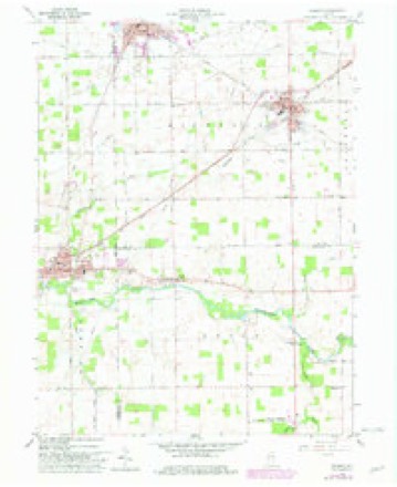
11 topographic sheets cover this place, the earliest surveyed in 1953 and the latest in 1986. It stands in Delaware Township. It lies in ZIP code area 47320. The Survey maps it on the Redkey quadrangle.
Topographic sheets covering this place
4 surveys from 11 printed sheetsMatched by testing this settlement's coordinate against the published boundary of every sheet in the United States Geological Survey's historical collection. Each opens the scanned sheet at the Survey.
- 1953 USGS Muncie quadrangle1:250000, 5 printings
- 1956 USGS Muncie quadrangle1:250000
- 1960 USGS Redkey quadrangle1:24000, 2 printings
- 1986 USGS Muncie quadrangle1:100000, 3 printings



In the county-history sources
36,998 words on this townshipHistory of Delaware County, Indiana : with Illustrations and Biographical Sketches of Some of Its Prominent Men and Pioneers, published 1881 names this settlement in its chapter on Delaware Township. These are the passages that mention it, exactly as the scans read.
Late in 1827, or early in 1828, Andrew Kennedy settled with his family on the land where the village of Albany is now situated, in Section 2. It is probable that he only occupied the land by the right of possession, as we learn that the same tract was subsequently entered at the Government Land Office by William Venard, in October, 1832. Mr. Venard took immediate possession of the land, after paying Mr. Kennedy for the improvement made thereon by him, and, in 1833, subdivided it into town lots and founded the village of Albany.
Passage source: History of Delaware County, Indiana : with Illustrations and Biographical Sketches of Some of Its Prominent Men and Pioneers, published 1881.
Mr. Black succeeded him as the incumbent of that office. The present townships of Niles and Union were within his jurisdiction, and nearly all the settlers as far north as the Salamonie River, came to him to make out the necessary affidavits for land entries. Tiring of so much work for a little compensation, he followed the example of his predecessor and resigned. His suecessor was Uriah Pace, who served four years.
Passage source: History of Delaware County, Indiana : with Illustrations and Biographical Sketches of Some of Its Prominent Men and Pioneers, published 1881.
James Orr, Sr., came to the township in 1838 with his wife and five children - Joseph, Margaret, Samuel, Martha and James. He emigrated from the North of Ireland to Greenbrier County, Va., in 1821; to Greene County, Ohio, in 1836, and finally to Delaware County, Ind. At the time of his arrival here he purchased 320 acres of land, located in the townships of Liberty and Delaware, and erected his house in Section 27, the south border of Delaware Township.
Passage source: History of Delaware County, Indiana : with Illustrations and Biographical Sketches of Some of Its Prominent Men and Pioneers, published 1881.
Machine-read from a century-old scan, so expect the errors a machine makes: misspelled names, dropped words, stray characters.
Read the whole chapter on Delaware Township - it names this place 72 more 72 times.
Mines and quarries near this place
1 within 5 milesRegional context, not property-specific evidence. The federal mineral resources record lists 1 working within 5 miles of Albany: 1 producer. All of them still produce. What was taken out: Stone, Crushed/Broken. Distance is straight-line from the map coordinates, so a quarry counted here may appear on a neighbouring settlement's page as well.
| Where | Site | Commodity | Status | Recorded |
|---|---|---|---|---|
| Fairview-Meshberger Bros. Ston | Stone, Crushed/Broken | Producer |
Storms near this place
14 since 2002Regional context, not property-specific evidence. The National Weather Service names Albany in 14 storm reports between 2002 and 2025: 7 hail, 4 thunderstorm wind, 1 tornado, 1 flash flood. No death or injury is recorded in these reports. Each account below is quoted exactly as the forecast office filed it, from the NOAA Storm Events Database, and each date opens the federal record of that event.
| When | Event | Place named | Harm | What the report says |
|---|---|---|---|---|
| August 2003 | Tornado (F0) | Albany | $20,000 | Distinct right moving supercell produced a weak tornado near Albany. The tornado continued northeast into Jay county in the Northern Indiana CWA. A barn was destroyed and a couple of homes recieved minor damage, otherwise there was only damage to trees. |
| April 2025 | Thunderstorm Wind | Albany | $2,000 | Trees and or power lines downed by thunderstorm wind gusts. |
| December 2021 | Flood | Albany | - | Overwhelmed storm drains in downtown Albany due to heavy rain, causing flooding about one foot deep near fire station. |
| July 2014 | Hail | Albany | - | The hail observed in this location was up to quarter size. |
| May 2005 | Flash Flood | Albany | - | Roads were closed in Albany due to high water. |
| March 2023 | Hail | Albany | - | no account filed |
| May 2011 | Hail | Albany | - | no account filed |
| May 2011 | Hail | Albany | - | no account filed |
| May 2005 | Hail | Albany | - | no account filed |
| May 2005 | Hail | Albany | - | no account filed |
| July 2003 | Thunderstorm Wind | Albany | - | no account filed |
| July 2003 | Thunderstorm Wind | Albany | - | no account filed |
| July 2002 | Thunderstorm Wind | Albany | - | no account filed |
| November 2002 | Hail | Albany | - | no account filed |
Nearest settlements
The eight closest, with where each one stands in the county. Distances are straight-line, computed from the Geographic Names Information System coordinates.
Provenance
This settlement is recorded in the Geographic Names Information System as feature 430041. The sheet list is computed by point-in-boundary test against the United States Geological Survey's historical topographic inventory. Both are works of the United States government and carry no copyright under 17 U.S.C. 105.
Mines and quarries. USGS Mineral Resources Data System (MRDS) https://mrdata.usgs.gov/mrds/ A work of the United States government, no copyright under 17 U.S.C. 105.
Storms. NOAA National Centers for Environmental Information, Storm Events Database https://www.ncei.noaa.gov/stormevents/ A work of the United States government, no copyright under 17 U.S.C. 105. Narratives are quoted verbatim from the National Weather Service report and are not edited or summarised.