 Block
Curtisville, Indiana
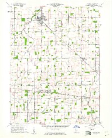
11 topographic sheets cover this place, the earliest surveyed in 1953 and the latest in 1986. It stands in Madison Township. It lies in ZIP code area 46036. The Survey maps it on the Windfall quadrangle. It stands 876 feet above sea level.
Topographic sheets covering this place
4 surveys from 11 printed sheetsMatched by testing this settlement's coordinate against the published boundary of every sheet in the United States Geological Survey's historical collection. Each opens the scanned sheet at the Survey.
- 1953 USGS Muncie quadrangle1:250000, 5 printings
- 1956 USGS Muncie quadrangle1:250000
- 1960 USGS Windfall quadrangle1:24000, 2 printings
- 1986 USGS Muncie quadrangle1:100000, 3 printings



In the county-history sources
2,603 words on this townshipHistory of Tipton County Indiana, published 1914 names this settlement in its chapter on Madison Township. These are the passages that mention it, exactly as the scans read.
The first mill in the township was a saw mill erected sometime during the year 1848. It was the property of Gilbert Wright and was located on the west fork of Duck creek, from which it drew its motive power. It was operated by a large water-wheel, and supplied the lumber for many of the first frame houses in the township. Wright operated the mill until his death in 1854, and from then on it passed through several hands. B. F. Mar¬ shall erected a saw mill, run by steam, in 1868, at the village of Curtisville.
Passage source: History of Tipton County Indiana, published 1914.
Near the year 1859 the town of Curtisville was founded by L. B. Col¬ vin, who built a saw mill in section 31, on the railroad, and sold lots for the purpose of securing a switch and a station. Among the first men to buy lots were U. T. Moon, John Balser, C. D. Colvin and A. B. Newman. The latter opened up the first stock of goods for sale, erecting a building in the east part of town for that purpose. Jacob Stamm, John Tuttle, Tohn Starkey were subsequent owners of this business. The early blacksmiths were Will¬ iam Little, Joseph Leach and James Hamilton. The manufacturing interests of the place have been represented by several steam saw mills; at one time the village was a popular trading point and shipping point for lumber.
Passage source: History of Tipton County Indiana, published 1914.
Curtisville has reached the climax of its growth and now is in the fourth act of its existence. There are not two hundred people in the village and the chief industry is the Curtisville Tile and Brick Company, manu- (6) facturing, as the name signifies, various sizes of drain tile and various kinds of brick. The town is not incorporated in any form and, like Hobbs, has no officers. The Pittsburg, Cincinnati, Chicago & St. Louis Railroad runs through the town, stopping a few accommodation trains there daily. This is the only avenue of commerce there, intercourse being even cut off from the county seat, except by way of Elwood, in Madison county. Curtisville has one of the most modern public school buildings in the state of Indiana, it being a model recommended by the state board of health for other schools to pattern after.
Passage source: History of Tipton County Indiana, published 1914.
Machine-read from a century-old scan, so expect the errors a machine makes: misspelled names, dropped words, stray characters.
Read the whole chapter on Madison Township - it names this place 1 more 1 time.
Nearest settlements
The eight closest, with where each one stands in the county. Distances are straight-line, computed from the Geographic Names Information System coordinates.
| Map | Place | Distance | Sheets |
|---|---|---|---|
| West Elwood | 3.3 miles | 11 | |
| Hobbs | 3.5 miles | 11 | |
| Windfall | 4.3 miles | 11 | |
| New Lancaster | 4.5 miles | 11 | |
| Nevada | 7.7 miles | 10 | |
| Tipton | 8.0 miles | 9 | |
| Jacksons | 8.6 miles | 9 | |
| Sharpsville | 10.9 miles | 10 |
Elsewhere
Matched on this settlement's Geographic Names Information System number rather than its name, so it cannot be a different place of the same name in another state.
| Wikipedia article on Curtisville | An encyclopaedic summary. Its text is share-alike, so it is linked here rather than copied. |
| Wikidata item Q5195995 | The structured record the population and elevation above come from. Public domain (CC0). |
Provenance
This settlement is recorded in the Geographic Names Information System as feature 433262. The sheet list is computed by point-in-boundary test against the United States Geological Survey's historical topographic inventory. Both are works of the United States government and carry no copyright under 17 U.S.C. 105.