 Block
Franklin, Indiana
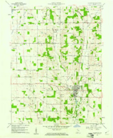
8 topographic sheets cover this place, the earliest surveyed in 1953 and the latest in 1986. It stands in Dalton Township. It lies in ZIP code area 47346. It stands on Franklin Run. The Survey maps it on the Hagerstown quadrangle. It stands 1,099 feet above sea level.
Topographic sheets covering this place
4 surveys from 8 printed sheetsMatched by testing this settlement's coordinate against the published boundary of every sheet in the United States Geological Survey's historical collection. Each opens the scanned sheet at the Survey.
- 1953 USGS Cincinnati quadrangle1:250000, 3 printings
- 1957 USGS Cincinnati quadrangle1:250000
- 1960 USGS Hagerstown quadrangle1:24000, 2 printings
- 1986 USGS New Castle quadrangle1:100000, 2 printings



In the county-history sources
12,981 words on this townshipHistory of Wayne County, Indiana, from Its First Settlement to the Present Time : with Numerous Biographical and Family Sketches, published 1872 names this settlement in its chapter on Dalton Township. These are the passages that mention it, exactly as the scans read.
Aquila "West settled on the farm now owned by Lyndsey Dennis, near the town, as early, probably, as 1818 or 1819. He removed some years after from the county. James Lindley settled, soon after West, south-east from town, on West Kiver, where Jesse Fonts now resides. He removed from the township, and died. Seth Mills, from Tennessee, settled on the farm now owned by Isaac W. Beeson. These, and some in other parts of the township, settled before the lands were offered for sale.
Passage source: History of Wayne County, Indiana, from Its First Settlement to the Present Time : with Numerous Biographical and Family Sketches, published 1872.
Joseph Davis, from North Carolina to Ohio, in 1808, removed, in 1823, to the farm on which he now resides, near town. Charles Burroughs, from Virginia, purchased a mile and a half north of town, in 1822, and settled permanently half a mile north of town, in 1826, where he now resides. Isaac W. Beeson, from North Carolina, settled early near Franklin, and in 1835 where he now resides, near and west of Dalton. Isaac Reynolds, from North Carolina, settled near Franklin, on land bought by his father of Sampson Smith, now owned by Wilson Reynolds. Nathan Baldwin, from North Carolina, near town, in 1880 or 1831, where he still re- sides. Thomas E. Beeson, from Korth Carolina, son of Isaac Beeson, about 1831, one mile east of town. Pleasant Harris, from K'orth Carolina, near Franklin; land now owned by Thomas and. Wilson Dennis; had. settled early in New Garden; came to Dalton before the land, sales ; removed to Iowa, and died there. Benj. F. Beeson, from North Carolina, near Franklin ; land now owned by John Bering, Thomas Is^icholson, and others. Thomas Antrim, from Tennessee, about 1820, three-quarters of a mile north of towm; land now owned by Charles Burroughs and Isaac Covalt. Samuel Beeson, half a mile east of Dalton, about 1826; died there, aged about 94 years. Land tirst settled by Wm. Main.
Passage source: History of Wayne County, Indiana, from Its First Settlement to the Present Time : with Numerous Biographical and Family Sketches, published 1872.
In the south-iuest quarter of the township, Jonathan Evans, settled on land now owned by Joseph Weaver. Joseph Johnson, from North Carolina, about 1820, a mile south of Franklin; died there; present owner, Branson Dennis. John Smith, from Pennsylvania ; present owners, B. Dennis, J. G. Allen, Wm. Baldwin. Peter Smith, from Tennessee, about 1822; died on his farm about three years ago ; his wife a year before. His son-in-law, James Con away, resides on the farm. Aaron Lesh, from Ohio, about the same time as Smith ; present owner, Martha i^ewcomb. Thomas Richardson, on land now owned by Abraham Smith. Thomas Marshall, from Tennessee, before land sale?; died on the farm, now or lately owned by John and Alexander Ditch, and occupied by John. Stephen Lear, from Ohio, where Levi Harter now lives. Daniel Ulrich, from Ohio, son of John Ulrich, of Jefferson township, about 1824, in the south-west corner of the township, adjoining the White Branch Woolen Mills. Benj. Beeson, from North Carolina, bought of Lear one mile south of Franklin, where
Passage source: History of Wayne County, Indiana, from Its First Settlement to the Present Time : with Numerous Biographical and Family Sketches, published 1872.
Machine-read from a century-old scan, so expect the errors a machine makes: misspelled names, dropped words, stray characters.
Read the whole chapter on Dalton Township - it names this place 13 more 13 times.
Mines and quarries near this place
1 within 5 milesRegional context, not property-specific evidence. The federal mineral resources record lists 1 working within 5 miles of Franklin: 1 producer. All of them still produce. What was taken out: Sand and Gravel, Construction. Distance is straight-line from the map coordinates, so a quarry counted here may appear on a neighbouring settlement's page as well.
| Where | Site | Commodity | Status | Recorded |
|---|---|---|---|---|
| House Gravel Pit | Sand and Gravel, Construction | Producer |
Nearest settlements
The eight closest, with where each one stands in the county. Distances are straight-line, computed from the Geographic Names Information System coordinates.
| Map | Place | Distance | Sheets |
|---|---|---|---|
| Dalton | 0.8 miles | 8 | |
| Hagerstown | 4.6 miles | 8 | |
| Economy | 5.5 miles | 8 | |
| Jacksonburg | 9.5 miles | 9 | |
| Greens Fork | 9.7 miles | 8 | |
| Hoover Mill | 10.1 miles | 9 | |
| Williamsburg | 10.4 miles | 9 | |
| Mount Auburn | 11.1 miles | 8 |
Elsewhere
Matched on this settlement's Geographic Names Information System number rather than its name, so it cannot be a different place of the same name in another state.
| Wikipedia article on Franklin | An encyclopaedic summary. Its text is share-alike, so it is linked here rather than copied. |
| Wikidata item Q17183311 | The structured record the population and elevation above come from. Public domain (CC0). |
Provenance
This settlement is recorded in the Geographic Names Information System as feature 449869. The sheet list is computed by point-in-boundary test against the United States Geological Survey's historical topographic inventory. Both are works of the United States government and carry no copyright under 17 U.S.C. 105.
Mines and quarries. USGS Mineral Resources Data System (MRDS) https://mrdata.usgs.gov/mrds/ A work of the United States government, no copyright under 17 U.S.C. 105.