 Block
Economy, Indiana
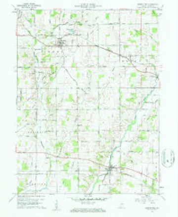
8 topographic sheets cover this place, the earliest surveyed in 1953 and the latest in 1986. It stands in Perry Township. It lies in ZIP code area 47339. It stands on Jordon Creek. The Survey maps it on the Greens Fork quadrangle. 145 people lived here at the 2020 count. It stands 1,152 feet above sea level.
Population over time
2 figuresEconomy fell from 187 to 145 between 2010 and 2020. These are the recorded population figures Wikidata holds for this place, reached through the Geographic Names Information System number this page is keyed on rather than by name, so they belong to this place and not to another of the same name. Most are census counts, but not all are: an early figure may be a founding or settlement estimate, and an estimate published within five years of a census is left out. The change column is computed, and is left blank where more than 20 years separate a figure from the one before it, because a gap that long is not a change between two counts.
| Year | People | Change |
|---|---|---|
| 2010 | 187 | |
| 2020 | 145 | -42 (-22%) |
Topographic sheets covering this place
4 surveys from 8 printed sheetsMatched by testing this settlement's coordinate against the published boundary of every sheet in the United States Geological Survey's historical collection. Each opens the scanned sheet at the Survey.
- 1953 USGS Cincinnati quadrangle1:250000, 3 printings
- 1957 USGS Cincinnati quadrangle1:250000
- 1960 USGS Greens Fork quadrangle1:24000, 2 printings
- 1986 USGS New Castle quadrangle1:100000, 2 printings



In the county-history sources
17,166 words on this townshipHistory of Wayne County, Indiana, from Its First Settlement to the Present Time : with Numerous Biographical and Family Sketches, published 1872 names this settlement in its chapter on Perry Township. These are the passages that mention it, exactly as the scans read.
Richard Williams, from Tenu., settled, Dec, 1814, one-fourth of a mile west of town, where his son John M. Williams lives. He had other sons, William, Alfred, Elam, and Millikin, who reside in Westville. Robert Canaday, from Tenn., settled near Economy in 1814, and died there in 1836 or 1837. He had two sons, Joshua and Thomas. Henry and Moses Mills, from Tenn., settled in 1815 on the present sitQ of Economy. Henry sold to Elihu Swain and Wm. Locke, who, in 1818 or 1819, sold to Charles Osborn, who laid out the town. Of the quarter section on which the town stands, those portions which lie outside of the town, are owned by John Osborn, Thomas B. and John M.Williams, Wm. Clark, and Samuel L. McDonald. Elihu and Samuel Swain, fi'om Tenn., settled on land now owned by the heirs of Elihu Swain, Jun. Elihu Swain and a son, Ira, reside in town. Miles Marshall, from Tenn., settled on Green's Fork, near Washington; returned south in January, 1813, and after the war of 1812, came back, and settled, about 1815, near Economy ; removed ten or twelve years ago to Iowa, and died there about 1867 or 1868. John Canaday, brother of Robert, settled, about 1816, south side of tlie town ; land now owned by Jesse H. Greenstreet, Jonathan B. Clark, and Philip Replogle, lately by Wm. Lewis. Wm. Blount, from Pa. to Ky., in 1800, and thence, in 1805, to Wayne township, and about the year 1814 to Perr\% a mile west of Economy, on land north of Macy's, on which Jesse Willetts afterward settled, now^ owned by Edwin P. and Julia Thornburg, and Thomas J.Cook. Several of Blount's sons removed to Henry Co., and laid out the town of Blountsville. The father removed about 1830 to Delaware Co. Thomas Gallon, Ky., settled IJ miles south-west of town, on land now owned by George Comer, lately by J. Ilartup. James Warren, from Tenn., on land now owned by Elvan Thornburg. Jonathan Macy, from Tenn., next north of Warren ; he was an early justice and a merchant. The lands settled by Robert Canaday and Miles Marshall, in or about the year 1814 and 1815, are said to be those now owned by Lindsey Canaday, John A. Shepard, Matilda, widow of Jonathan B. Macy, and others.
Passage source: History of Wayne County, Indiana, from Its First Settlement to the Present Time : with Numerous Biographical and Family Sketches, published 1872.
Daniel Mills, from N. C. in 1804, and from Ohio in 1816, on lands now owned by Wilson Pierce, Isaac B. Underbill, and Josef)b L. Wood. Miles Marshall, of Tenn., and Thomas Carr, of O., on lands now owned by John M, and Merchant B. Williams and Jonathan Brewer. Thomas Carr also owned land where the heirs of Kichard Pugh reside. David Osborn, a Carolinian, from 0., in 1816, settled on land now owned by John X. Dean, lately by Tliomas B. Williams. John Jordan, who had settled in 1810 in what is now Boston township, removed in 1815 to the north-west corner section of this townsliip, where he died. The entire section, a part of which was recently owned by T. D. Barnett, is now owned by his son Wm. Jordan and his sons John W. and George !M., and by John P. Jordan, nephew of Wm. Jordan. About the year 1815, Wm. Fife and his son-in-law, Jonathan Thornburg, of Tenn., and Amy Hall, settled where Jonathan Thornburg lives, on the township north line. In 1816, George Hobson, from Tenn., on land now owned by Charity Gwinn and Jonathan Brewer.
Passage source: History of Wayne County, Indiana, from Its First Settlement to the Present Time : with Numerous Biographical and Family Sketches, published 1872.
Robert Canady, in 1819, built a Saw-mill half a mile from Economy, on Martindale's creek, (so named from John Martindale, an early settler on the stream,) Abel Lomax, masterbuilder. By repairs and rebuilding a mill has been kept there until the present time ; present owner, John A. Shepard. An oil-mill was built at the same place as early as 1830; proprietors, Richard Williams, Wm. Barnard, and Matthew Williams, and was run six or seven years. About the year 1827, a grist-mill was started by Daniel and Richard Mills and Thomas Cox, a mile below town, and was run about ten years. A steam grist-mill and saio-mill were built at Economy about the year 1830, by Nathan Proctor, and run about five years. John and Larkin Maulsby built, in 1849, a steam saw-mill, and afterward added a corn-cracker. They were run but a few years.
Passage source: History of Wayne County, Indiana, from Its First Settlement to the Present Time : with Numerous Biographical and Family Sketches, published 1872.
Machine-read from a century-old scan, so expect the errors a machine makes: misspelled names, dropped words, stray characters.
Read the whole chapter on Perry Township - it names this place 41 more 41 times.
Storms near this place
8 since 1994Regional context, not property-specific evidence. The National Weather Service names Economy in 8 storm reports between 1994 and 2017: 3 thunderstorm wind, 2 flash flood, 2 hail, 1 tornado. No death or injury is recorded in these reports. Each account below is quoted exactly as the forecast office filed it, from the NOAA Storm Events Database, and each date opens the federal record of that event.
| When | Event | Place named | Harm | What the report says |
|---|---|---|---|---|
| July 2001 | Thunderstorm Wind | Economy | $10,000 | A severe thunderstorm moved across the northwest and north-central part of the county downing trees between Economy and Greens Fork. Many of the trees fell across roads. Golf ball size hail also occurred in Economy. |
| July 2012 | Thunderstorm Wind | Economy | $3,000 | Trees were downed due to damaging thunderstorm winds. |
| June 2005 | Thunderstorm Wind | Economy | $3,000 | Trees and large limbs were downed. |
| June 2008 | Flash Flood | Economy | $1,000 | Centerville Road was flooded and closed to the north of Williamsburg. |
| July 2017 | Flash Flood | Economy | - | High water was reported across several roads across the northern part of the county between Economy and Fountain City. |
| April 1994 | Tornado (F0) | Economy | - | Economy Fire Department reported a tornado touchdown. No damage or injuries were reported or found. |
| August 2015 | Hail | Economy | - | no account filed |
| May 2011 | Hail | Economy | - | no account filed |
Nearest settlements
The eight closest, with where each one stands in the county. Distances are straight-line, computed from the Geographic Names Information System coordinates.
| Map | Place | Distance | Sheets |
|---|---|---|---|
| Dalton | 5.0 miles | 8 | |
| Williamsburg | 5.2 miles | 9 | |
| Franklin | 5.5 miles | 8 | |
| Hagerstown | 6.0 miles | 8 | |
| Greens Fork | 6.4 miles | 8 | |
| Hoover Mill | 8.0 miles | 9 | |
| Jacksonburg | 8.7 miles | 9 | |
| Webster | 9.2 miles | 9 |
Elsewhere
Matched on this settlement's Geographic Names Information System number rather than its name, so it cannot be a different place of the same name in another state.
| Wikipedia article on Economy | An encyclopaedic summary. Its text is share-alike, so it is linked here rather than copied. |
| Wikidata item Q2744375 | The structured record the population and elevation above come from. Public domain (CC0). |
Provenance
This settlement is recorded in the Geographic Names Information System as feature 433994. The sheet list is computed by point-in-boundary test against the United States Geological Survey's historical topographic inventory. Both are works of the United States government and carry no copyright under 17 U.S.C. 105.
Storms. NOAA National Centers for Environmental Information, Storm Events Database https://www.ncei.noaa.gov/stormevents/ A work of the United States government, no copyright under 17 U.S.C. 105. Narratives are quoted verbatim from the National Weather Service report and are not edited or summarised.