 Block
Gem, Indiana
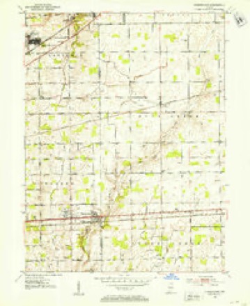
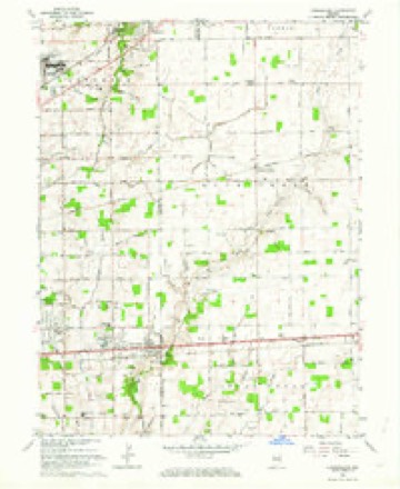
12 topographic sheets cover this place, the earliest surveyed in 1952 and the latest in 1986. It stands in Sugar Creek Township. It lies in ZIP code area 46140. The Survey maps it on the Cumberland quadrangle. It stands 856 feet above sea level.
Topographic sheets covering this place
5 surveys from 12 printed sheetsMatched by testing this settlement's coordinate against the published boundary of every sheet in the United States Geological Survey's historical collection. Each opens the scanned sheet at the Survey.
- 1952 USGS Cumberland quadrangle1:24000
- 1953 USGS Cincinnati quadrangle1:250000, 3 printings
- 1957 USGS Cincinnati quadrangle1:250000
- 1962 USGS Cumberland quadrangle1:24000, 5 printings
- 1986 USGS New Castle quadrangle1:100000, 2 printings



In the county-history sources
46,576 words on this townshipHistory of Hancock County, Indiana, from Its Earliest Settlement by the "pale Face," in 1818, Down to 1882, published 1882; History of Hancock County, Indiana; Its People, Industries and Institutions, published 1916 names this settlement in its chapter on Sugar Creek Township. These are the passages that mention it, exactly as the scans read.
Gem post-office was established in 1878, on the P., C. and St. L. R. R., in the central northern part of the township, and Andrew Stutsman was the first postmaster. The first store at this place was kept by Nicholas Stutsman, sevens-ears prior to the establishment of the post-office. There never was a plat made of the place, consequenth' no additions. It has a general store, kept by J. Townsend ; a boot an(;l shoe shop, by Joseph Coon ; a blacksmith shop, by Isaac Stutsman ; a steam saw-mill, by Nicholas Stutsman : a daily mail, James Townsend, P. M.
Passage source: History of Hancock County, Indiana, from Its Earliest Settlement by the "pale Face," in 1818, Down to 1882, published 1882.
Since 191 1 Isaac H. Day has been elected president of the board composed of the presidents of the township institutes. All funds appropriated by law for the use of the farmers' institutes have been drawn in his name.
Passage source: History of Hancock County, Indiana; Its People, Industries and Institutions, published 1916.
Two men stand out prominently in the history of the New Palestine school. During the seventies the school had a very bad reputation for discipline, etc. A number of teachers had been unsuccessful, when William A. Wood appeared upon the scene. He wras a small man physically, yet he possessed the disciplinary ability necessary to "straighten out" the school.
Passage source: History of Hancock County, Indiana; Its People, Industries and Institutions, published 1916.
Machine-read from a century-old scan, so expect the errors a machine makes: misspelled names, dropped words, stray characters.
Read the whole chapter on Sugar Creek Township - it names this place 7 more 7 times.
Storms near this place
11 since 2012Regional context, not property-specific evidence. The National Weather Service names Gem in 11 storm reports between 2012 and 2023: 7 hail, 4 thunderstorm wind. No death or injury is recorded in these reports. Each account below is quoted exactly as the forecast office filed it, from the NOAA Storm Events Database, and each date opens the federal record of that event.
| When | Event | Place named | Harm | What the report says |
|---|---|---|---|---|
| February 2023 | Thunderstorm Wind | Gem | $50,000 | Thunderstorm winds collapsed a barn. |
| May 2019 | Thunderstorm Wind | Gem | $1,000 | A power line was reported down due to damaging thunderstorm wind gusts. |
| July 2016 | Thunderstorm Wind | Gem | $1,000 | The top of a 40 foot tree was snapped off in this location due to damaging thunderstorm wind gusts. |
| May 2018 | Thunderstorm Wind | Gem | $750 | A small tree was blown down on South Fox Tail Pass, located just west of South County Road 700 West due to strong thunderstorm wind gusts. |
| July 2012 | Hail | Gem | - | Pea to quarter sized hail fell for five minutes. |
| June 2021 | Hail | Gem | - | no account filed |
| March 2017 | Hail | Gem | - | no account filed |
| April 2012 | Hail | Gem | - | no account filed |
| September 2012 | Hail | Gem | - | no account filed |
| September 2012 | Hail | Gem | - | no account filed |
| September 2012 | Hail | Gem | - | no account filed |
Nearest settlements
The eight closest, with where each one stands in the county. Distances are straight-line, computed from the Geographic Names Information System coordinates.
| Map | Place | Distance | Sheets |
|---|---|---|---|
| Spring Lake | 2.3 miles | 12 | |
| Philadelphia | 2.7 miles | 12 | |
| Carriage Estates | 2.9 miles | 11 | |
| Mount Comfort | 3.7 miles | 12 | |
| Brookville Heights | 3.8 miles | 11 | |
| New Palestine | 4.0 miles | 11 | |
| Schildmeier Park | 4.3 miles | 11 | |
| Mohawk | 5.3 miles | 12 |
Elsewhere
Matched on this settlement's Geographic Names Information System number rather than its name, so it cannot be a different place of the same name in another state.
| Wikipedia article on Gem | An encyclopaedic summary. Its text is share-alike, so it is linked here rather than copied. |
| Wikidata item Q5530536 | The structured record the population and elevation above come from. Public domain (CC0). |
Provenance
This settlement is recorded in the Geographic Names Information System as feature 435008. The sheet list is computed by point-in-boundary test against the United States Geological Survey's historical topographic inventory. Both are works of the United States government and carry no copyright under 17 U.S.C. 105.
Storms. NOAA National Centers for Environmental Information, Storm Events Database https://www.ncei.noaa.gov/stormevents/ A work of the United States government, no copyright under 17 U.S.C. 105. Narratives are quoted verbatim from the National Weather Service report and are not edited or summarised.