 Block
Hamilton, Indiana
11 topographic sheets cover this place, the earliest surveyed in 1953 and the latest in 1983. It stands in Olive Township. It lies in ZIP code area 46552. The Survey maps it on the Lydick quadrangle. It stands 758 feet above sea level.
On record in Hamilton
Buildings and businesses the archive holds for this place. Each opens its own page, with the source record it came from.
On the National Register within a mile 1 record
The National Register names another town for these. They stand within one mile of this settlement's coordinate.
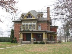 Haven Hubbard Homelisted 2013 · 0.6 miles away
Topographic sheets covering this place
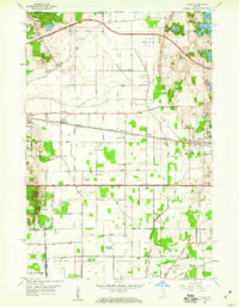
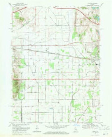
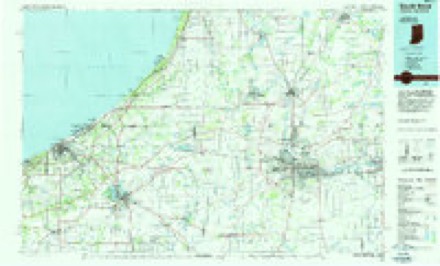
5 surveys from 11 printed sheetsMatched by testing this settlement's coordinate against the published boundary of every sheet in the United States Geological Survey's historical collection. Each opens the scanned sheet at the Survey.
- 1953 USGS Chicago quadrangle1:250000, 5 printings
- 1957 USGS Chicago quadrangle1:250000
- 1958 USGS Lydick quadrangle1:24000
- 1969 USGS Lydick quadrangle1:24000, 2 printings
- 1983 USGS South Bend quadrangle1:100000, 2 printings


In the county-history sources
11,271 words on this townshipHistory of St. Joseph County, Indiana :, published 1880 names this settlement in its chapter on Olive Township. These are the passages that mention it, exactly as the scans read.
By the year 1836, about all the Government land was taken up. The land oflice was at Crawfordsville, and there were residents enough to justify the holding of public religious services. The first church was built at Hamilton in 1838, by the Methodists, who still hold meetings in it. At that time Hamilton was the great business center for this part of St. Joseph count}'. Since the railroad has been built through the county and made a station at New Carlisle, Hamilton has run down. This place is frequently called Terre Coupee, from a postoflice of that name near there. There are also at Hamilton a neat school-house, a grocery and several residences. This village is situated near the center of section 2-4, in Terre Coupee Prairie. This prairie was very marshy before it was drained and cultivated; it is now one of the most fertile spots in the State of Indiana. It is over four miles in diameter and contains 3,000 or 4,000 acres, which is worth $80 to $120 an acre. It is almost as level as a barn floor, and just sandy enough for agricultural purposes.
Passage source: History of St. Joseph County, Indiana :, published 1880.
The first Methodist house of worship in the county was erected at Hamilton, and was dedicated in May, 1841, by Rev. Aaron Wood, D. D. The first Methodist preaching at New Carlisle was by Rev. Abram Saulsberry, in 181:9, then on " Byron Circuit." The first class in New Carlisle was formed in 1853, of the following members: Mr. and Mrs. A. H. Pidge, Josiah Pidge, Jacob Hopkins, James and Delilah Egbert, Mr. and Mrs. James S. White and Eliza White. Kev. A. H. Pidge was the class-leader. This year the parsonage was built, and ever since then it has been the home of the circuit preacher. The church building at this place was erected in 1858.
Passage source: History of St. Joseph County, Indiana :, published 1880.
James Davis, deceased, was a successful farmer. He was among the early settlers of Olive tp. He was born in Butler county, Ohio, in 1802, the son of Daniel Davis, and of Welsh descent. He received his education in the common schools in Ohio. He was married in 1824 to Jane Hull. They were the parents of 3 children, all boys, only one of whom is living at the present time. The eldest was married, and at his death, which occurred in 1877, left a wife and 7 children, 4 girls and 3 boys; the eldest girl is living with her grandmother, who is still living on sec. 8, the old homestead. The subject of this sketch died in 1873. His wife, Jane, nee Davis, is still living. She used to be a good horseback rider; when 15 years of age she rode on horseback from Florida to Ohio, and says she enjoyed the trip ver3' much. She was born in 1807, in Hamilton county, Ohio; came to this county in 1835, in company with her liusband, James Davis, wlio died here in 1873. They were married in Hamilton county, O. She now owns 184 acres of land in two farms, one in Indiana, the other in Michigan. Mr. D. was a Republican in politics. Sami'.el, the only child living of the family, spent 20 years of his life as a telegraph operator; at the present time he is a photographer in Michigan.
Passage source: History of St. Joseph County, Indiana :, published 1880.
Machine-read from a century-old scan, so expect the errors a machine makes: misspelled names, dropped words, stray characters.
Fires near this place
3 since 2005Regional context, not property-specific evidence. The federal wildfire occurrence database lists 3 fires within 5 miles of Hamilton between 2005 and 2019, burning about 6 acres in total. 1 started naturally. None was recorded as arson. Distance is straight-line from the map coordinates, so a fire counted here may appear on a neighbouring settlement's page as well.
| Reported cause | Fires |
|---|---|
| Missing data/not specified/undetermined | 2 |
| Natural | 1 |
The most recent of them, most recent first, with the day each was reported and the service that recorded it.
| Date | Cause | Size | Reported by | Name on the report |
|---|---|---|---|---|
| 10 September 2005 | Natural | 4.0 acres | Michigan Department of Natural Resources | not named |
| 3 August 2019 | Missing data/not specified/undetermined | 1.0 acres | Michigan Department of Natural Resources | BERTRAND TOWNSHIP FD 2019066 - 2019 |
| 23 December 2019 | Missing data/not specified/undetermined | 1.0 acres | Michigan Department of Natural Resources | GALIEN TOWNSHIP FD 0000033 - 2019 |
Storms near this place
2 since 2019Regional context, not property-specific evidence. The National Weather Service names Hamilton in 2 storm reports between 2019 and 2021: 1 thunderstorm wind, 1 tornado. No death or injury is recorded in these reports. Each account below is quoted exactly as the forecast office filed it, from the NOAA Storm Events Database, and each date opens the federal record of that event.
| When | Event | Place named | Harm | What the report says |
|---|---|---|---|---|
| October 2021 | Tornado (EFU) | Hamilton | - | A trained spotter photographed a brief tornado in a farm field north of US 20 and Walnut Grove intersection. The photo showed dirt being kicked up in the farm field. The tornado lasted about one minute. No damage was reported. |
| July 2019 | Thunderstorm Wind | Hamilton | - | A trained spotter reported a large tree limb was blown down onto a road. |
Nearest settlements
The eight closest, with where each one stands in the county. Distances are straight-line, computed from the Geographic Names Information System coordinates.
| Map | Place | Distance | Sheets |
|---|---|---|---|
| Terre Coupee | 2.1 miles | 11 | |
| Olive | 2.7 miles | 11 | |
| New Carlisle | 2.8 miles | 10 | |
| Zeigler | 3.3 miles | 11 | |
| Hubbard | 4.0 miles | 11 | |
| Chain-O-Lakes | 5.5 miles | 11 | |
| Lydick | 5.8 miles | 11 | |
| Westfield | 6.5 miles | 11 |
Elsewhere
Matched on this settlement's Geographic Names Information System number rather than its name, so it cannot be a different place of the same name in another state.
| Wikipedia article on Hamilton | An encyclopaedic summary. Its text is share-alike, so it is linked here rather than copied. |
| Wikidata item Q5644793 | The structured record the population and elevation above come from. Public domain (CC0). |
Provenance
This settlement is recorded in the Geographic Names Information System as feature 452615. The sheet list is computed by point-in-boundary test against the United States Geological Survey's historical topographic inventory. Both are works of the United States government and carry no copyright under 17 U.S.C. 105.
Wildfire. Short, Karen C. 2022. Spatial wildfire occurrence data for the United States, 1992-2020 [FPA_FOD_20221014]. 6th Edition. Fort Collins, CO: Forest Service Research Data Archive. https://doi.org/10.2737/RDS-2013-0009.6 Collected with United States Government funding and usable without additional permissions or fees.
Storms. NOAA National Centers for Environmental Information, Storm Events Database https://www.ncei.noaa.gov/stormevents/ A work of the United States government, no copyright under 17 U.S.C. 105. Narratives are quoted verbatim from the National Weather Service report and are not edited or summarised.