 Block
New Carlisle, Indiana
10 topographic sheets cover this place, the earliest surveyed in 1953 and the latest in 1983. It stands in Olive Township. It lies in ZIP code area 46552. The Survey maps it on the New Carlisle quadrangle. 1,891 people lived here at the 2020 count. It stands 810 feet above sea level.
On record in New Carlisle
Buildings and businesses the archive holds for this place. Each opens its own page, with the source record it came from.
On the National Register 4 records
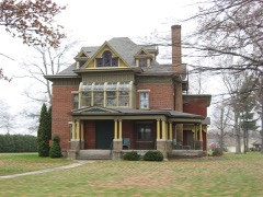 Haven Hubbard Homelisted 2013
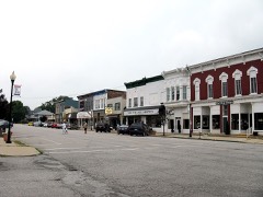 New Carlisle Historic Districtlisted 1992
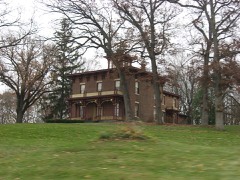 Jeremiah H. Service Houselisted 2000
 Studebaker Clubhouse and Tree Signlisted 1985
Population over time
2 figuresNew Carlisle grew from 1,861 to 1,891 between 2010 and 2020. These are the recorded population figures Wikidata holds for this place, reached through the Geographic Names Information System number this page is keyed on rather than by name, so they belong to this place and not to another of the same name. Most are census counts, but not all are: an early figure may be a founding or settlement estimate, and an estimate published within five years of a census is left out. The change column is computed, and is left blank where more than 20 years separate a figure from the one before it, because a gap that long is not a change between two counts.
| Year | People | Change |
|---|---|---|
| 2010 | 1,861 | |
| 2020 | 1,891 | +30 (+2%) |
Topographic sheets covering this place
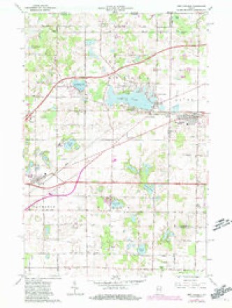
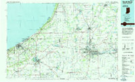
4 surveys from 10 printed sheetsMatched by testing this settlement's coordinate against the published boundary of every sheet in the United States Geological Survey's historical collection. Each opens the scanned sheet at the Survey.
- 1953 USGS Chicago quadrangle1:250000, 5 printings
- 1957 USGS Chicago quadrangle1:250000
- 1958 USGS New Carlisle quadrangle1:24000, 2 printings
- 1983 USGS South Bend quadrangle1:100000, 2 printings


In the county-history sources
11,271 words on this townshipHistory of St. Joseph County, Indiana :, published 1880 names this settlement in its chapter on Olive Township. These are the passages that mention it, exactly as the scans read.
Among the oldest settlers of Olive township we may mention that man of great memory, Mr. Barvilla Drnliner, of New Carlisle, who was born July 7, 1807; Joseph Adams and wife, of section 31, the oldest couple now living in the township. Mr. A. made his start in the West by splitting rails, at 50 cents per 100, while boarding himself lie has made as many as 500 rails in one day. The young men uf to-day would as soon try Dr. Tanner's experiment of fasting iO days as to make 500 rails in one day. Jacob Kush, who was born in Ohio in 1806, is now living on section 36, one of our oldest pioneers. He held tiie plow for the first furrow ever turned in this township, and he also helped to i-aise the first cabin here, which belonged to his brotiier Israel Hush, who was afterward the first Justice of the Peace, and died in 1837. Jacob is still a lively and energetic man. Asher White was a boy of only 16 years of age when he came here in 1830. His biography is given more in full on a subsequent page.
Passage source: History of St. Joseph County, Indiana :, published 1880.
This part of Indiana was surveyed in 1830 by "William and Noah Brock, the latter running the base lines, and the former dividing the land into sections; and this township received its name in honor of the wife of Charles Vail. She is still living in New Carlisle. Mr. v., who settled here in 1830, was alterward elected County Judge. After the survey of the township, the first Justice of the Peace acted as County Commissioner until the regular annual election.
Passage source: History of St. Joseph County, Indiana :, published 1880.
By the year 1836, about all the Government land was taken up. The land oflice was at Crawfordsville, and there were residents enough to justify the holding of public religious services. The first church was built at Hamilton in 1838, by the Methodists, who still hold meetings in it. At that time Hamilton was the great business center for this part of St. Joseph count}'. Since the railroad has been built through the county and made a station at New Carlisle, Hamilton has run down. This place is frequently called Terre Coupee, from a postoflice of that name near there. There are also at Hamilton a neat school-house, a grocery and several residences. This village is situated near the center of section 2-4, in Terre Coupee Prairie. This prairie was very marshy before it was drained and cultivated; it is now one of the most fertile spots in the State of Indiana. It is over four miles in diameter and contains 3,000 or 4,000 acres, which is worth $80 to $120 an acre. It is almost as level as a barn floor, and just sandy enough for agricultural purposes.
Passage source: History of St. Joseph County, Indiana :, published 1880.
Machine-read from a century-old scan, so expect the errors a machine makes: misspelled names, dropped words, stray characters.
Read the whole chapter on Olive Township - it names this place 31 more 31 times.
Mines and quarries near this place
1 within 5 milesRegional context, not property-specific evidence. The federal mineral resources record lists 1 working within 5 miles of New Carlisle: 1 producer. All of them still produce. What was taken out: Sand and Gravel, Construction. Distance is straight-line from the map coordinates, so a quarry counted here may appear on a neighbouring settlement's page as well.
| Where | Site | Commodity | Status | Recorded |
|---|---|---|---|---|
| Hunt Lake Pit | Sand and Gravel, Construction | Producer |
Storms near this place
19 since 1996Regional context, not property-specific evidence. The National Weather Service names New Carlisle in 19 storm reports between 1996 and 2024: 12 thunderstorm wind, 4 hail, 1 tornado, 1 flood. No death or injury is recorded in these reports. Each account below is quoted exactly as the forecast office filed it, from the NOAA Storm Events Database, and each date opens the federal record of that event.
| When | Event | Place named | Harm | What the report says |
|---|---|---|---|---|
| May 2007 | Tornado (EF0) | New Carlisle | $13,000 | Local residents south of New Carlisle reported seeing a funnel pass over several rows of trees, causing some damage to the tree tops. The funnel subsequently touched down in an open field and moved rapdily east. A section of an irrigation system was twisted and destroyed in an open field. In addition, strong winds entered an open barn area resulting in much of the roofing material being removed. The winds also weakened the supports causing partial structural failure to a lean-to. A combine in the lean-to sustained some damage. A large tree also fell onto the residence causing some roof damage. Debris was thrown a few hundred feet into an open field. It appears that the tornado lifted shortly after affecting the residence. No injuries occurred with the brief touch down. The irrigation system damages has been estimated at $13,000. Damage estimates to the house and barn are to be determined. |
| August 2024 | Thunderstorm Wind | New Carlisle | $5,000 | Large tree limbs and a few trees down in New Carlisle. |
| May 2024 | Thunderstorm Wind | New Carlisle | $1,000 | Powerlines down across SR 2 at County Line Road. |
| July 2023 | Thunderstorm Wind | New Carlisle | - | Numerous trees, tree limbs and power lines down in New Carlisle. Some trees fell onto homes. No injuries reported. Time estimated from radar. |
| July 2023 | Heavy Rain | New Carlisle | - | Rain total of 5.20 inches since 11 PM EDT. |
| June 2021 | Flood | New Carlisle | - | Water rose quickly in ditch and field after a 60 minute downpour, then receded after rain rate diminished. |
| September 2019 | Thunderstorm Wind | New Carlisle | - | The public reported downed trees and power line damage along railroad tracks near this location. |
| June 2014 | Hail | New Carlisle | - | The public reported hail from the size of quarters to nearly half dollars. |
| June 2013 | Thunderstorm Wind | New Carlisle | - | County highway officials reported a tree down onto Highway 2, near the county line. The tree was blocking all west bound lanes. |
| July 2012 | Thunderstorm Wind | New Carlisle | - | Local media reported a tree was blown down across a road in New Carlisle. |
| July 2012 | Thunderstorm Wind | New Carlisle | - | Law enforcement officials reported numerous trees down in New Carlisle. |
| July 2003 | Thunderstorm Wind | New Carlisle | - | Law enforcement reported trees and power lines down in new Carlisle. |
| July 2003 | Thunderstorm Wind | New Carlisle | - | Law enforcement reported power lines down northwest of New Carlisle. |
| July 2003 | Thunderstorm Wind | New Carlisle | - | Law enforcement reported trees and power lines down in New Carlisle. |
| June 1998 | Thunderstorm Wind | New Carlisle | - | LARGE TREES BLOWN DOWN |
| March 2019 | Hail | New Carlisle | - | no account filed |
| June 2019 | Hail | New Carlisle | - | no account filed |
| July 1998 | Thunderstorm Wind | New Carlisle | - | no account filed |
| July 1996 | Hail | New Carlisle | - | no account filed |
Nearest settlements
The eight closest, with where each one stands in the county. Distances are straight-line, computed from the Geographic Names Information System coordinates.
| Map | Place | Distance | Sheets |
|---|---|---|---|
| Terre Coupee | 1.7 miles | 11 | |
| Hamilton | 2.8 miles | 11 | |
| Olive | 3.3 miles | 11 | |
| Zeigler | 4.0 miles | 11 | |
| Hubbard | 4.8 miles | 11 | |
| Lydick | 6.9 miles | 11 | |
| Chain-O-Lakes | 6.9 miles | 11 | |
| Westfield | 7.1 miles | 11 |
Elsewhere
Matched on this settlement's Geographic Names Information System number rather than its name, so it cannot be a different place of the same name in another state.
| Wikipedia article on New Carlisle | An encyclopaedic summary. Its text is share-alike, so it is linked here rather than copied. |
| Wikidata item Q2291241 | The structured record the population and elevation above come from. Public domain (CC0). |
Provenance
This settlement is recorded in the Geographic Names Information System as feature 452704. The sheet list is computed by point-in-boundary test against the United States Geological Survey's historical topographic inventory. Both are works of the United States government and carry no copyright under 17 U.S.C. 105.
Mines and quarries. USGS Mineral Resources Data System (MRDS) https://mrdata.usgs.gov/mrds/ A work of the United States government, no copyright under 17 U.S.C. 105.
Storms. NOAA National Centers for Environmental Information, Storm Events Database https://www.ncei.noaa.gov/stormevents/ A work of the United States government, no copyright under 17 U.S.C. 105. Narratives are quoted verbatim from the National Weather Service report and are not edited or summarised.