 Block
Johnson, Indiana
23 topographic sheets cover this place, the earliest surveyed in 1901 and the latest in 1986. It stands in Montgomery Township. It lies in ZIP code area 47665. It stands on Barren Creek. The Survey maps it on the Owensville quadrangle. It stands 430 feet above sea level.
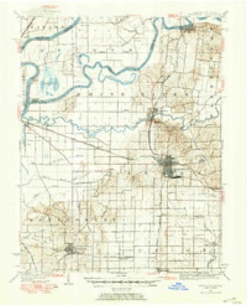
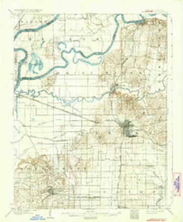
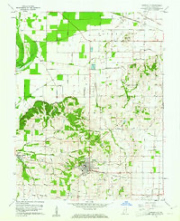
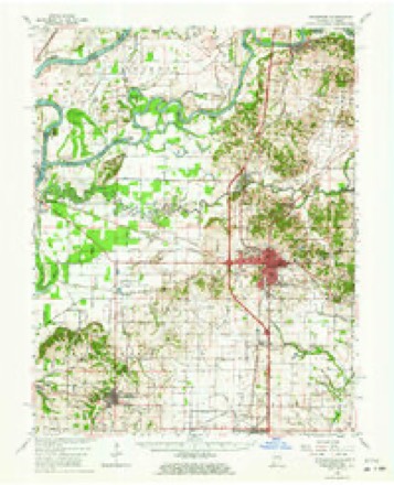
Topographic sheets covering this place
9 surveys from 23 printed sheetsMatched by testing this settlement's coordinate against the published boundary of every sheet in the United States Geological Survey's historical collection. Each opens the scanned sheet at the Survey.
- 1901 USGS Princeton quadrangle1:62500
- 1903 USGS Patoka quadrangle1:125000, 2 printings
- 1903 USGS Princeton quadrangle1:62500, 6 printings
- 1956 USGS Vincennes quadrangle1:250000, 4 printings
- 1957 USGS Vincennes quadrangle1:250000
- 1958 USGS Vincennes quadrangle1:250000, 2 printings
- 1959 USGS Owensville quadrangle1:24000, 3 printings
- 1959 USGS Princeton quadrangle1:62500, 2 printings
- 1986 USGS Princeton quadrangle1:100000, 2 printings





In the county-history sources
7,349 words on this townshipHistory of Gibson County Indiana, published 1884 names this settlement in its chapter on Montgomery Township. These are the passages that mention it, exactly as the scans read.
John Benson, a Pennsylvanian, emigrated to Kentucky in 1788, where he married and came to Gibson County in 1807, settling in the northwest quarter ot Section 35, Township 2, Range 12. He made an improvement, and lived in the vicinity until 1820, when he moved to Illinois. In 1816 William Benson, then a single man, came here from Kentucky, iis native state, and purchased his brother John Benson's place. He was a wheel-wright and followed his trade together with farming. Of a family of eight children, six are now living, viz : - Martha, Ellen, Louisa, Sarah, Lemira, and Sylvester, born in this county in 1828, and resided on the old homestead. Sylvester isa member of the present board of county commissioners, and is one of the largest land owners in the county. Jesse and Asa Music, from Kentucky, brothers-in-law to John Benson, settled in the same neighborhood in 1808. John Benson and Jesse Music were in the Tippecanoe battle, where the latter was mortally wounded and died on the return trip to Vincennes. Elias, William, John and Jesse Barker, brothers, and James Stewart, a half brother, all natives of Kentucky, also arrived and located in the Montgomery settlement in 1807. 'They all had families but Jesse, when they came, and he married Elizabeth, daughter of William Key, an early settler about three miles north of Owensville, and made his farm just at the north edge of that village, where he died in 1863.
Passage source: History of Gibson County Indiana, published 1884.
Thomas Waters was another sturdy pioneer of 1807. He was a Virginian, but was reared principally in North Carolina, where he married Polly Page, and made his home in Caswell County of that state. He was twice murried and had ten children born to him. His second wife was Maitha Southerlain.
Passage source: History of Gibson County Indiana, published 1884.
Jesse Emerson, afterward associate judge, and a very prominent and influential man in the county, came here from Kentucky, in 1811, and settled on the road leading from Owensville to Princeton, in the northwest quarter of Section 28, Township 2, Range 11. He reared alarge family, of who.n Henry Emerson, at Haubstadt, is the only one living. Reuben Emerson, brother of the above, came to the county in 1813, and settled in what is now Johnson Township. Andrew Gudgel, the pioneer of that family in this county, settled in the timber, about two miles east of Owensville, in the early part of the year, 1811. He was three times married, and left a large posterity. James Knowles, a native of Delaware, emigrated from Georgia to Indiana, in December of the same year, and made his home on the southwest quarter of Section 28, Township 3, Range 12. He brought with him his wife and nine children, viz: Nathan, Ephnam, Eli, Asa, Prettyman, James, Edward, Jesse and Comfort, the wife of Joshua Wilson. The last four named sons, were married and had families. Their family, of itself, formed quite a little colony. Nathan and Asa are still living, the latter in Kansas. Nathan was born June 17, 1795, and is still living near where his father settled, and works on his place every day. Elisha Marvel, cousin of Prettyman Marvel, came with him and afterward settled the Samuel Redman place in Johnson Township. Samuel Barr, Joshua Nichols, Thomas Sharp, Thomas Stone and William Leach were also early settlers.
Passage source: History of Gibson County Indiana, published 1884.
Machine-read from a century-old scan, so expect the errors a machine makes: misspelled names, dropped words, stray characters.
Read the whole chapter on Montgomery Township - it names this place 6 more 6 times.
Fires near this place
1 since 2010Regional context, not property-specific evidence. The federal wildfire occurrence database lists 1 fire within 5 miles of Johnson in 2010, burning about 43 acres in total. None started naturally. None was recorded as arson. Distance is straight-line from the map coordinates, so a fire counted here may appear on a neighbouring settlement's page as well.
| Reported cause | Fires |
|---|---|
| Debris and open burning | 1 |
The most recent of them, most recent first, with the day each was reported and the service that recorded it.
| Date | Cause | Size | Reported by | Name on the report |
|---|---|---|---|---|
| 17 March 2010 | Debris and open burning | 43 acres | Patoka River National Wildlife Refuge | CANE RIDGE |
Settlements close enough to share some of these fires:
Mines and quarries near this place
1 within 5 milesRegional context, not property-specific evidence. The federal mineral resources record lists 1 working within 5 miles of Johnson: 1 producer. All of them still produce. What was taken out: Sand and Gravel, Construction. Distance is straight-line from the map coordinates, so a quarry counted here may appear on a neighbouring settlement's page as well.
| Where | Site | Commodity | Status | Recorded |
|---|---|---|---|---|
| Gibson County Plant | Sand and Gravel, Construction | Producer |
Storms near this place
7 since 1996Regional context, not property-specific evidence. The National Weather Service names Johnson in 7 storm reports between 1996 and 2016: 3 hail, 1 flood, 1 flash flood, 1 thunderstorm wind. No death or injury is recorded in these reports. Each account below is quoted exactly as the forecast office filed it, from the NOAA Storm Events Database, and each date opens the federal record of that event.
| When | Event | Place named | Harm | What the report says |
|---|---|---|---|---|
| January 2008 | Thunderstorm Wind | Johnson | $300,000 | Many homes around the county sustained some type of wind damage, mostly minor. At least two homes had roofs blown off, including one in Fort Branch and one near Oakland City. A church in Johnson was partially unroofed. A single wide mobile home just west of Johnson was overturned. A line of utility poles went down in Fort Branch, leaving the entire town without power. The ticket booth, concession stand, bleachers, and light towers were damaged at a high school. In Princeton, a tree fell across a main street and onto a vehicle. Near Oakland City, one house was destroyed. Several other houses and a barn had roof damage. A turkey farm received major damage, where over 2,000 turkeys, a brooder house, and a garage were destroyed. Indiana Route 57 was closed four miles north of the Indiana 64 junction because of downed power lines. About 15 people spent the night at a Red Cross shelter in Fort Branch. |
| July 2004 | Flash Flood | Johnson | $15,000 | A number of roads were flooded, including a couple of primary roads. Roads that remained flooded after the rain ended included Highway 168, County Road 350S, and County Road 400W. Many county roads were washed out, and several were closed. Several motorists were stranded in floodwaters. The heaviest rain and most of the flooding was in the southwest and south central part of the county, mainly west of Fort Branch. |
| May 2016 | Tornado (EF1) | Johnson | $5,000 | Trees were snapped and uprooted. The tornado track ended on Indiana Route 165 about two miles west of Owensville. Maximum winds were estimated near 95 mph. |
| June 1996 | Flood | Johnson | $5,000 | no account filed |
| April 2013 | Hail | Johnson | - | Quarter size hail was reported in Johnson and Owensville. |
| May 2005 | Hail | Johnson | - | Quarter-size hail was reported at Johnson, and dime-size hail was reported at Owensville. |
| May 2003 | Hail | Johnson | - | no account filed |
Nearest settlements
The eight closest, with where each one stands in the county. Distances are straight-line, computed from the Geographic Names Information System coordinates.
| Map | Place | Distance | Sheets |
|---|---|---|---|
| Owensville | 3.1 miles | 23 | |
| Mounts | 3.9 miles | 17 | |
| Egg Harbor | 4.1 miles | 21 | |
| Hickory Ridge | 4.5 miles | 19 | |
| Crawleyville | 4.7 miles | 19 | |
| Skelton | 4.8 miles | 19 | |
| Jimtown | 5.7 miles | 19 | |
| McGary | 6.3 miles | 23 |
Elsewhere
Matched on this settlement's Geographic Names Information System number rather than its name, so it cannot be a different place of the same name in another state.
| Wikipedia article on Johnson | An encyclopaedic summary. Its text is share-alike, so it is linked here rather than copied. |
| Wikidata item Q6268126 | The structured record the population and elevation above come from. Public domain (CC0). |
Provenance
This settlement is recorded in the Geographic Names Information System as feature 437029. The sheet list is computed by point-in-boundary test against the United States Geological Survey's historical topographic inventory. Both are works of the United States government and carry no copyright under 17 U.S.C. 105.
Wildfire. Short, Karen C. 2022. Spatial wildfire occurrence data for the United States, 1992-2020 [FPA_FOD_20221014]. 6th Edition. Fort Collins, CO: Forest Service Research Data Archive. https://doi.org/10.2737/RDS-2013-0009.6 Collected with United States Government funding and usable without additional permissions or fees.
Mines and quarries. USGS Mineral Resources Data System (MRDS) https://mrdata.usgs.gov/mrds/ A work of the United States government, no copyright under 17 U.S.C. 105.
Storms. NOAA National Centers for Environmental Information, Storm Events Database https://www.ncei.noaa.gov/stormevents/ A work of the United States government, no copyright under 17 U.S.C. 105. Narratives are quoted verbatim from the National Weather Service report and are not edited or summarised.